
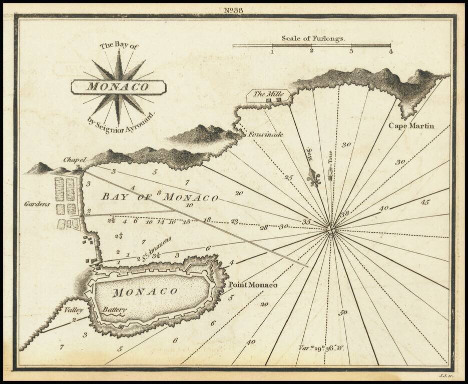
Very scarce miniature engraved chart of the town of Monaco. This is possibly the first English printed chart of the famous city-state of Monaco. The chart includes soundings in the bay of Monaco, the famous citadel, information about the...
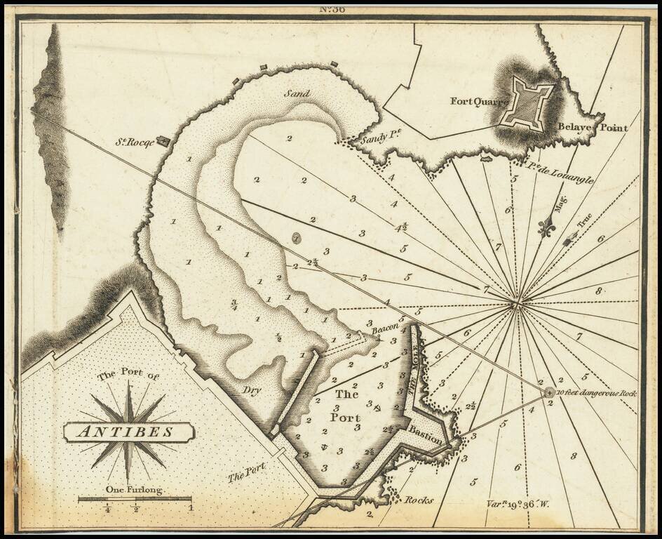
Very scarce miniature engraved chart of the port of Antibes, in the south of France. This is possibly the first English printed chart of the famous port of Antibes, now sometimes known as Port Vauban, one of the great private yacht in the south of...
![[Cannes, Pointe Croisette, Ile Sainte Marguerite, Ile Saint-Honorat]](/map/small/70870.jpg)
Rare Chart of the Islands near Cannes Very scarce miniature engraved chart of Pointe Croisette, Ile Sainte Marguerite, Ile Saint-Honorat on the French Riviera. The chart includes soundings i and sailing directions, the Ile Sainte Marguerite citadel,...
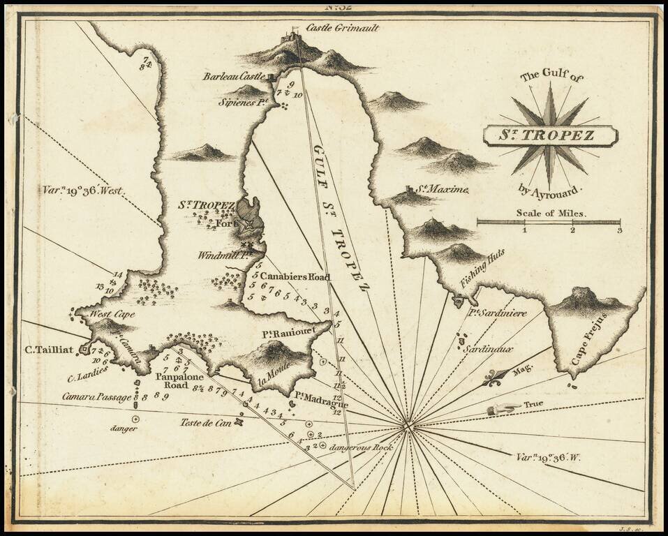
Rare miniature chart of St. Tropez, France, published by William Heather in London. The chart is oriented with west at the top. It includes good detail of the region of St. Tropez, illustrating how much has changed over the more than 200 years since...
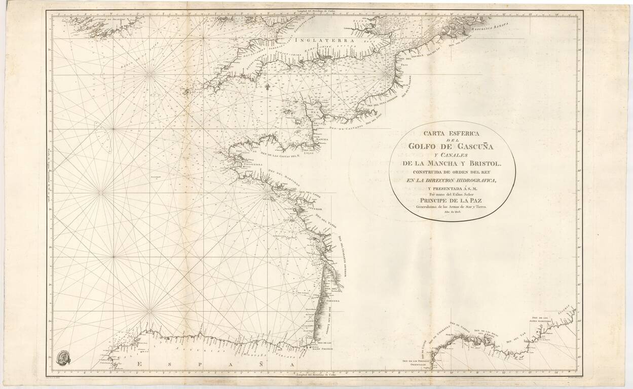
Rare Official Spanish Blue Backed Sea Chart of the Bay of Biscay (Biscaya) First edition of this fine sea chart, created by Juan Ferrer and engraved by Fernando Selma for the Spanish Hydrographical Department in 1803. The chart extends from the...
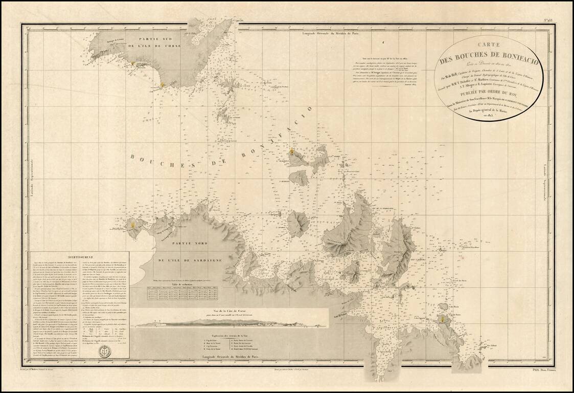
Detailed map of channel between the Islands of Corsica and Sardinia, with topographical and nautical details concerning the contiguous coastlines of each of the islands. Includes a profile view of the Coast of Corsica, along with detailed sailing...
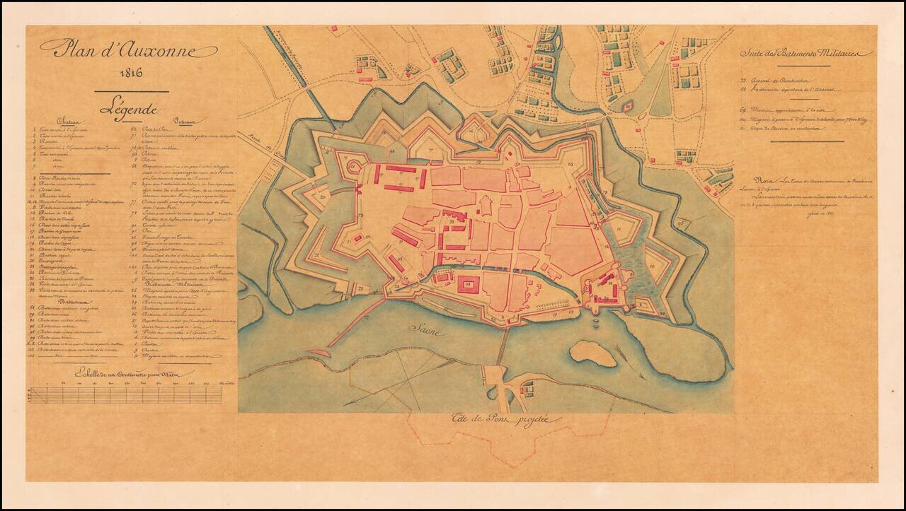
Detailed Plan of Auxonne, where Napoleon Studied to Become a Gunner Fine plan of Auxonne, a Burgundian fortification on the banks of the Saône. The stronghold, which housed an artillery school for France’s army, had Napoleon as a student and...
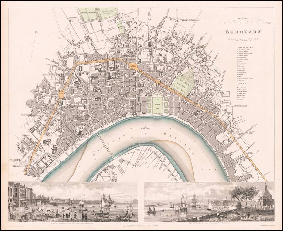
Highly detailed town plan of Bordeaux, with two large views, including the view of Quai de Salinieres and the view from Quai des Chartrons. One of the best town plans published in a commercial atlas in the 19th Century. Includes nice views.
![[Map of France] Карта Франціи](/map/small/66907.jpg)
Detailed and very rare Russian-language map of France, published in Saint Petersburg in 1836. Rarity The map is very scarce. We have been unable to find any other examples in sales databases, libraries and archives, nor in general online searches....
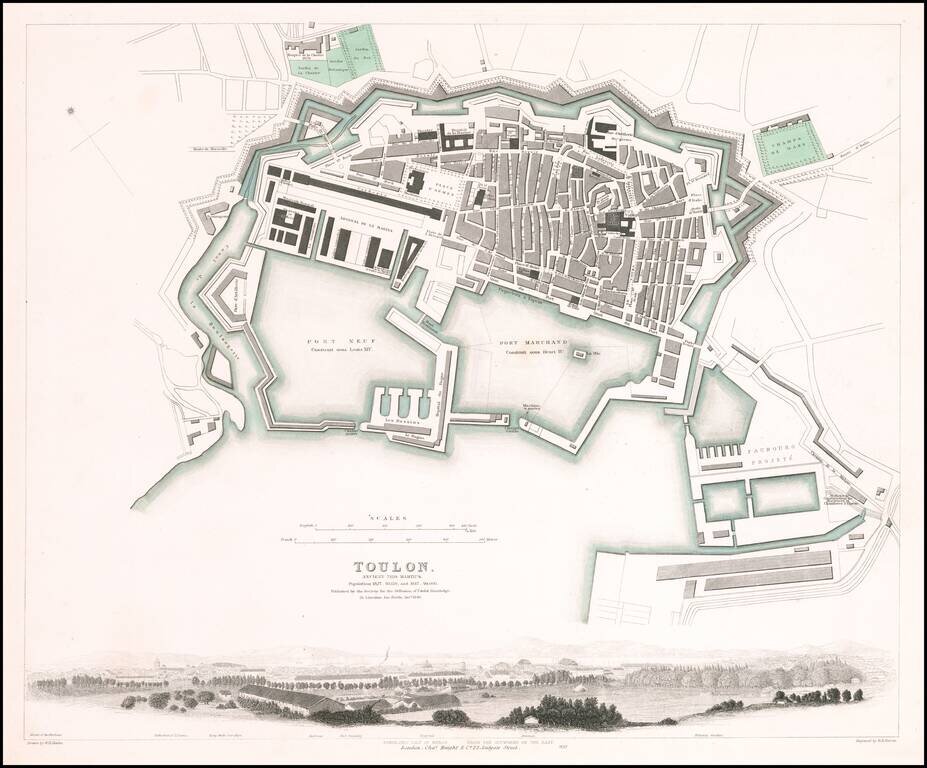
Fabulous town plan of Toulon, with a large panorama view of the City. One of the best 19th Century English towns plans to appear in a commercial atlas.
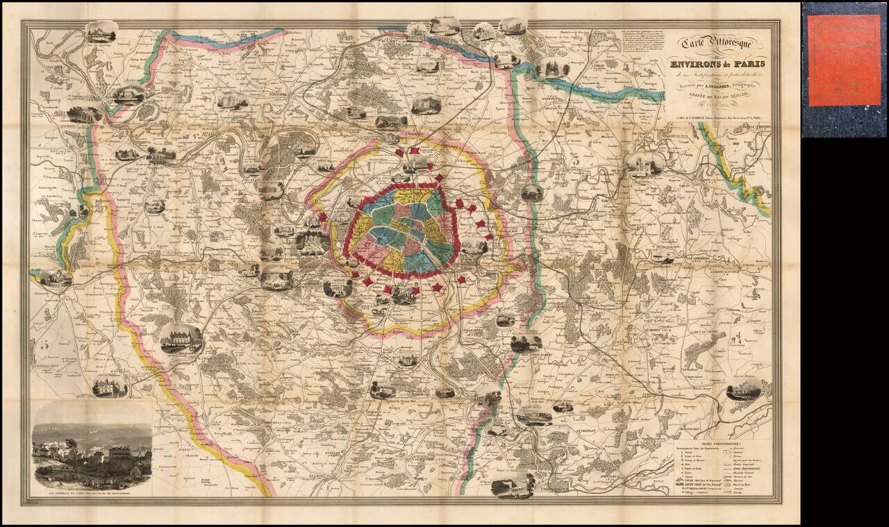
Fine decorative map of Paris and environs, embellished with a number of vignettes showing important landmarks around the City and beyond. Includes a key at the bottom, identifying hundreds of streets and second table locating important places within...
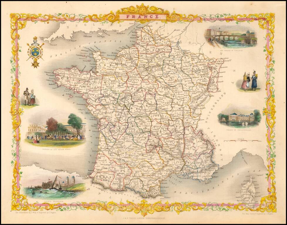
Decorative map of France with vignettes showing the Bridge of Toulouse, Palace of Fontainebleau, Garden of the Palais Royale, Harbor at Calais and two sets of costumes. Includes Corsica. Engraved for R. Montgomery Martin's Illustrated Atlas. Tallis...
![Valetta, the Capital of the Island of Malta [with] Balearic Islands [and] Corsica and Sardinia](/map/small/54874.jpg)
Detailed plan of Valetta, with a map of the Balearic Islands and a map of Sardinia and Corsica.
![Camp De Chalons - Sur - Marne / Plan du Terrain Affecte au Camp et Des Terrains Environnans Leve par les Officieres du Genie Paris 1757 [with military movements added by hand]](/map/small/65093op.jpg)
Napoleon III's Military Showpiece Fine depiction of Napoleon III prized military camp, with significant annotations showing the military manoevers in the Summer of 1866. The present example is filled with annotations in different colors, illustrating...
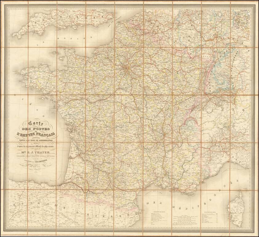
Detailed railroad and postal map of France from the 1860s. The map differentiates between operating railroads and those that are in construction or had been granted concessions. The map illustrates the State, Department, and Arrondissement. Special...
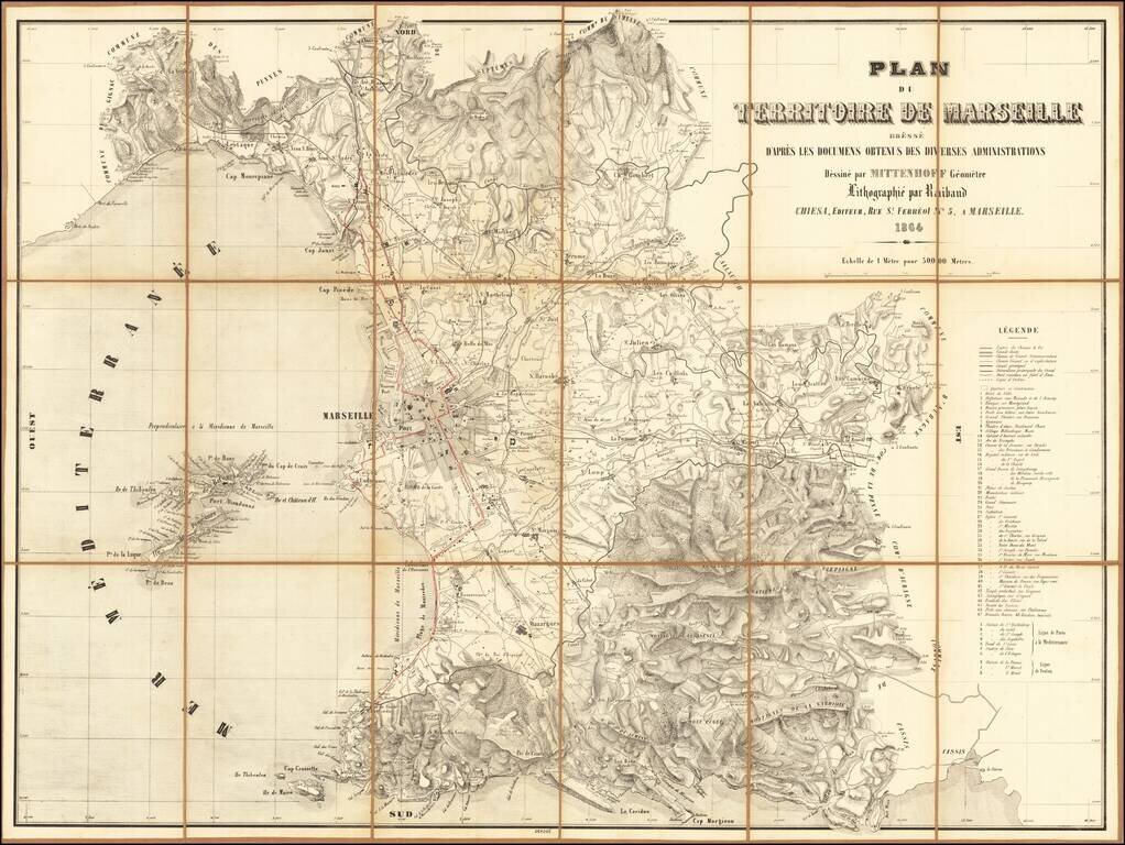
Rare map of the environs of Marseille, published in Marseille in 1864. Includes a detailed legend at the right side of the map.