Map size in jpg-format: 78.6192MiB
Click to open in high resolution (open in new tab).

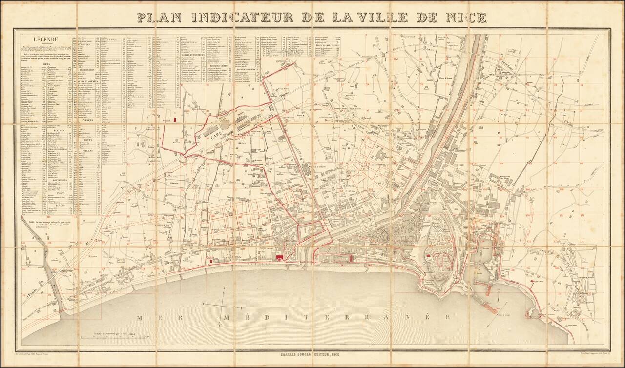
With Additions Showing Improvements in the Harbor and Other Places
Fine large plan of Nice, published in Paris in about 1865.
The present example has been extensively annotated in red throughout the map, but most notably in the harbor, where designs for improving the breakwater in the Harbor and enlarging the existing mole is illustrated.
The work was done after the Treaty of Turin was signed in 1860 between the Sardinian king and Napoleon III, when Nice was definitively ceded to France as a territorial reward for French assistance in the Second Italian War of Independence against Austria, which saw Lombardy united with Piedmont-Sardinia.
If you are a student, write to us in telegram: @antiquemaps and indicate what material you need and for what work you need a map in high detail. We are ready to provide material on special terms. For students only!
![Carte d'Etude [Study Map]](/map/small/66795.jpg)
![Orange [Vauban Style Fortress]](/map/small/62043.jpg)
