
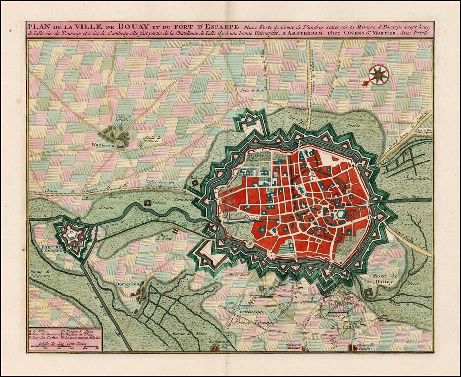
Striking old color example of Covens & Mortier's plan of Douay and the neighboring Fort D'Escape. The map focuses on the town fortifications and also includes details of the town plan, and neighboring fields and details. Coven's & Mortier's...
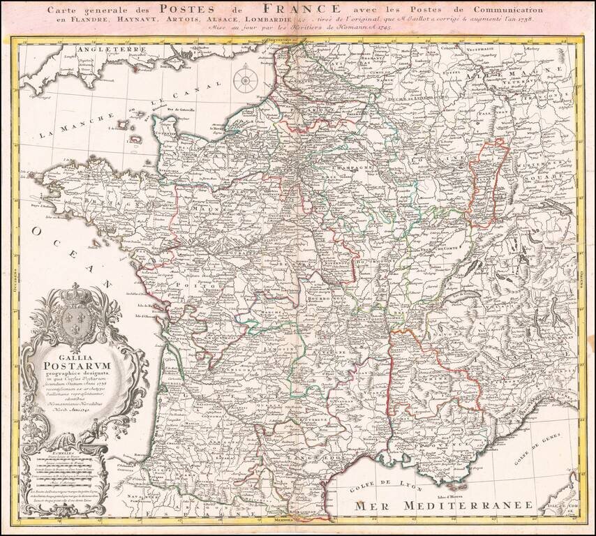
Scarce early postal map of France, published in Nuremberg. Includes an elaborate cartouche with coat of arms.
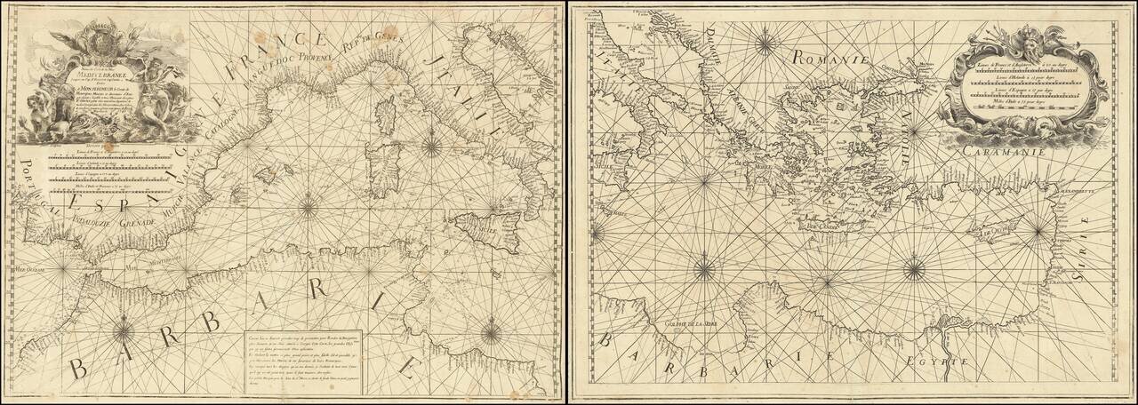
Rare 2 sheet chart of the Mediterranean, published by Francois Olivier in Toulon in 1746. One of the most advanced sea charts of the period, which was produced as a working chart and for which there are very few surviving examples. To the upper right...
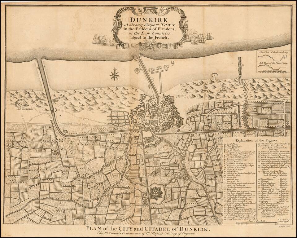
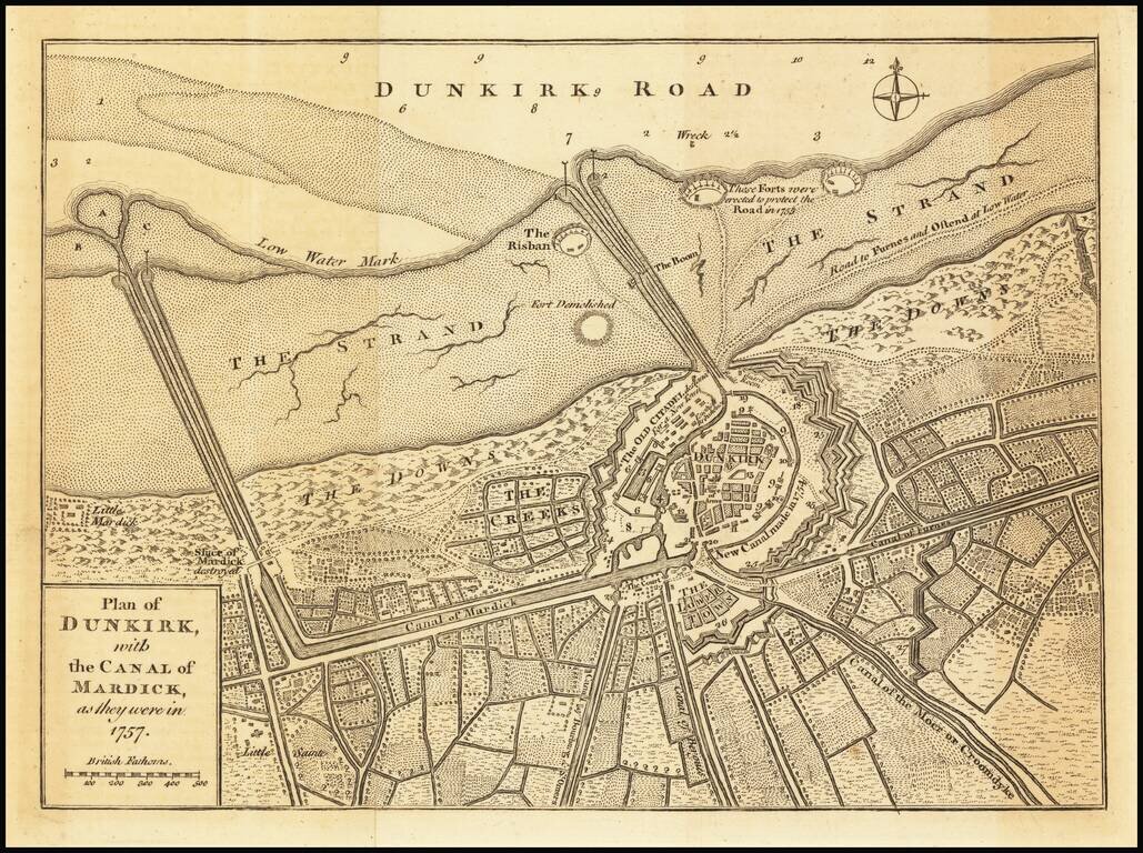
Detailed plan of the city of Dunkerque, including fortifications, town plan, roads, farms, rivers, and a decorative compass rose. From Tindal's Continuation of Rapin's History.
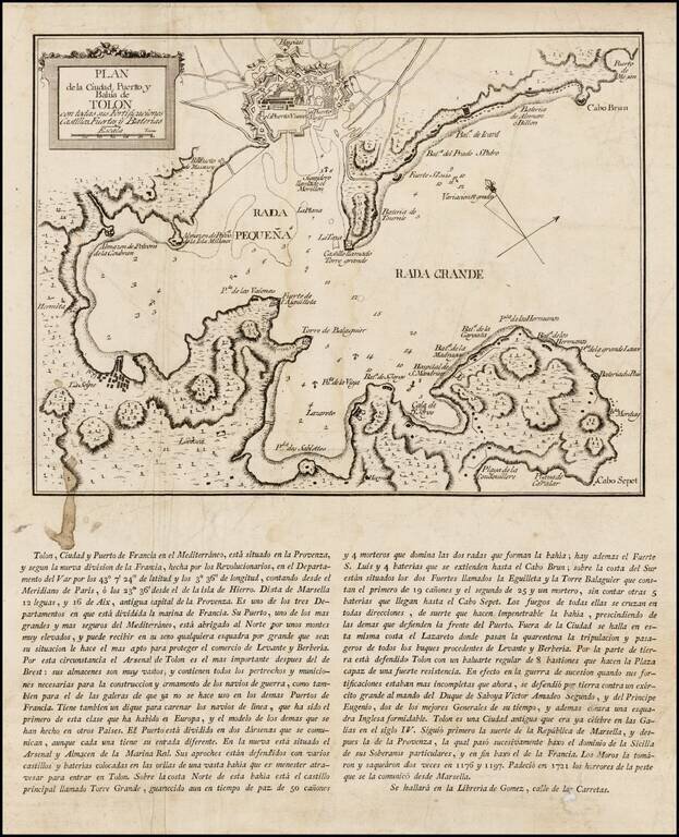
Rare Spanish broadside plan of the harbor, environs and military fortifications of Toulon, published by during the Siege of Toulon in 1793. This rare Spanish broadside depicts the Bay and Port of Toulon, one of the 3 major military ports of France. In...
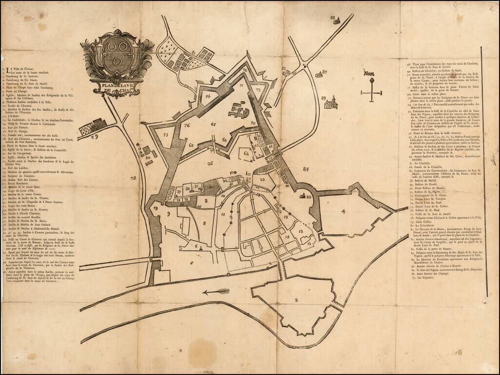
Fine early map of Chalone-sur-Saone, likely one of the earliest printed maps of the city. The map is surmounted by a large coat of arms above the title. Item #17 is Grande rue, anciennement rue des Juifs (Great street, formerly street of the Jews)....

Highly detailed map of the Alsace region, tracking the course of the Rhein from the Strassbourg area to just east of Landau. Large decorative cartouche.
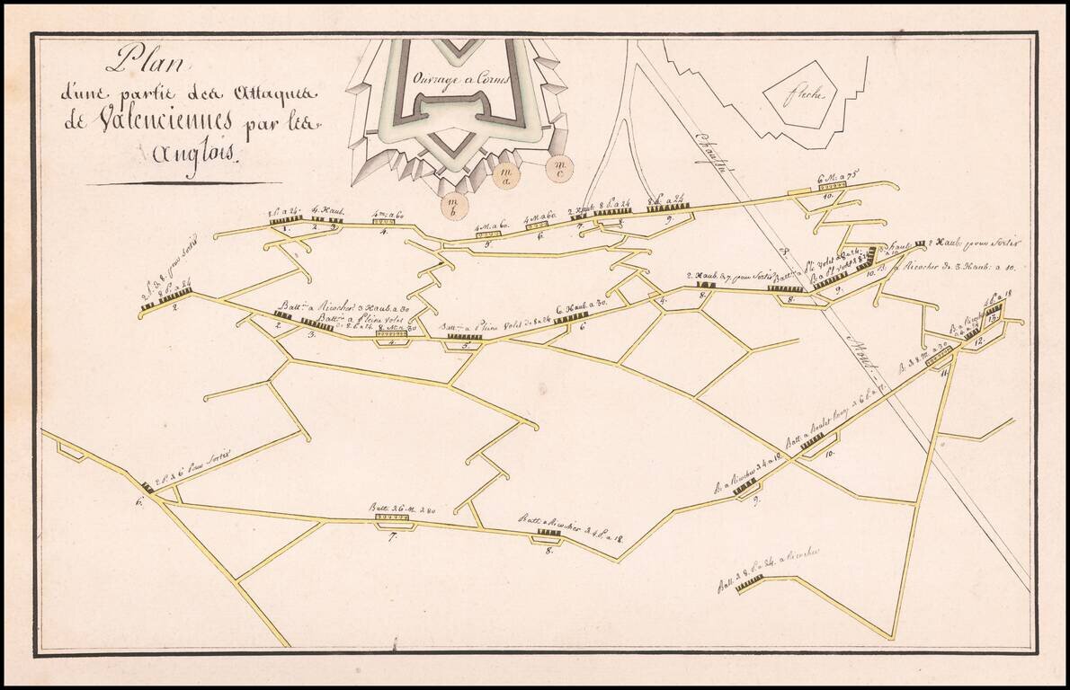
Finely illustrated manuscript plan illustrating the defenses and batteries around Valenciennes.
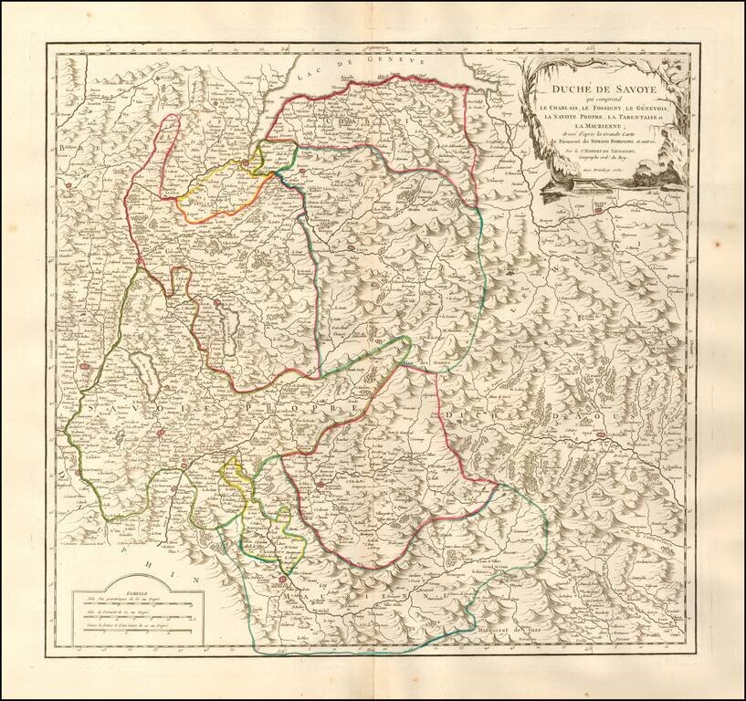
Detailed map of the Duchy of Savoy. Includes cities, villages, rivers, mountain ranges, castles, etc.
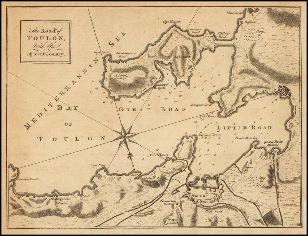
Engraved folding map showing the Bay of Toulon and surrounding defenses, published in the Gentleman's Magazine. The Gentleman's magazine was one of the foremost periodicals of its time, and was routinely consulted by the English public for its coverage...
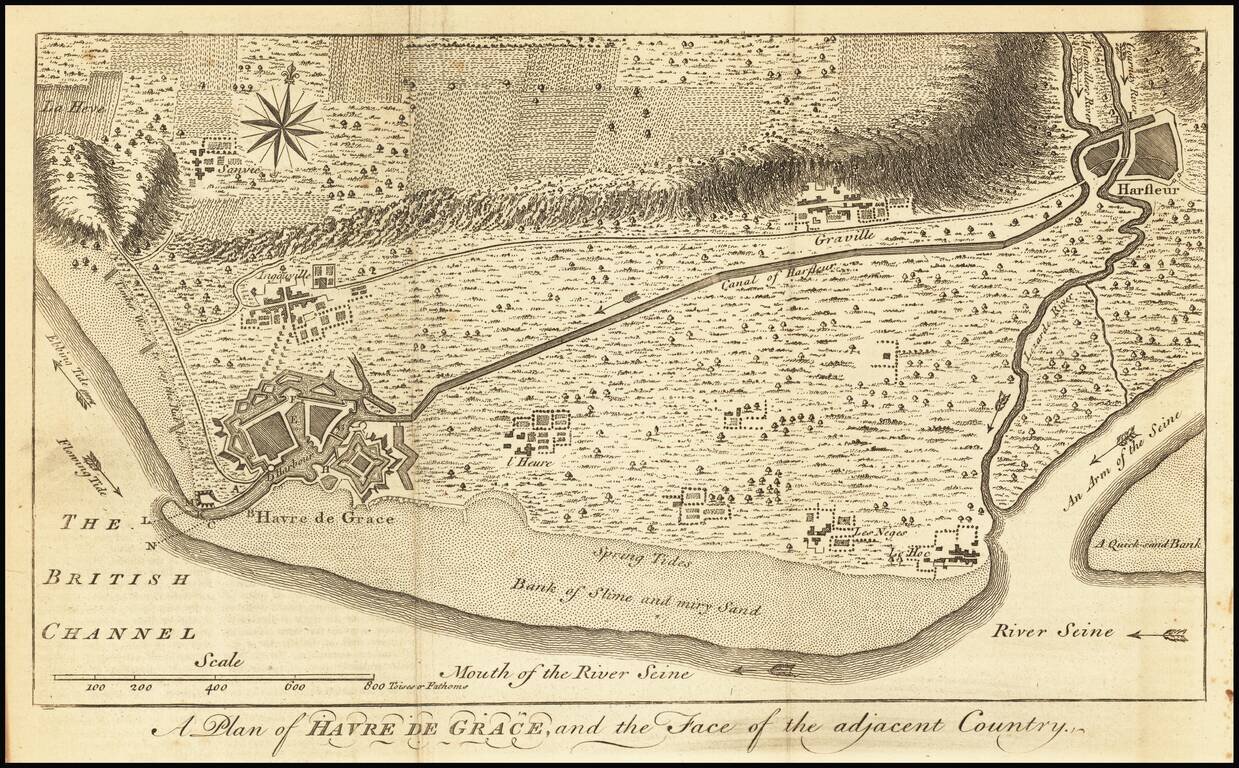
Detailed map of the area around Havre de Grace on the Seine River, along with the Canal of Harfleur and surrounding roads, rivers and town.
Detailed plan of the city of Dunkirk, including fortifications, town plan, roads, farms, rivers and canals. The map appeared in the Universal Magazine.

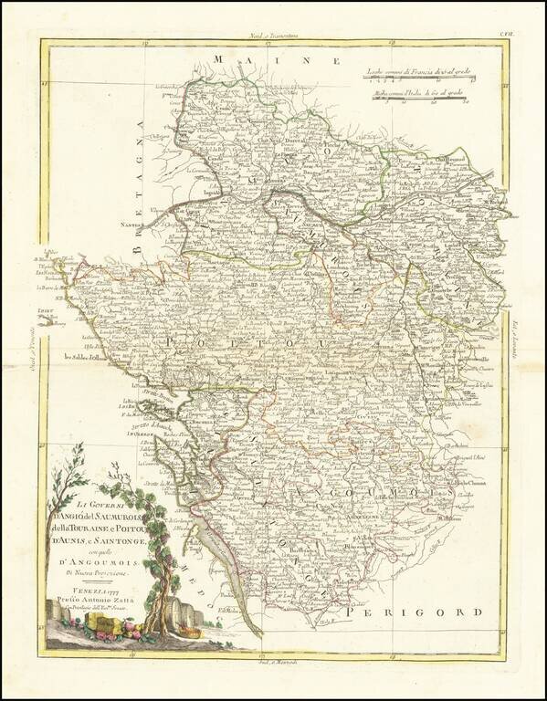
Striking map of France, divided by Governments (pre-dating the Department system). Decorative title cartouche. From Zatta's monumental Altante Novissimo, one of the last great decorative atlases of the 18th Century.
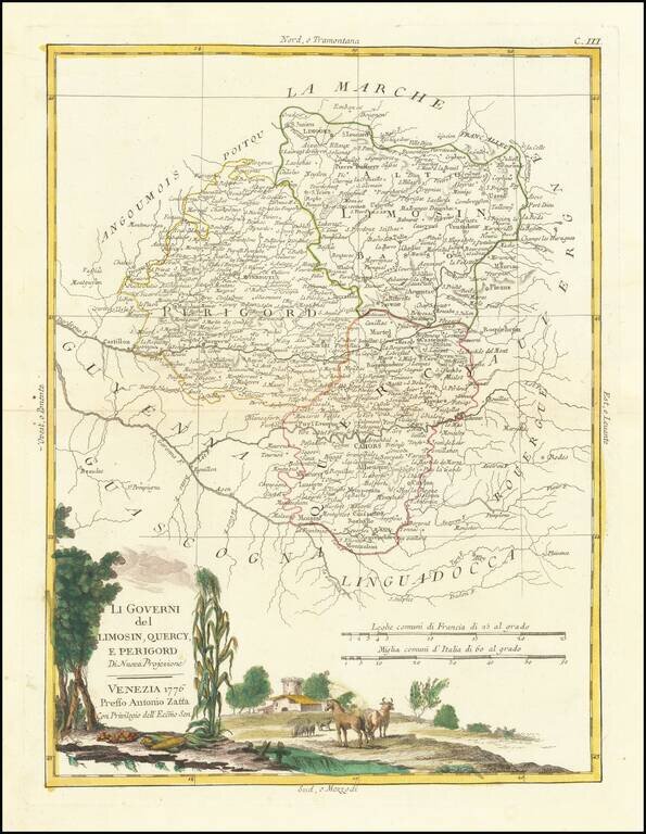
Decorative map of Southern France. Includes Limoges, Perigueux, Bergerac, Cahors, Montauban, Castillon-la-Bataille, etc. Includes a large decorative title cartouche. The map was issued in Zatta's Atlante Novissimo, a monumental 4 volume work and one...
Attractive antique map of Southwestern France, including Bordeaux and the Basque region. Includes a large decorative title cartouche, surrounded by emblems of winemaking which made the region famous. The cartouche includes vines of wine grapes and...
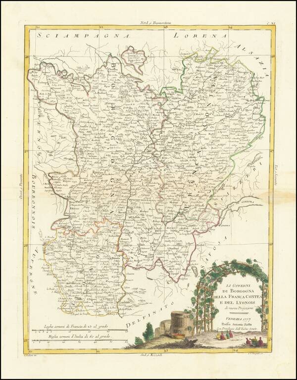
Decorative map of the Burgundy, Franche Comte and Lyon regions. Includes a large decorative title cartouche. The map was issued in Zatta's Atlante Novissimo, a monumental 4 volume work and one of the last great decorative atlases.