logo

1874. Plan de la Ville de Bordeaux 1874

  • Plan de la Ville de Bordeaux 1874

Plan de la Ville de Bordeaux 1874 information:

Year of creation: 
Resolution size (pixels): 
 22878x14908 px
Disk Size: 
 80.2064MiB
Number of pages: 
 1
Place: 
 Bordeaux
Author: 

Print information. Print size (Width x height in inches):
Printing at 72 dpi 
  317.75 х 207.06
Printing at 150 dpi 
 152.52 х 99.39
Printing at 300 dpi 
 76.26 х 49.69

An example of detailing the file of this map of in a printable high-resolution:

Click to open in high resolution (open in new tab).
Attention! this is just the central piece (central area 960x960 px) of the map file!
This is an example, so that you can see and study the level of detail of a given map. The entire Map will be fully available after payment!

Plan de la Ville de Bordeaux 1874

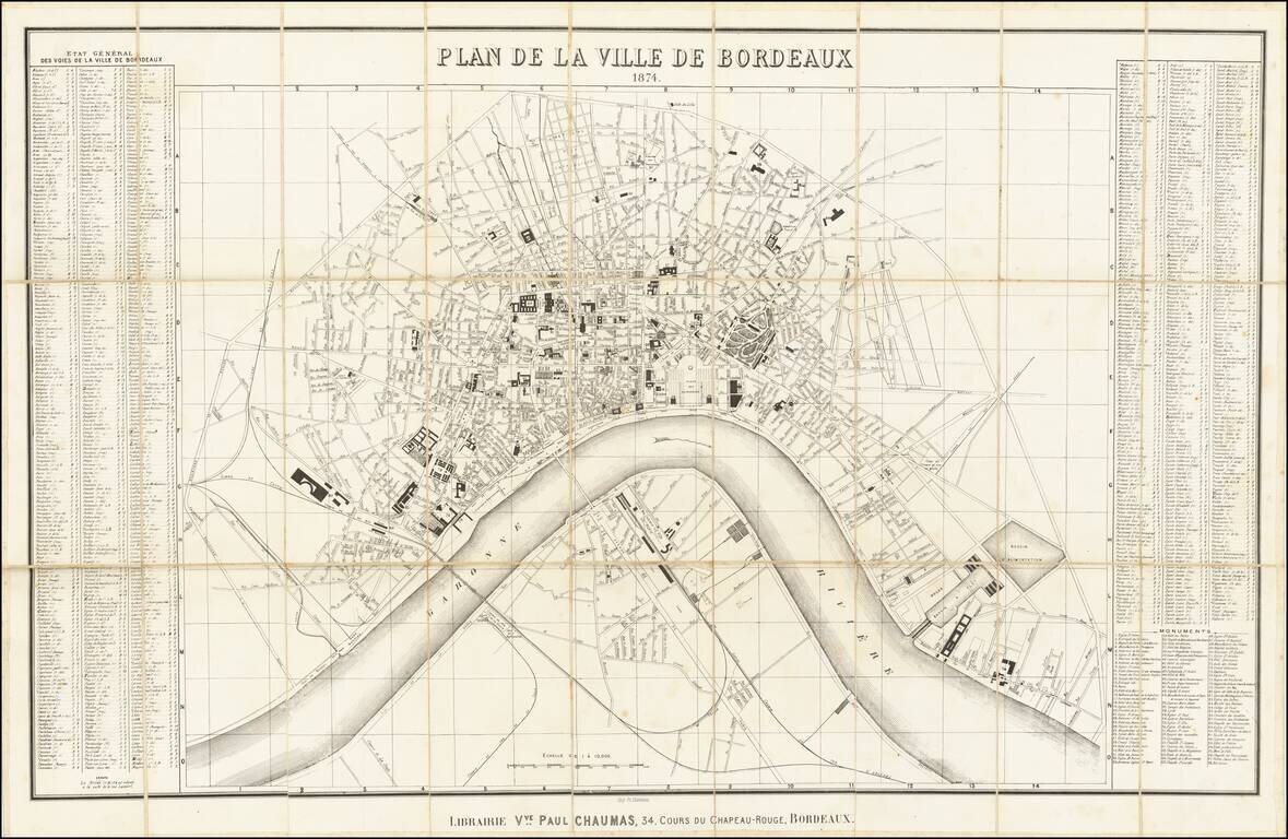
Highly detailed map of Bordeaux, published in Bordeaux in 1874.

The map is oriented with east at the top, and includes a detailed index on either side of the map.

The map illustrates the major buildings and squares, along with the town lay out along the west side of the Garonne River. Includes train lines, bridges, etc.


Special conditions for students!

If you are a student, write to us in telegram: @antiquemaps and indicate what material you need and for what work you need a map in high detail. We are ready to provide material on special terms. For students only!

Item information:

Year of creation:
Size:
22878x14908 px
Disk:
80.2064MiB
Number of pages:
1
Place:
Bordeaux
Author:
Paul Chaumas.
$21.99

Related item