
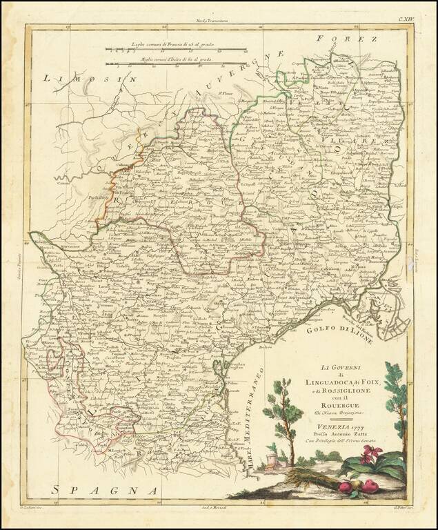
Decorative map of South France. Includes Montpellier, Nimes, Beziers, Narbonne, Perpignan, Toulouse, Montauban, etc. Includes a large decorative title cartouche. The map was issued in Zatta's Atlante Novissimo, a monumental 4 volume work and one of...
Decorative map of South France. Includes Montpellier, Nimes, Beziers, Narbonne, Perpignan, Toulouse, Montauban, etc. Includes a large decorative title cartouche. The map was issued in Zatta's Atlante Novissimo, a monumental 4 volume work and one of...
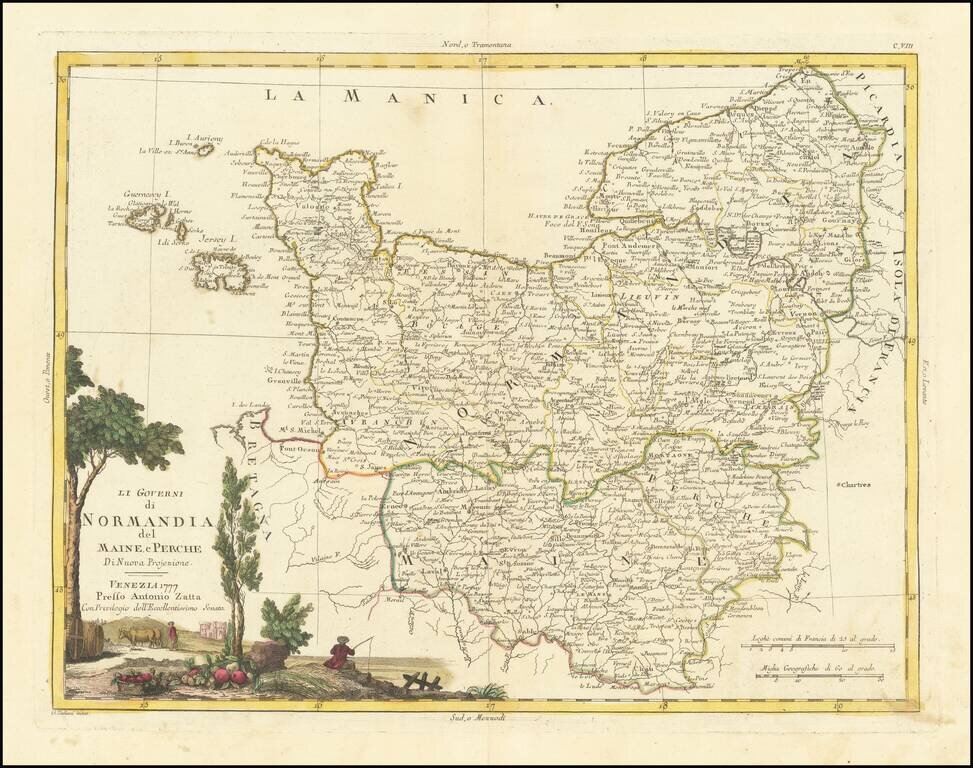
Striking map of Normandy and contiguous regions, published in Venice. Includes a decorative title cartouche. The map appeared in Zatta's monumental Altante Novissimo, one of the last great decorative atlases of the 18th Century.

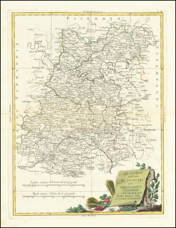
Decorative map of the Champagne and Brie regions. Includes a large decorative title cartouche. The map was issued in Zatta's Atlante Novissimo, a monumental 4 volume work and one of the last great decorative atlases.
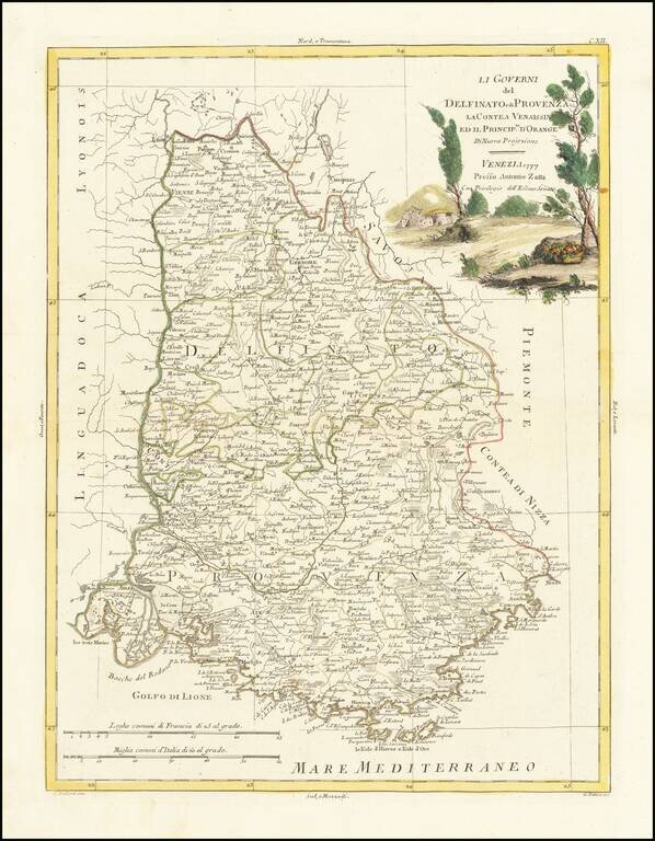
Decorative map of South France. Includes a large decorative title cartouche. The map was issued in Zatta's Atlante Novissimo, a monumental 4 volume work and one of the last great decorative atlases.
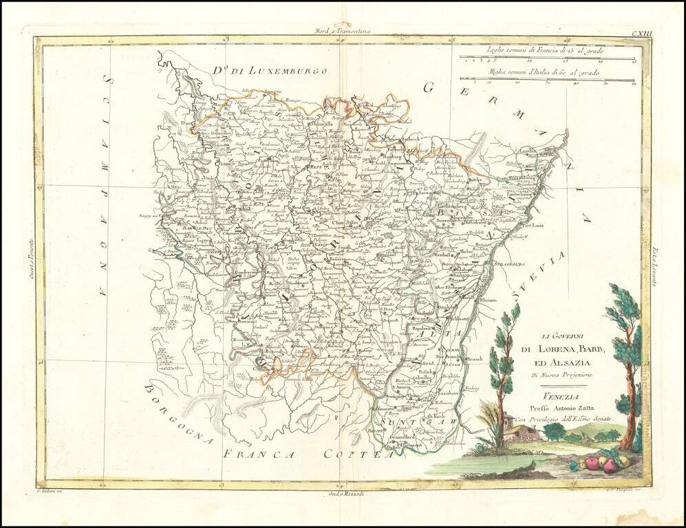
Striking map of Lorraine, Alsace and contiguous regions, published in Venice. Includes a decorative title cartouche. The map appeared in Zatta's monumental Altante Novissimo, one of the last great decorative atlases of the 18th Century.
![[Paris -- With Manuscript Additions Showing The 20 Departments] Plan Routier De La Ville et Faubourg De Paris 1777 . . .](/map/small/70471.jpg)
With Hand Drawn Boundaries Showing The Twenty Noble Departments of Paris Under The Reglements Royaux of April 13, 1789 Fine example of this detailed plan of Paris, published by Jean Lattre in 1777, redlined to show the 20 departments of Paris created...

Detailed plan of Plan Du Port-Vendres, showing the fortifications and the Obelisk designed by Sr. De Wailly, with a second map below showing the location of the port on a larger map. Includes a key identifying 24 important places. The map was prepared...
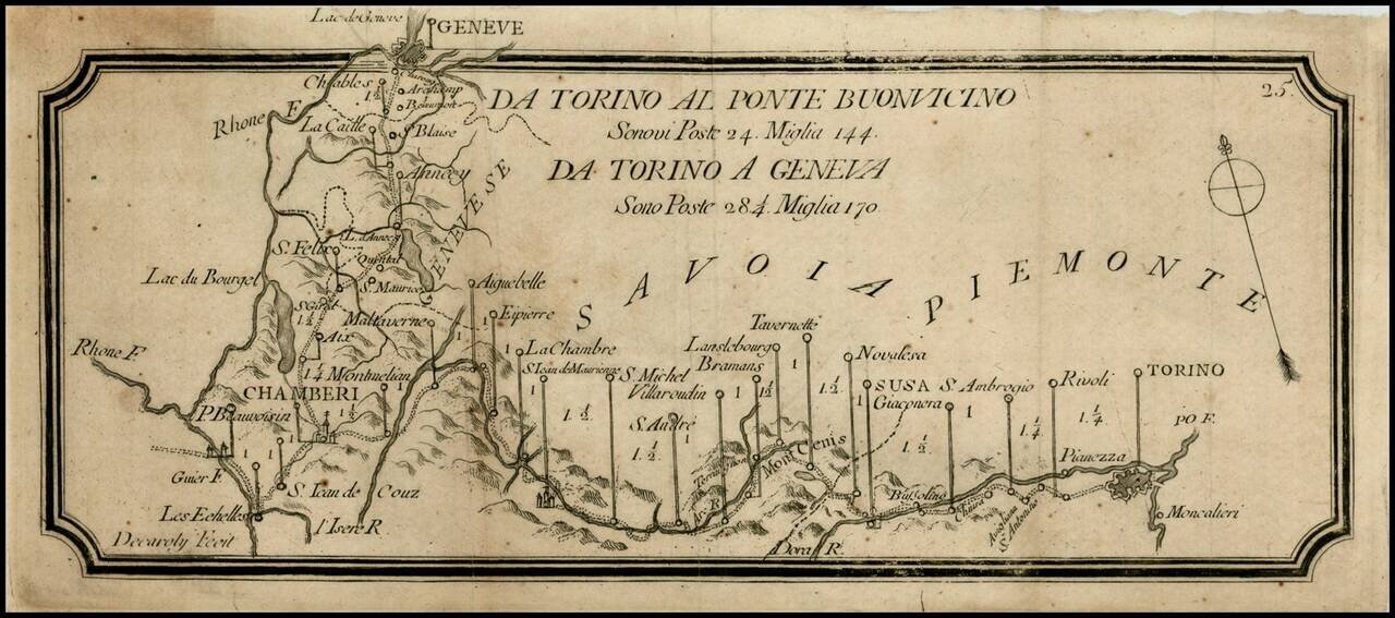
Rare postal roads map, showing the post roads from Torino to Geneva and Torino to Buonvincino. Includes distances, rivers and some topographical features.
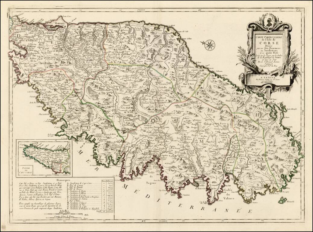
Striking large format map of Corsica, oriented with east at the top. Includes a large decorative cartouche and table showing details of the Jurisdictions and Fiefs. The map shows towns, roads, rivers, lakes, mountains, gulfs and many other details. A...
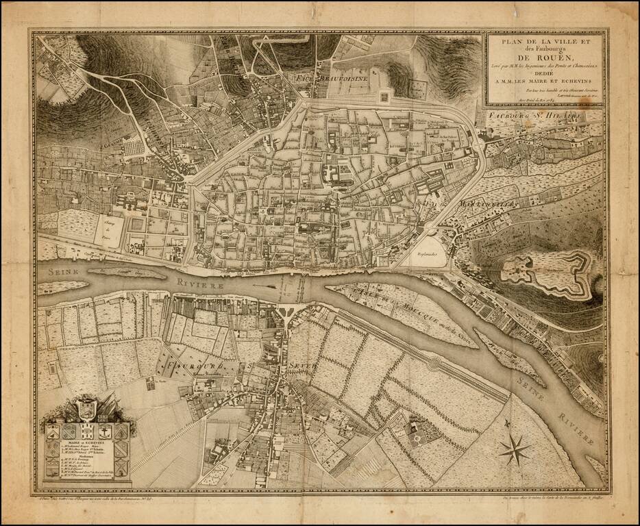
Finely engraved plan of Rouen (Haute-Normandie) centered around the Seine. Excellent detail of streets, buildings and the surrounding countryside. Names and locates important buildings from keyed list surrounded by ten coats of arms. Includes the...
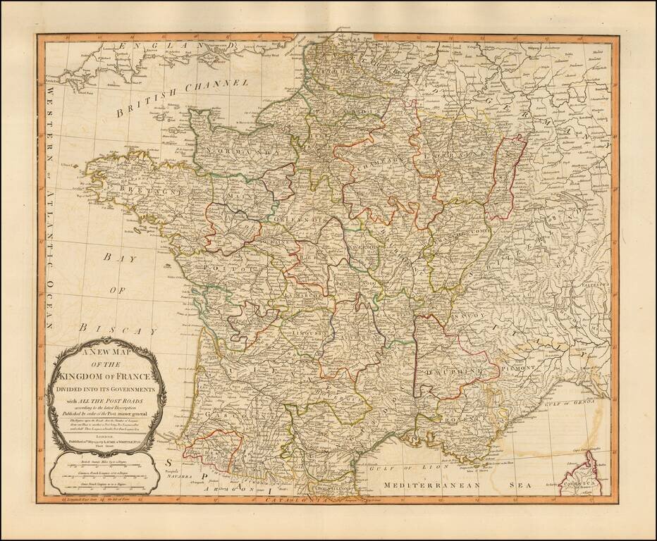
Handsome double-page engraved map of Napoleonic France, by one of the best English mapmaking firms of the period. Laurie & Whittle Robert Laurie (ca. 1755-1836) and James Whittle (1757-1818) formed their Fleet Street, London-based firm upon the...
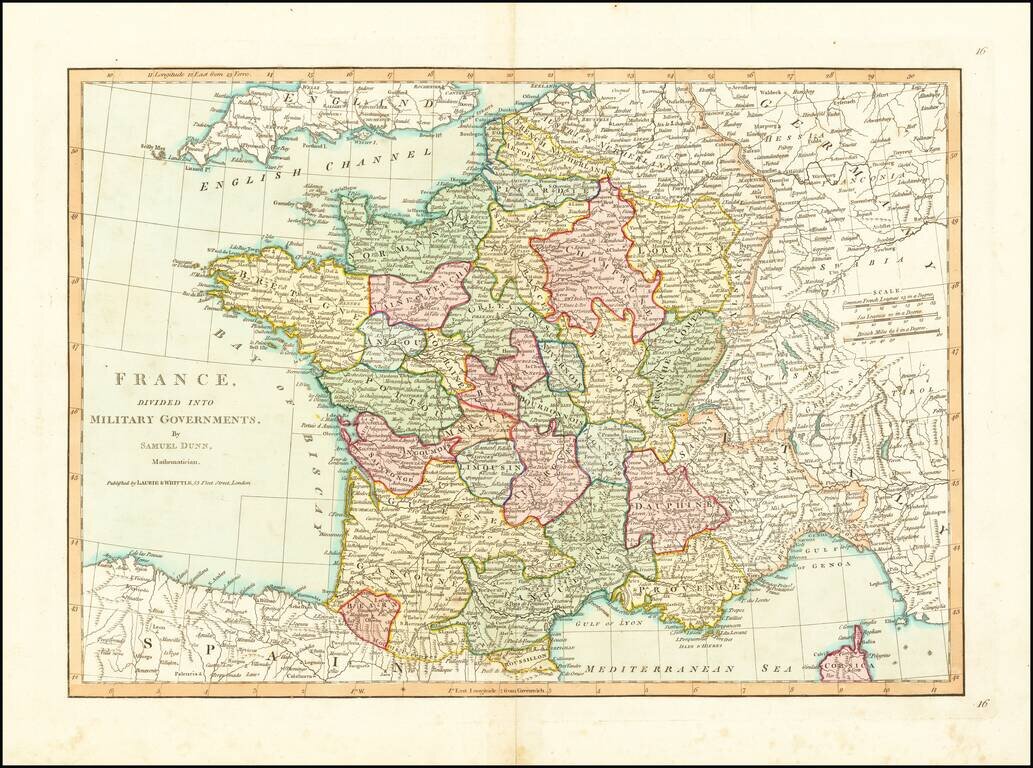
Detailed map of France, divided into its provinces. From Dunn's New Atlas or Mundane System of Geography.
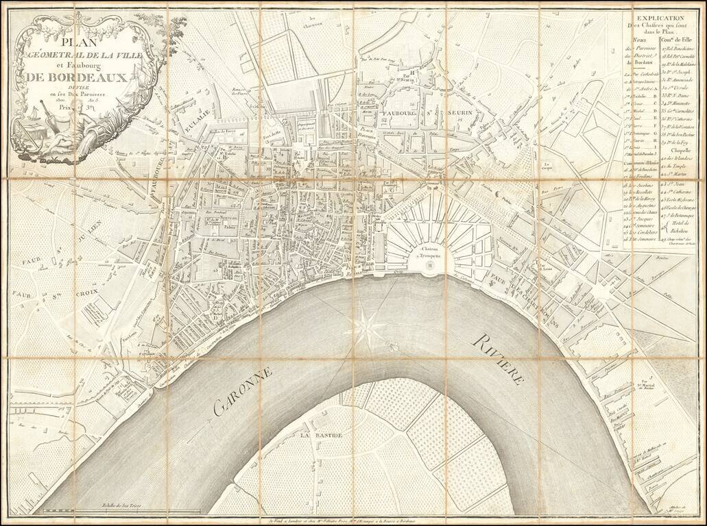
Rare and highly detailed plan of Bordeaux, published and sold by Mrs. Filliatre Frere, a print and bookseller active in Bordeaux in the first half of the 19th century. The map is apparently quite rare, as we were not able track any other examples...
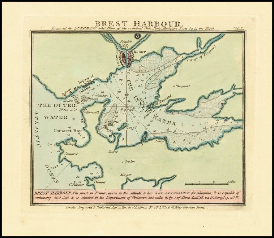
Rare harbor chart of Cadiz, published in London by John Luffman. The text at the bottom notes: Brest Harbour, The Finest in France, opens to the Atlantic & has every accommodation for shipping: It is capable of containing 500 Sail & is...
![Carte Choroghique des 6 départemens du piémont formant la 29ime. division militaire territoriale. Ou Se trouve repartie la 28ime. Légion de gendarmerie nationale composée de 3[?] cadrons, 6 compagnies 18. Lieutenance[?] et 126 Brigades dont 63 apied, et 6](/map/small/60835.jpg)
Manuscript Administrative Map At The End of the Subalpine Repubic Prepared For General de Moncey A superlative Napoleonic military map of northwestern Italy, showing the former territory of the Subalpine Republic after it was folded into the French...