
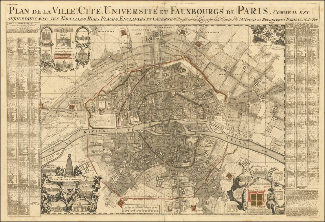
Rare large plan of Paris by Jouvin de Rochefort, published by Nicolas de Fer in 1694. Rochefort's map is of note as the second map to present Paris in a North-South axis, with the Seine being illustrated horizontally. The plan shows the city's five...
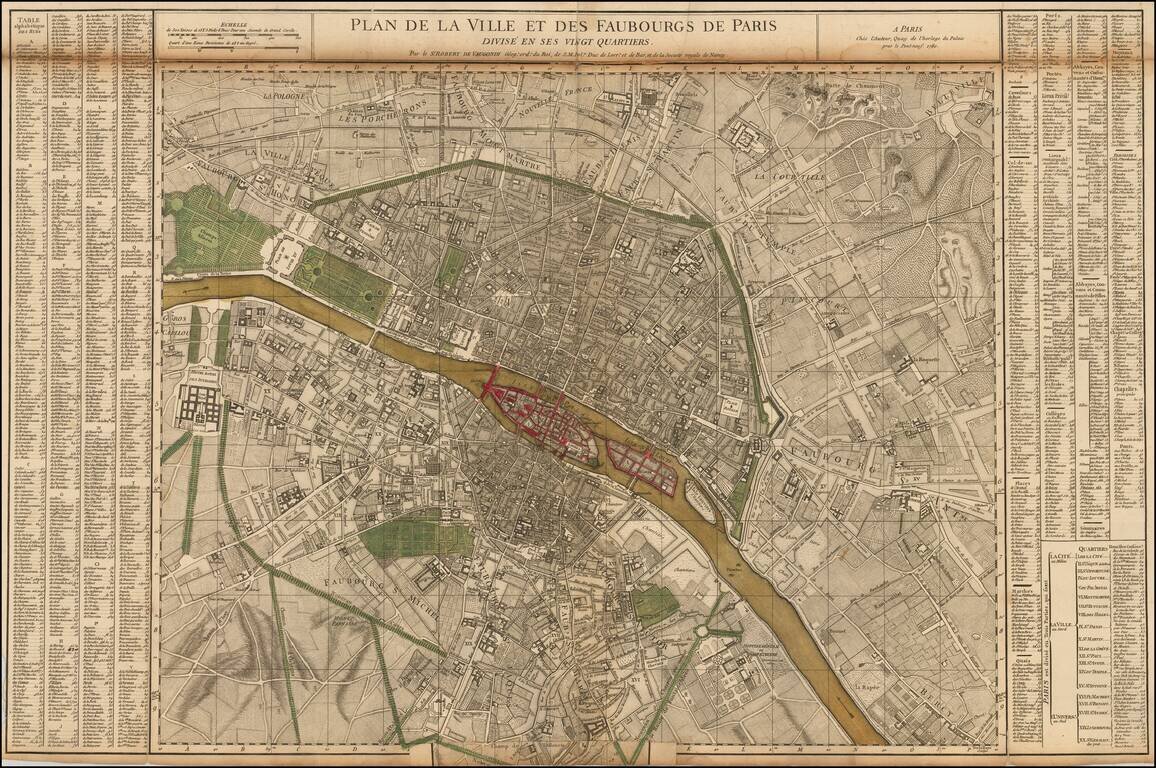
Nice example of the first state of De Vaugondy's 2 sheet map of Paris. Includes symbols showing the limits of the City at the time of Philippe Auguste, Charles V and Charles VI, and Louis XIII (based upon the map of Gomboust). Inset at the sides...
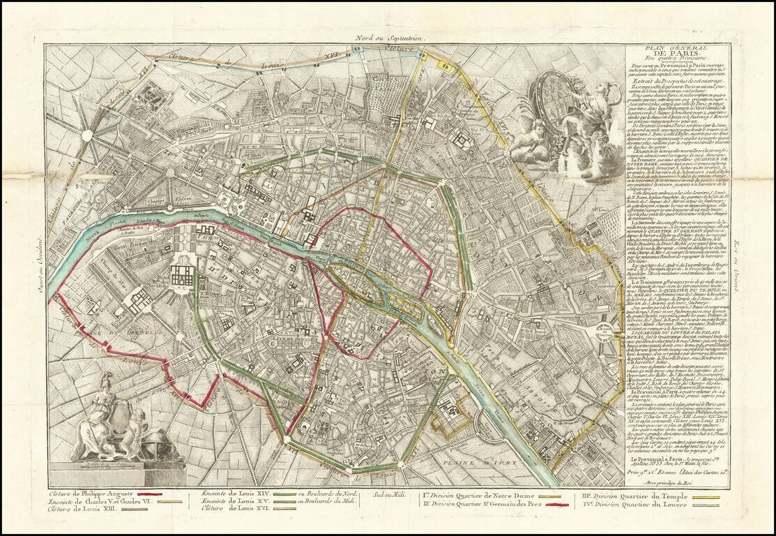
Rare map of Paris, illustrating the expansion of Paris's outer walls over the centuries and its 4 quarters. Paris is divided into four districts: Notre-Dame district (South-East) Saint-Germain-des-Prés district (South-West) Temple or Marais...
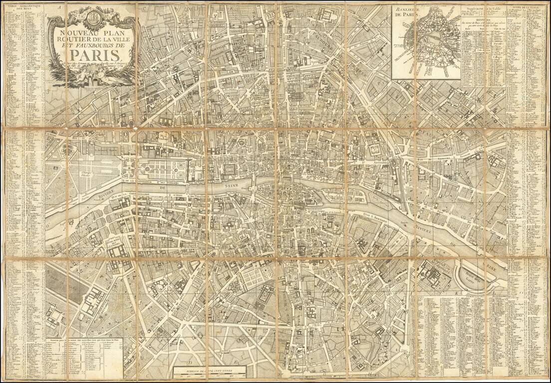
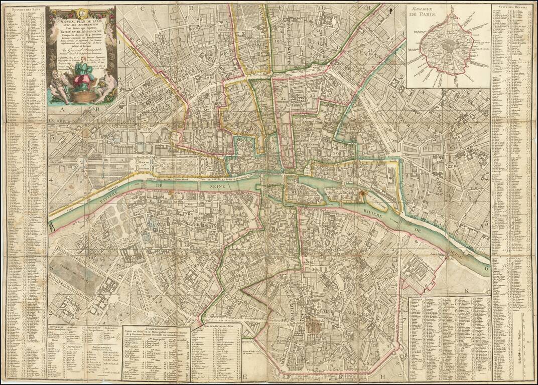
Paris Five Years Before the French Revolution. A decorative and highly detailed plan of Paris, by the famous Parisian mapmaking duo Esnauts and Rapilly, published in Paris in 1784. The map includes an inset map of "Banlieue de Paris." Shows Paris in...
A Rare Republic of France Imprint Dedicated to General Bonaparte Premier Consul de la Republique Francaise Decorative plan of Paris on the eve of the French Revolution, published by Louis Brion de la Tour. The plan is centered on the Seine River and...
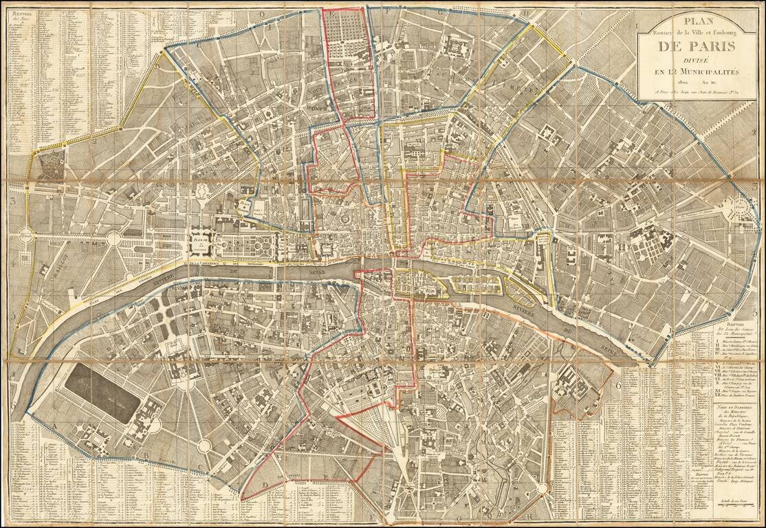
Napoleon's Paris Fine large plan of Paris, published by Jean. The map was published 2 years after the reorganization of the city by Napoleon into the 12 municipalities. During the French Revolution, Paris briefly had a democratically elected mayor...
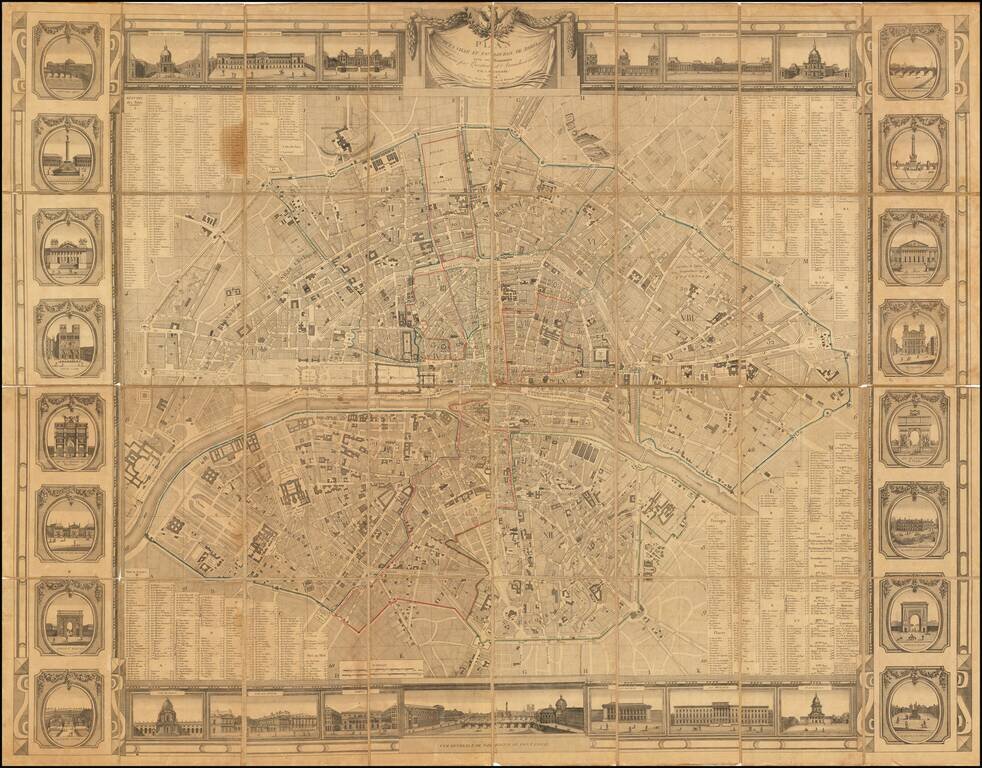
Rare wall map of Paris, issued at the beginning of the 19th Century, several decades before the major projects to re-design Paris under Georges-Eugène Haussmann commenced planning. The map divides Paris nto 12 arrondissements and 48 districts,...
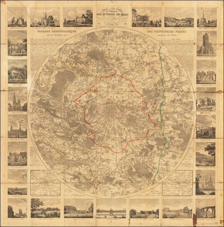
Detailed map of the environs of Paris, published by Le Roi in 1830. Very rare circular map of the area around Paris, prepared for the use of the travelers. The map covers and area in a radius of eight leagues, illustrating all the communes, castles...
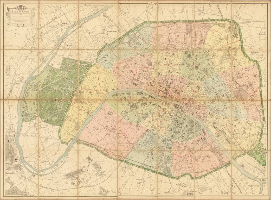
The Deschamps-Hausmann Plan of Paris Important Early Modern Plan of Paris, prepared under the direction of Eugene Deschamps. Divided into Arrondissements, the plan provides an exacting depiction of Paris at the conclusion of the multi-decade...
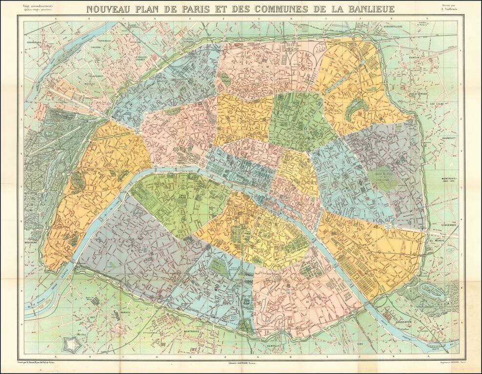
Striking map of metropolitan Paris, published by Garnier Freres. The map is colored by Arrondissements.
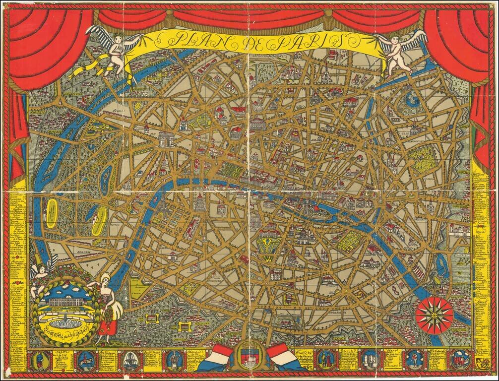
Finely illustrated pictorial map of Paris, drawn by Ilonka Karasz and published by the Washington Square Book Shop, 27 West 8th Avenue, New York City. Rumsey (8091) notes: Karasz's design and the vivid color printing used for this map of Paris are...
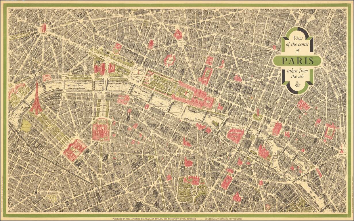
Vintage pictorial bird's eye view of Paris, based on the view Peltier and issued by Blondel La Rougery for a host of hotels and Parisian retail companies throughout the 20th century. This view is the most famous bird's eye view of Paris, second only...