
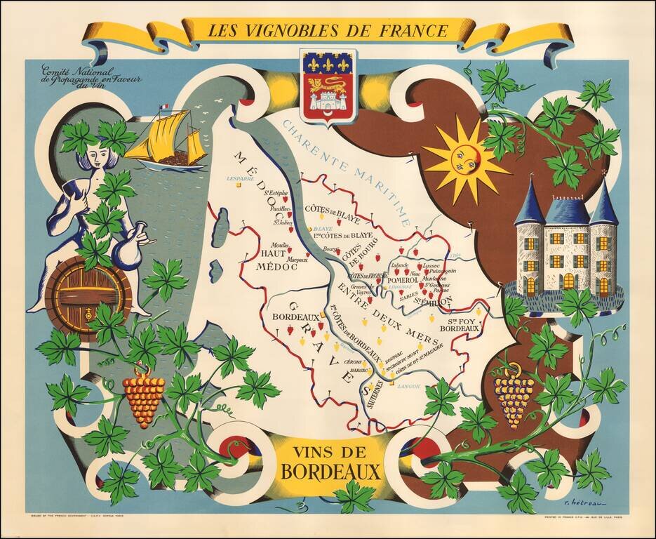
Fine promotional map of the wine regions of Bordeaux, drawn by Remy Heteau in 1954. The map shows the major wine producing regions with cluster of grapes, using red for red wines, and yellow for white wines. The map is surrounded by a compass rose,...
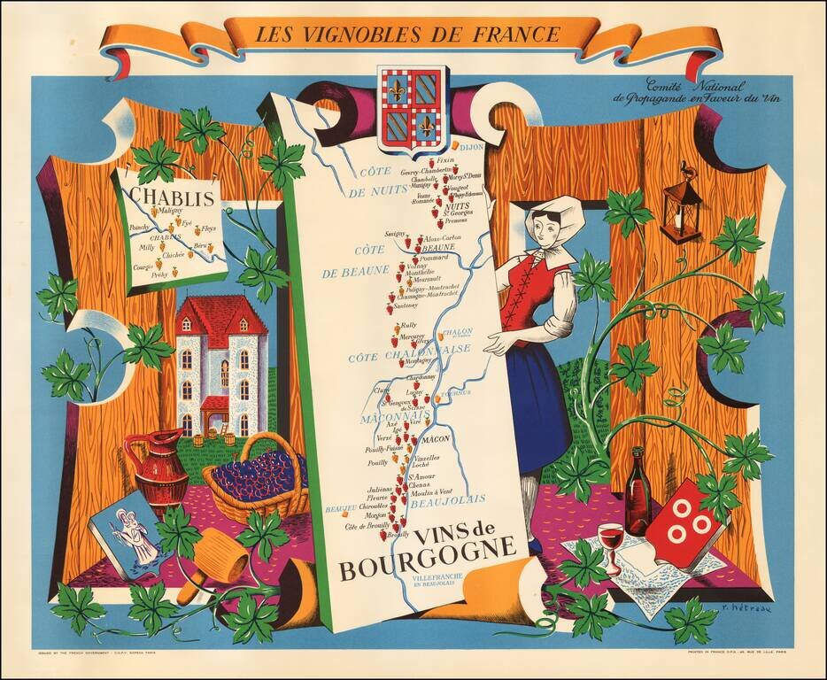
Fine promotional map of the Burgundy wine region, drawn by Remy Heteau in 1954. The map is one of a series of 11 maps titled Les Vignobles de France; the others in the series are of Région Est, Région Normandie, Champagne, Roussillon, Val de Loire,...
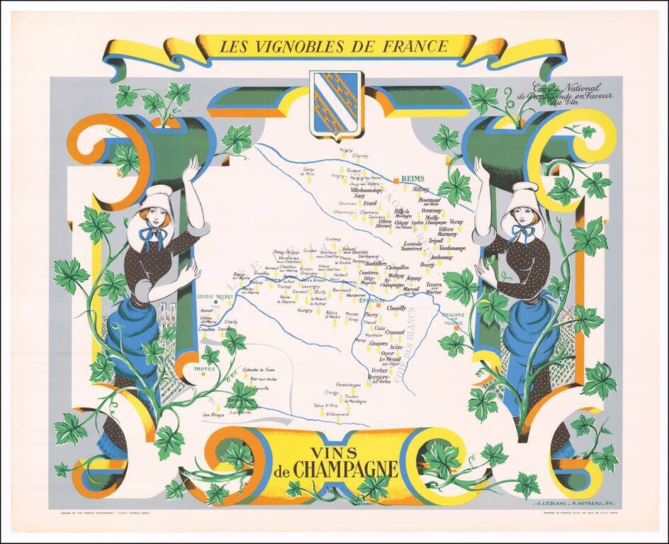
Fine promotional map of the Champagne Region, drawn by Remy Heteau in 1954. The map shows the major wine producing regions with cluster of grapes, using red for red wines, and yellow for white wines. The map is surrounded by a compass rose, grapes on...
Fine example of this decorative map promoting the Wines of the Burgundy Region of France, published by the Comite National des Vins de France. The center of the map includes a map of the Burgundy Region, from Dijon to Lyon, tracking the Saone River...
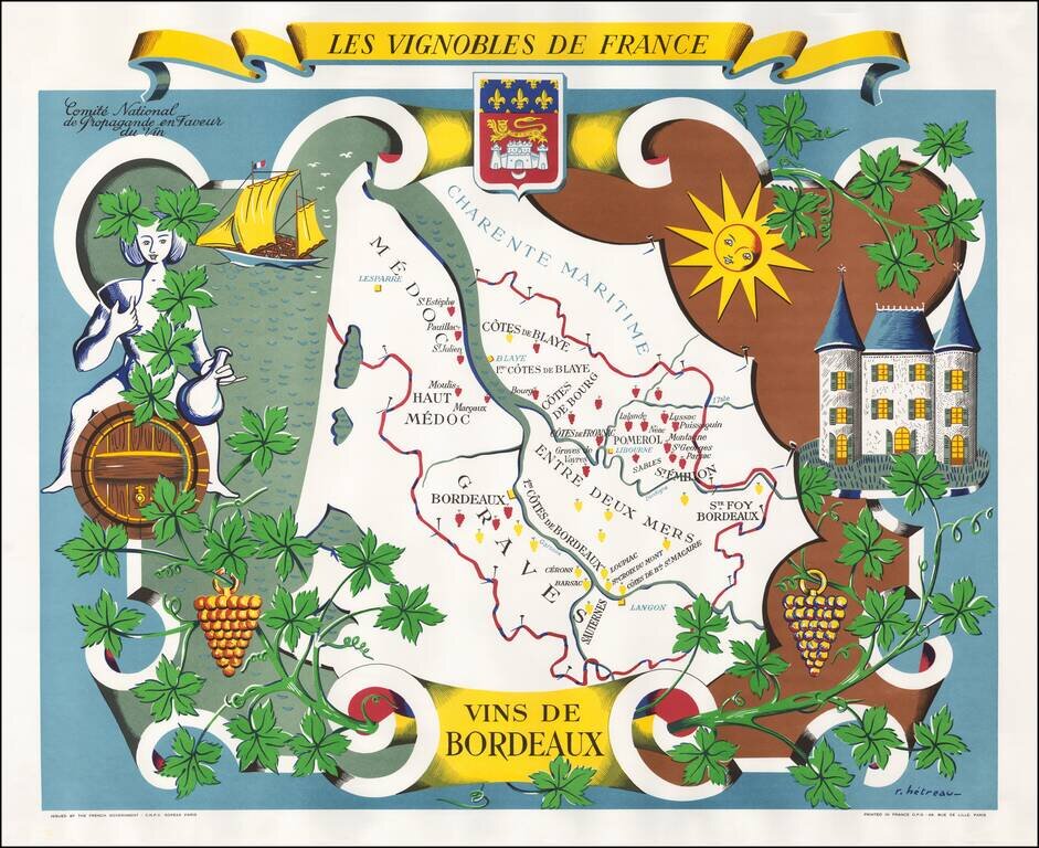
Fine example of this decorative map promoting the Wines of the Bordeaux Region of France, published by the Comite National des Vins de France. The center of the map includes a map of the Bordeaux Region, following the Gironde River from...
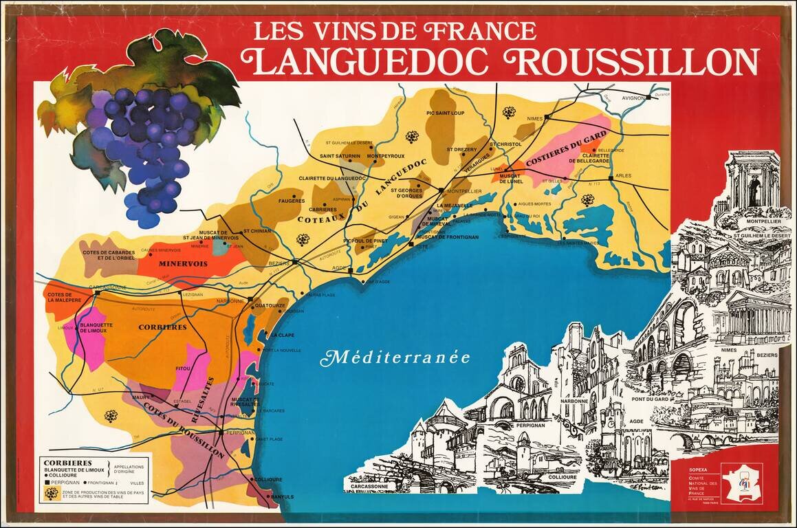
Fine large poster map promoting wine from the Languedoc and Roussillon regions. The poster was issued by Sopexa - International Communication Agency Food, Drink, Lifestyle, for the Comite National Des Vins de France. At the bottom right is an...
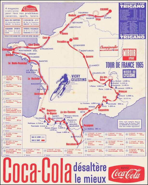
Coca Cola Sponsors The Tour de France A map showing the route of the 1965 Tour de France, sponsored by Coca Cola. The 1965 Tour de France was the 52nd edition of the Tour, June 22 - July 14, 1965, with 22 stages covering a distance of 4,188 km (2,602...
![[Cultural Revolution Maps - Map of France / A Sketch Map of Events of May 1968] [Fagu di tu - Faguo ren min ge ming dou zheng yi tu]](/map/small/65576.jpg)
Chinese Reporting on the May 1968 Uprising in France Two Chinese cultural Revolution Maps printed on a single sheet (back to back), published following hte May Uprising in France in 1968. The map illustrates France as dominated by the worker's...
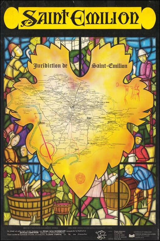
Striking wine map of the Saint-Emilion region, surrounded by a medieval stained glass image of wine making. The map was issued as a promotional map for Viticulture and Agricultural Syndicate of Saint-Emilion.
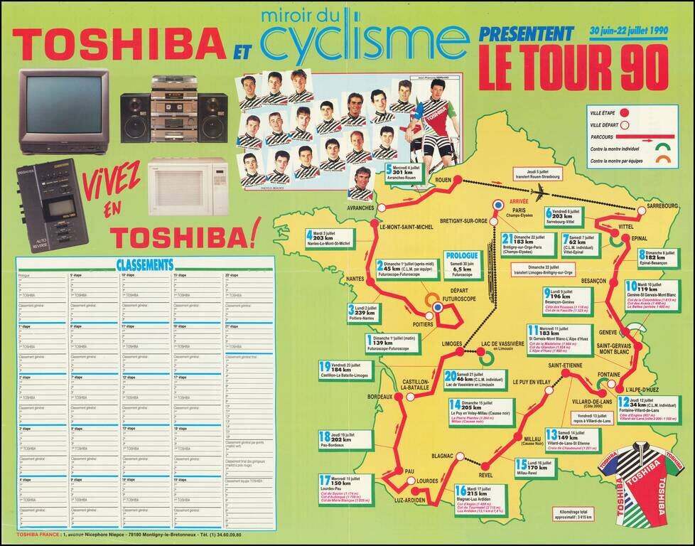
A vintage Tour de France map showing the 1990 edition of the event. Riders started at the "Futuroscope" theme park near Poitiers before making their way through Nantes, the Mont-Saint-Michel, Geneva, L'Alpe d'Huez, Le Puy en Velay, Lourdes, Bordeaux,...
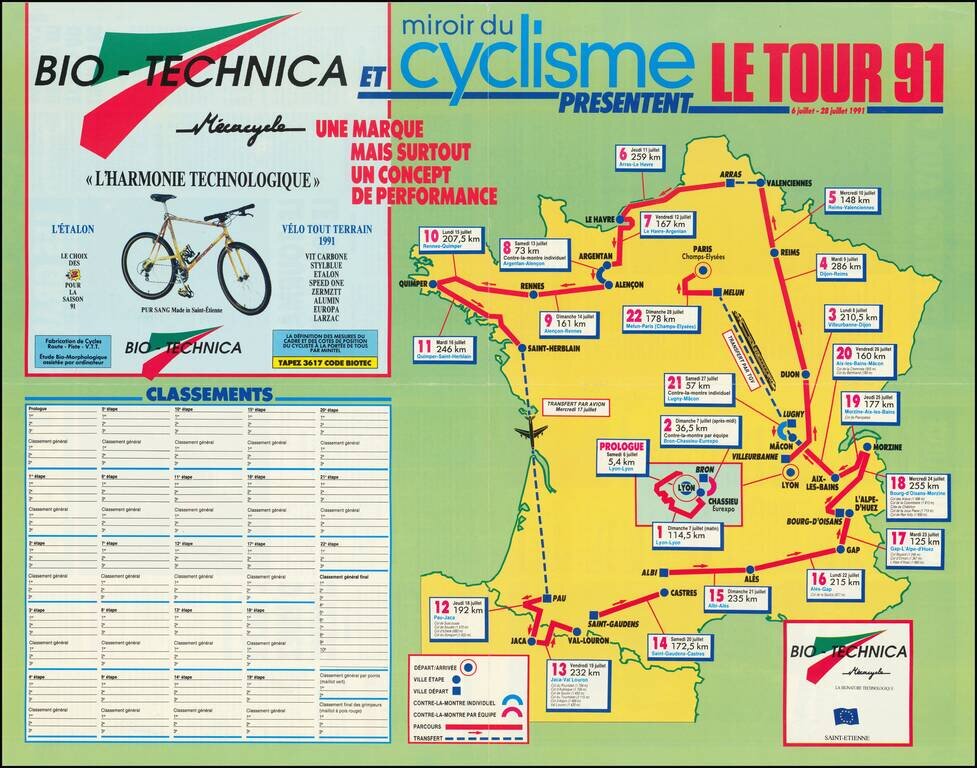
A vintage Tour de France map showing the 1991 edition of the event. Riders started in Lyon before making their way north through Dijon and Reims, then headed to the western edge of Brittanny. The race then moved on to the more exciting stages of the...
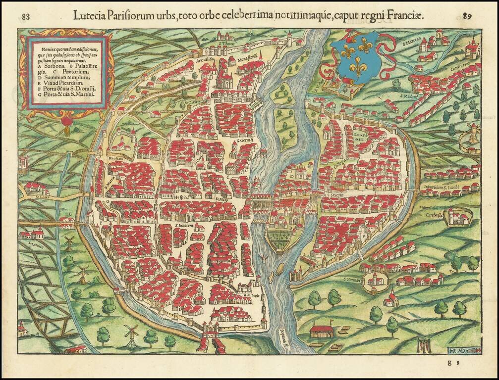
Paris in the 16th Century. Gorgeous example of Munster's early birdseye view of Paris. Includes a coat of arms and illustrates the town in remarkable detail, including buildings, bridges, the fortified walls of the city and other landmarks within the...
![[Paris Area]](/map/small/54190.jpg)
Finely engraved image of what appears to be Paris in the foreground. The image appeared in the 1568 Venice edition of Ludovico Ariosto's Orlandi Furioso, which first published in 1515, but not completed until 1532. Orlando furioso (the Frenzy of...
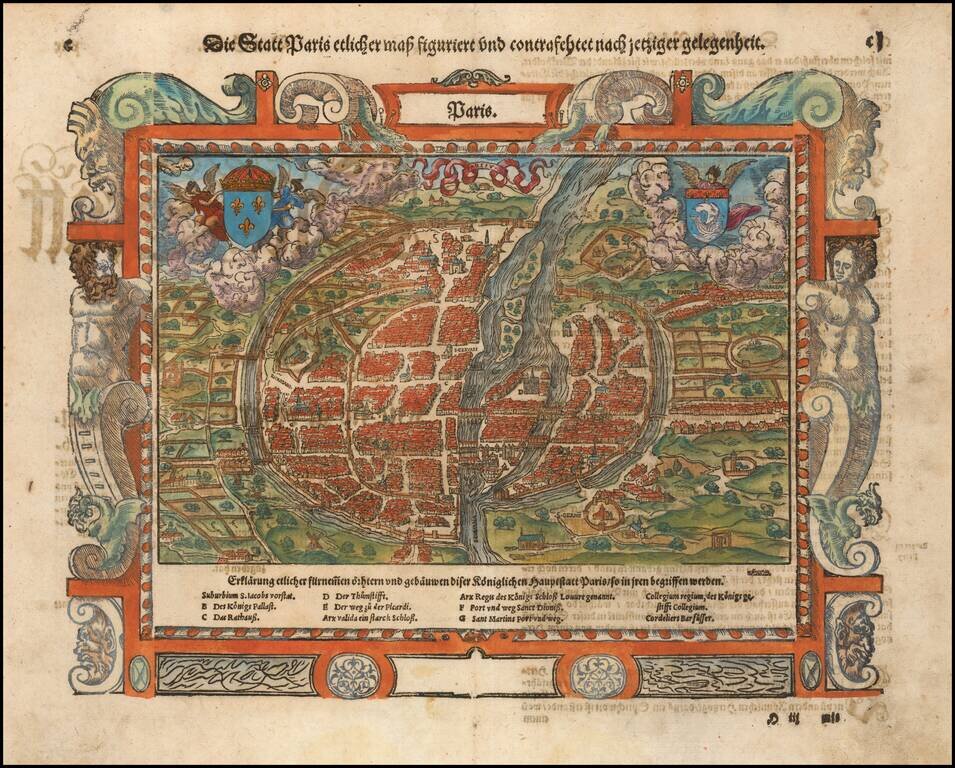
Nice example of Munster's second map of Paris, from Munster's Cosmographia. The map includes two coats of arms and a decorative picture frame border. Excellent early city plan, including the fortified walls of the city and place names inside of the...
![[Paris] Lutetia vulgari Nomine Paris, Urbs Galliae Maxima . . .](/map/small/47086.jpg)
Fine example of Jansson' rare town plan of 16th Century Paris, based on Sebastian Munster's map of 1569. Paris began as a small settlement on an island in the Seine, named Lutetia by the Gallii Parisii. This island, seen at the center of the map,...
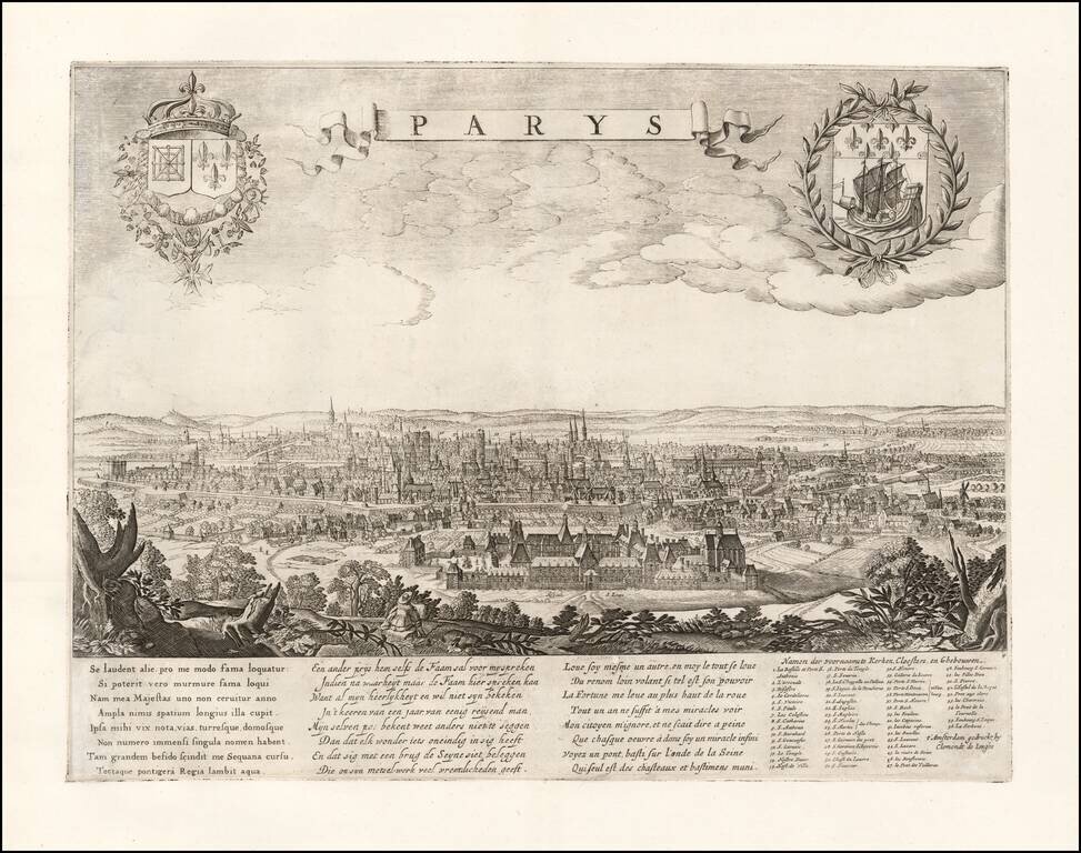
Rare separately published view of Paris by Clement De Jonge. With poem on the beauty of the town in Latin, Dutch and French by A. Montanus. With legend of main churches, monasteries and buildings. Includes the coats of arms of the City of Paris and...