
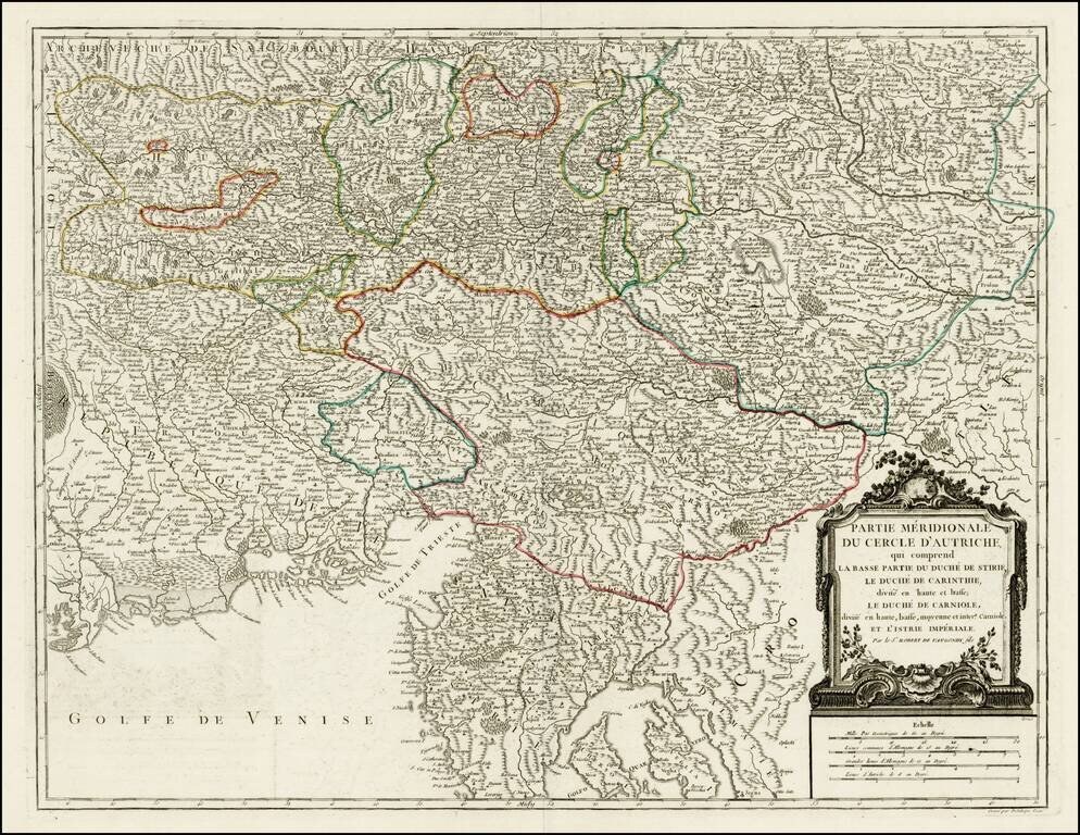
Detailed regional map of the region north of the Gulf of Venice, Istria, etc.. Shows the Southern portion of the Austrian Empire, from the Republic of Venice and the Gulf of Venice in the west to the Croatian Border. Shows Salzburg, Graz, Rijeka,...
![[Austria] Nova Mappa Archiducatus Austriae Superioris Ditiones in suos Quadrantes divisas conspectui sistens . . . .](/map/small/62749.jpg)
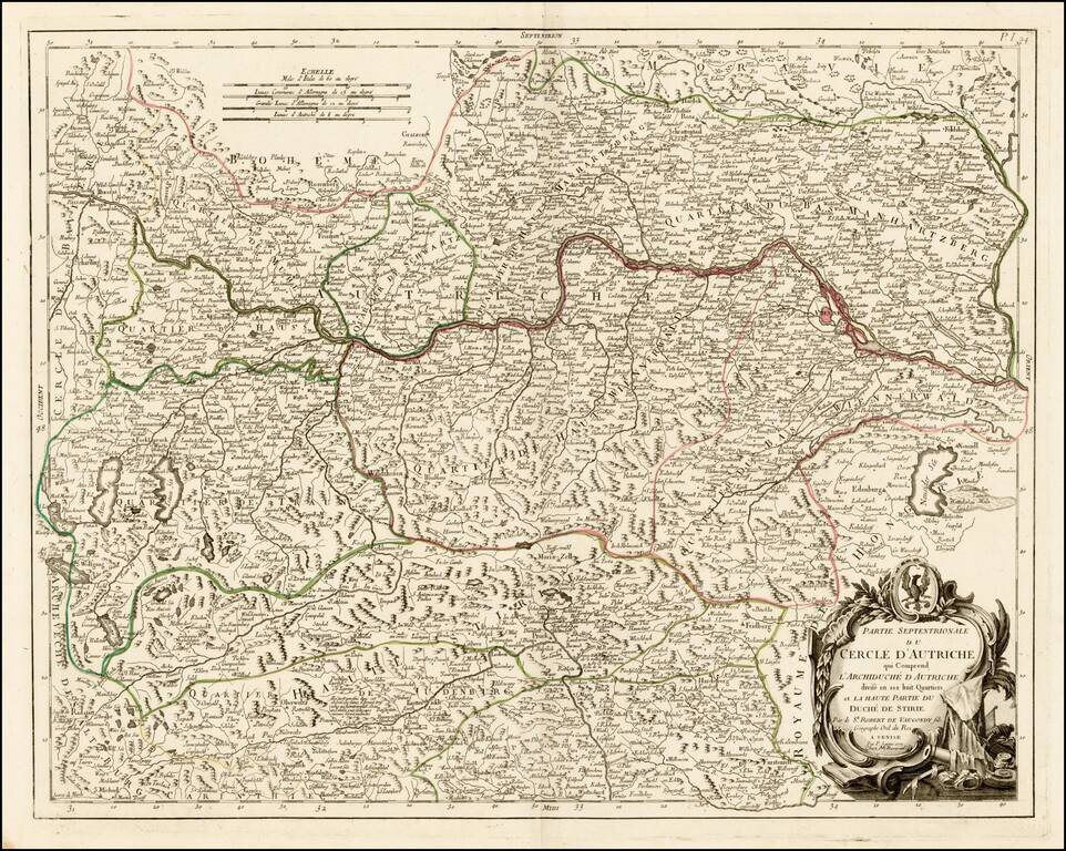
Highly detailed regional map, centered on the course of the Danube River, from Ips to Braunau. Also shows Salzburg, Rachstats, Rottenman, Loeben, Waiddhofen, Zwetl, Weitra and Passau. Ornate cartouche.
Detailed map of the northern part of Austria, published in Venice by Paolo Santini. The map is centered on the Course of the Danube River, from Passau, Germany to Vienna.
![[Ottman Empire] Partes confines Trium Magnorum Imperiorum Austriaci Russici et Osmanici Foliis VI compreshensa ex novissimis observationibus, dimensionibus optimisque tabulis geographicus descripta . . . Anno MDCCLXXXV](/map/small/52715.jpg)
Three Empires At War -- Austrian, Russian and Ottoman Fine 6 sheet map published in Berlin in the midst of the Austro-Turkish and Russo-Turkish wars, between the Austrian, Russian and Ottoman Empires. Centered on the Black Sea, the map shows the...
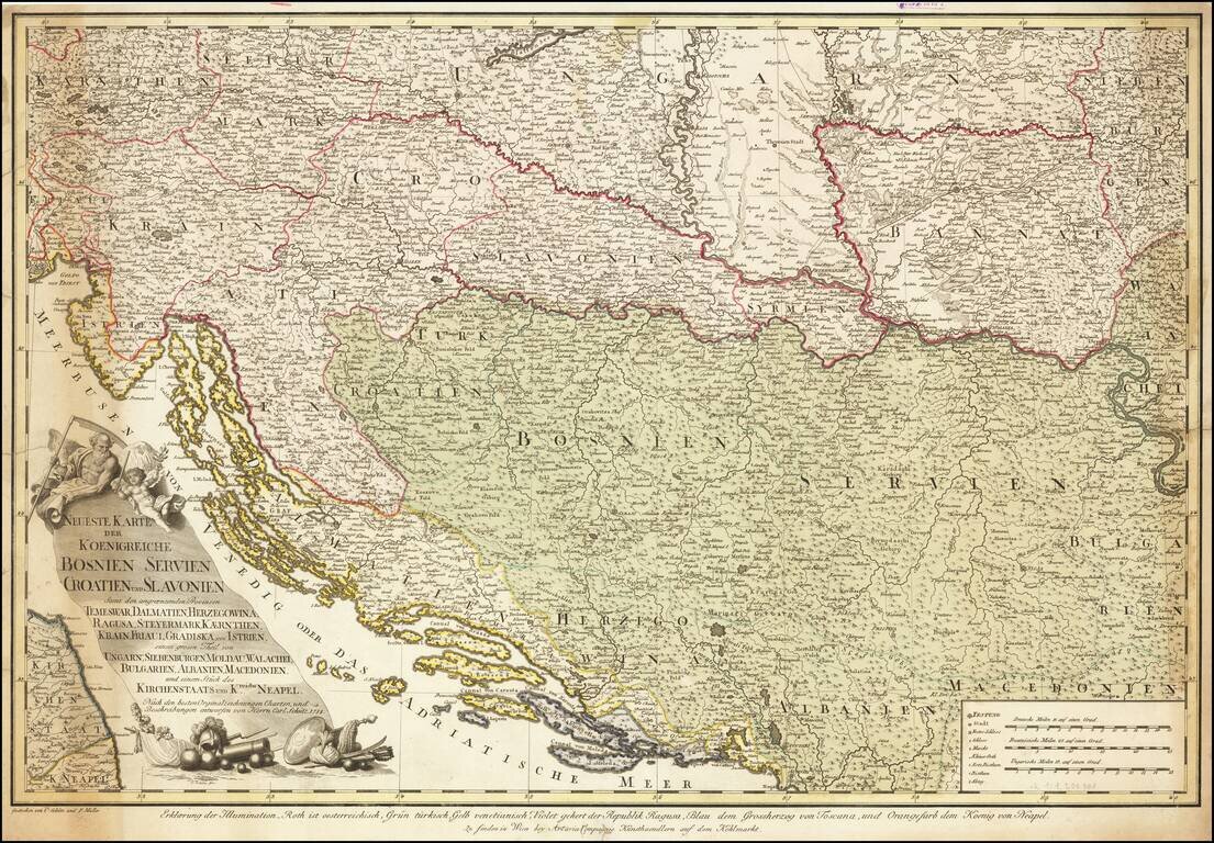
Extremely rare separately published map of the region bounded by Adriatic in the south and centered on the course of the Donau (Danube) River. The map is drawn from larger maps published General Bauer and F. Schmid, with credits for this map given to...
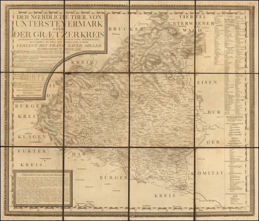
Rare Separately Published Map from Kindermann's Important Atlas of Inner Austria Rare late 18th Century map of the Graz region in Southwestern Austraia, which was one of 12 maps, typically referred to as the Atlas von Inner Osterreich (Atlas of Inner...
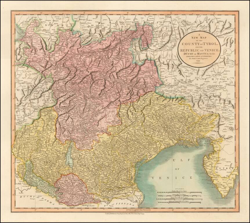
Detailed regional map of the area north of the Gulf of Venice, hand colored by provinces. Shows roads, rivers, lakes, mountains, islands, towns, etc. One of the best large format English atlas maps of the period. Gorgeous wide margined example.
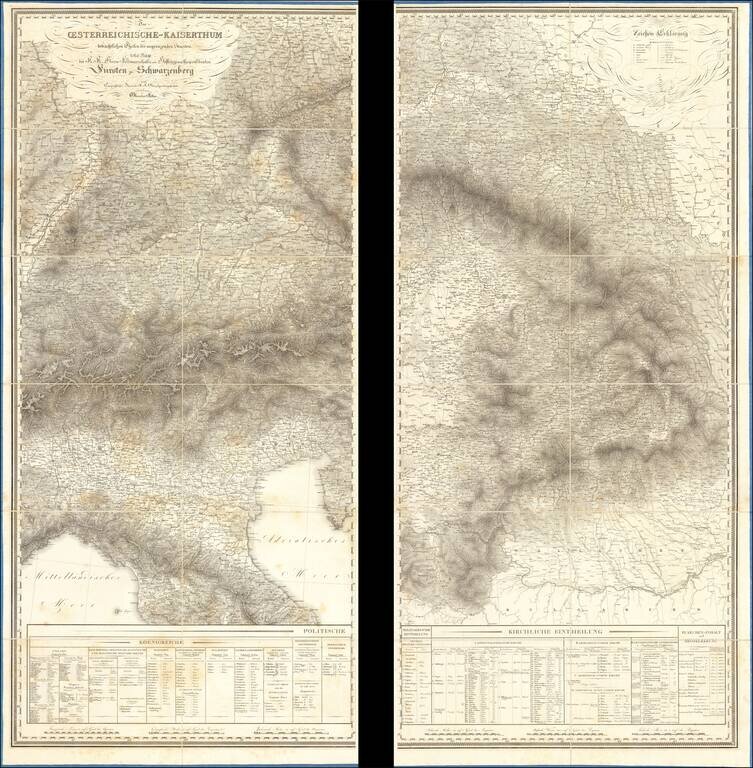
Six of 9 sheets, of this rare detailed map of the Austro-Hungarian Empire. The map was published by the : Topographisches Bureau des K.K. Generalquartiermeisterstabs.
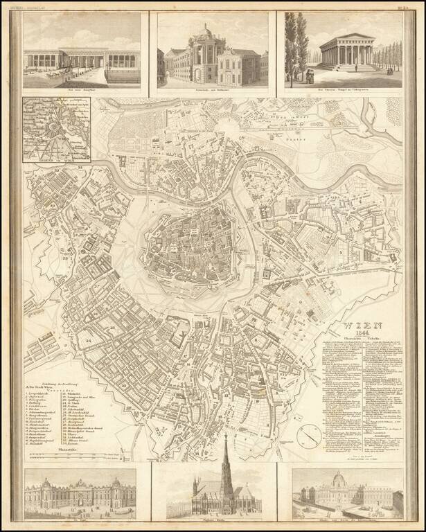
Decorative map of Vienna, published by Joseph Meyer. The map includes 6 large decorative vignettes.
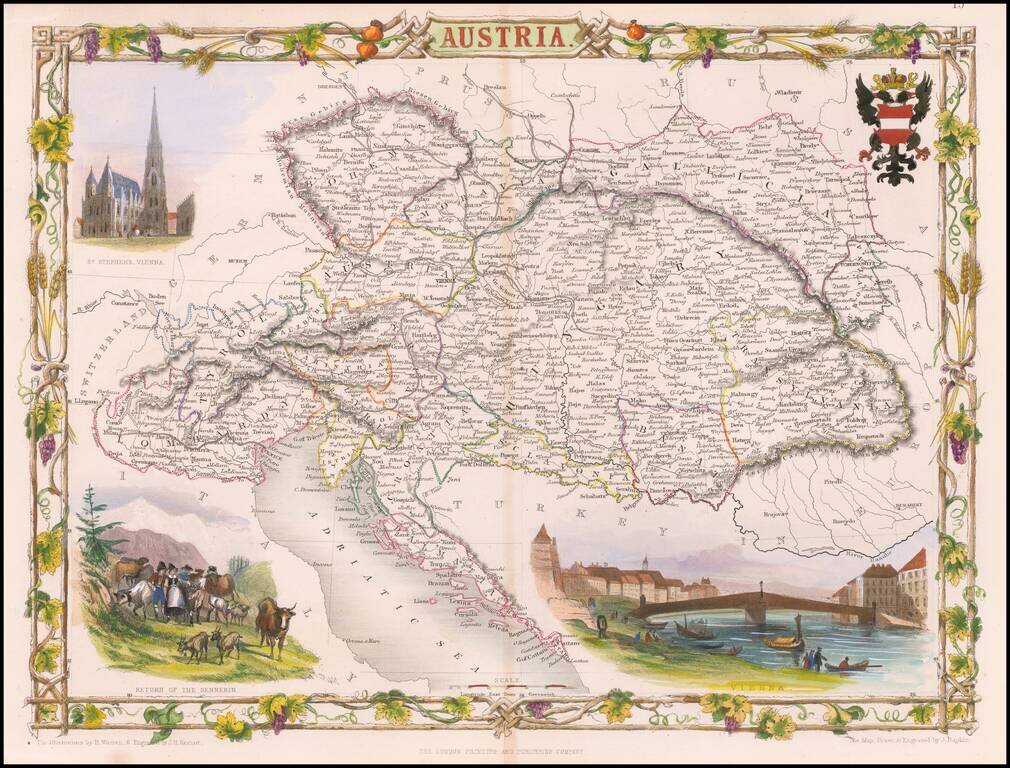
Gorgeous full color example of Tallis' decorative map of Austria, with vignettes showing St. Stephens, Vienna, and Return of the Sennerin. Engraved for R. Montgomery Martin's Illustrated Atlas. Tallis was one of the last great decorative map makers....
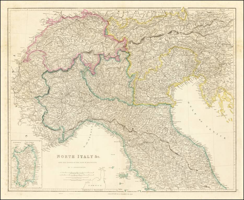
Detailed map of Northern Italy (including Switzerland and Austria, etc.), published in London by John Arrowsmith. The map appeared in Arrowsmith's London Atlas.
![[Vienna - Siege of 1683] Illustriss.mo et excell.mo domino domino Rutgero Ernesto Comitia Stahremberg, aurei velleris equiti, sac. caes. regiaeque mai. camerario, campi marescallo generali, consiliario aulico bellico, commendanti Viennae. Viennam Austria](/map/small/63249.jpg)
1683 Siege of Vienna Panoramic View Map Rare separately issued plan / view of Vienna, published in Vienna by Heinrich Schmidt and Albert Camesina. This unusual work presents a rounded view of the area outside of Vienna's city walls, at the time of...
![[Austrian Alps] Dachstein / Der Alt Welt Begriff, Besthende in 3 Haubt Theilen als Arica, Europa, Asia. Warinnen der Erste Meridian nach Frantzossicher art gezogen](/map/small/68924.jpg)
Lively pictorial map of the region centered on Dachstein in the distance. Centered on Traunsee, Attersee, Mondsee, Zellersee, Wofgangsee, Hallstattersee Fuschlsee, Wallersee, etc.
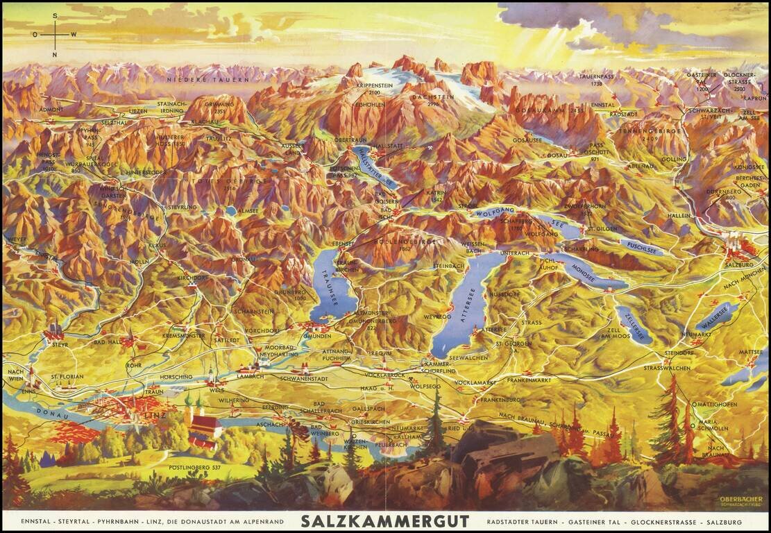
Lively pictorial map of the region including Salzburg, Linz and the Donau (Danube) River, oriented with south at the top. Centered on Traunsee, Attersee, Mondsee, Zellersee, Wofgangsee, Hallstattersee Fuschlsee, Wallersee, etc. The tallest peaks in...
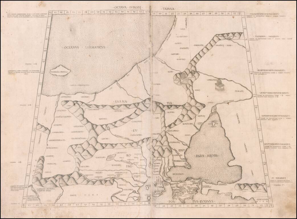
The Earliest Obtainable Map of the Poland, the Baltic, Russia & Ukraine Region Important early map of Northeastern Europe, from the Baltic to the Sea of Azoff and the Danube, which first appeared in the 1478 Rome edition of Ptolemy's Geography,...
![Octava Europae Tabula [Russia, Ukraine, Poland, Baltic]](/map/small/42081.jpg)
Sylvanus' map of Poland, the Baltic, Russia and Ukraine, extending south to the Black Sea and west to the Vistula. Sylvanus's map is one of the earliest obtainable maps of the region and the first printed in two colors. The map appeared in Sylvanus'...