
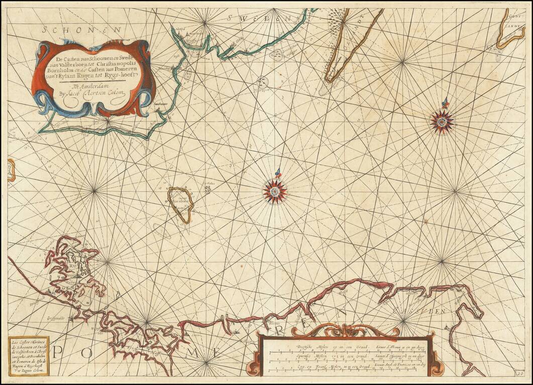
Rare early Dutch sea chart, pubished in Amsterdam by Jacob Colom. The map covers the coastlines of western Poland, Pomerania and part of southern Sweden. The chart appeared in one of the earliest Dutch Sea Atlases. The only example of the map we...
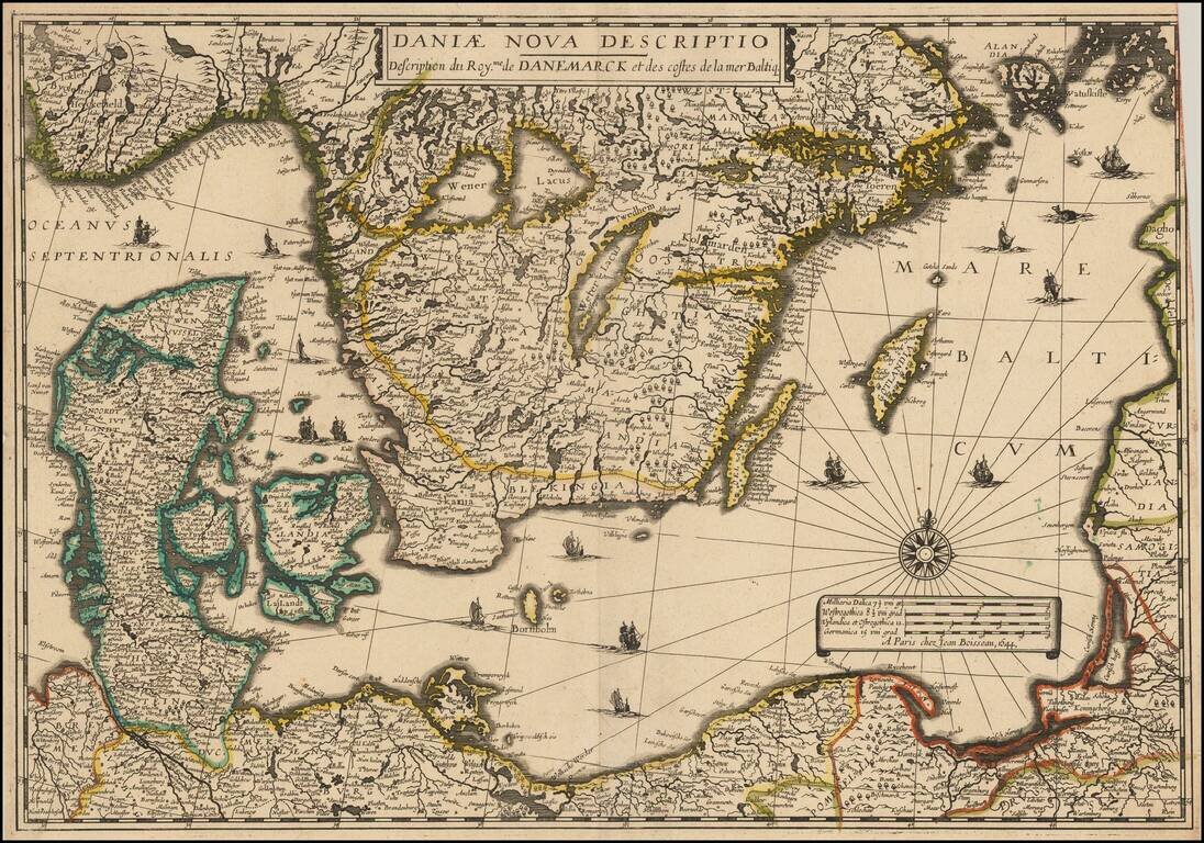
Rare separately issued map of Scandinavia and the Baltic Regions, published by Jean Boisseau. The map would later be issued by Langlois in Paris, circa 1660, with name "Mare Balticum" revised to "Mer Balticque." Not in Pastereau or Nordenskiold. We...
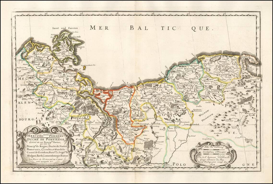
Nicolas Sanson's engraved map of Pomerania, straddling the modern border of Germany and Poland. The map was published in Paris in 1654.
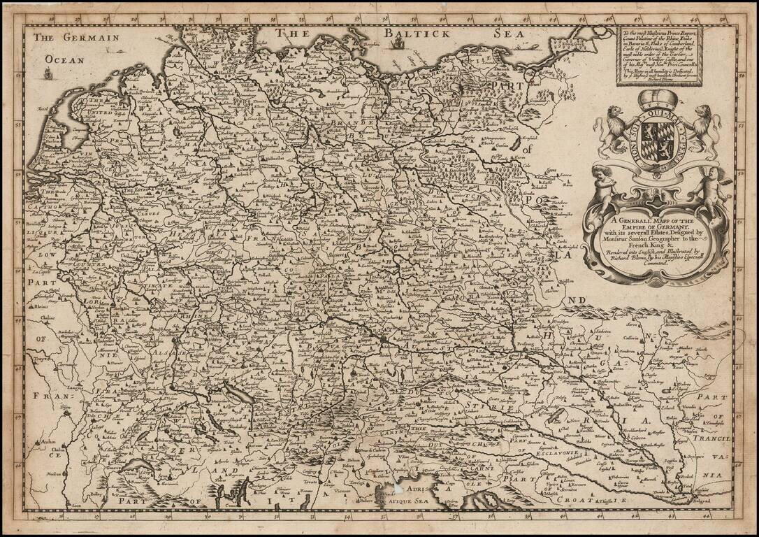
A striking dark impression of Richard Blome's scarce map of the German Empire, the earliest folio sized map of the region to be engraved in England. The map features an elaborate heraldic cartouche and a dedication to Prince Rupert, Count Palatine of...
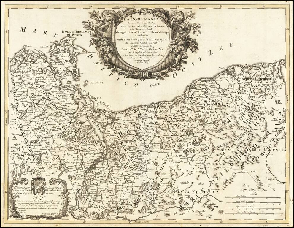
"Why would you not live without your joyous protector, O Pomerania, region that justly mourns the loss of its Palatine?" A scarce map of Pomerania, stretching along the coast from present-day eastern Germany to the outskirts of Gdansk in modern...
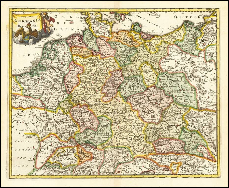
Interesting map of the Holy Roman Empire, including Germany, Poland, Lithuania, the Low Countries, Austria, Hungary, etc. From Cluverius' Introductio in Universam Geographiam (first issued in 1629) and re-issued many times over the next 100 years,...
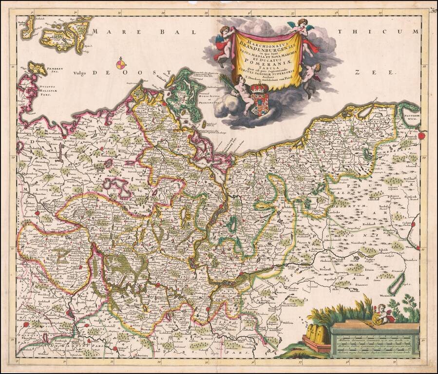
Fine old color example of Theodore Danckerts rare map the Brandenburg and Pomerania regions, published in Amsterdam. Extends east to Dantzig (Gdansk) and Chelm in Poland, to Donneberg and Magdeburg in the west. Cartouches depict coat of arms...
![Hanc Ger[maniae et P]oloniae de[s ... ]em Serenissim [P]otentissimi Poloniae Regi August offert et inscribit Petrus Schenck](/map/small/64898.jpg)
With Portrait of the King of Poland and Lithuania Large engraved antique map of Poland, Lithuania and the Holy Roman Empire, by one of Amsterdam's most important mapmakers, Peter Schenk. The map includes a portrait of King Augustus II the Strong,...
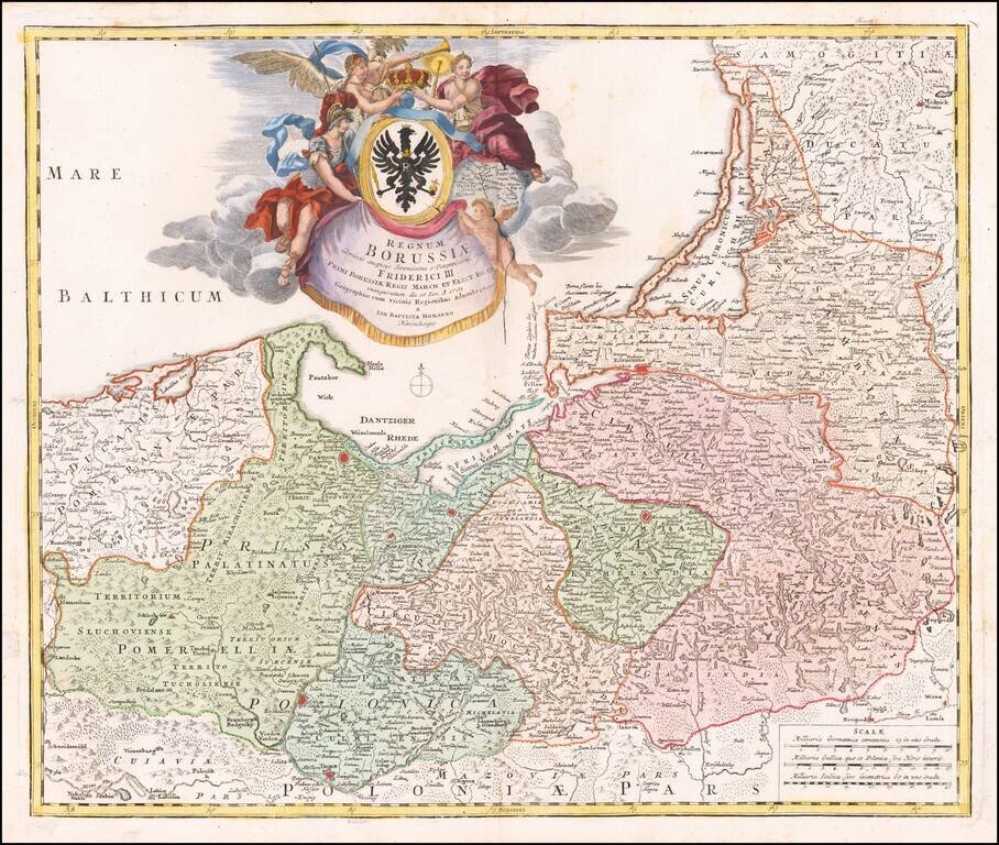
Fine map of Bohemia, celebrating the inauguration of Fredrick I as King of Prussia on January 1, 1713. Gorgeous map of the Baltic region, from Memel to Pomerania, extending south to Poland. Centered on Dantzig, Konigsberg, Heilsperg, etc. Magnificent...
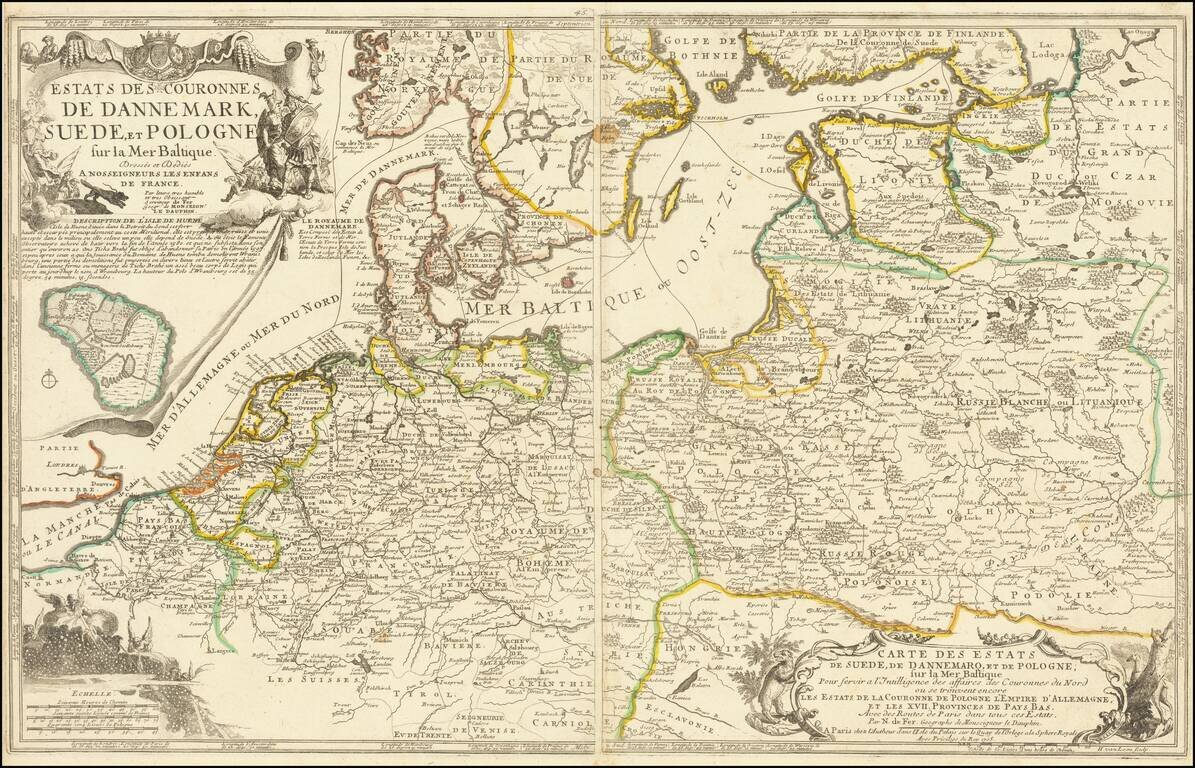
Scarce two sheet map of the Poland, the Baltic Sea and contiguous regions. The map includes a number of sea routes throughout the North Sea, Danish Sea and Baltic, ultimately connecting Finland and Latvia with Rotterdam, Friedrichstadt, Dantzig,...
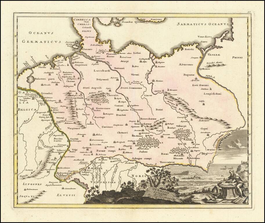
Decorative and highly detailed map of Ptolemaic Germany, extending east to the Vistula and South to the Danube River.
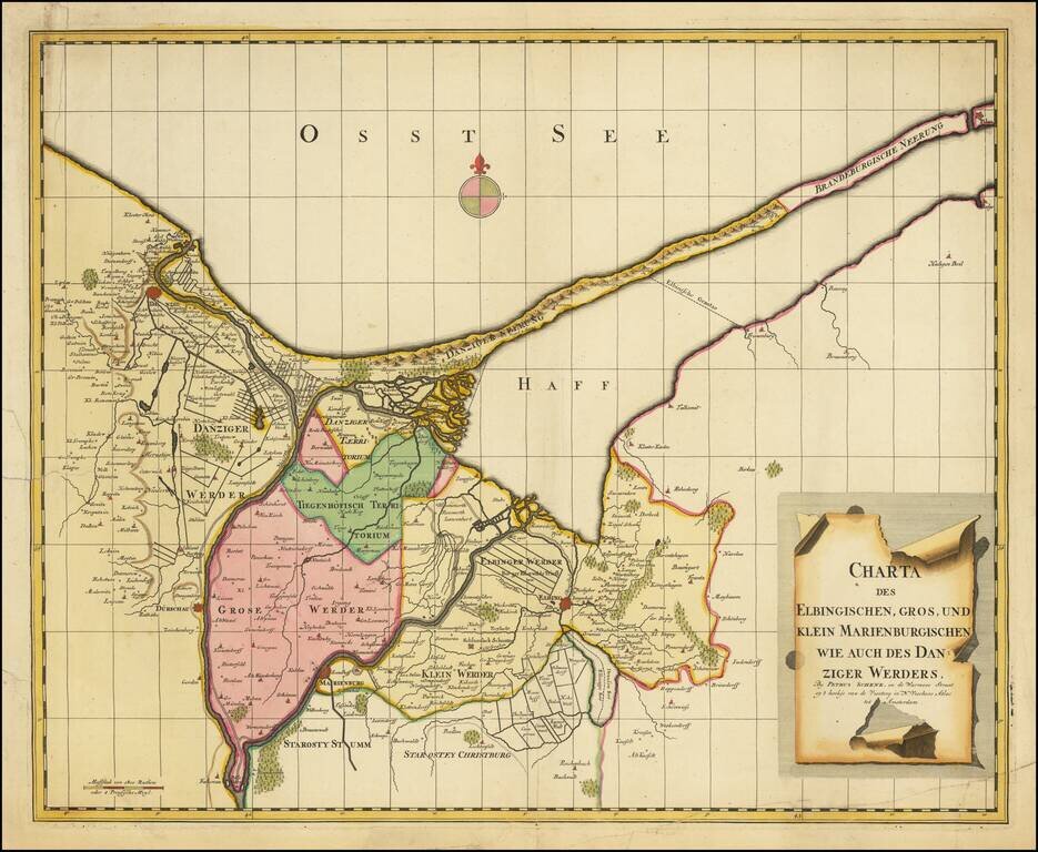
Scarce regional map of the area including Danzig, Elbang and Marienburg (Malbork), published in Amsterdam by Peter Schenk.
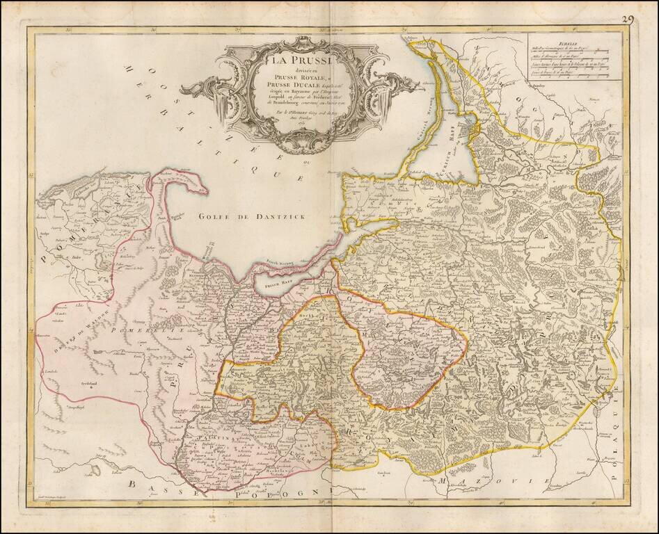
Detailed map of Prussia, including much of Poland and the Baltic Countries, published by De Vaugondy in Paris.
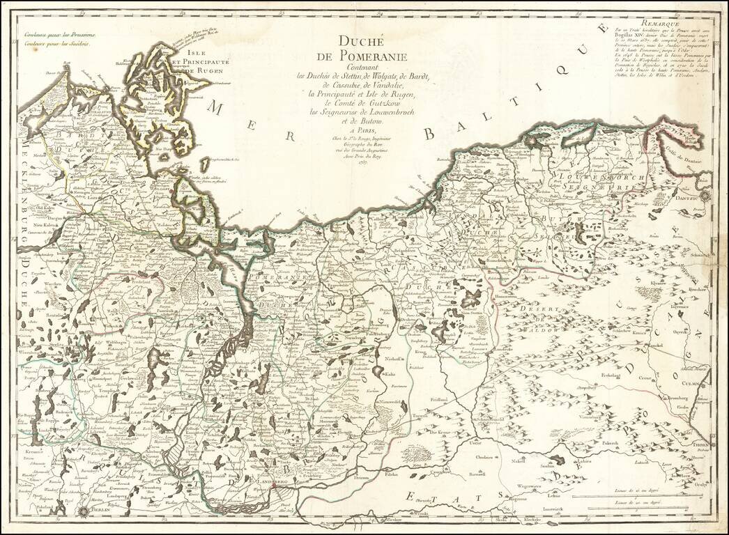
Scarce large format map of Pomerania and Szczecin, including the northwestern part of Poland, published by Le Rouge in Paris. Includes several roads, as well as towns, rivers, woods and lakes and other local details. The map is based on early maps by...
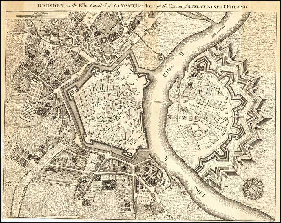
Fine early plan of Dresden was published in the supplement to the December 1759 issue of Universal Magazine, and accompanied an article on the city, with a focus on the treasures held within the Grünes Gewölb (Green Vault), a museum that holds the...
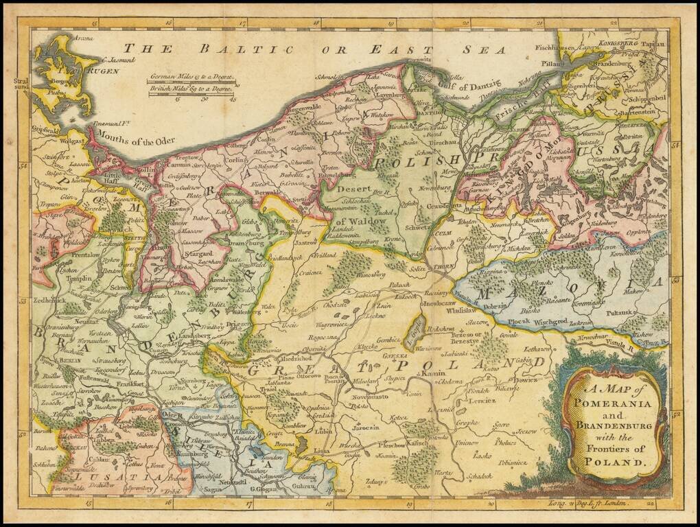
An attractive map of Poland and Northeastern Germany, with great detail of the small villages, forests, rivers, lakes and roads. Covers most of northern Poland with a bit of Germany, including Berlin and Frankfurt on the Oder River.