
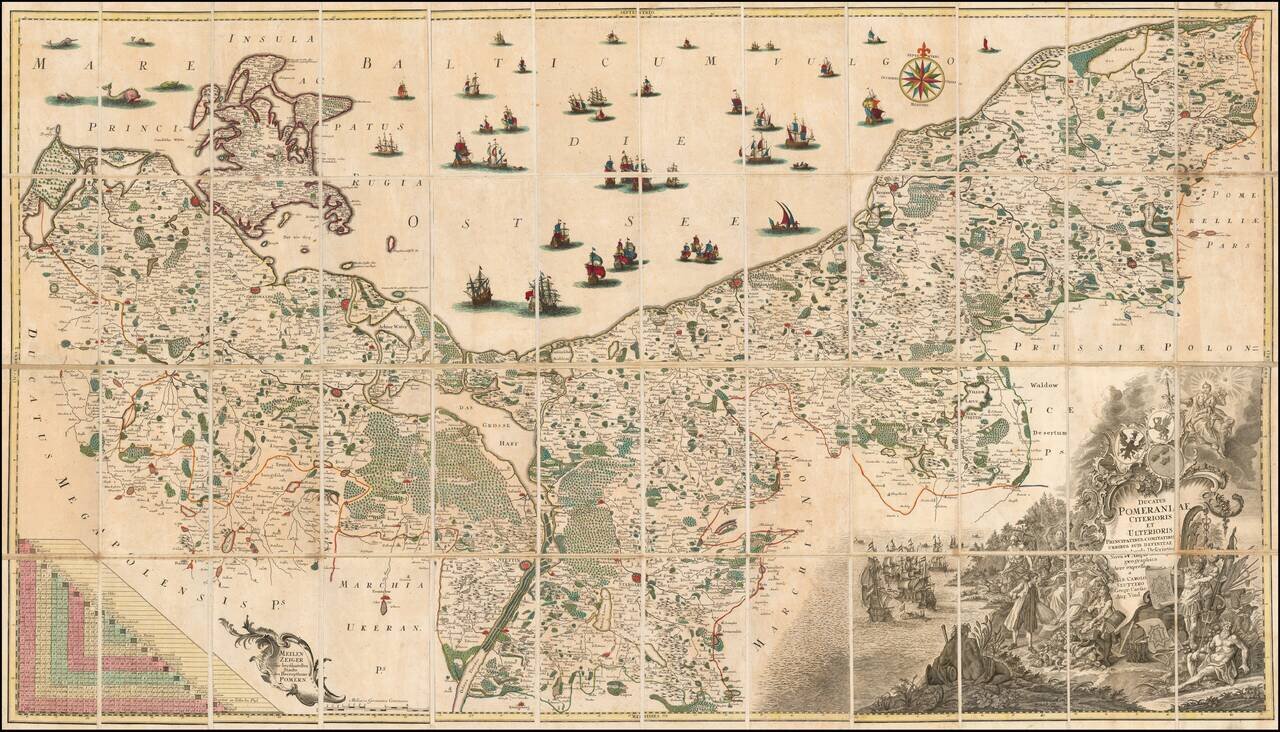
Fine example of the first state of Albrecht Carl Seutter's 6-sheet map of Pomerania, first published in about 1760. Seutter's map was based upon the so-called 'Lubin Map' and was created by the Rostock scholar, Eilhard Lubin, on behalf of the Duke...
Detailed map of the dismembered parts of Poland and the Baltic Region, extending from Prussia in the West to Smolensk in the East. Divided by regions. Highly detailed.
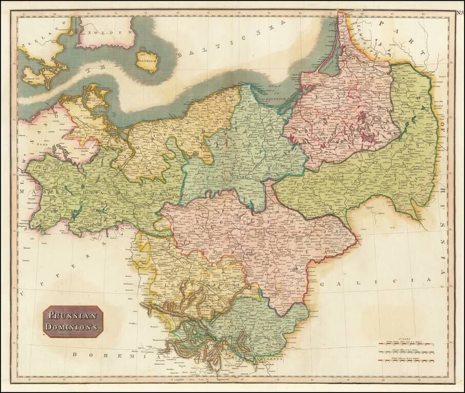
Detailed map of the Prussian Dominions, including parts of the former Kingdom of Poland. Colored by provinces. Excellent detail. One of the best large format English atlas maps of the period. Pinkerton's maps reflect the fine copperplate engraving...
![[Map of the Kingdom of Prussia and the Kingdom of Poland] Карта Королевства Прусского и Царства Польского](/map/small/66819.jpg)
Shows the Free, Independent, and Strictly Neutral City of Cracow with its Territory! Detailed and very rare Russian-language map of Poland, Prussia, and the Free City of Krakow, published in Saint Petersburg in 1836. This map shows Krakow as the Free...
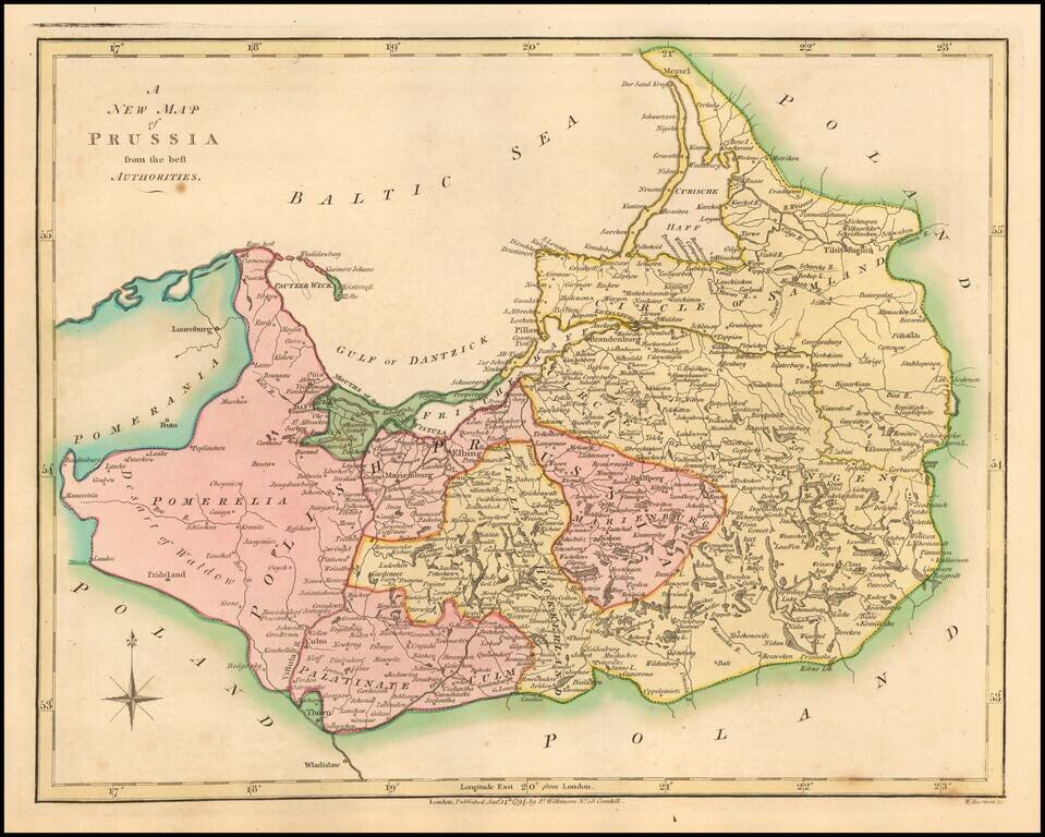
Attractive engraved antique map of Prussia (part of modern-day Poland and Germany), published by David Burr in New York in 1836. The map extends from the Lower Rhine in the west to central Poland in the east. Numerous towns are named, such as Leipzig,...
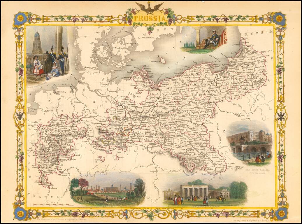
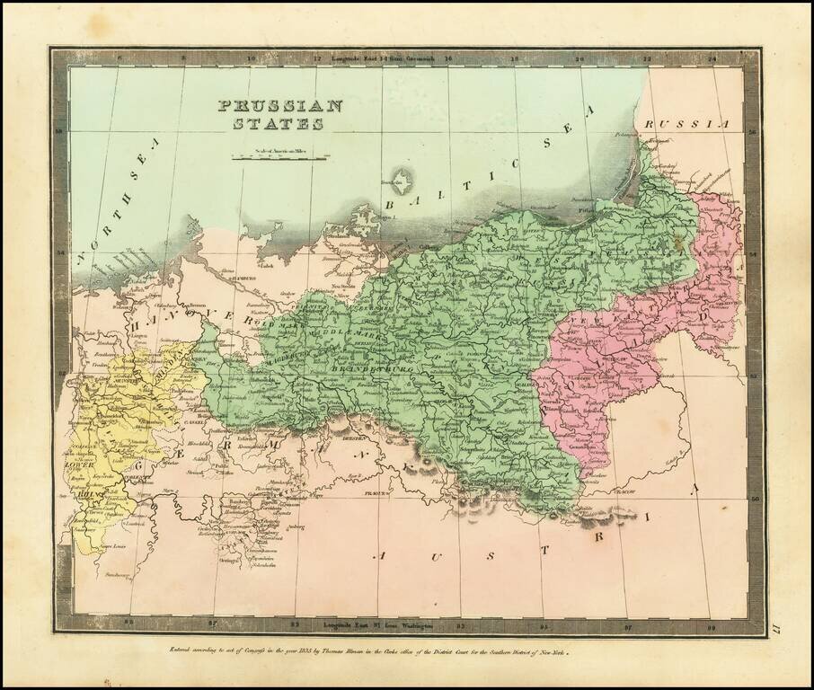
Stunning full color example of this marvelous map of Pussia, surrounded by decorative vignettes. Includes decorative vignettes showing French Church Berlin, Frederick the Great, The Royal Palace, Berlin, and Bradenberg Gate. Engraved for R....
![[Uniforms and Insignia of the German Army] Форма Обмундирования и Знаки Различия Германской Армии](/map/small/67803.jpg)
A very rare pre-World War II Soviet poster of Nazi-era German military uniforms. Underneath the title is an elaboration of colors used on the strap edging and buttonholes of troop uniforms, depending on their area of service. From left to right:...
![[Fascist Organizations of Germany] Фашистские Организации Германии](/map/small/67801.jpg)
One of the Most Dramatic Soviet Cartographic Appraisals of Nazi Germany. A fascinating Soviet poster map documenting the "Fascist Organizations of Germany", recording their structures, uniforms, and locations within the country, prior to the Second...
![(Second World War - Eastern Front) [The Soviet Encirclement of Konigsberg]](/map/small/65659.jpg)
Color-printed German map of East Prussia, with extensive manuscript additions in a Soviet hand noting the troop movements during the East Prussia Offensive and encirclement of Konigsberg. The Red Army movements are shown in red pencil, Wehrmacht...
![[Battle of Berlin] План г. Берлин 1:25000](/map/small/68524.jpg)
"The Victory Map". The Official Soviet Map Used in the Battle of Berlin, April 1945. This is a color-printed folding map of Berlin, issued by the Soviet Union in 1945, shortly before the Fall of Berlin. Many examples of this map were used by...
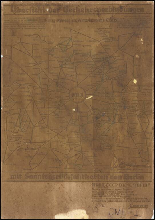
A fascinating relic of mapmaking on the Eastern Front of World War II, being a field-printed map of Berlin and the surrounding area produced for one of the most infamous groups involved in the Second World War, the Отдел Контрразведки...
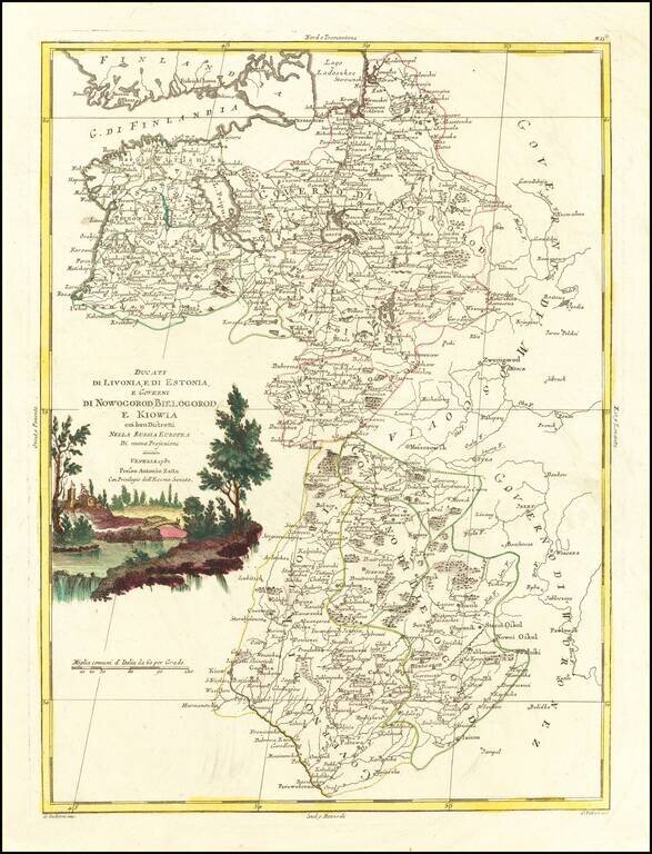
Antique engraved map of the Duchies of Livonia and Estonia, and the Governments of Novgorod, Belgorod, and Kiev. The map was published by Antonio Zatta in Venice in 1782.
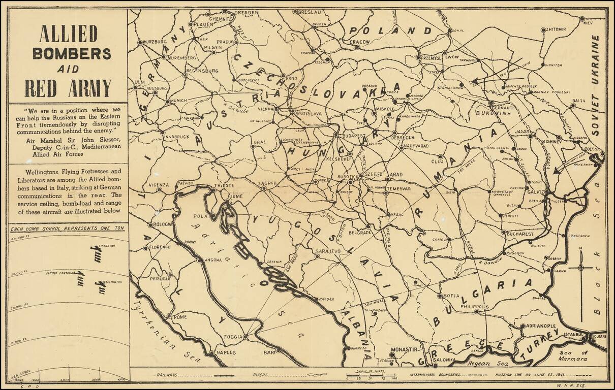
Anti-Nazi Propaganda Broadside Published in the British Empire Fascinating WWII broadside propaganda map, published in India, in order to keep the local populous informed about the War. The map provides a graphic overview of the Allied bombing...
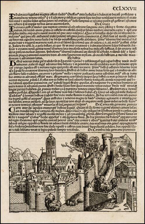
Nice example of Schedel's mythical view of the City of Carinthia, published in 1493. Hartmann Schedel's Liber Chronicarum: Das Buch der Croniken und Geschichten (commonly referred to as the Nuremberg Chronicle, based upon the city of its publication),...
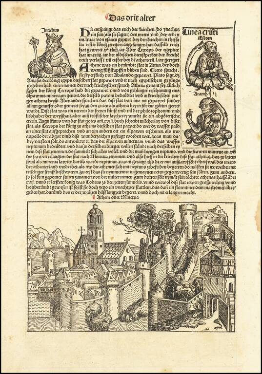
Nice example of Schedel's mythical view of the City of Carinthia, published in 1493. Hartmann Schedel's Liber Chronicarum: Das Buch der Croniken und Geschichten (commonly referred to as the Nuremberg Chronicle, based upon the city of its publication),...
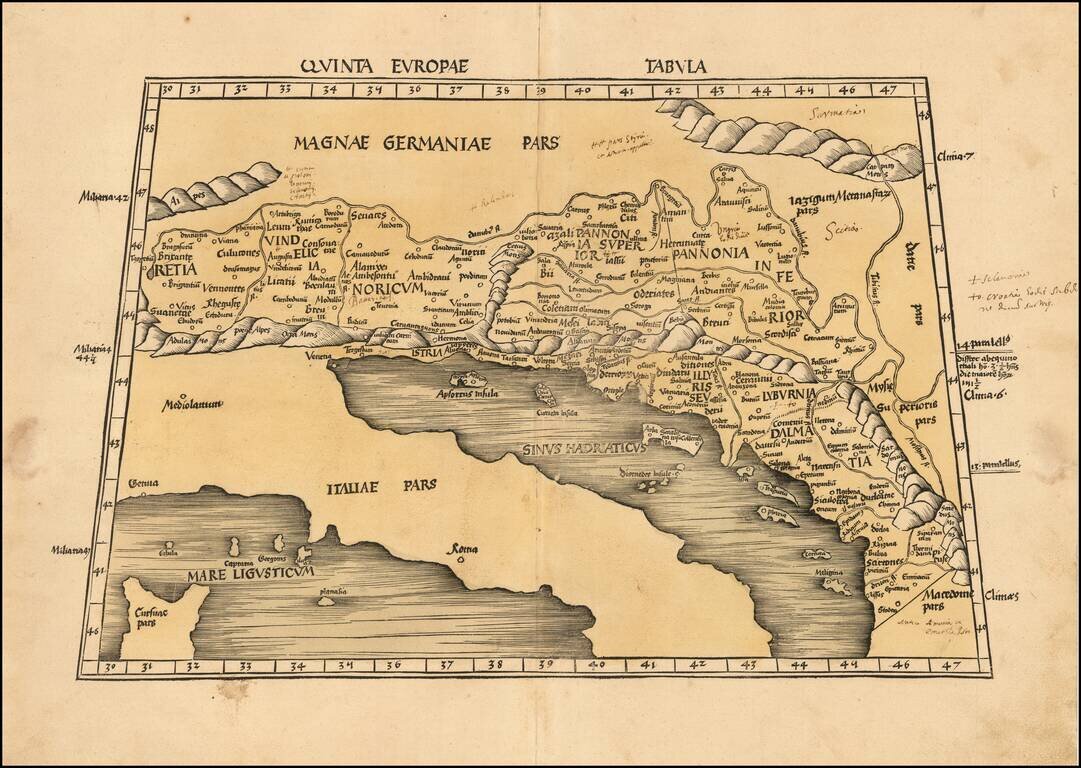
Nice example of Martin Waldseemuller's map of the region between the Danube River and the Adriatic Sea from the 1513 edition of Waldseemuller's Geographia. The map extends from Italy and the Adriatic Sea in the South to Austria, Croatia, Slovenia,...