
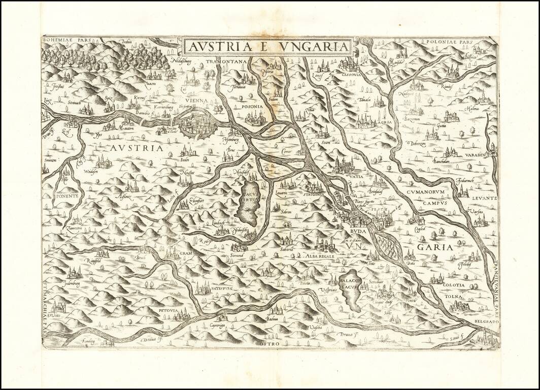
First State of Lafreri's Rare Map of Austria & Hungary Rare of the Austria and Hungary, published in Rome by Antonio Lafreri. The present map is among the earliest obtainable modern maps of Austria and Hungary. Based upon an early map engraved...
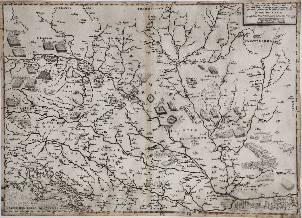
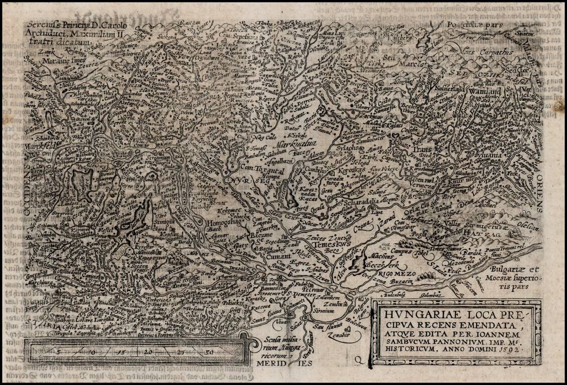
Rare Early Lafreri School Map of Hungary, Austria and the Balkans Region Nice example of Paolo Forlani's rare map of Austria, Hungary, Transylvania and adjacent regions. The map depicts the military activities in the region, between the...
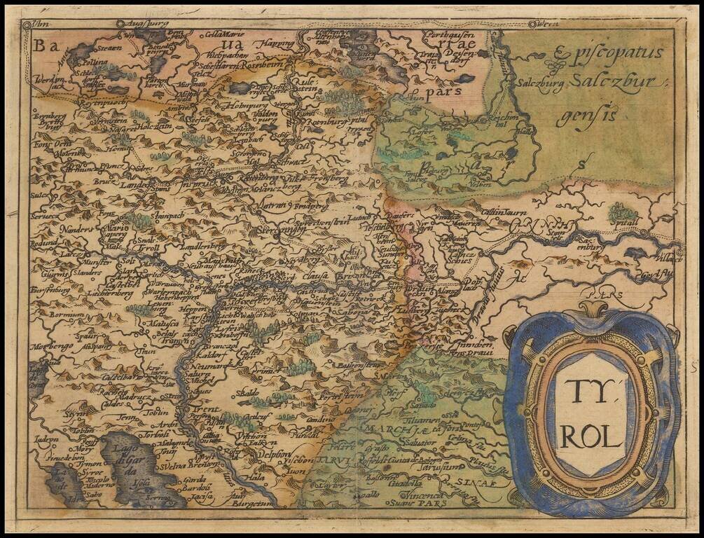
Rare modern map of the Tyrol region, extending from Lago di Garda and Vincenzo in the south to Innsburck, Kitzbuel and Villach in the north, published in Cologne by Johannes Metellus in 1579 in fine original color. The map is one of the earliest...
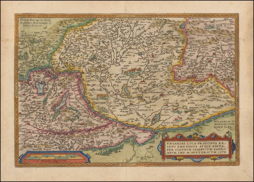
Nice full color example of Ortelius' map of Hungary and surrounding regions. Highly detailed regional map with decorative cartouche, coat of arms and migratory animals in the middle of the map. The map appeared in Ortelius' Theatrum Orbis Terrarum,...
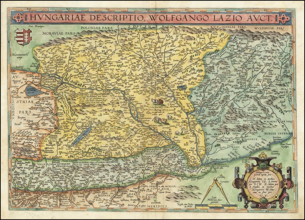
Striking full color example of Ortelius' map of Hungary and surrounding regions, which appeared in Ortelius' Theatrum Orbis Terrarum, the first modern atlas of the World. Highly detailed regional map with decorative cartouche, coat of arms and...
![Rhetiae alpestris descriptio in qua hodie Tirolis Comitatus [with] Goritiae, Karstii, Chaczeolae, Carniolae, Histriae, et Windorum Marchae Descrip.](/map/small/22133.jpg)
A nice full color example of these two regional maps by Ortelius. The Tirolian map extends from Mantua, Verona and Vincenza to Furstenfeld, Mildorf and Wasserburg and is centered on Innsburck. Salzburg also appears. The second map extends from the...
Decorative regional map of Austria and Hungary, following the Danube from Lintz to Bratislava and extending north to the Teya and south to the Dranus. A nice full color example with wide margins. From the 1587 French edition of Ortelius' Theatrum...
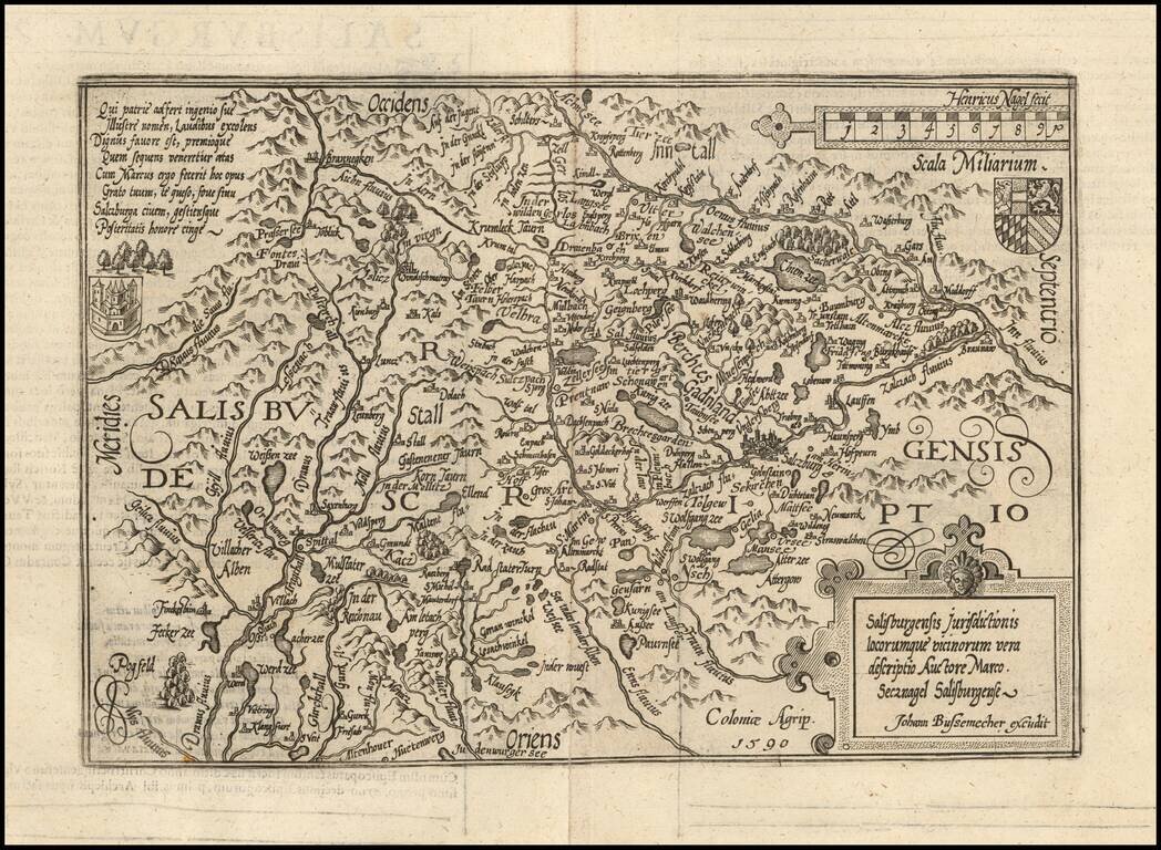
Detailed map of Saltzburg, based upon an earlier map by Markus Setznagel. Setznagel was the son of an official and member of the external council of the city Salzburg, Michael Setznagel. His most important work was the first general map of Salzburg,...
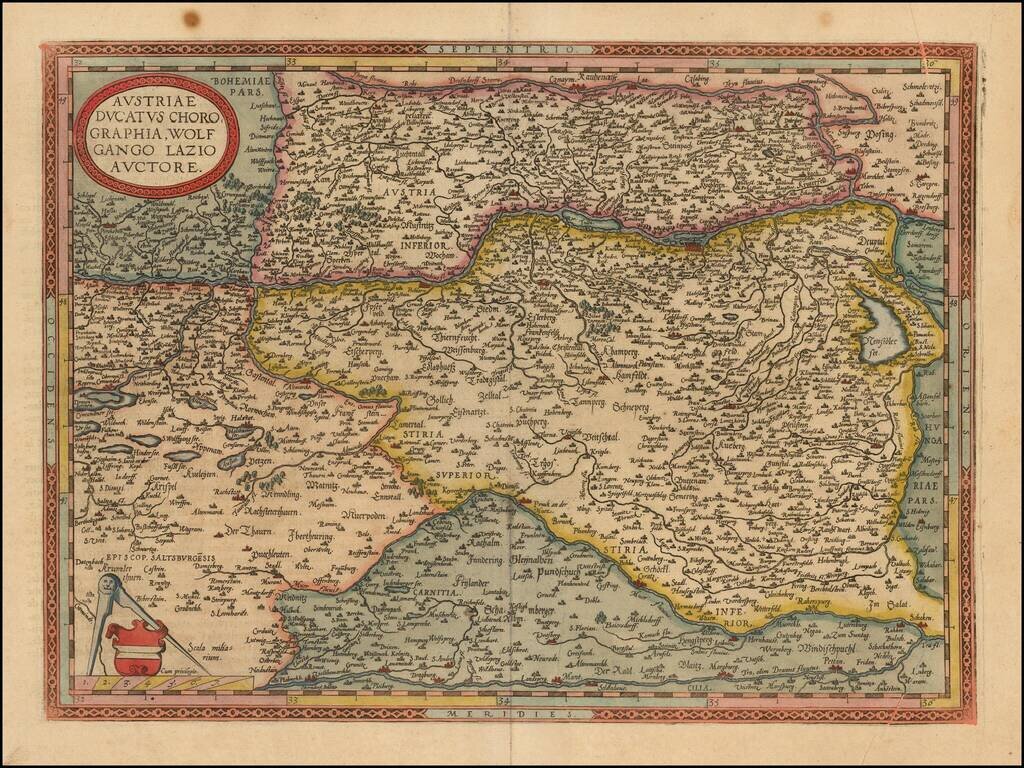
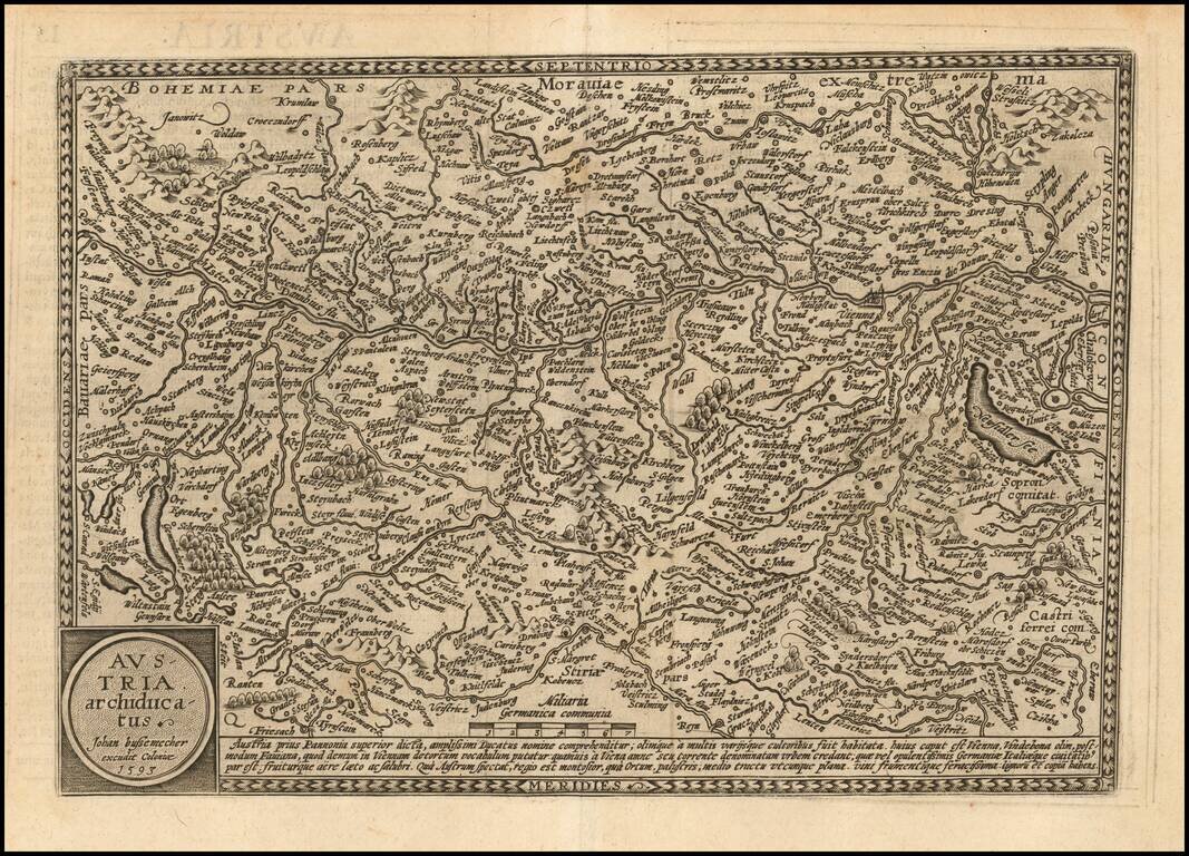
De Jode's edition of Wolfgang Lazius' map of Austria. Fine 16th Century map of Austria, extending from Lintz in the west to Gratz and Volkmarkt in the south, Bratislava and the Neusiedler See in the east. The map is drawn from Wolfgang Lazius' Typi...
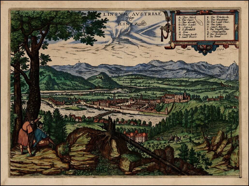
Decorative early view of Braun & Hogenberg's view of Lintz, from an elevated viewpoint, looking south from Across the Danube. The map is based upon a landscape painting by Lukas van Valckenborch, engraved by Georg Hoefnagel in 1594. The text on...
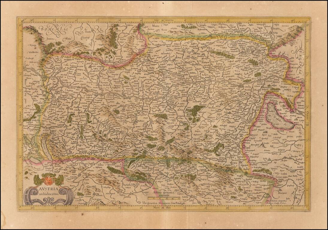
Old color example of the Mercator's map of Austria from his Atlas Sive Cosmographia. The map is centered on the Danube River from the Bavarian border to Pressburg.
Detailed map of the the region bounded by Vienna in the West and following the course of the Danube to Belgrade. Decorative early region map, centered on Hungary.
Detailed map of Austria, published in Cologne by Quad and Bussemacher. Matthaus Quad was a German cartographer based in Cologne. The map was engraved by Johannes Bussemacher and appeared in several Geographical works published by Quad and Bussemacher...
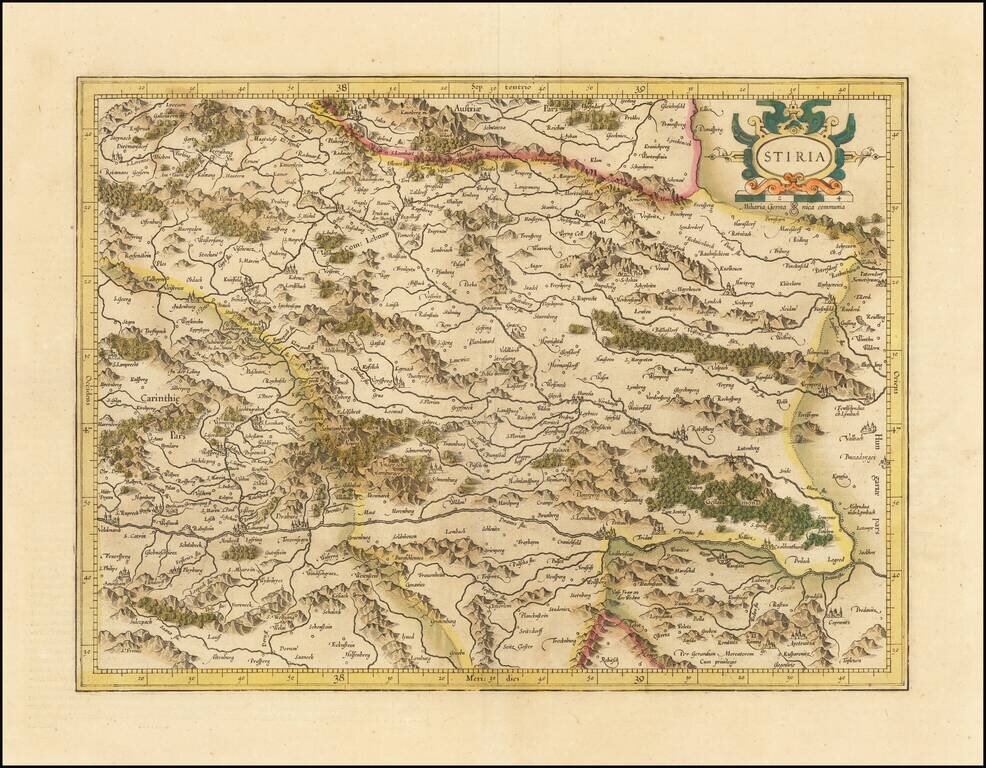
Detailed map of Stiria, centered on the course of the Dranus River and the Mura River. Decorative cartouche with coat of arms.
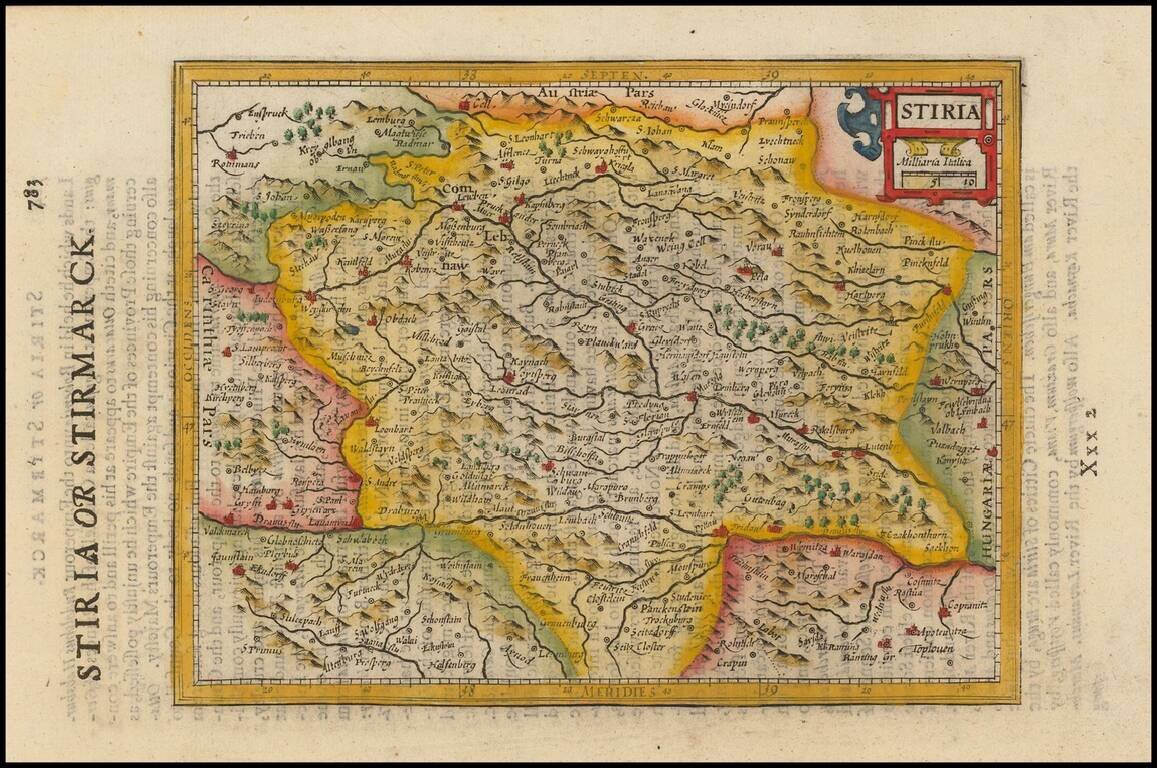
Fine map of Stiria, from the 1625-26 edition of Purchas His Pilgrims, one of the seminal early 17th Century English Language travel works. On a 13 x 9 inch sheet with English text, front and back.
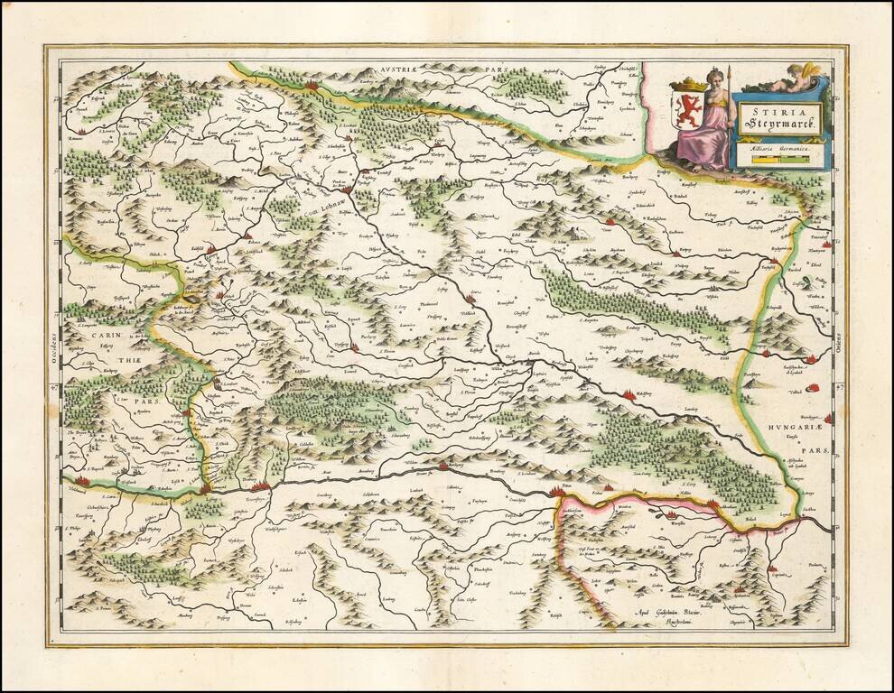
Detailed map of Stiria, published by Willem Blaeu. The map tracks the region north of the Drava River. Major cities include Gratz, Voitsberg, Bruck an der Mur, Kapfenberg, Leoben, Kobenz, Knittelfeld, Obdach, Kreiglach,