Map size in jpg-format: 70.0302MiB
Click to open in high resolution (open in new tab).
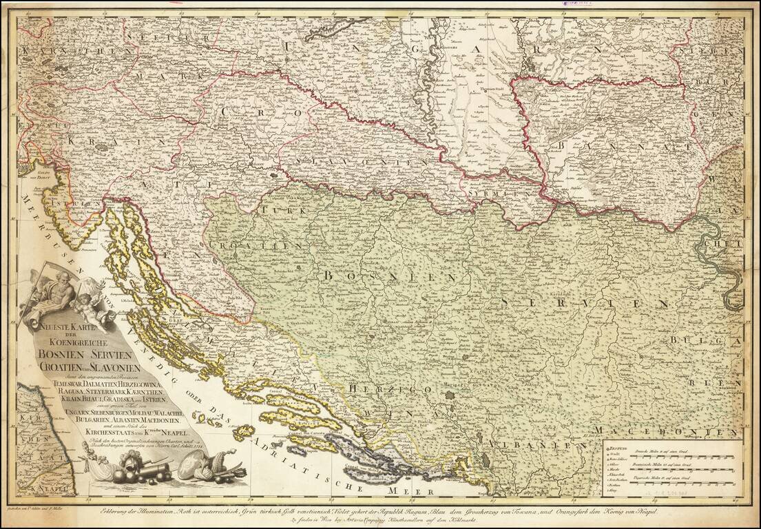
Extremely rare separately published map of the region bounded by Adriatic in the south and centered on the course of the Donau (Danube) River.
The map is drawn from larger maps published General Bauer and F. Schmid, with credits for this map given to H.C. Schmitz and Franz Muller. Fantastic engraving and decorative cartouche.
This is one of the two versions of the map. The other includes a title in French in the upper margins and a privilege notation at the bottom left ( C. Priv. S. C.M. ).
If you are a student, write to us in telegram: @antiquemaps and indicate what material you need and for what work you need a map in high detail. We are ready to provide material on special terms. For students only!