logo

1965. Salzkammergut

  • Salzkammergut
  • Salzkammergut

Map size in jpg-format: 32.6525MiB

Download "Salzkammergut", in high resolution.

Salzkammergut information:

Year of creation: 
Resolution size (pixels): 
 9765x6748 px
Disk Size: 
 32.6525MiB
Number of pages: 
 2
Place: 
 Vienna
Author: 

Print information. Print size (Width x height in inches):
Printing at 72 dpi 
  135.63 х 93.72
Printing at 150 dpi 
 65.1 х 44.99
Printing at 300 dpi 
 32.55 х 22.49

An example of detailing the file of this map of in a printable high-resolution:

Click to open in high resolution (open in new tab).
Attention! this is just the central piece (central area 960x960 px) of the map file!
This is an example, so that you can see and study the level of detail of a given map. The entire Map will be fully available after payment!

Salzkammergut

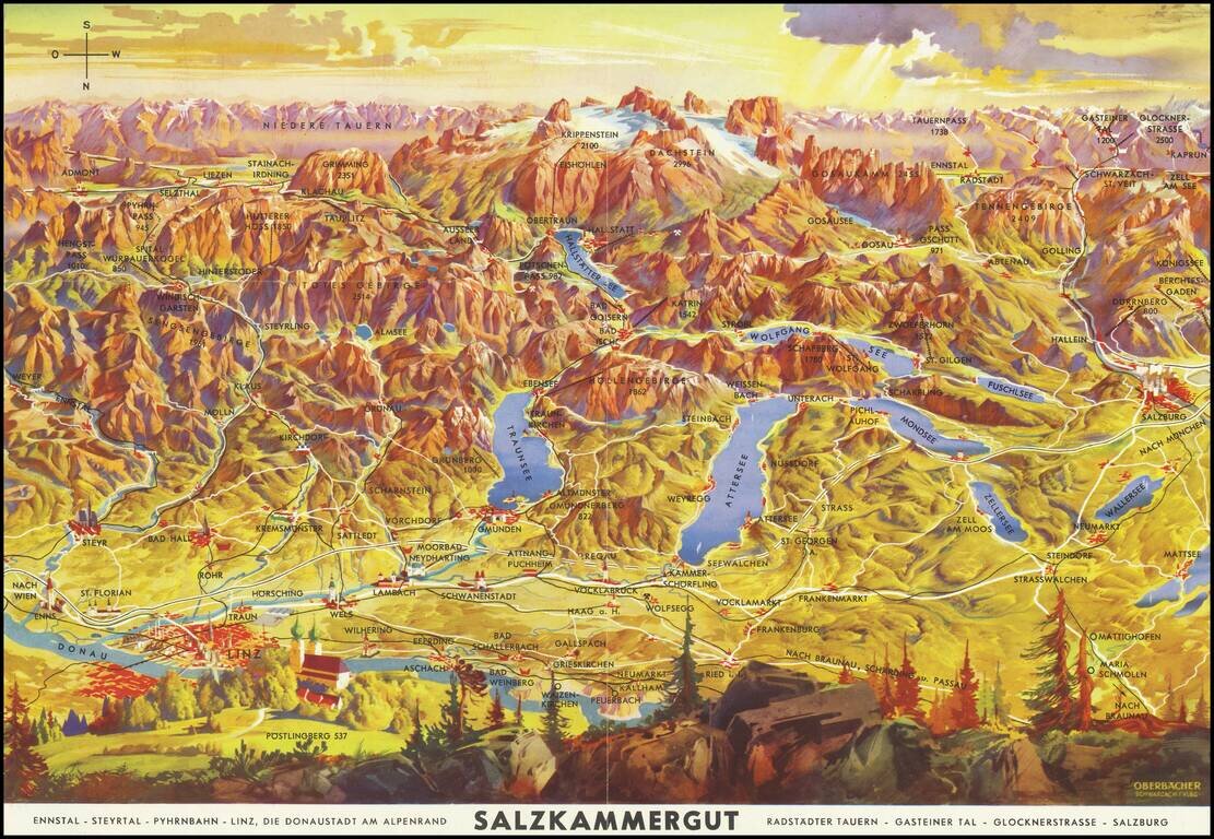
Lively pictorial map of the region including Salzburg, Linz and the Donau (Danube) River, oriented with south at the top.

Centered on Traunsee, Attersee, Mondsee, Zellersee, Wofgangsee, Hallstattersee Fuschlsee, Wallersee, etc.

The tallest peaks in the center are Krippenstein and Dachstein.


Special conditions for students!

If you are a student, write to us in telegram: @antiquemaps and indicate what material you need and for what work you need a map in high detail. We are ready to provide material on special terms. For students only!

Item information:

Year of creation:
Size:
9765x6748 px
Disk:
32.6525MiB
Number of pages:
2
Place:
Vienna
Author:
J. Wimmer.
$14.99

Related item