
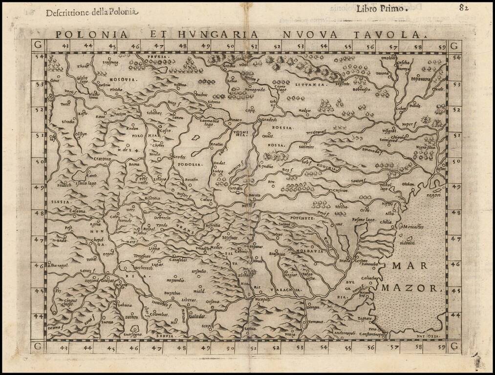
Striking dark impression of Ruscelli's map of Poland, Hungary, Slovakia, the Czech Republic and parts of the region bounded by the Black Sea in the east and the Danube in the south. Ruscelli's Atlas is an expanded edition of Gastaldi's Atlas of 1548,...
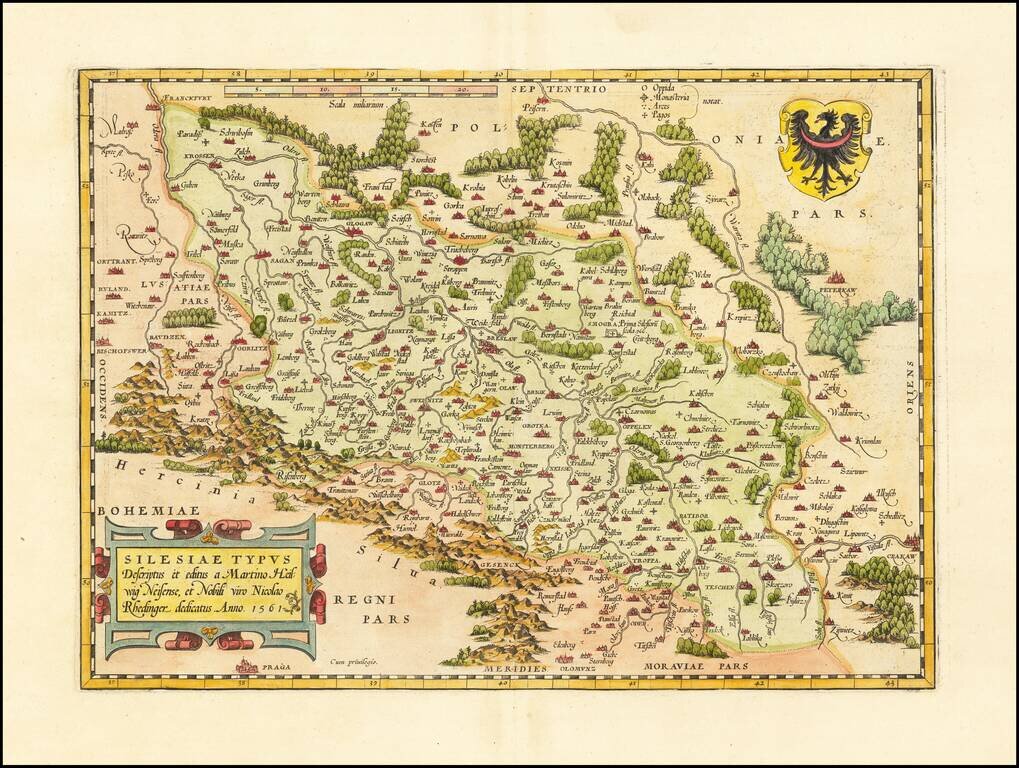
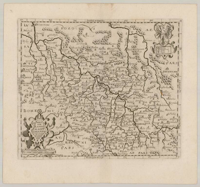
The Abraham Ortelius edition of Martin Helwig's seminal map of Silesia. Important regional map of Silesia, from Abraham Ortelius' Theatrum Orbis Terrarum, the first modern atlas of the World. Shows the region from Olomunz and Crackaw in the south to...
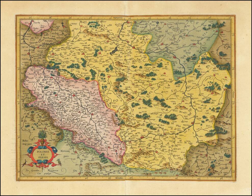
Fine old color example Mercator's detailed map of a portion of Poland, including a number of its major cities (Warsaw, Krackow, Oppeln, Breslau, Gnezna, Graudenz, Lublin, etc.).
This is an early state of Barent Langenes's map of the region around the headwaters of the Vistula. The map of this historically significant part of Poland is detailed, with dozens of cities and towns labeled, and the many tributaries of Poland's most...
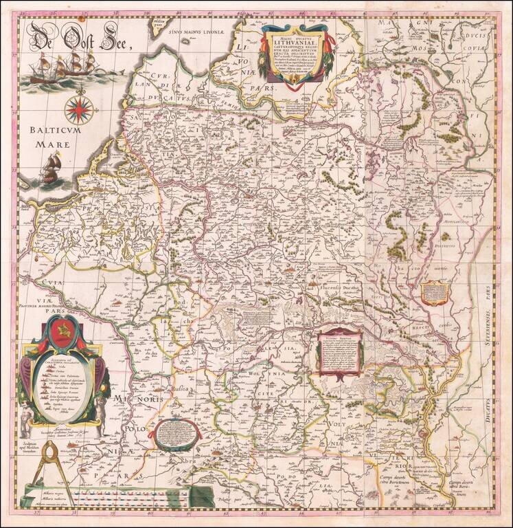
The Most Important Map of Lithuania and Poland from the first part of the 17th century Fine example of this important wall map of Lithuania and parts of Poland, Russia, Ukraine, Latvia, etc. extending to Cracow, Kiev, Warsaw, Riga, Konigsberg,...
![[Warsaw] Varsovia](/map/small/66354.jpg)
Fine old color example of this important early view of Warsaw, first published by Braun & Hogenberg in Theatri praecipuarum Totius Mundi Urbium Liber Sextus Anno MDCXVII, the rare 6th and final volume of their monumental work of City Views of the...
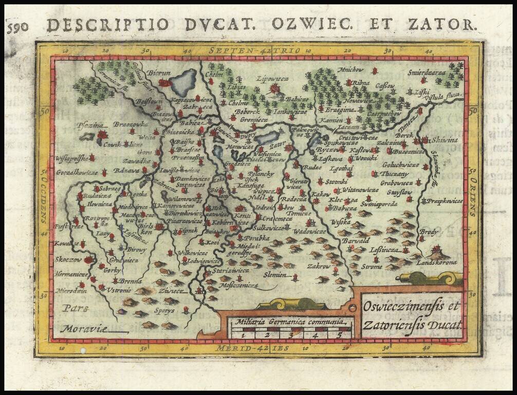
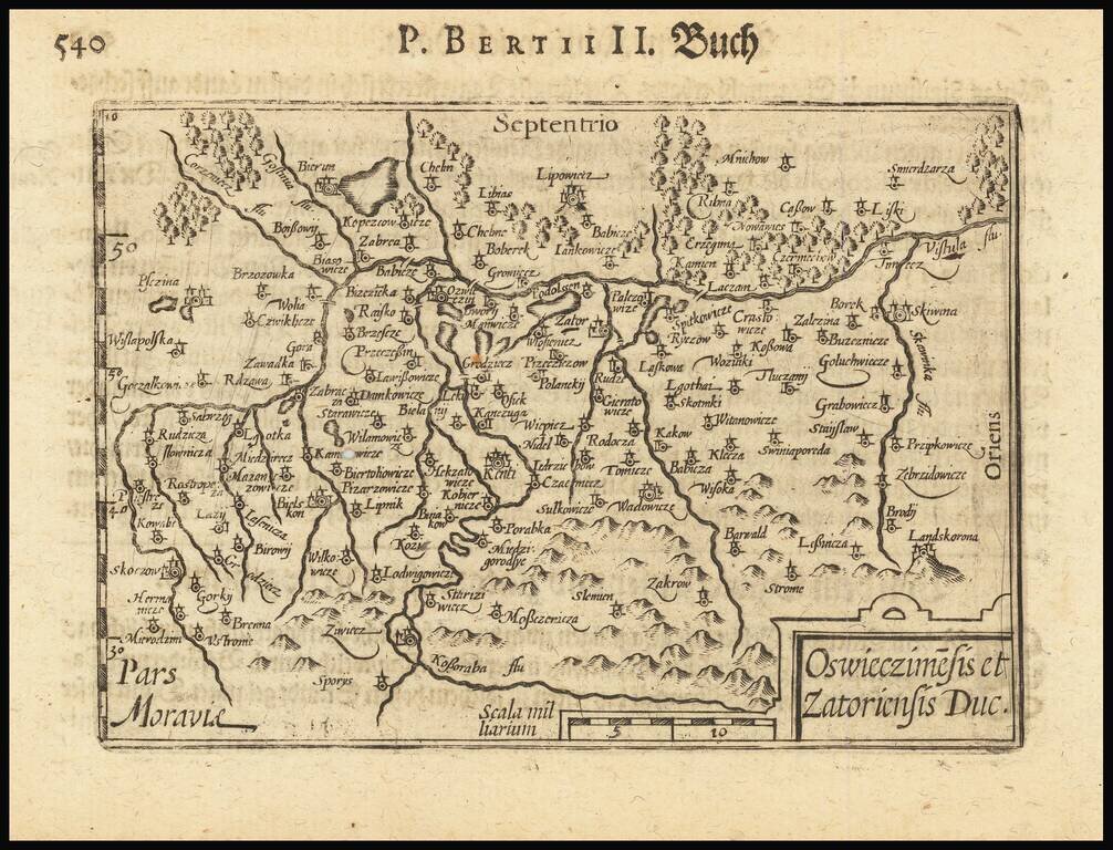
Nice example of the scarce map of southern Poland, from the Hondius/Bertius Tabularum Geographicarum Contractarum… Krakow is curiously depicted on the shore of a river, well south of the Vistula River.
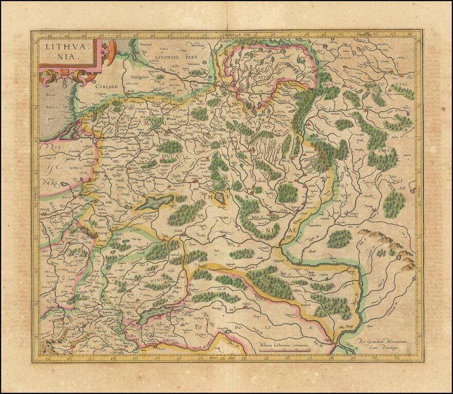
Nice old color map of Lithuania, with parts of Poland, Prussia, Ukraine and Belarus, published by Gerard Mercator. This is one of the maps which includes Gerhard Marcator's name as the map maker. Extends from the Baltic, including part of Prussia, to...
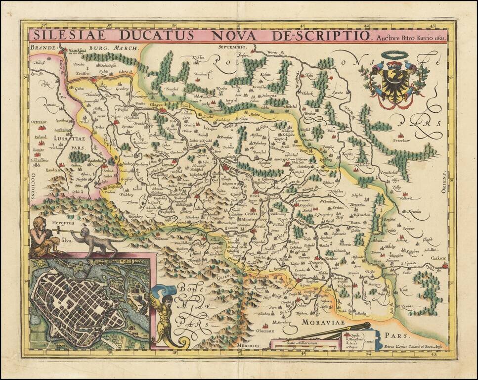
Scarce early Pieter van den Keere map of the Polish region of Silesia, published in Amsterdam in 1621. The map shows Silesia, bordered by the contemporary polities of Moravia, Bohemia, Lusatia, Brandenburg, and Polonia. At the center of the map is...
Scarce map of Southern Poland and a bit of Northern Moravia, published in Frankfurt by David Custodis (Custos).
![[ Gdansk Environs ] Schweetsche Schans Auff Den Weyselstrom ongefehr neun Meilen von Dantzig gelegen Ao. 1626.](/map/small/68842.jpg)
Swedish fort constructed on the Vistula River near Danzig, dated 1626. At the bottom a cartouche with a map held up by two soldiers appears, with a key locating 11 places.
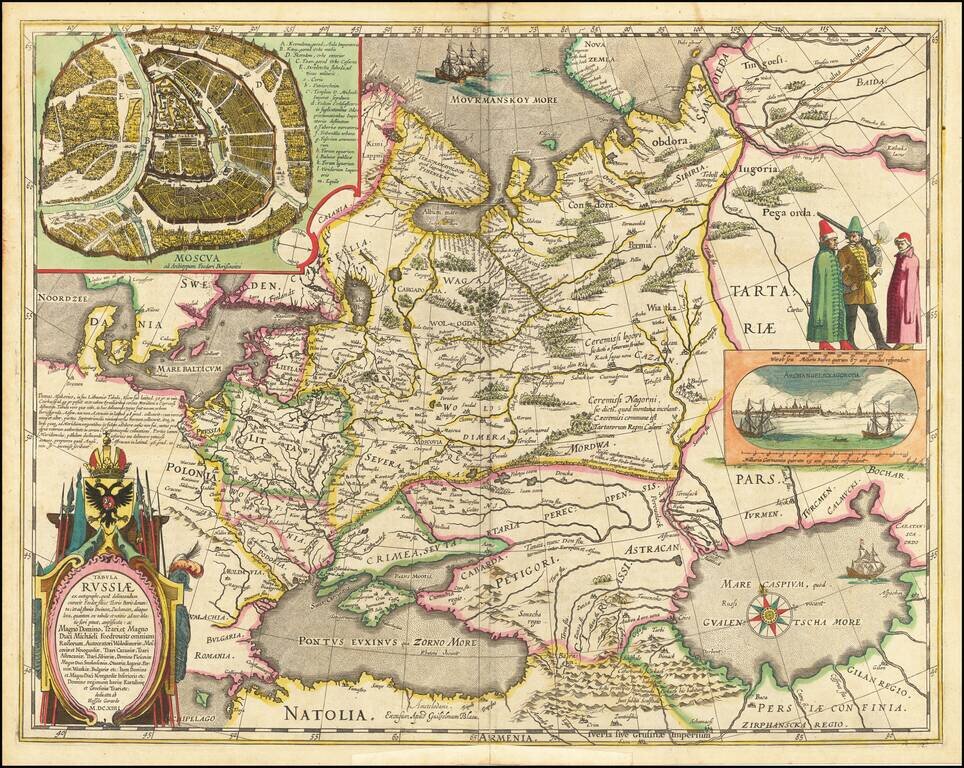
Decorative hand-colored example of Hessel Gerritsz's map of Russia, with the large inset of Moscow and plan of Archangelsckagoroda. Hessel Gerritsz's map of Russia, first issued 1613, was published by Blaeu after he acquired the plate following...
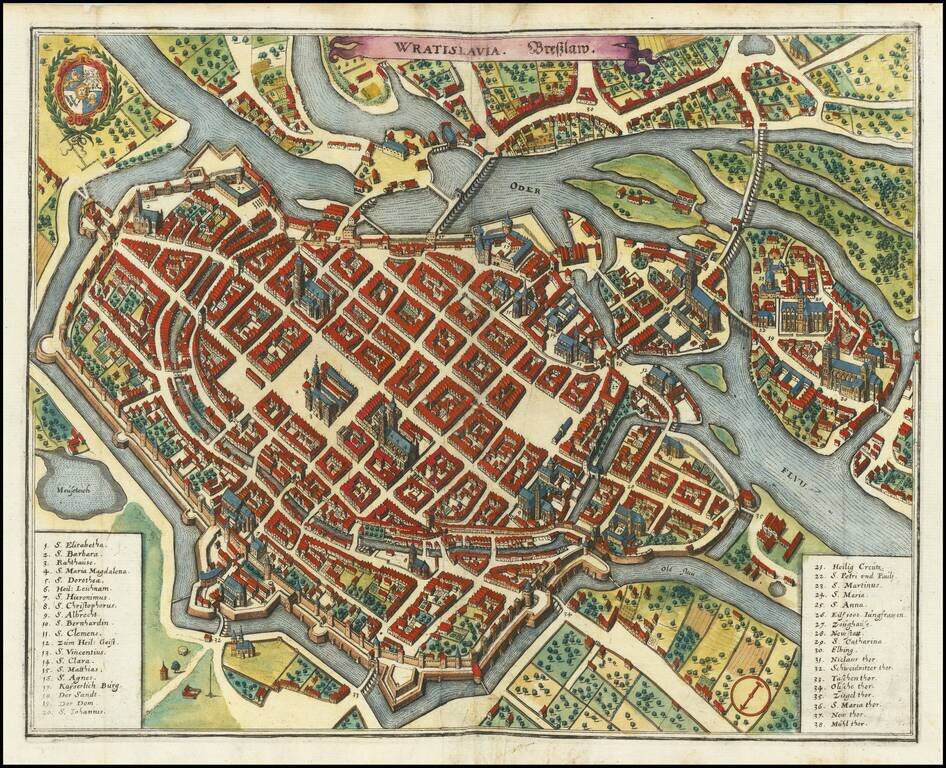
A detailed antique town plan of Wroclaw, once known as Breslau, in Poland. The map shows fortified walls, city gates, important public buildings, squares, and more. A key names thirty-eight important places in Worclaw. The coats of arms of the city of...
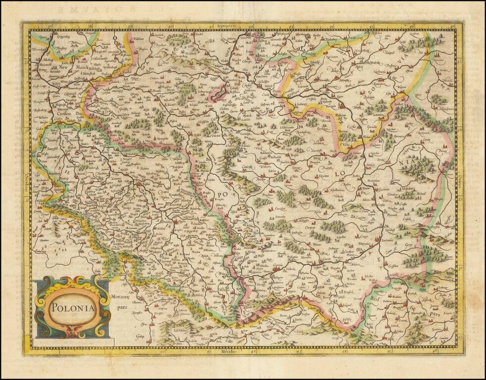
Fine early map of Poland, published by Henricus Hondius in Amsterdam. Originally issued by Mercator, the map depicts most of present-day Poland and Lithuania (including Vilna) and a the eastern part of Czechia. Among the major cities to appear are...
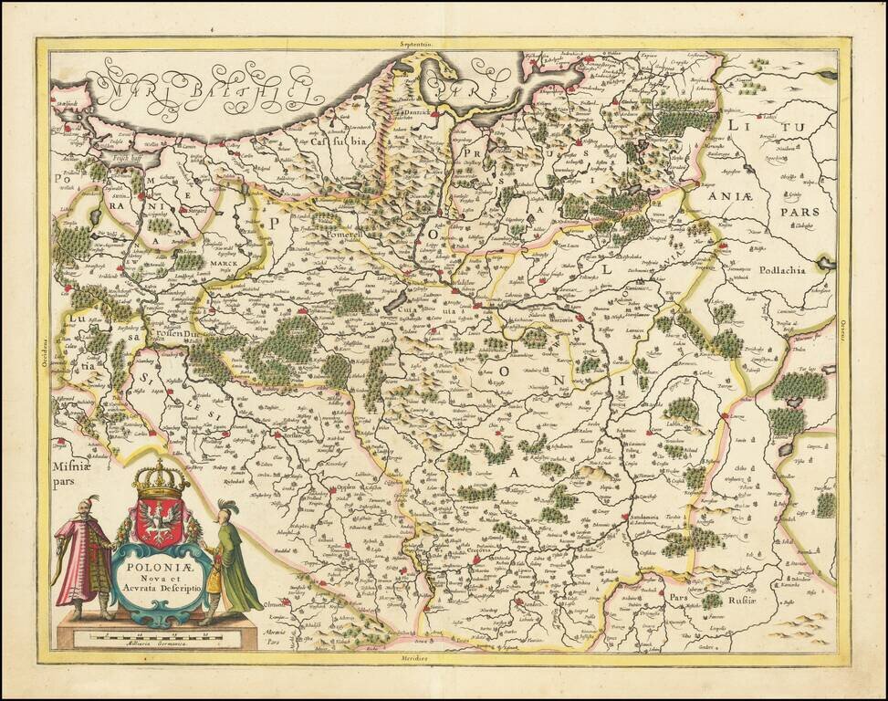
Striking antique engraved map of Poland and parts of Lithuania, Pomerania, and Prussia, published in Amsterdam by Jan Jansson. The map includes a large decorative cartouche and the Coat of Arms of Poland, with a crowned white eagle on a red field.
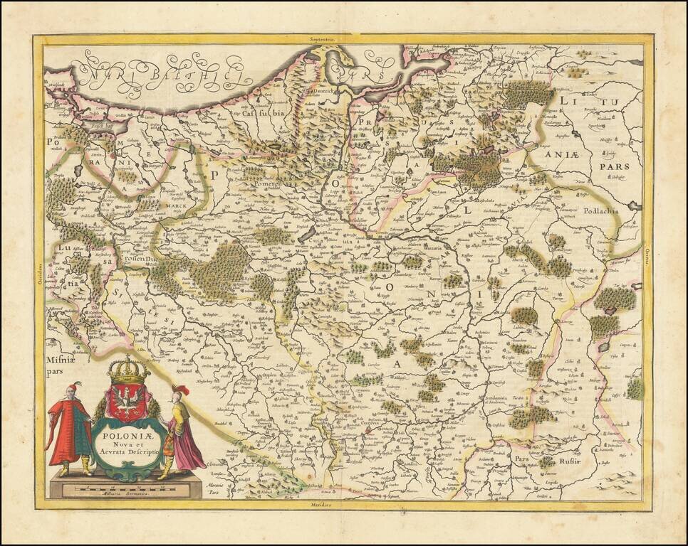
Striking example of Jansson's map of Poland and parts of Lithuania, Pomerania and Prussia. A scarce map of Poland extending from Stettin and Crossen to Cracow, to Lublin and Warsaw and north to the Baltic. Several imposing figures support the...