
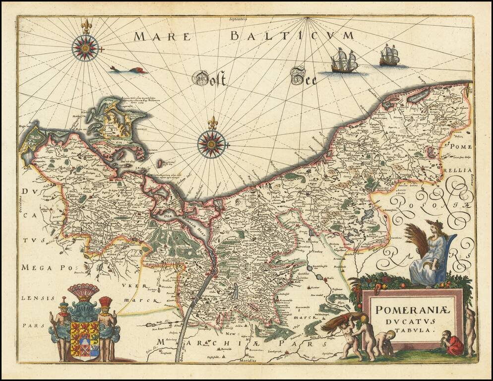
Decorative map of Pomerania and the Baltic Sea, from Merian's Neuwe Archontologica Cosmica . . .. Includes a decorative coat of arms and title cartouche. Based on earlier maps by Blaeu.
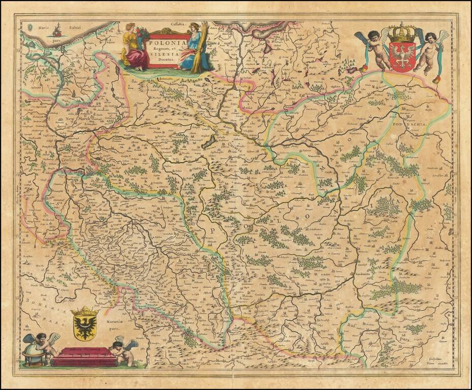
Old color example of Blaeu's map of Poland showing the region from the Oder east to Podlachia on the Bug. Also shows parts of Prussia and Brandenberg. A highly decorative map of Poland, including several coats of arms, cherubs and cartouches.
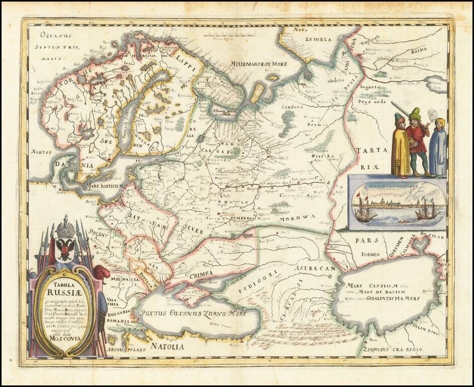
Nice example of the Merian edition Hessel Gerritsz's map of Russia, with view of Archangelsckagoroda. The map was compiled from manuscript maps and work brought back by Isaac Massa. Includes a decorative birdseye view. Richly decorated a large title...
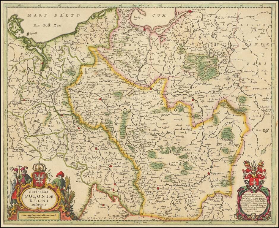
Striking map of Poland and the Baltic states, with two decorative cartouches. Extends east to Lithuania, North To Koningsperg, East to Rugia and South to Dresden, Olmutz, Radibor and Carcovia. Shows Danzig, Wladislaw and Warzovia.
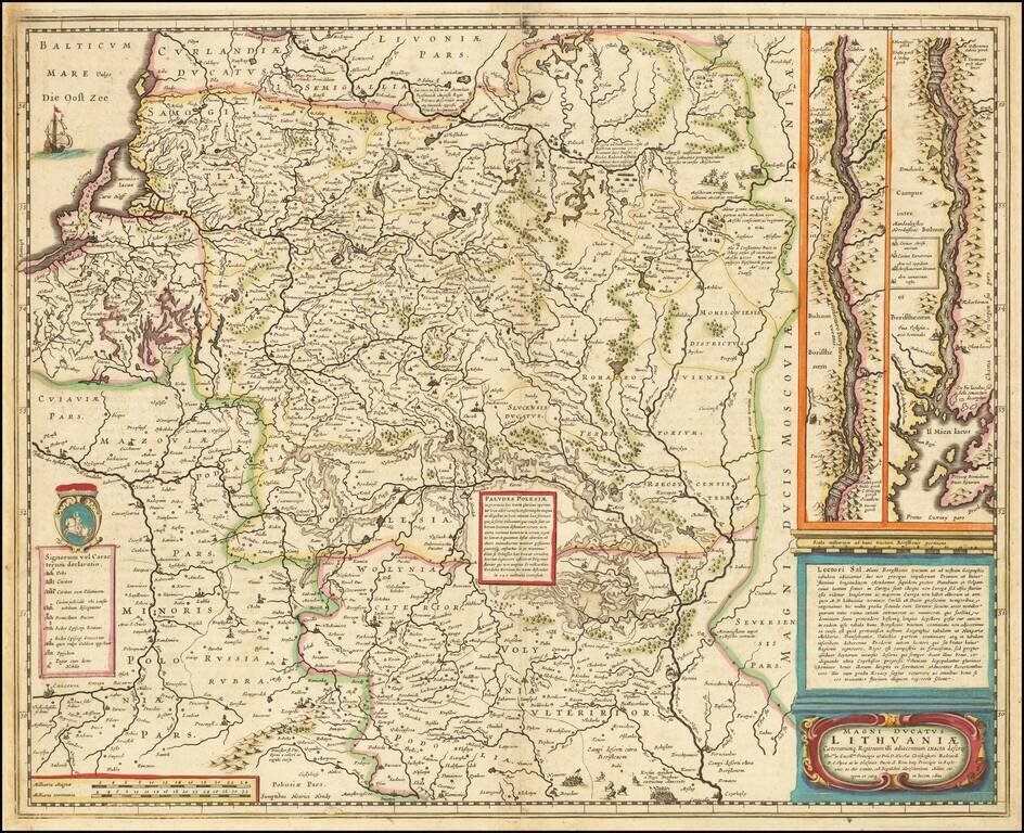
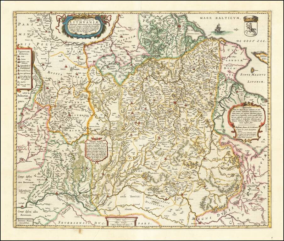
Nice old color example of this important map of Lithuania at its grandest scale (incuding Poland, Ukraine and part of Russia), including a large inset of the Dniepr River, based upon Hessel Gerritsz's four sheet map of the same title. Hessel Gerritsz...
![Oost Zee door Arnold Colom . . . [Heightened with Gold!]](/map/small/26286.jpg)
Fine example of this rare sea chart of the Baltic Sea (Oost Zee), by Arnold Colom, from Colom's Zee Atlas Ofte Water-Wereldt. Colom's detailed sea chart of the Baltic Sea from Rügen and Denmark extending towards eastern Finland and Livland, is one of...
First state of Nicolas Sanson's 1655 double-page engraved map of Poland, Ukraine, and the Baltic states, including modern-day Lithuania and Estonia. Sanson revised the map a number of times during its 50-year publication history.
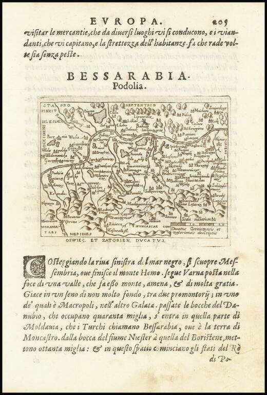
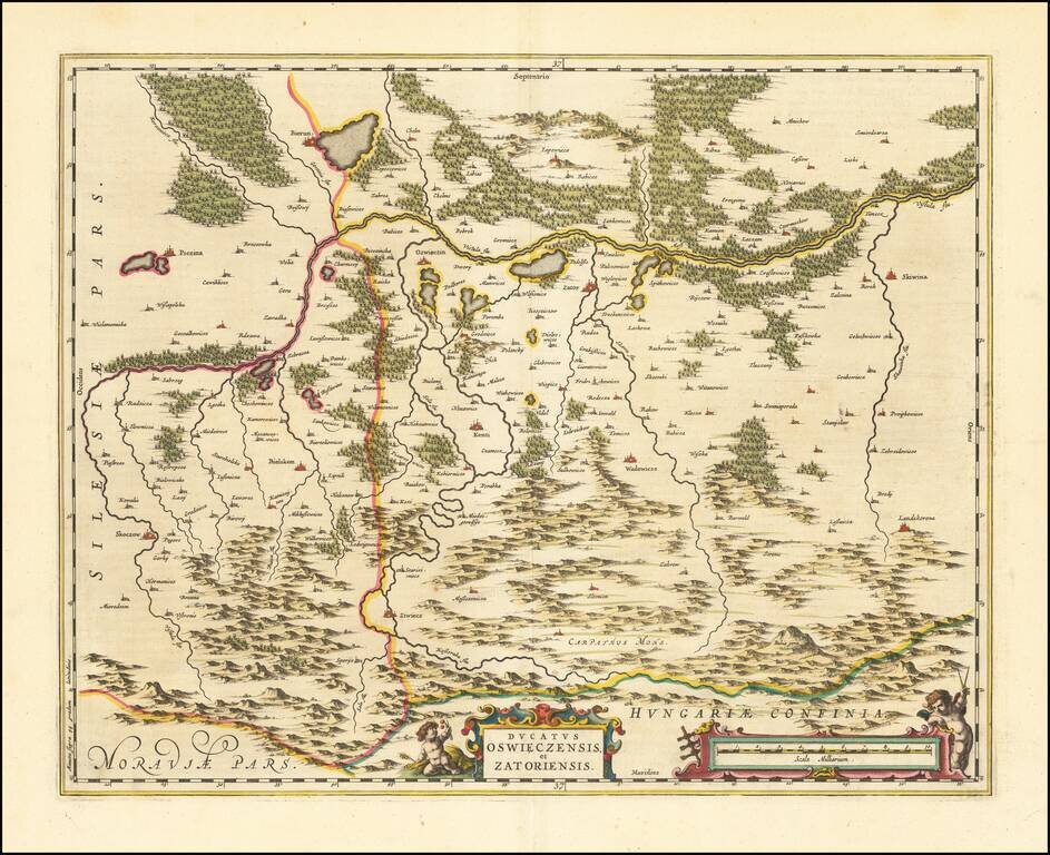
An attractive antique map of the region around the headwaters of the Vistula, in south-central Poland. Accompanying text describes the outflow of another of the great rivers of Europe, the Danube. The towns of Zatoriensis [Zator] and Osroiczensis...
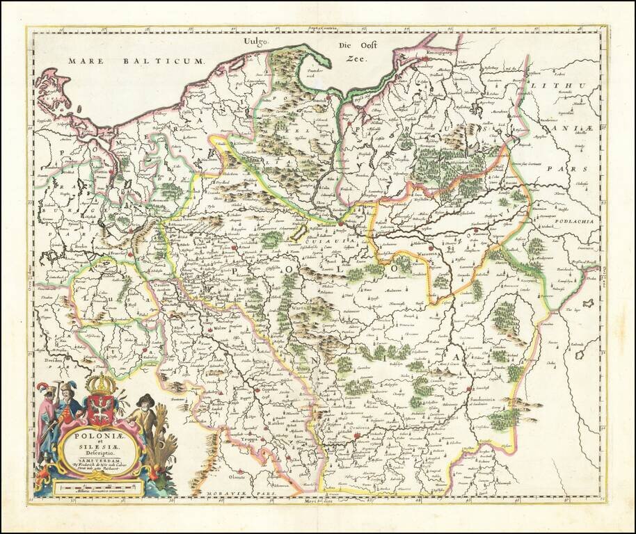
Fine example of De Wit's rare map of Poland and Silesia, extending north to the Baltic Sea. This is the second state, with "fo. 16" at the top right corner. This the second example of the map we have offered in more than 20 years.
Nice example of Blaeu's rare map of Poland, Lithuania, etc., which first appeared in the 1662 edition of Blaeu's Atlas Maior. This is Blaeu's second map based upon Radizwill's early map, originally engraved by Hessel Gerritsz. The Radziwill map is one...
An attractive antique map of southwestern Poland, which appeared in Blaeu's Atlas Maior. Focused on the border between the historical regions of Silesia and Lesser Poland, the map preserves a detailed layout of the area. While the map is named after...
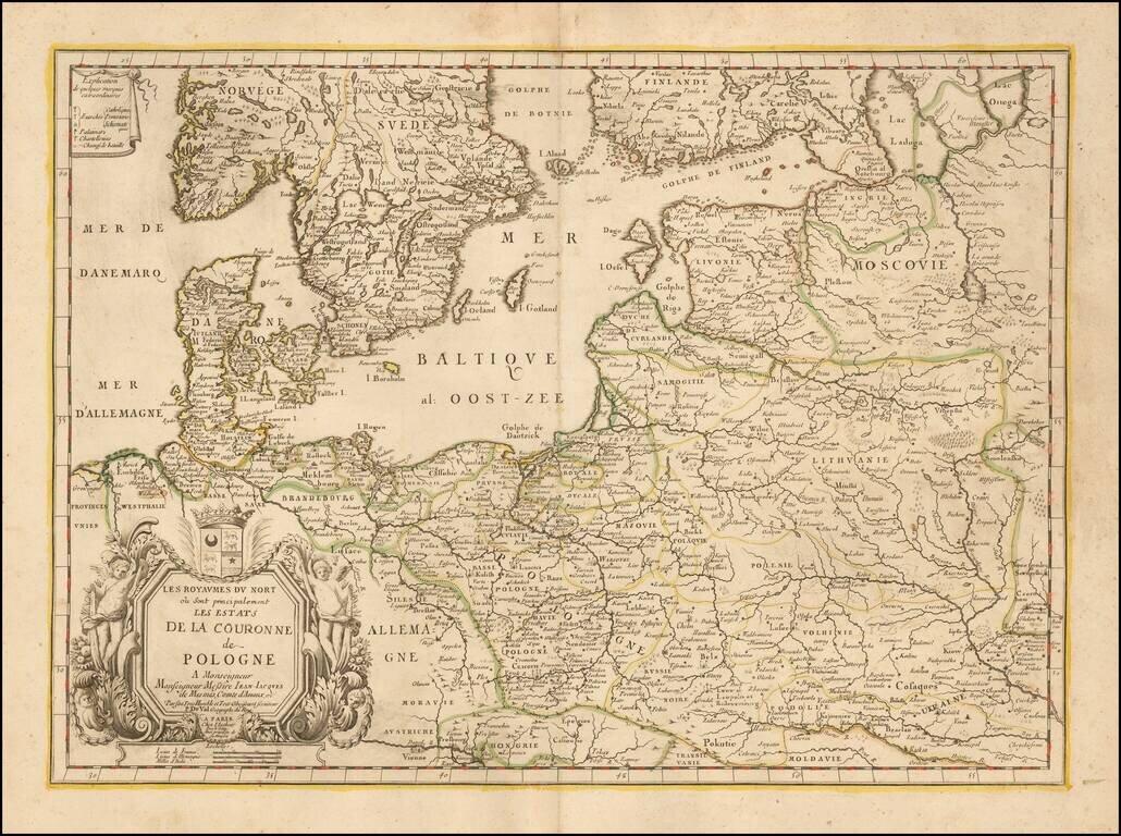
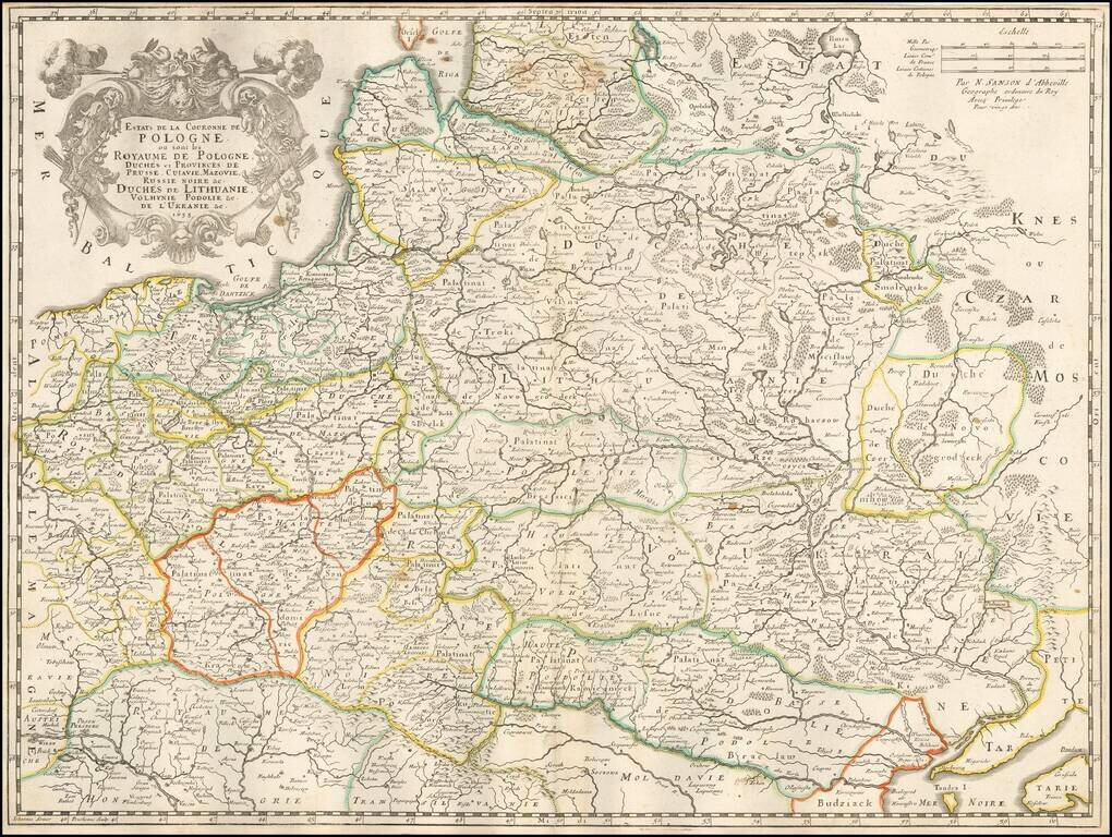
Rare map of Poland and the neighboring regions, published in Paris by Du Val. The map extends to include the Ukraine and western Russia. With decorative tittle cartouche lower left with a dedication to Jean-Jacques de Mesmes, comte d'Avaux (1640 - 9...
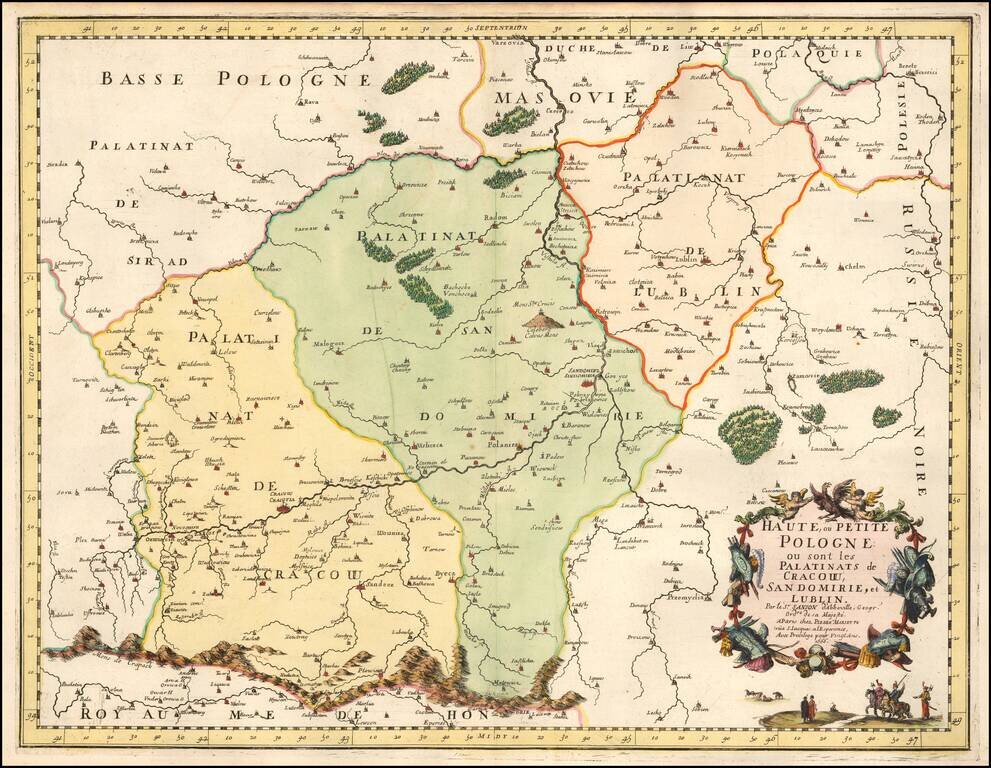
Nice example of Sanson's regional map of a portion of Poland, including the Palatinats of Cracow, Sandomirie, and Lublin. A nice example, with excellent detail.
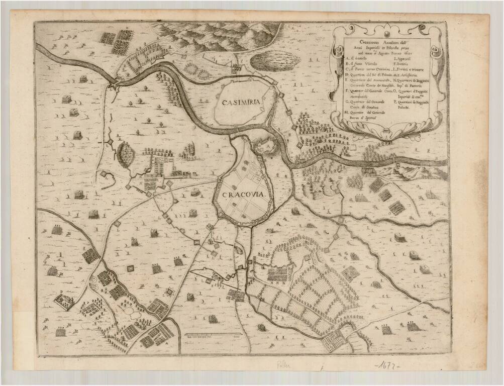
Rare map of the area around Krakow, showing the siege of August 1657. The map shows the positions of the combatants in and around the walled city of Krakow and neighboring Casimiria on the opposite side of the river. After 2 years of Swedish and...
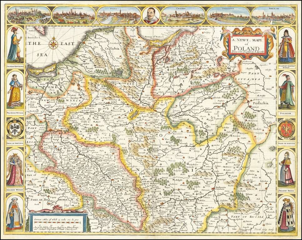
The First Map of Poland Published in England Decorative example of John Speed's highly sought after map of Poland, the first map of Poland to appear in an English Atlas. The map includes birdseye views of Cracow, Dantzick, Posna, Crossen, Sandomiria...
Rare separately issued map of Poland, published by Giacomo Rossi. Rossi's maps are often based on the cartography of Nicolas Sanson, although the present example gives credit to Nicolas's son, Guillaume Sanson. This map was followed by a similar map...