logo

1831. Karte von dem Konigreich Pohlen Grosse-Herzogthum Posen und den angrenzenden staaten in IV Sectionen nach en besten vorhandenen Hulfsmitteln entworfen im jahr 1810 . . . 1831

  • Karte von dem Konigreich Pohlen Grosse-Herzogthum Posen und den angrenzenden staaten in IV Sectionen nach en besten vorhandenen Hulfsmitteln entworfen im jahr 1810 . . . 1831

Karte von dem Konigreich Pohlen Grosse-Herzogthum Posen und den angrenzenden staaten in IV Sectionen nach en besten vorhandenen Hulfsmitteln entworfen im jahr 1810 . . . 1831 information:

Year of creation: 
Resolution size (pixels): 
 26264x22354 px
Disk Size: 
 173.115MiB
Number of pages: 
 1
Place: 
 Berlin

Print information. Print size (Width x height in inches):
Printing at 72 dpi 
  364.78 х 310.47
Printing at 150 dpi 
 175.09 х 149.03
Printing at 300 dpi 
 87.55 х 74.51

An example of detailing the file of this map of in a printable high-resolution:

Click to open in high resolution (open in new tab).
Attention! this is just the central piece (central area 960x960 px) of the map file!
This is an example, so that you can see and study the level of detail of a given map. The entire Map will be fully available after payment!

Karte von dem Konigreich Pohlen Grosse-Herzogthum Posen und den angrenzenden staaten in IV Sectionen nach en besten vorhandenen Hulfsmitteln entworfen im jahr 1810 . . . 1831

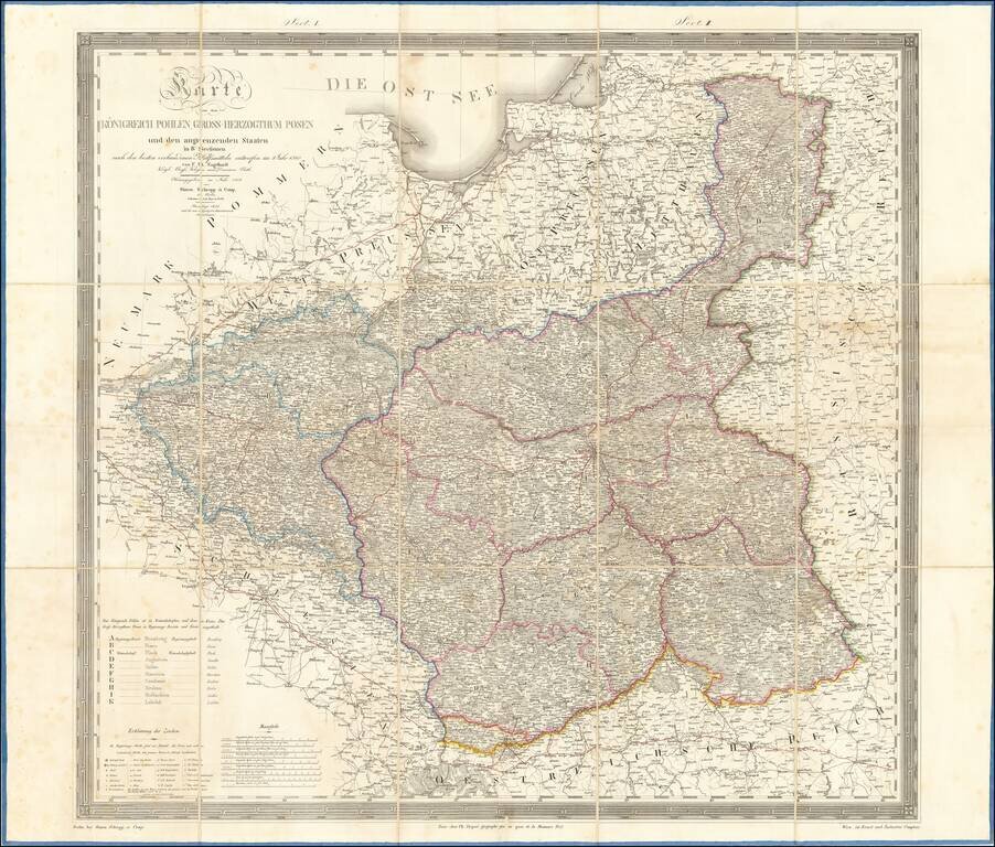
Large folding map of Poland and environs, published in Berlin.

The map is subdivided into region, A to K.

Includes towns, rivers, forests, postal roads and a host of other details.


Special conditions for students!

If you are a student, write to us in telegram: @antiquemaps and indicate what material you need and for what work you need a map in high detail. We are ready to provide material on special terms. For students only!

Item information:

Year of creation:
Size:
26264x22354 px
Disk:
173.115MiB
Number of pages:
1
Place:
Berlin
Author:
Friedrich Bernhard Engelhardt.
$21.99

Related item