Map size in jpg-format: 43.8051MiB
Click to open in high resolution (open in new tab).
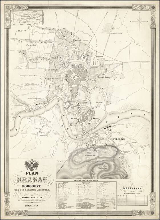
Fine large plan of Krakow, published in 1847 by Alexander Kocziczka, surmounted by the coat of arms of the Holy Roman Emperor.
Kocziczka's plan depicts Krakow from Czarna Wies and Nowa Weis to Podgorze and from the Upper Silesian - Krakow Railway to the Krakus Mound.
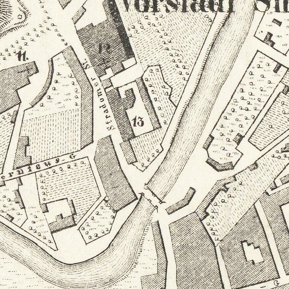
The Urban center of the town is highlighted with darker shading. A key at the bottom of the map locates 25 points of interest, including churches. The map also locates theroads to Breslau, Warsaw, and Lublin.
Eighteen locations in surrounding communities are also identified. In the town of Podgorze, across the Vltava River, 11 sites are numerically identified.
Rarity
The map is very rare on the market. We locate 3 examples (National Library of Poland, the Bibliothèque Nationale de France, and the Kriegsarchiv (War Archive) in Vienna.
If you are a student, write to us in telegram: @antiquemaps and indicate what material you need and for what work you need a map in high detail. We are ready to provide material on special terms. For students only!


![[Hand Drawn Prussian Military Encampment at Opole, Poland] Special Grund-Riss Des Kaeyserl Feldl Lagers bey Oppeln in Ober Schlesien](/map/small/59726.jpg)