Map size in jpg-format: 38.8905MiB
Click to open in high resolution (open in new tab).

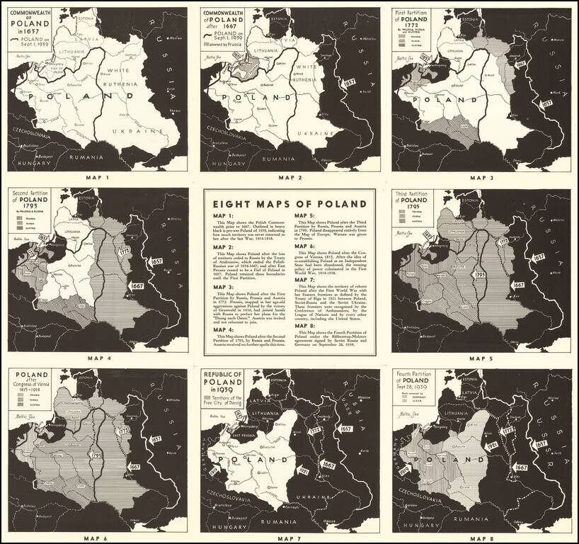
Polish Propaganda During World War II
Interesting set of maps of Poland, illustrating the changing boundaries of Poland from 1657 through 1939, with a short explanation explaining each of the maps.
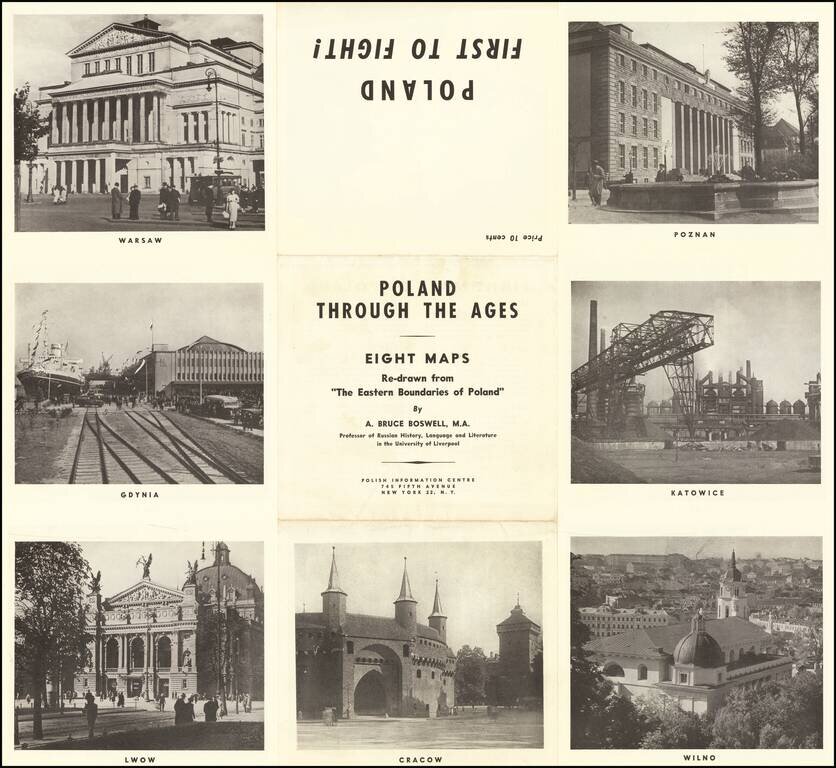
On the verso, a set of 7 images of major Polish cities.
The map was published by the Polish Information Centre. Boswell was a Professor of Russian History, Language and Literature at the University of Liverpool and author of "The Eastern Boundaries of Poland."
The Polish Information Centre was established to give a voice to Polish resistance in America and would later go on to advocate mass Jewish emmigration from Poland, a position which would run afoul of the Jewish communities in England and America.
If you are a student, write to us in telegram: @antiquemaps and indicate what material you need and for what work you need a map in high detail. We are ready to provide material on special terms. For students only!


![[Hand Drawn Prussian Military Encampment at Opole, Poland] Special Grund-Riss Des Kaeyserl Feldl Lagers bey Oppeln in Ober Schlesien](/map/small/59726.jpg)