Map size in jpg-format: 42.0587MiB
Click to open in high resolution (open in new tab).
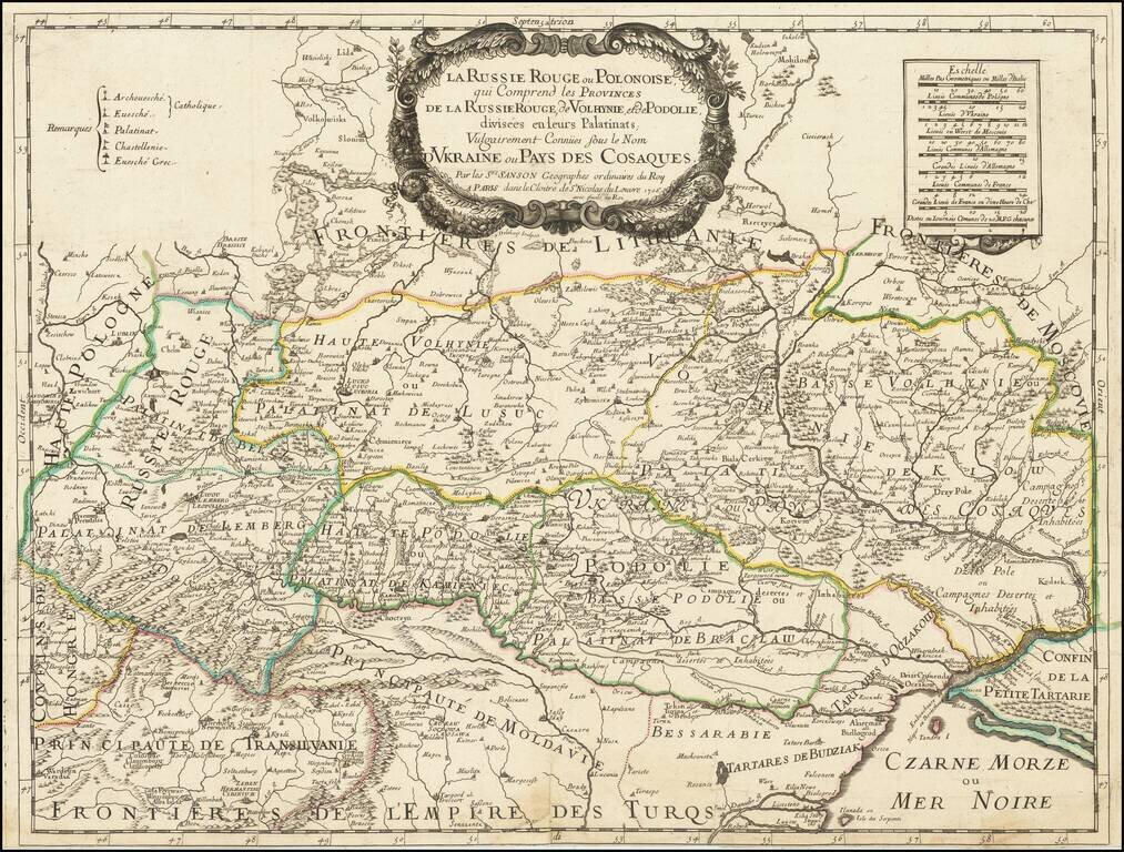
Very rare Sanson map of Ukraine and so-called Russie Rouge, stretching from Lublin in the west to Kherson Oblast in the east (here called "Confin de La Petite Tartarie").
"Russie Rouge" or Red Ruthenia or Red Rus' is a term dating back to the Middle Ages, which was used to refer to the southwestern polities of the Kievan Rus', which include parts of present-day western Ukraine and southern Poland. On this map the area is split between the Palatinate of Lemberg and the Palatinate of Belcz.
At the bottom of the map the frontiers of the Turkish Empire are sown.
The first state was published in 1674, lacking the decorative border on the cartouche and the longer imprint line. This is the third state, which was published by Sanson's heirs. All states are rare.
This is the first time we have offered the map for sale. Maps which name and focus on Red Ruthenia are very rare.
If you are a student, write to us in telegram: @antiquemaps and indicate what material you need and for what work you need a map in high detail. We are ready to provide material on special terms. For students only!


![[Hand Drawn Prussian Military Encampment at Opole, Poland] Special Grund-Riss Des Kaeyserl Feldl Lagers bey Oppeln in Ober Schlesien](/map/small/59726.jpg)