Map size in jpg-format: 5.52627MiB
Click to open in high resolution (open in new tab).
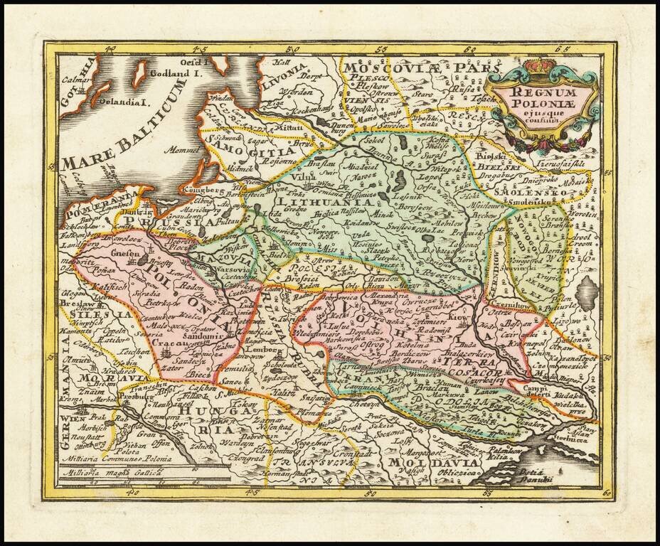
Decorative map of Poland and Lithuania in their grandest configurations, published by Weigel.
The map extends from the Baltic to the Black Sea, capturing the details and reach of these then powerful countries at the beginning of the 18th Century.
The map is quite scarce, this being the first time we have offered the map.
Andrew Kapochunas hsd identified 4 states of this map, this final circa 1770 state being the last: http://www.lithuanianmaps.com/MapmakersT-Z.html
If you are a student, write to us in telegram: @antiquemaps and indicate what material you need and for what work you need a map in high detail. We are ready to provide material on special terms. For students only!


![[Hand Drawn Prussian Military Encampment at Opole, Poland] Special Grund-Riss Des Kaeyserl Feldl Lagers bey Oppeln in Ober Schlesien](/map/small/59726.jpg)