Map size in jpg-format: 50.8644MiB
Click to open in high resolution (open in new tab).
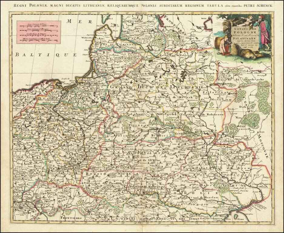
A scarce Pieter Schenk map of Poland, which is attributed to an earlier map published by Sanson. The map extends to the Black Sea and Vienna in the south and to Estonia in the north. The work is a prime example of Schenk's strong engraving style, notable in the shading of the cartouche.
Intricate and attractive detail is portrayed in this map. The dense cities of Poland, Silesia, and Hungary in the west give way to large swaths of forest in the north and east. All the major rivers of the region are shown. Many regions are named including "Livonie," "Curland," "Lithuanie," "Moscovie," and more.
The map includes a decorative cartouche in the upper right, apparently showing a scene representative of the region. A slain fox shows the rich fur industry of the area. The wheat and child carrying a sickle may represent the large wheat production in Prussia and surrounding regions. Other inclusions, such as the beehive, are harder to justify, though the old man is wearing distinctly Eastern European clothes of the time, and carrying a sword which looks more eastern than western.
This map was made at the start of the Great Northern War. Lithuania and Poland had been joined for over a century as part of their second commonwealth, but both countries had recently been weakened by several revolts. The Great Northern War would further ravage the countries due to the early Swedish victories. Even though Poland and Lithuania helped win this war in the end, the weakening of Sweden and the rise of Prussia and Russia would lead to their downfall.
The map is scarce on the market.
Peter Schenk the Elder (1660-1711) moved to Amsterdam in 1675 and began to learn the art of mezzotint. In 1694 he bought some of the copperplate stock of the mapmaker Johannes Janssonius, which allowed him to specialize in the engraving and printing of maps and prints. He split his time between his Amsterdam shop and Leipzig and also sold a considerable volume of materials to London.
Peter Schenk the Elder had three sons. Peter the Younger carried on his father’s business in Leipzig while the other two, Leonard and Jan, worked in Amsterdam. Leonard engraved several maps and also carried on his father’s relationship with engraving plates for the Amsterdam edition of the Histoire de l'Académie Royale des Sciences.
If you are a student, write to us in telegram: @antiquemaps and indicate what material you need and for what work you need a map in high detail. We are ready to provide material on special terms. For students only!


![[Hand Drawn Prussian Military Encampment at Opole, Poland] Special Grund-Riss Des Kaeyserl Feldl Lagers bey Oppeln in Ober Schlesien](/map/small/59726.jpg)