logo

1798. (Central Estonia) No. VII: Der Fellinsche Kreis; Le Cercle de Felllin

  • (Central Estonia) No. VII: Der Fellinsche Kreis; Le Cercle de Felllin

(Central Estonia) No. VII: Der Fellinsche Kreis; Le Cercle de Felllin information:

Year of creation: 
Resolution size (pixels): 
 17908x12517 px
Disk Size: 
 67.9376MiB
Number of pages: 
 1
Place: 
 Riga
Author: 

Print information. Print size (Width x height in inches):
Printing at 72 dpi 
  248.72 х 173.85
Printing at 150 dpi 
 119.39 х 83.45
Printing at 300 dpi 
 59.69 х 41.72

An example of detailing the file of this map of in a printable high-resolution:

Click to open in high resolution (open in new tab).
Attention! this is just the central piece (central area 960x960 px) of the map file!
This is an example, so that you can see and study the level of detail of a given map. The entire Map will be fully available after payment!

(Central Estonia) No. VII: Der Fellinsche Kreis; Le Cercle de Felllin

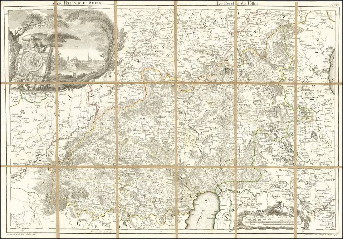
Rare engraved map of central Estonia north of Lake Võrtsjärv covering parts of present-day Järva, Viljandi, Tartu, and Jõgeva Counties.

The map features an attractively-engraved coat of arms of Viljandi Kreis, a province in Livoniain the 18th and 19th centuries.

This map was included in Ludwig August Mellin's Riga-published Atlas von Liefland, oder von den beyden Gouvernementern u. Herzogthümern Lief- und Ehstland, und der Provinz Oesel.

This example of the map was never bound in an atlas, instead being mounted on linen for individual use.


Special conditions for students!

If you are a student, write to us in telegram: @antiquemaps and indicate what material you need and for what work you need a map in high detail. We are ready to provide material on special terms. For students only!

Item information:

Year of creation:
Size:
17908x12517 px
Disk:
67.9376MiB
Number of pages:
1
Place:
Riga
Author:
Ludwig August Mellin.
$14.99

Related item