
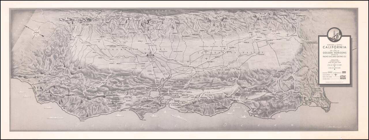
Finely executed map of Northern and Central California, prepared by Pacific Gas and Electric. The map locates cities (by size), Railroads, Major Highways, Major Airports, Agricultura Areas and Wooded Aresa. Rarity We locate a larger example in...
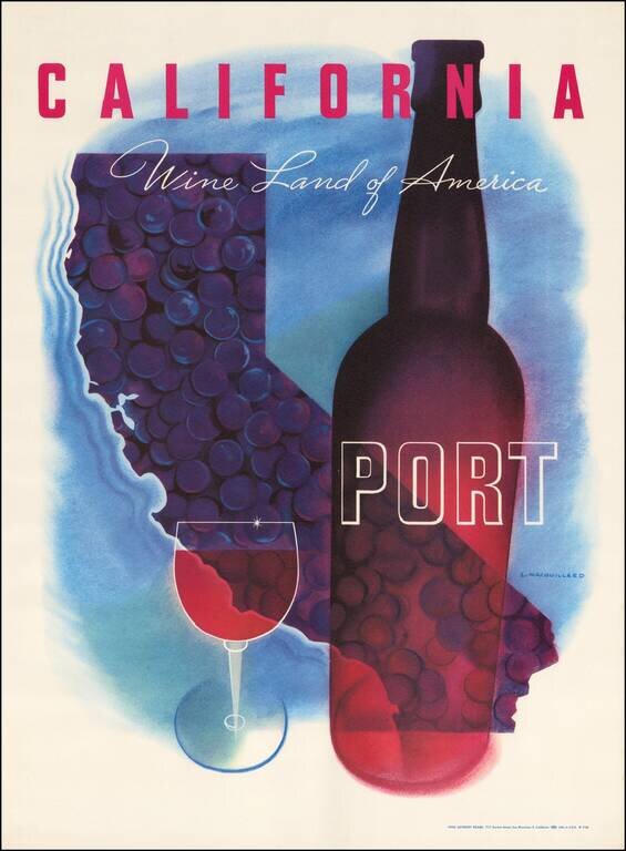
Striking map of California by Louis Macouillard in 1958. This is one of a series of Macouillard's images prepared for the California Wine Advisory Board in the 1950s, but to our knowledge, the only one to include a map image. Part of the great...
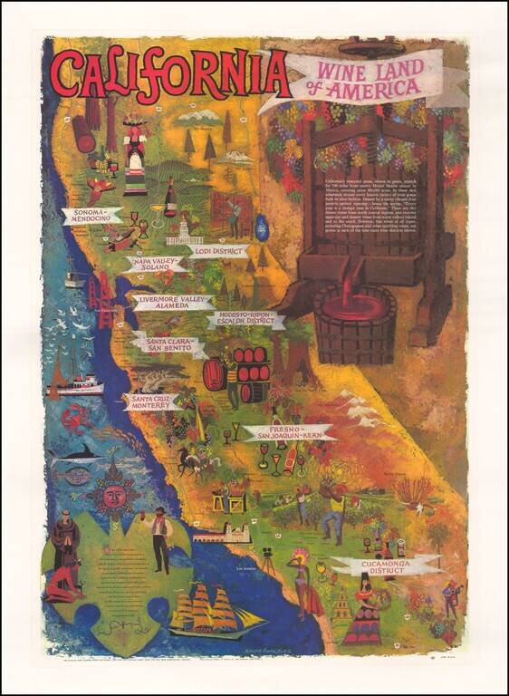
Striking map of California, prepared by the Wine Advisory Board to promote California wines. Includes a lively depiction of California's growing regions, with vignettes intended to illustrate the towns and characteristics of the various regions. The...
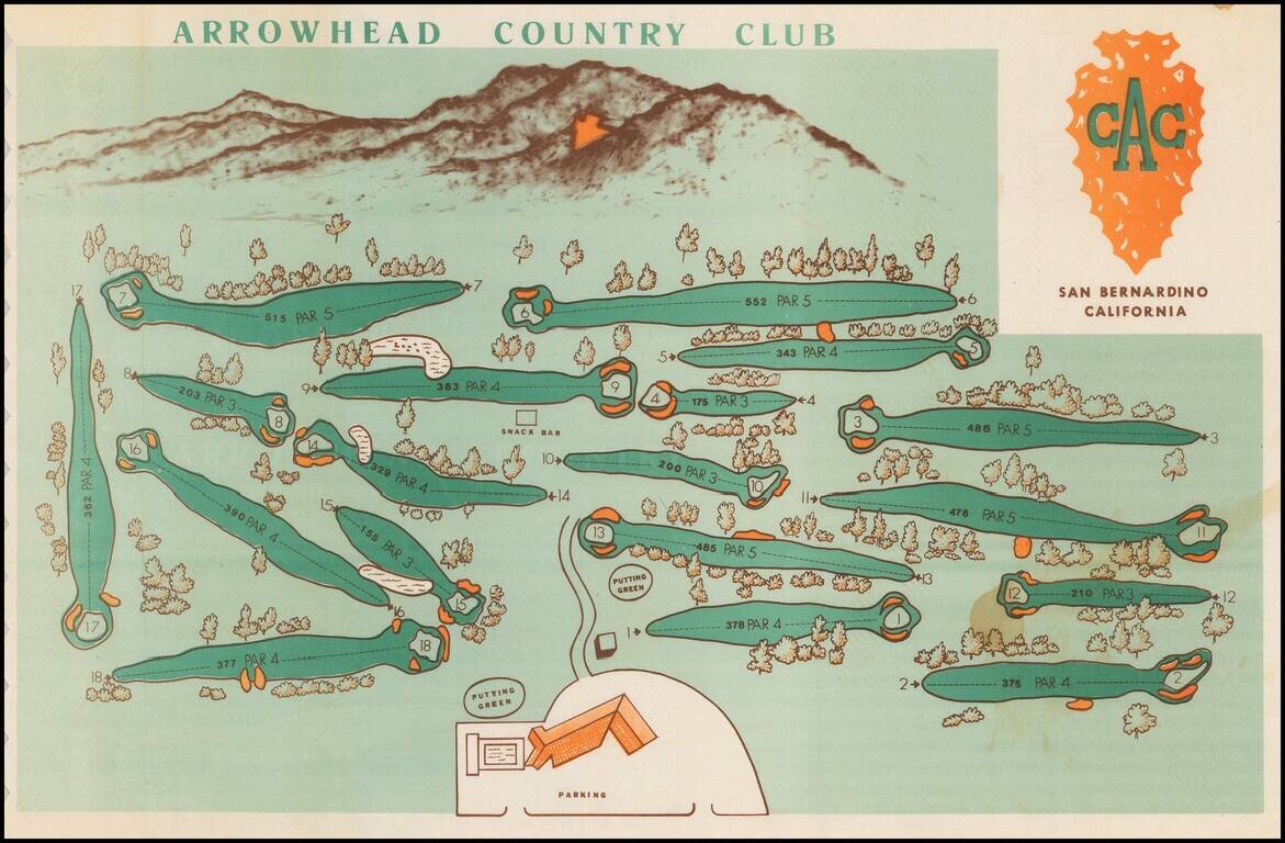
Decorative pictorial style map, showing the golf course and the San Bernardino mountains in the background, including the famous Arrowhead on the mountain. Having grown up in Rialto, I can say with confidence that the Arrowhead, while very clear on...
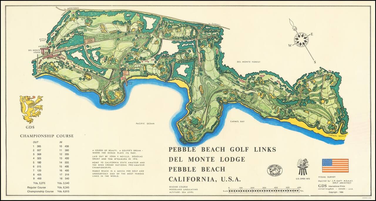
Decorative map of the Pebble Beach Golf Links, first published in 1968. Pebble Beach is the oldest continuously operating golf course west of the Mississippi River.
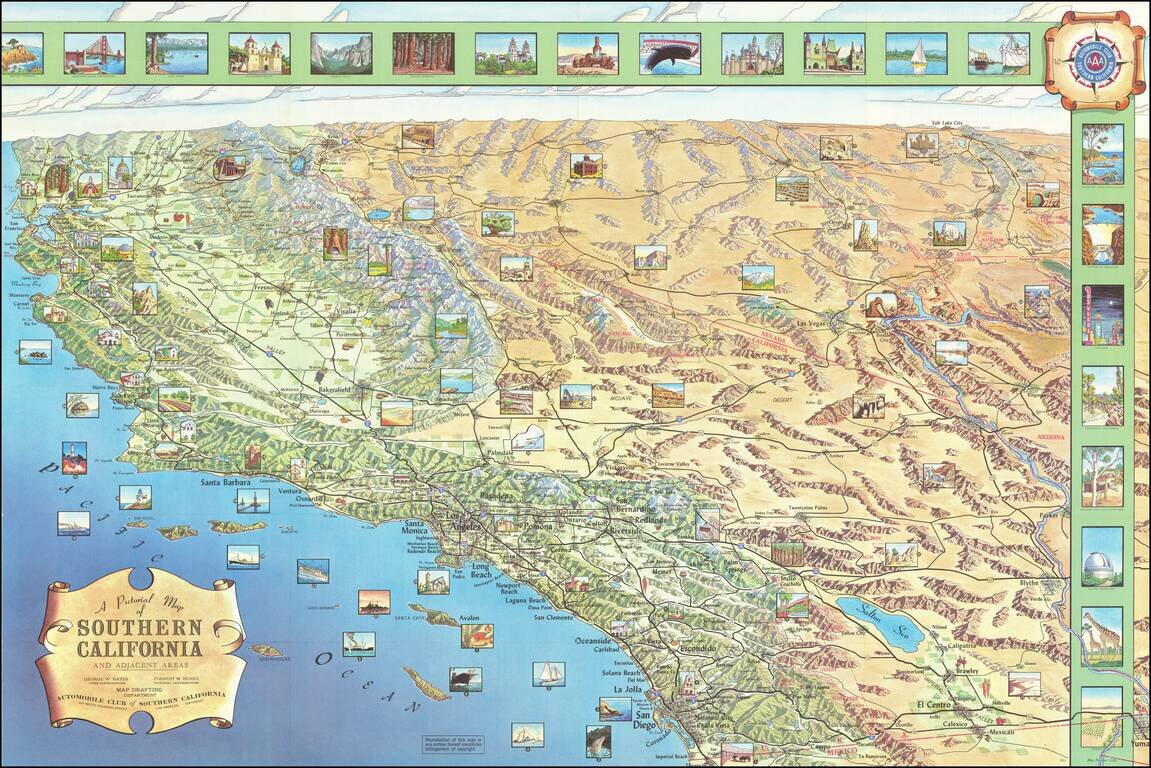
Decorative pictorial map of Southern California, produced by Harry F. Pflum for the Automobile Club of Southern California. Includes over 30 inset views.
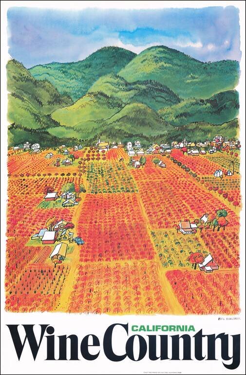
Fine wine country promotional poster published by Earl Thollander. On the verso is a map of the California Grape Growing Regions. Thollander did a number of California Wine industry promotional graphics in the 1970s, including several maps.
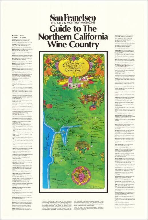
Scarce vintage map of California Wine Country, published by the San Francisco monthly magazine. The map lists about 130 winemakers in northern California, centered on Napa County, Sonoma County, and the Central Valley.
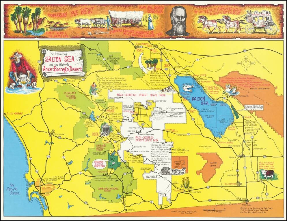
Lively pictorial map of the Southern California, focused on the Salton Sea and Anza-Borrego Desert. An unusual focus on the Desert regions of Imperial County and the eastern part of Riverside County, promoting recreational activities in the region....
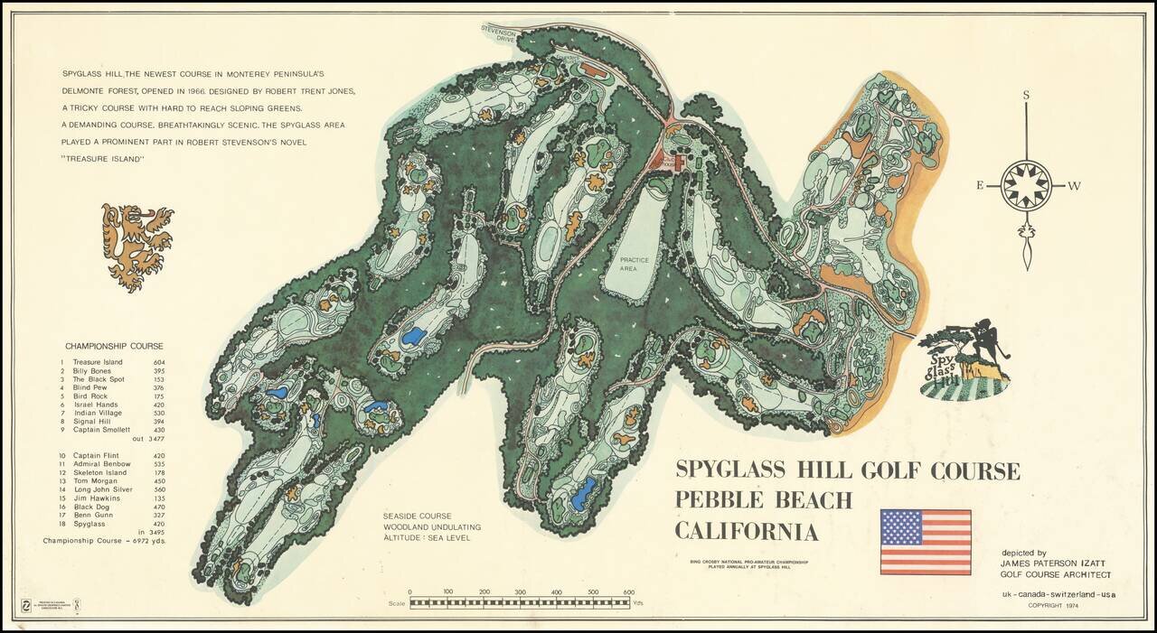
Decorative map of the Spyglass Hill Golf Course, published in 1974. Spyglass Hill was designed by Robert Trent Jones Sr., and opened 54 years ago on March 11, 1966, after six years of planning, design, and construction. The course has been in the...
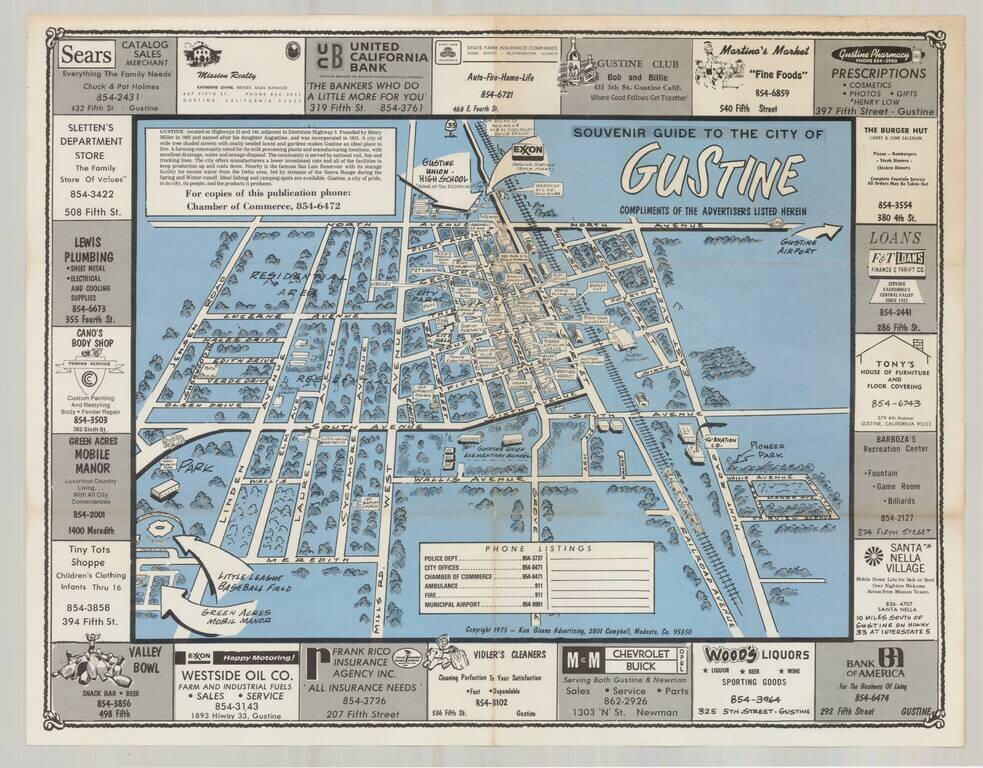
Interesting pictorial map of the Gustine, California, surrounded by local advertising, published by the Gustine Chamber of Commerce. While published in 1975, the map is a stylistic throwback to the pictorial maps of earlier times. The map was...
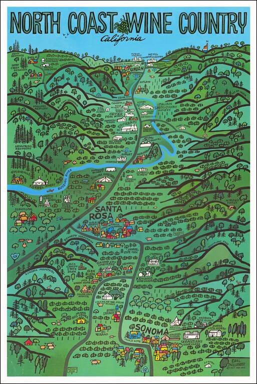
Fine pictorial map of the North Coast Wineries (Napa Valley, Sonoma Valley, etc.), published by Earl Thollander. The map shows many of California's top wineries from the mid-1970s. The reverse side features a map of the area, including a winery and...
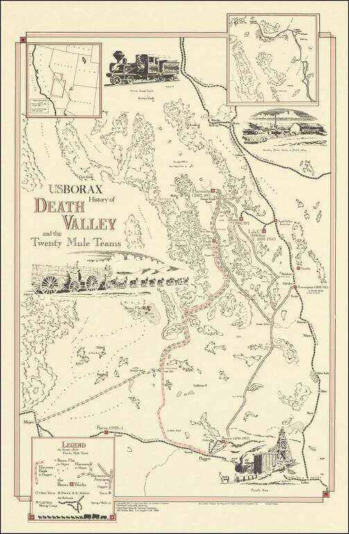
Interesting pictorial map of the Death Valley area, promoting US Borax and the Twenty Mule Teams. The map locates the routes of the mule teams around Death Valley at the end of the 19th Century, which led ultimately to a product name, radio and...
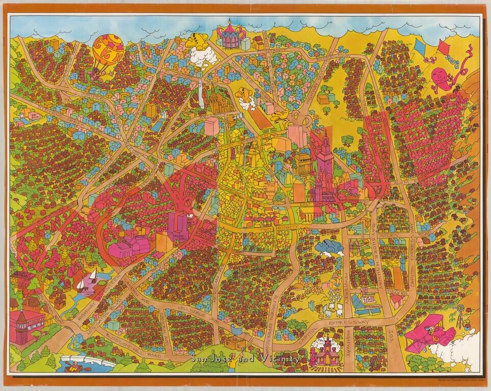
Decorative pictorial map of the area around San Jose, California, by Corbin Hilliam. Corbin Hilliam is currently best known as an illustrator of math and other text books for primary schools. The map was apparently part of an advertising campaign for...
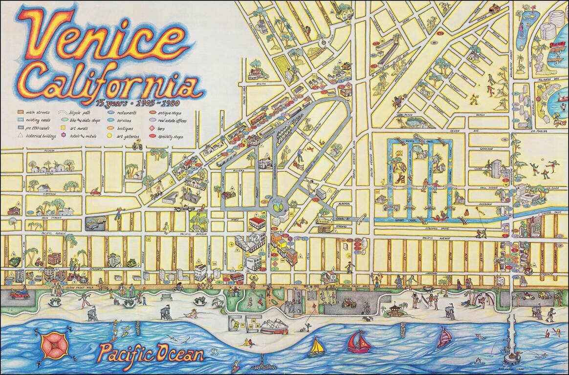
Whimsical Pictorial Map of Venice Beach, California, published as a local tourism promotional item. The artwork is by C. June Barton and R. Freenway Frager and includes an extensive guide on the verso, including lists of "Historic buildings," "Art...
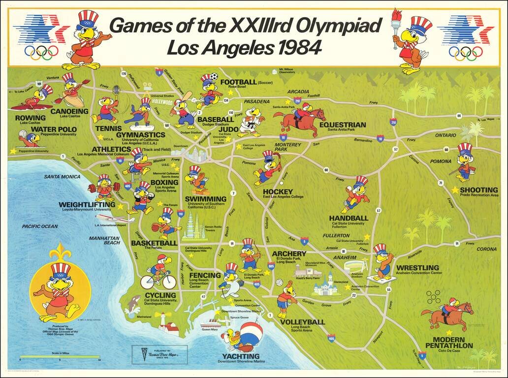
Los Angeles Olympics - 1984 Fine example of the official map of the 1984 Summer Olympics in Los Angeles. Each of the Olympic Sport venues around Southern California are shown, with the official mascot, which also appears on the compass rose.