Map size in jpg-format: 27.5689MiB
Click to open in high resolution (open in new tab).
Yosemite Pictorial Rarity
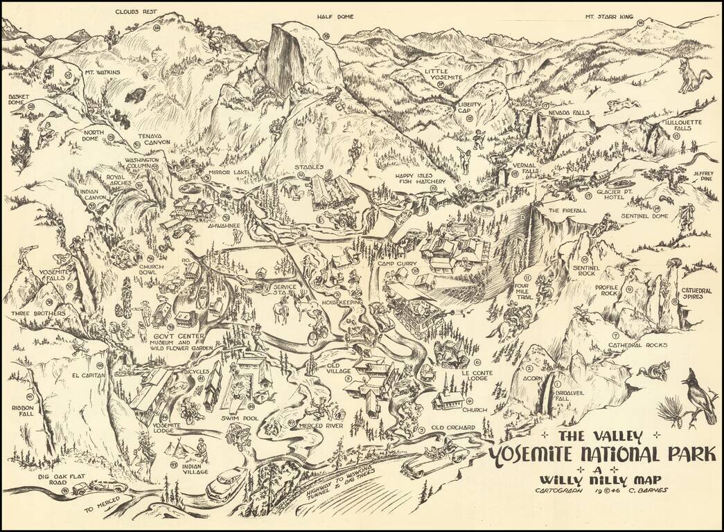
Rare self mailing map of Yosemite, published in 1946 by the Willy Nilly Map Company.
The map is centered on Camp Curry, with an indoor venue below it having its roof blown off with music and dance. Extends to Clouds Rest, and Mt. Starr King in the East, with the tunnel entrance in the foreground.
Many long since disappeared landmarks are shown, including:
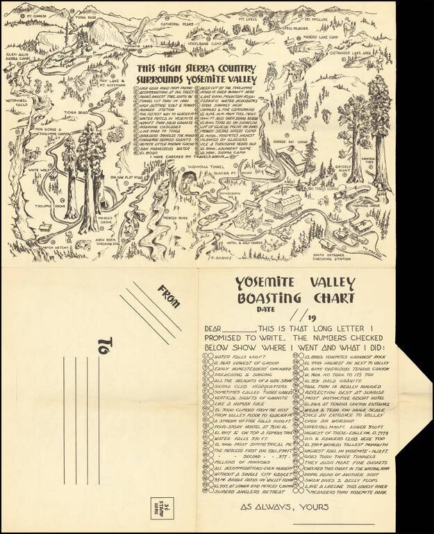
On the verso is a map of the High Sierra Country surrounding Yosemite Valley, with a key location 32 points of interest.
Rumsey notes:
A whimsical 1946 pictorial map of the Yosemite National Park, California. Made to be folded twice and sent through the mail. . . . Map showing several landmarks and places of interest, including Half Dome, Clouds Rest, Little Yosemite, Indian Village, wildlife, recreational facilities, roads and trails.
The reverse side of the map is printed with a Boasting Chart of 47 places and things to do and see corresponding to numbers on the map and a map of the High Sierra country surrounding the Yosemite Valley, with 35 corresponding to numbers on the map.
Willy Nilly Map Company
The Willy Nilly Map Company and C. Barnes seem to have had some success with self-mailing pictorial maps between 1946 and 1948. We note the following, all of which are rare:
Rarity
The map appears occasionally on the market, more often with color on the map.
If you are a student, write to us in telegram: @antiquemaps and indicate what material you need and for what work you need a map in high detail. We are ready to provide material on special terms. For students only!
![[Signed Political Satire Artwork] Vietnam ... Vietnam ... Vietnam ...](/map/small/68726.jpg)

