Map size in jpg-format: 29.1376MiB
Click to open in high resolution (open in new tab).

Promoting A Short Lived Puget Sound Ferry Line
Interesting pictorial map and illustrated travel brochure, promoting the Edmonds Olympic Route - Sound Ferry Lines Inc.
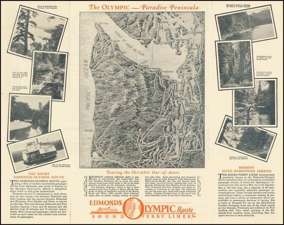
The main map image shows a monochromatic view of the Straits of Juan de Fuca and Olympic National Forest area, extending south to Gray's Harbor, Tacoma and Olympia, centered on the Edmonds area, with an array of recreational and scenic images on either side of the map.
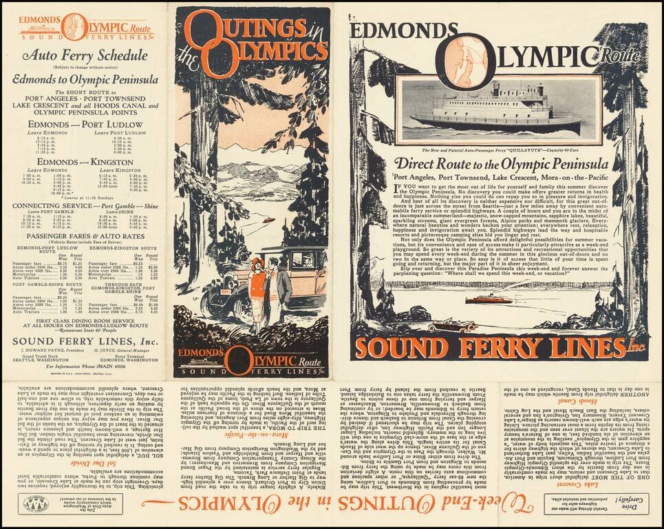
The verso includes more promotional information and a time schedule for Weekend Outings in the Olympics, including an image of the Ferry Quillayute.
The Quillayute
Built in 1927 as wooden hull ferry with twin diesel engines for Puget Sound Ferry Lines. In 1928 she was taken over by Puget Sound Navigation Company and ran from Edmonds to Kingston. At the time Washington state took over the line, she was not included in the sale.
The Quillayute went to Canada with Captain Peabody and the Black Ball Ferries and was used on the Horseshoe Bay route. After the Black Ball line was sold to the Canadian Government, the Quillayute was sold to the Nelson Brothers and thereafter used for a fishing camp in Northern Canada.
Rarity
The Sound Ferry Lines seems to have operated briefly in Edmonds in the late 1920s. We find no other examples of this pamphlet.
If you are a student, write to us in telegram: @antiquemaps and indicate what material you need and for what work you need a map in high detail. We are ready to provide material on special terms. For students only!
![[Map of the United States, illustrating the routes of the Candian Pacific Railway and the Seattle, Lake Shore and Eastern Railway]](/map/small/71080.jpg)

