logo

1981. The Puget Sound Country A Pictorial Overview With Historical Notes

  • The Puget Sound Country A Pictorial Overview With Historical Notes

The Puget Sound Country A Pictorial Overview With Historical Notes information:

Year of creation: 
Resolution size (pixels): 
 19417x13947 px
Disk Size: 
 126.203MiB
Number of pages: 
 1
Place: 
 Kent, WA
Author: 

Print information. Print size (Width x height in inches):
Printing at 72 dpi 
  269.68 х 193.71
Printing at 150 dpi 
 129.45 х 92.98
Printing at 300 dpi 
 64.72 х 46.49

An example of detailing the file of this map of in a printable high-resolution:

Click to open in high resolution (open in new tab).
Attention! this is just the central piece (central area 960x960 px) of the map file!
This is an example, so that you can see and study the level of detail of a given map. The entire Map will be fully available after payment!

The Puget Sound Country A Pictorial Overview With Historical Notes

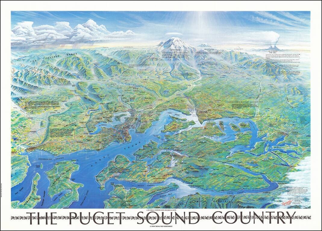
Attractive vintage bird's eye view poster of Puget Sound, showing Seattle, Mount Rainier, the eastern shores of the Olympic Peninsula, etc.

The map was published in Seattle in 1981.

Interestingly, the view includes a note about Mount St. Helens which had erupted one year earlier. The height is given as "9,766 8466+/-". The mountain is shown steaming. Numerous other mountains, including Rainier, Hood, and Adams, are shown.


Special conditions for students!

If you are a student, write to us in telegram: @antiquemaps and indicate what material you need and for what work you need a map in high detail. We are ready to provide material on special terms. For students only!

Item information:

Year of creation:
Size:
19417x13947 px
Disk:
126.203MiB
Number of pages:
1
Place:
Kent, WA
Author:
Richard A. Pargeter.
$14.99

Related item