Map size in jpg-format: 49.2263MiB
Click to open in high resolution (open in new tab).
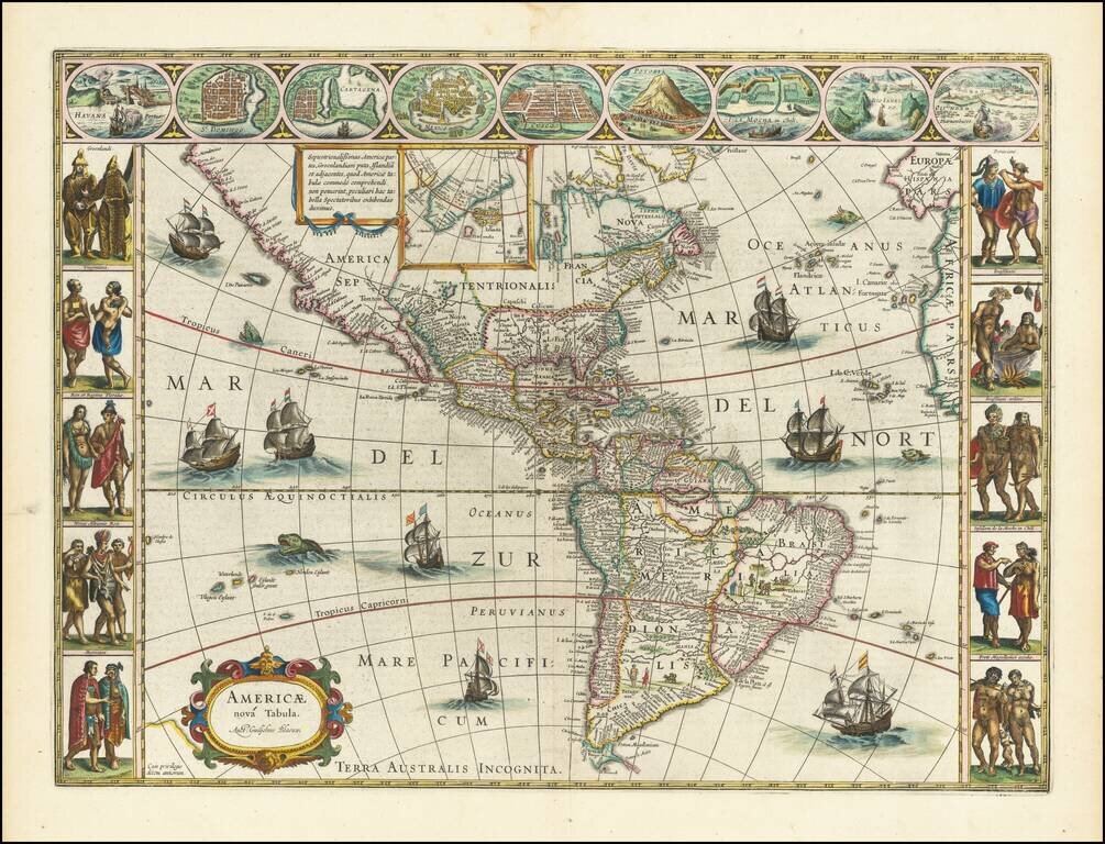
Antique Map of America From The Golden Age of Dutch Cartography
Willem Blaeu's famous antique map of the Americas.
Blaeu's map of America is one of the most sought after maps of America from the Golden Age of Dutch Cartography, blending contemporary geographical knowledge and a rich decorative image. Blaeu's maps set the standard for the quality of the engraving, paper and color, as well as a fine depiction of contemporary geographical knowledge.
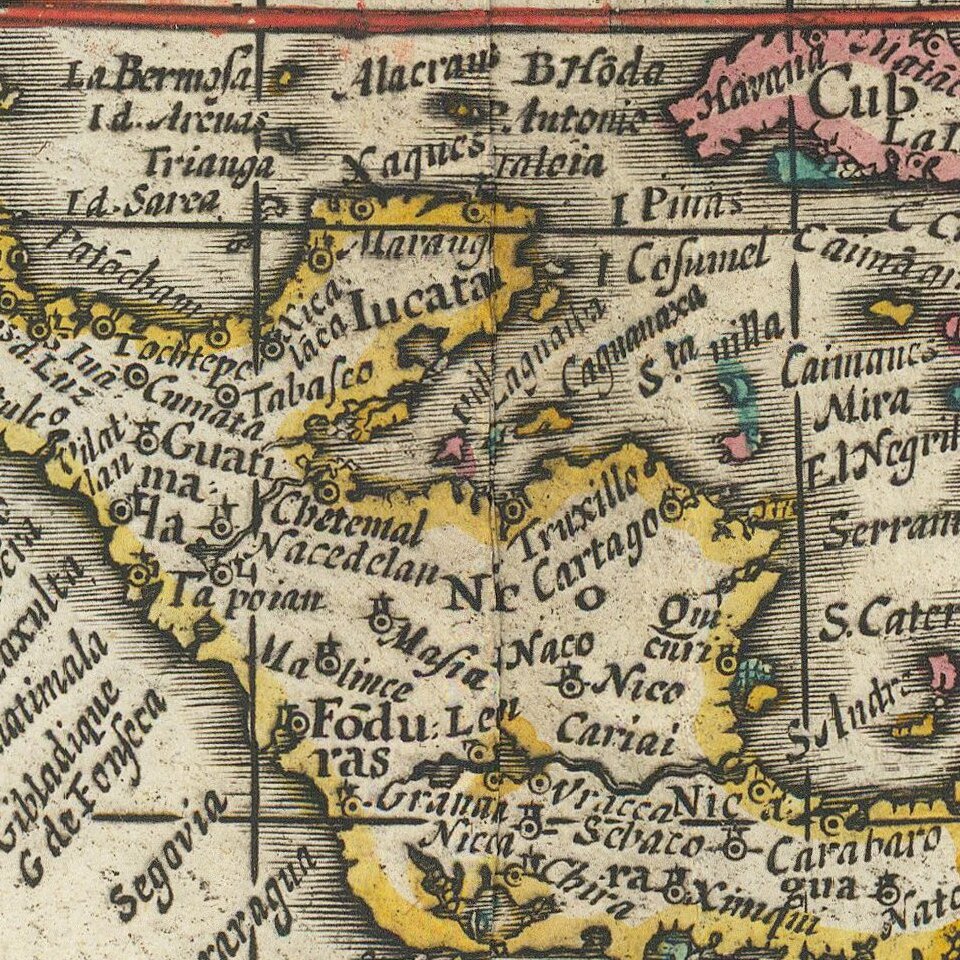
This map illustrates excellent detail throughout, including a classical rendition of the West Coast of America (which did not follow the California as an Island myth) and dozens of place names along the East Coast. Nine decorative views of important American Cities and Harbors across the top and 10 fine miniatures of Native Americans of various regions along the side panels. The map is also embellished with eight sailing ships, four sea monsters and vignettes in the interior of the continent showing Indian life. Goss states "this magnificent map sums up the general European view of the western hemisphere in the early seventeenth century…"
The present map is State 4. Burden identifies 5 states of the map as follows:
If you are a student, write to us in telegram: @antiquemaps and indicate what material you need and for what work you need a map in high detail. We are ready to provide material on special terms. For students only!


