Abraham Ortelius is perhaps the best known and most frequently collected of all sixteenth-century mapmakers. Ortelius started his career as a map engraver. In 1547 he entered the Antwerp guild of St Luke as afsetter van Karten. His early career was as a business man, and most of his journeys before 1560 were for commercial purposes. In 1560, while traveling with Gerard Mercator to Trier, Lorraine, and Poitiers, he seems to have been attracted, largely by Mercator’s influence, towards a career as a scientific geographer. From that point forward, he devoted himself to the compilation his Theatrum Orbis Terrarum (Theatre of the World), which would become the first modern atlas.
In 1564 he completed his “mappemonde", an eight-sheet map of the world. The only extant copy of this great map is in the library of the University of Basle. Ortelius also published a map of Egypt in 1565, a plan of Brittenburg Castle on the coast of the Netherlands, and a map of Asia, prior to 1570.
On May 20, 1570, Ortelius’ Theatrum Orbis Terrarum first appeared in an edition of 53 maps. By the time of his death in 1598, a total of 25 editions were published including editions in Latin, Italian, German, French, and Dutch. Later editions would also be issued in Spanish and English by Ortelius’ successors, Vrients and Plantin, the former adding a number of maps to the atlas, the final edition of which was issued in 1612. Most of the maps in Ortelius Theatrum were drawn from the works of a number of other mapmakers from around the world; a list of 87 authors is given by Ortelius himself
In 1573, Ortelius published seventeen supplementary maps under the title of Additamentum Theatri Orbis Terrarum. In 1575 he was appointed geographer to the king of Spain, Philip II, on the recommendation of Arias Montanus, who vouched for his orthodoxy (his family, as early as 1535, had fallen under suspicion of Protestantism). In 1578 he laid the basis of a critical treatment of ancient geography with his Synonymia geographica (issued by the Plantin press at Antwerp and republished as Thesaurus geographicus in 1596). In 1584 he issued his Nomenclator Ptolemaicus, a Parergon (a series of maps illustrating ancient history, sacred and secular.) Late in life, he also aided Welser in his edition of the Peutinger Table in 1598.
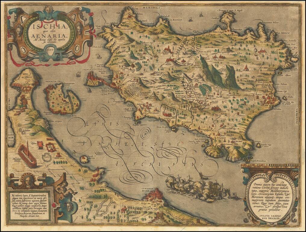
Striking old color example of Ortelius' map of Ischia, from Ortelius' Theatrum Orbis Terrarum. The map is based on a map engraved by Mario Cartario, in a book about Ischia, written by Guilio Iasolino in 1568.
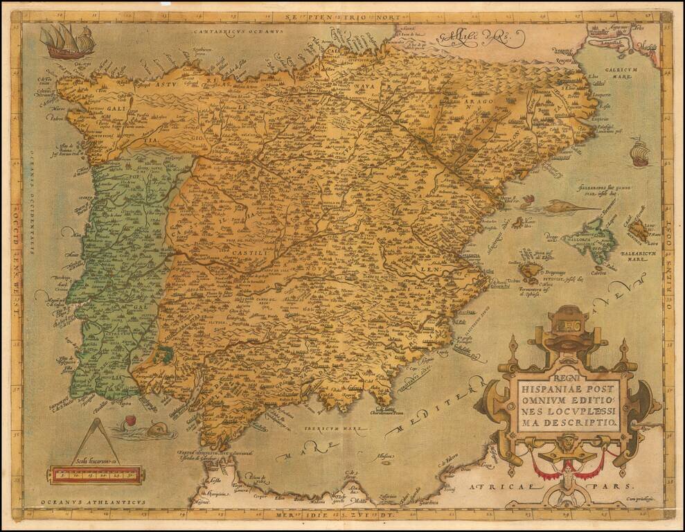
Ortelius’ Detailed Map of the Iberian Peninsula from the World’s First Modern Atlas Striking example of Abraham Ortelius' map of the Iberian Peninsula, from his influential Theatrum Orbis Terrarum, the first modern atlas of the world. The map is...
![Hispalensis Conventus Delineatio [Andalusia]](/map/small/60160mp2.jpg)
Gorgeous map of Andalusia, extending from Las Sierras de Ronda to Corduba and Sierra Morena to El Cerro and Aroche to Castromarin and Lepe, centered on Sevilla, with the Bay of Cadiz at the lower center. Three cartouches and a naval battle are shown,...
![Hanc Insulam Perlustrabat . . .[Bay of Cadiz] [with] Carpetaniae . . . 1584 [Toledo] [with] Guipuscoae Regionis Typus. . .](/map/small/65037.jpg)
Finely colored example of Ortelius' striking regional map of Spain, showing the Island and Bay of Cadiz, the departure point for Columbus and many other important voyages to the New World during the great age of Spanish exploration. The primary map...
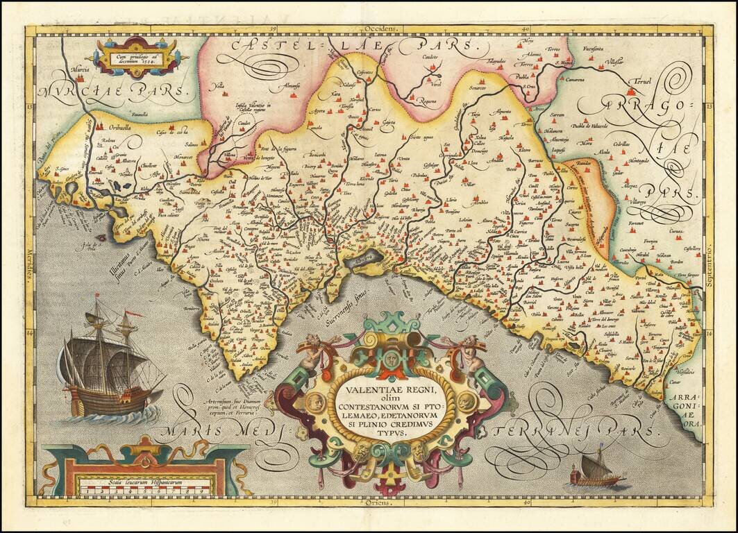
Old color example of this very rare edition of Ortelius' map of Valencia, which appeared only in the 1584 edition and in a very few examples of the 1592 edition, The map extends from Murcia and Orihuella to the Cenia River and extending inland to...
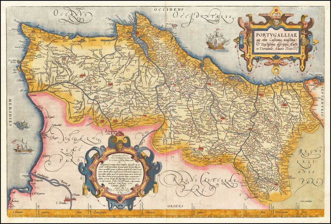
Full color example of Ortelius' map of Portugal, from Ortelius' Theatrum Orbis Terrarum, the first modern atlas of the world. Includes 2 ornate cartouches, sea monster and 2 sailing ships. Based upon Fernando Alvarez Secco's two-sheet map of...
![Cyprus Insula [with] Candia, Olim Creta](/map/small/65746.jpg)
Striking example of Ortelius' first map of Cyprus and Crete, from Ortelius' Theatrum Orbis Terrarum, the first modern atlas of the World. The map is based upon earlier maps by Bordone (1528) and Camocio (1564). During the time of the map's creation,...
![Archipelagi Insularum Aliquot Descrip. [Crete, Metellino, Cerigo, Scarpanto, Nicsia, Santorini, Milo, Stalimene, Negroponte, Rodus and Scio]](/map/small/59922mp2.jpg)
Nice full color example of Ortelius' maps of of Crete and 10 other islands, from the Ortelius' Theatrum Orbis Terrarum, the first modern atlas of the world. Includes Metellino, Cerigo, Scarpanto, Nicsia, Santorini, Milo, Stalimene, Negroponte, Rodus...
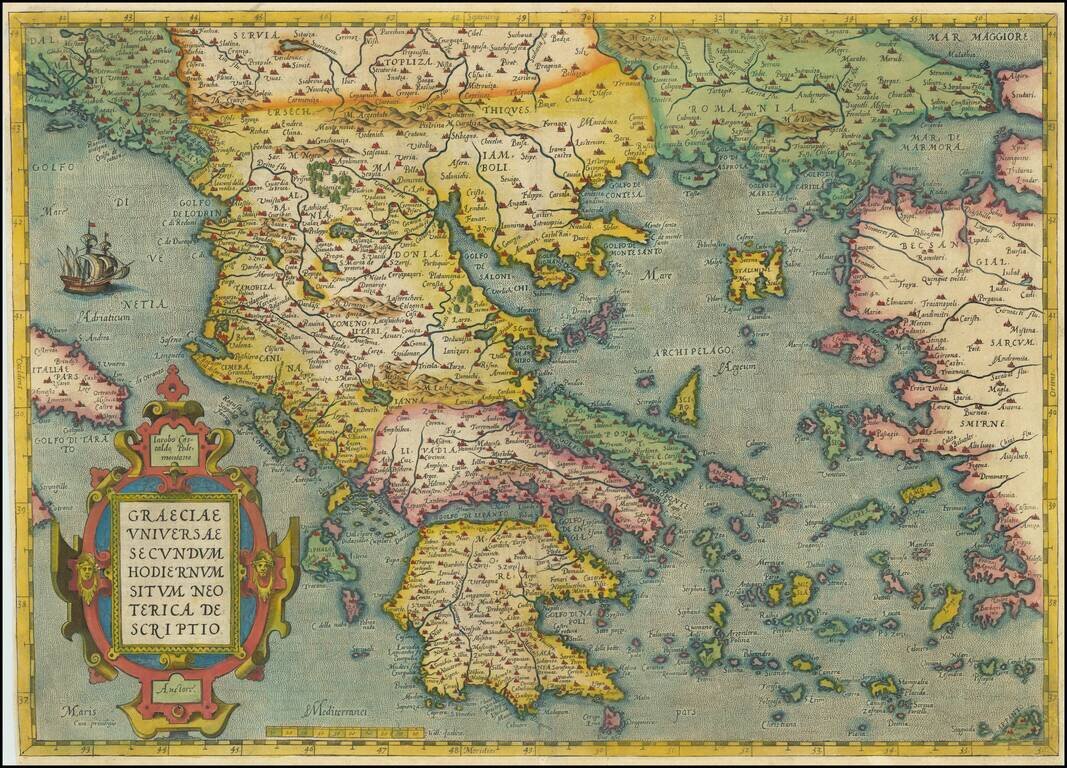
Decorative map of Greece and surrounding Islands and contiguous regions, from Ortelius' Theatrum, based upon the work of Giacomo Gastaldi. The map is embellished by a sailing ship and a large ornate cartouche. The map shows cities, rivers, mountains,...
![[Crete / Corsica / Sardinia] Corsica [and] Sardinia [and] Creta . . . [and] Insulae Mari Ionii](/map/small/33196bp.jpg)
Decorative example of Ortelius' maps of Corsica, Sardinia, Crete and the Ionian Sea, from his Theatrum Orbis Terrarum, the first modern atlas of the world.
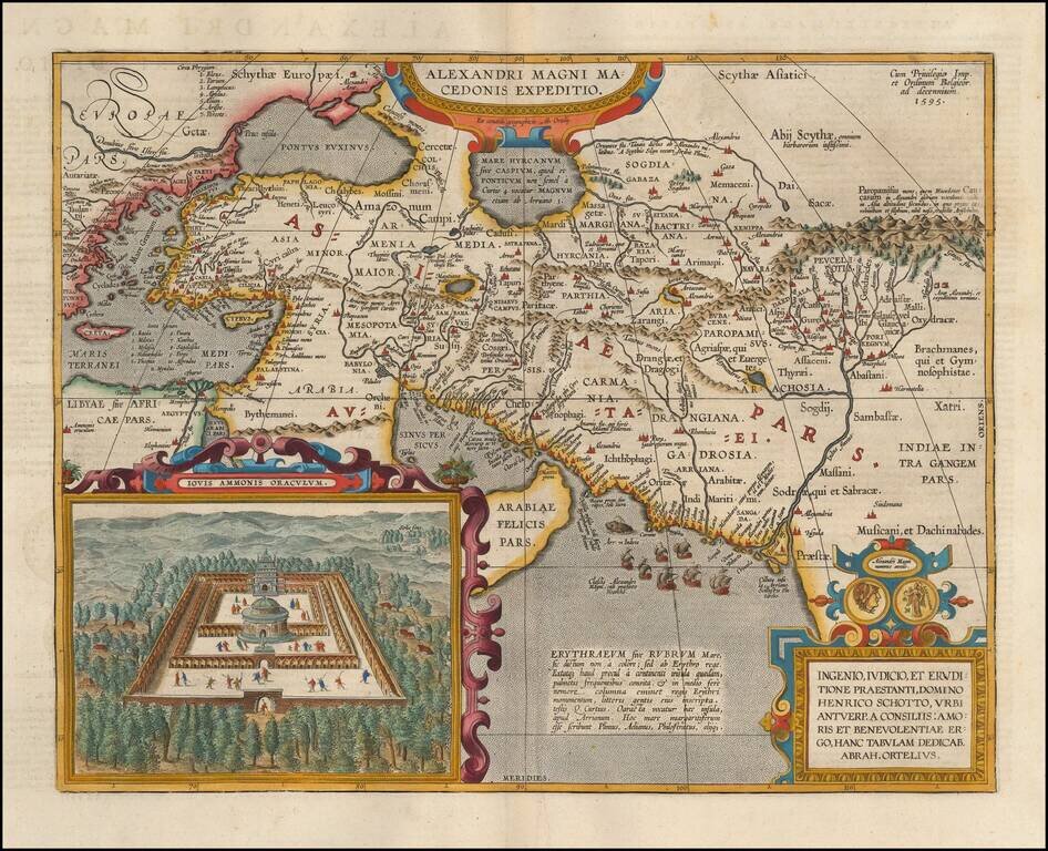
Detailed map of Alexander the Great's expedition to Macedonia. Includes an inset: Iovis Ammonis Oraculum, the oracle in Lybia which Alexander visited before he went to India. Several decorative cartouches, sailing ships, sea monsters, etc.
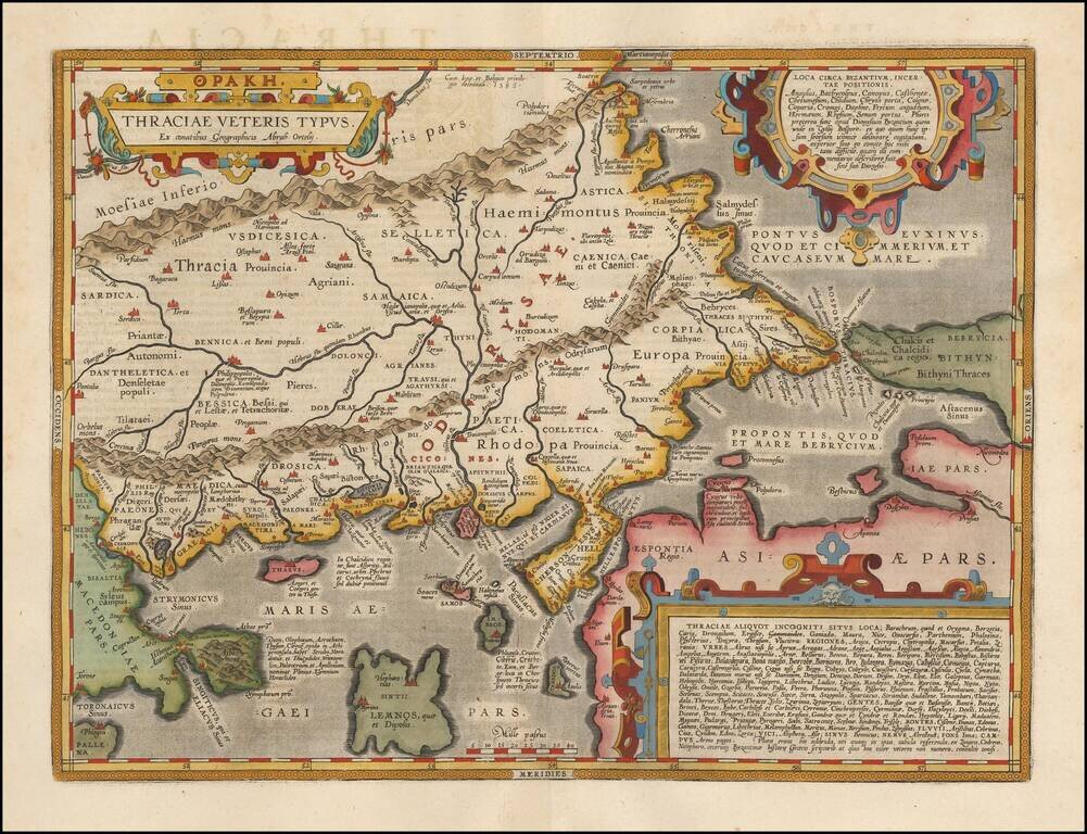
Fine map of ancient Thrace, extending from Byzantium (Istanbul) and the Bosphorus Straits to Macedonia, published by Abraham Ortelius. The map is based on Gastaldi's 1560 map of South East Europe, and on information from numerous ancient sources,...
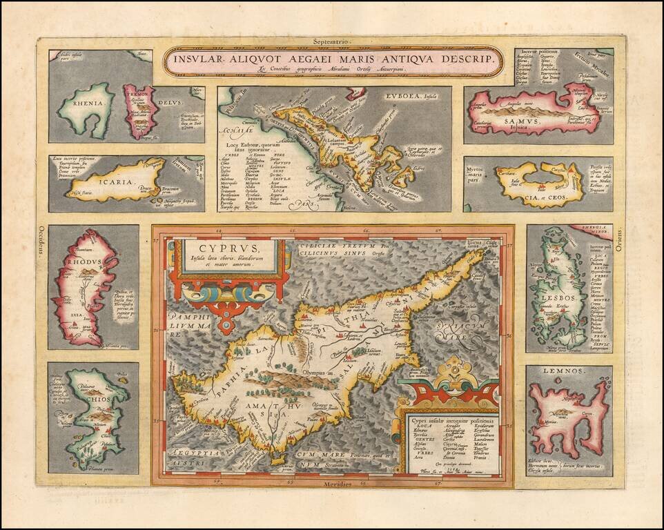
Striking full color example of Ortelius' map of Cyprus, ringed by smaller maps of islands in the Aegean, including Lesbos, Rhodes, Rhenia, Tremon, Icaria, Euboaea, Chios, Lemnos, Cia et Ceos and Samus. From Abraham Ortelius' Theatrum Orbis Terrarum,...
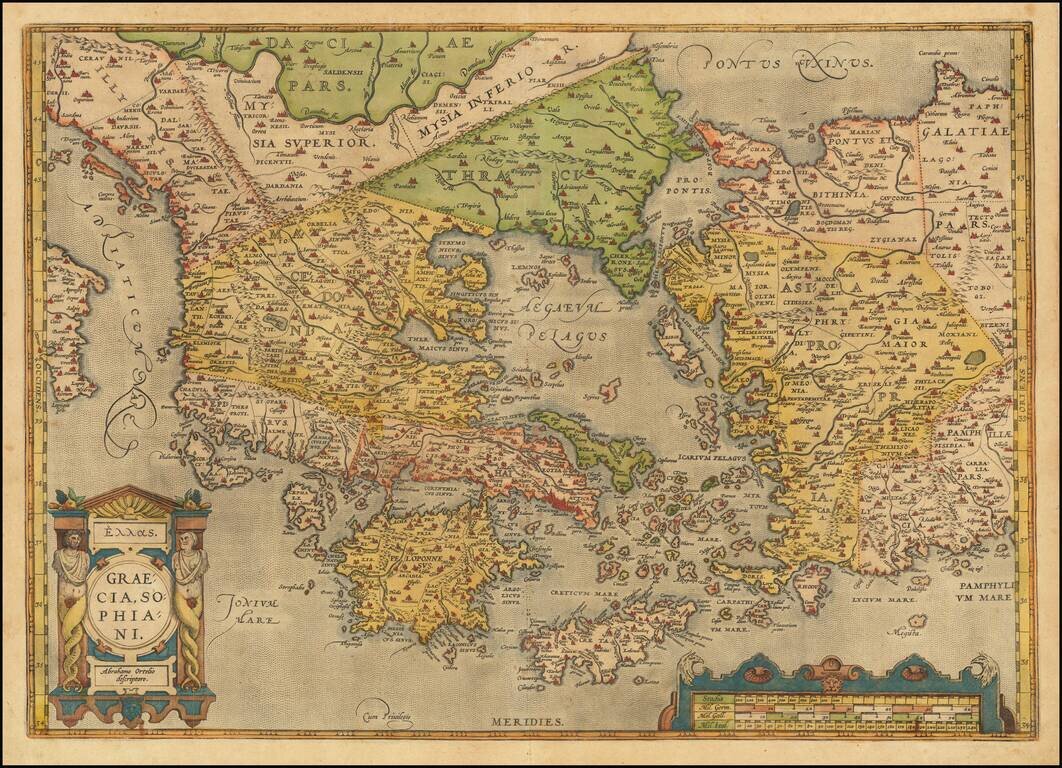
Old color example of Ortelius' decorative map of Greece, Turkey and Asia Minor, with neighboring islands, from Ortelius' Theatrum Orbis Terrarum, the first modern atlas of the world. The map is embellished by a decorative cartouche and scale of miles....
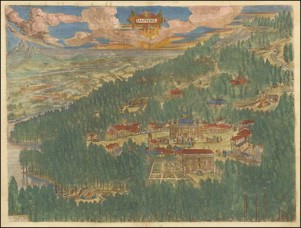
Fine old color example of Abraham Ortelius' view of the mythical paradise of Tempe in Thessaly, Greece. Located at the foot of Mount Olympus, this valley was known as the playground of the gods. The Pineios River, named after the river god Peneus,...
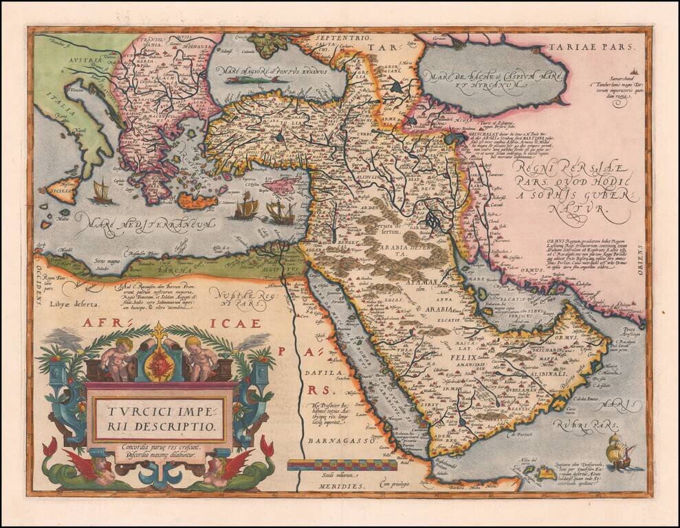
Second Edition of the Ortelius Map of the Turkish Empire Nice example of Ortelius' Turkish Empire, embracing the Middle East, Turkey and the Eastern Mediterranean from Sicily to Cyprus. The map is based upon Giacomo Gastaldi's wall map of Asia of...