Map size in jpg-format: 34.4089MiB
Click to open in high resolution (open in new tab).
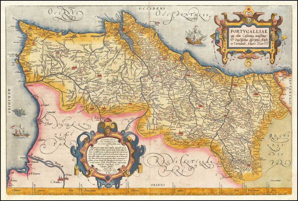
Full color example of Ortelius' map of Portugal, from Ortelius' Theatrum Orbis Terrarum, the first modern atlas of the world.
Includes 2 ornate cartouches, sea monster and 2 sailing ships.
Based upon Fernando Alvarez Secco's two-sheet map of Portugal, engraved by Sebastiano de Re, and published by Achilles Statius (1524-1581), a Portuguese, at the publishing house of Michele Tramezzino in 1561.
If you are a student, write to us in telegram: @antiquemaps and indicate what material you need and for what work you need a map in high detail. We are ready to provide material on special terms. For students only!