Map size in jpg-format: 41.3519MiB
Click to open in high resolution (open in new tab).

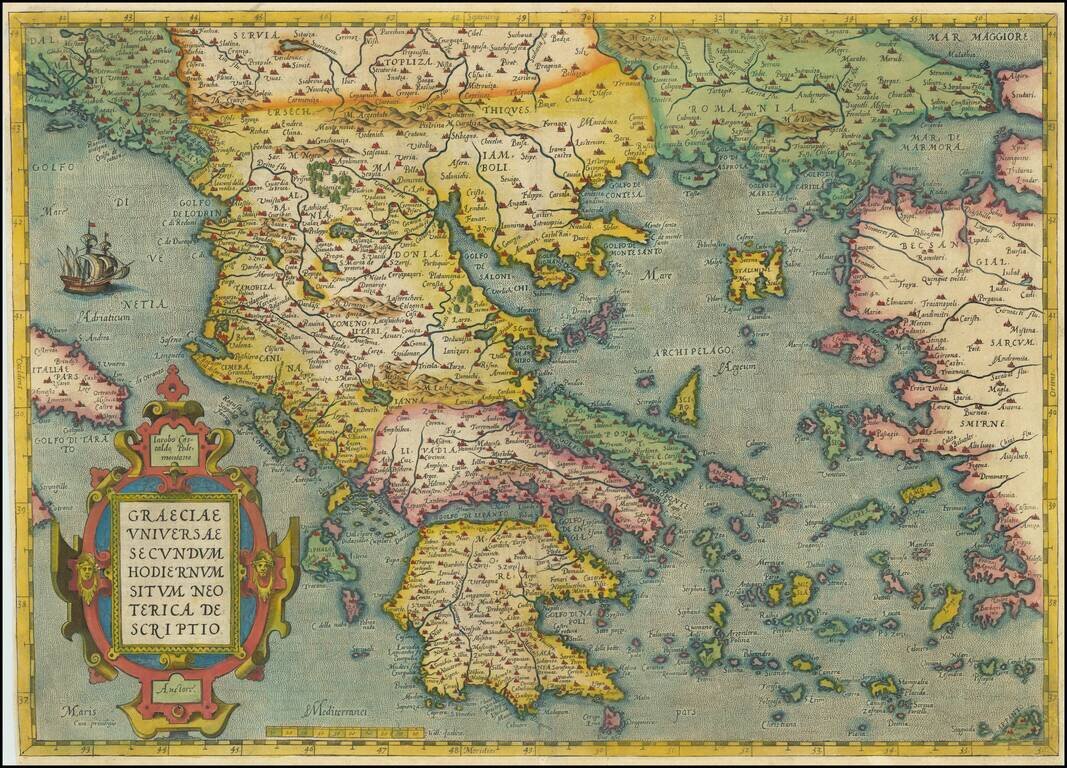
Decorative map of Greece and surrounding Islands and contiguous regions, from Ortelius' Theatrum, based upon the work of Giacomo Gastaldi.
The map is embellished by a sailing ship and a large ornate cartouche. The map shows cities, rivers, mountains, lakes, islands, ports, forests, etc. An attractive full color example, with nice margins.
If you are a student, write to us in telegram: @antiquemaps and indicate what material you need and for what work you need a map in high detail. We are ready to provide material on special terms. For students only!

![Patriarchatus Antiocheni Geographica Descriptio . . . [shows Cyprus]](/map/small/54177.jpg)
