Abraham Ortelius is perhaps the best known and most frequently collected of all sixteenth-century mapmakers. Ortelius started his career as a map engraver. In 1547 he entered the Antwerp guild of St Luke as afsetter van Karten. His early career was as a business man, and most of his journeys before 1560 were for commercial purposes. In 1560, while traveling with Gerard Mercator to Trier, Lorraine, and Poitiers, he seems to have been attracted, largely by Mercator’s influence, towards a career as a scientific geographer. From that point forward, he devoted himself to the compilation his Theatrum Orbis Terrarum (Theatre of the World), which would become the first modern atlas.
In 1564 he completed his “mappemonde", an eight-sheet map of the world. The only extant copy of this great map is in the library of the University of Basle. Ortelius also published a map of Egypt in 1565, a plan of Brittenburg Castle on the coast of the Netherlands, and a map of Asia, prior to 1570.
On May 20, 1570, Ortelius’ Theatrum Orbis Terrarum first appeared in an edition of 53 maps. By the time of his death in 1598, a total of 25 editions were published including editions in Latin, Italian, German, French, and Dutch. Later editions would also be issued in Spanish and English by Ortelius’ successors, Vrients and Plantin, the former adding a number of maps to the atlas, the final edition of which was issued in 1612. Most of the maps in Ortelius Theatrum were drawn from the works of a number of other mapmakers from around the world; a list of 87 authors is given by Ortelius himself
In 1573, Ortelius published seventeen supplementary maps under the title of Additamentum Theatri Orbis Terrarum. In 1575 he was appointed geographer to the king of Spain, Philip II, on the recommendation of Arias Montanus, who vouched for his orthodoxy (his family, as early as 1535, had fallen under suspicion of Protestantism). In 1578 he laid the basis of a critical treatment of ancient geography with his Synonymia geographica (issued by the Plantin press at Antwerp and republished as Thesaurus geographicus in 1596). In 1584 he issued his Nomenclator Ptolemaicus, a Parergon (a series of maps illustrating ancient history, sacred and secular.) Late in life, he also aided Welser in his edition of the Peutinger Table in 1598.
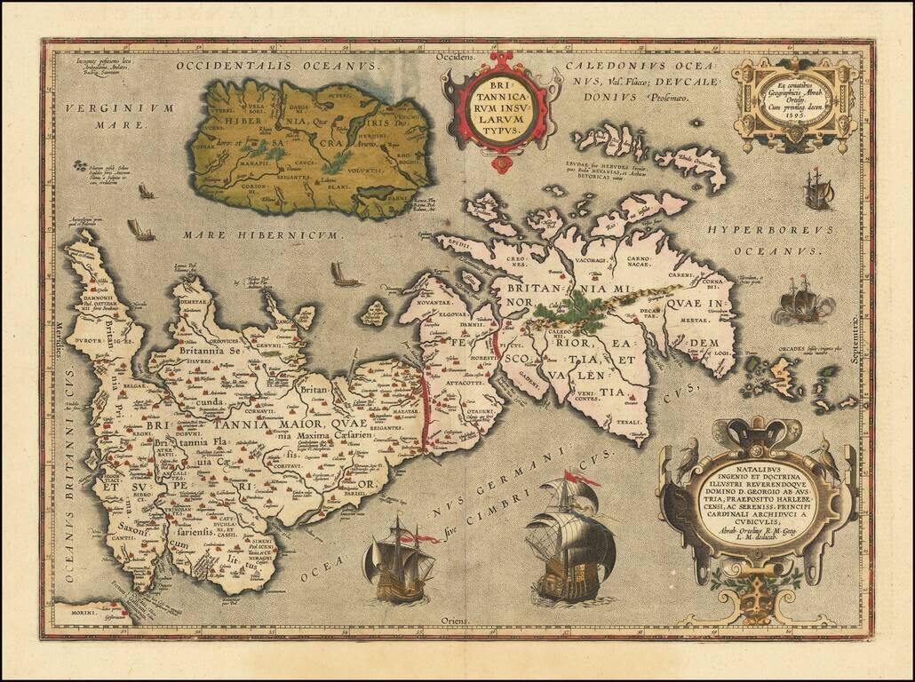
Notable Atlas Map of the British Isles, From the First Modern Atlas Scarce, fine map of the British Isles, from Ortelius' ground-breaking atlas, Theatrum Orbis Terrarum. Oriented to the west, the British Isles are shown as if on their side. The...
![[Wales] Cambriae Typus Auctore Humfredo Lhuydo . . .](/map/small/45077.jpg)
Ortelius' map is the first printed map of Wales. The map appeared in Ortelius' Theatrum Orbis Terrarum, the first modern atlas of the world. Ornate cartouche and many sailing ships and sea monster. The map is based upon Mercator's 1564 wall map of the...
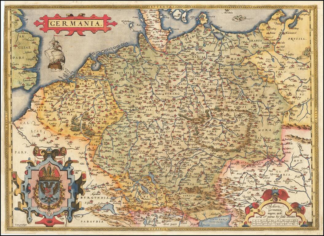
Fine old example of Ortelius' map of the German Empire, from his Theatrum Orbis Terrarum, the first modern atlas of the world. The map extends from The English Channel to the Baltic, the Vistula and Poland in the northeast, Budapest, Venice and the...
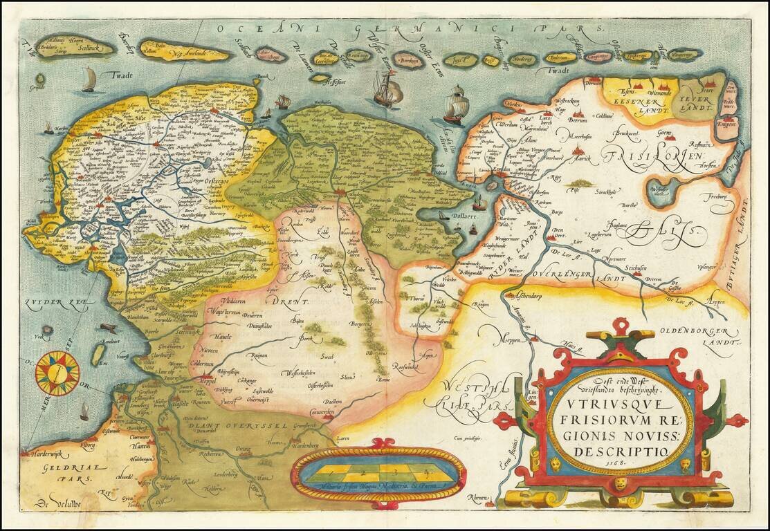
A nice old color example of Ortelius' map of Friesland, including a larger compass rose, sailing ships and an elaborate cartouche. The map appeared in Ortelius' Theatrum Orbis Terrarum, the first modern Atlas, first issued in 1584.
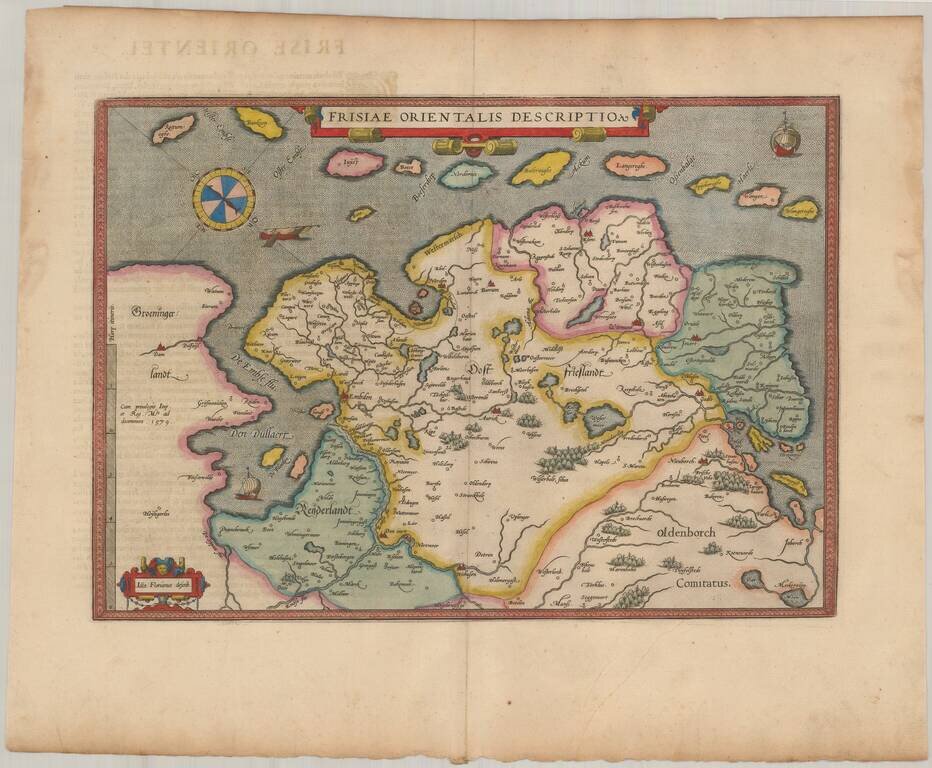
Nice example of Ortelius' map East Friesland, from his Theatrum Orbis Terrarum, the first modern atlas of the world. Includes a curious compass and three sailng vessels.
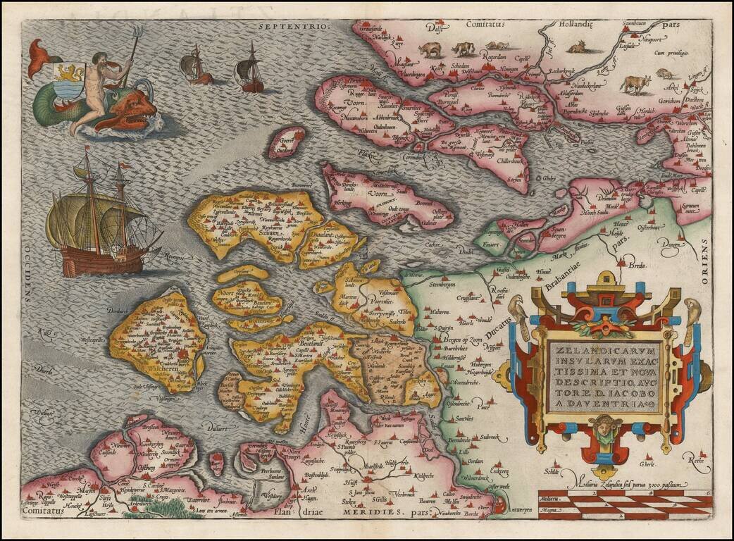
Nice full color example of this early state of Oretlius' decorative map of Zeelandia, including ornate cartouche, sailing ships and Triton riding a sea monster and carrying the coat of arms of the province. From Ortelius' Theatrum Orbis Terrarum, the...
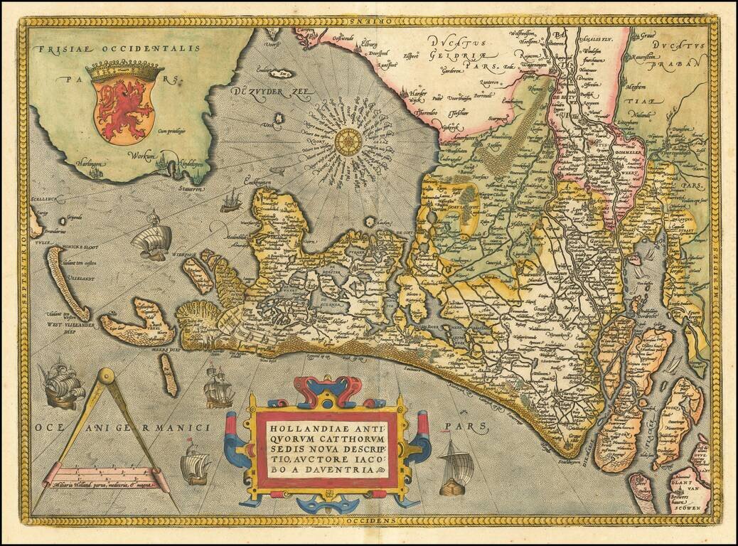
A nice full color example of Ortelius' map of Holland, drawn from Jacaob van Deventer's maps. The map is oriented with east at the top of the map. Elaborately embellished with a compass rose, sailing ships, coat of arms, etc. Nice dark impression and...
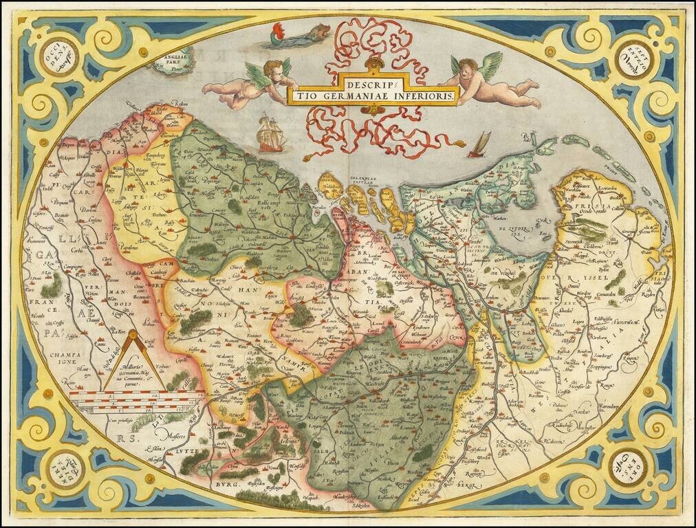
Old color example of the Low Countries set in an ornate decorative border, from Ortelius' Theatrum Orbis Terrarum, the first modern atlas of the world. Two cherubs hold an ornate banner cartouche aloft, with sailing ships and a sea monster. Koeman...
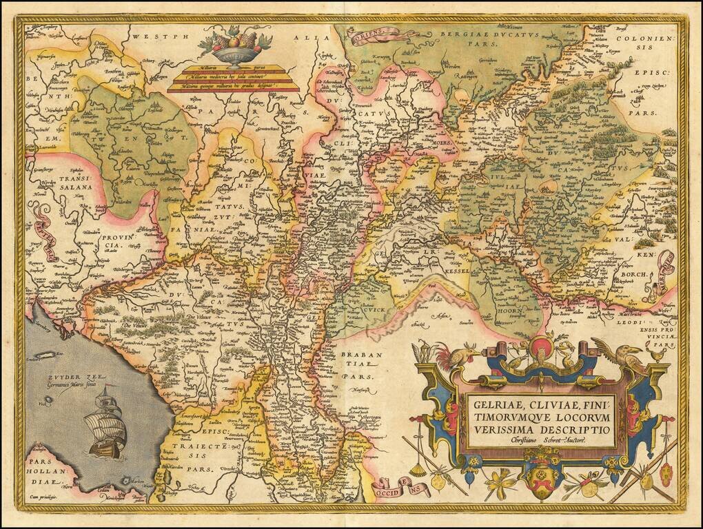
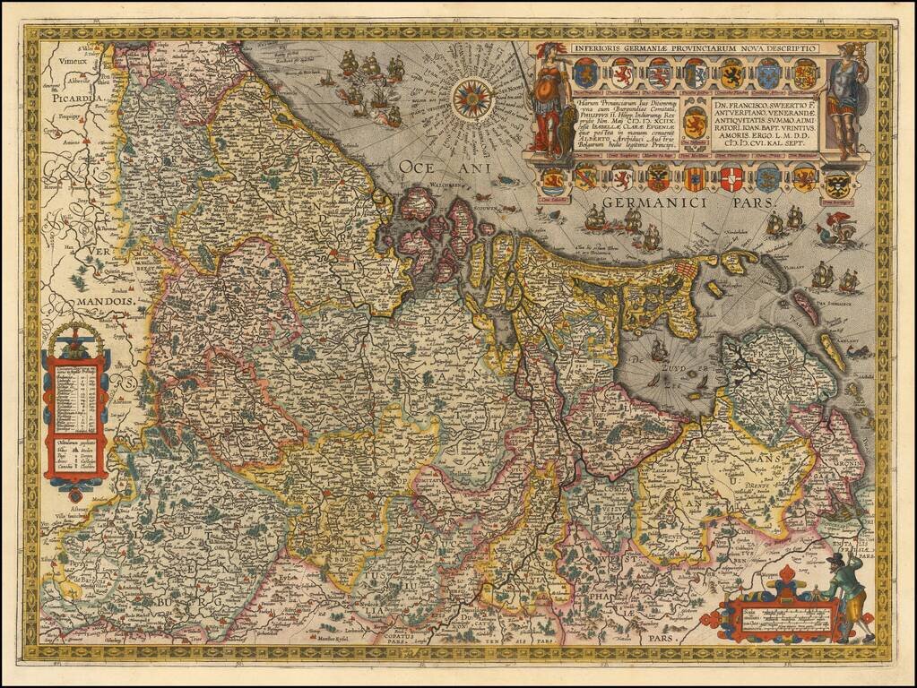
Striking regional map of the Low Countries from Ortelius' Theatrum Orbis Terrarum, the first modern atlas of the world. Includes a large cartouche, war ship and scale of miles.
Fine example of Jan Baptiste Vrients map of the Low Countries and environs, which first appeared in the 1608 edition of Abraham Ortelius' Theatrum Orbis Terrarum, the first modern atlas of the world. The map is based upon a wall map of Philip Galle,...
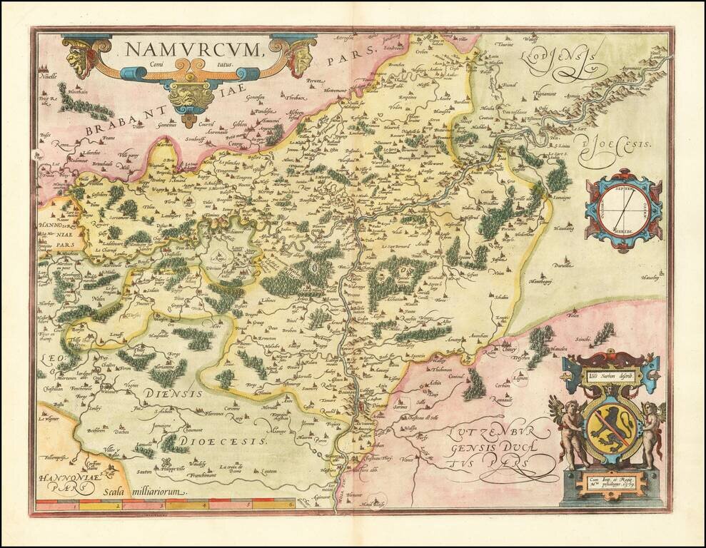
Fine old color example of Ortelius' map of Namur, with compass rose and two cartouches. From Ortelius' Theatrum Orbis Terrarum, the first modern Atlas.
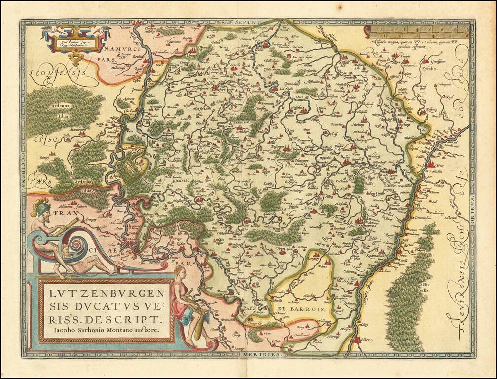
Fine old color example of this early map of Luxembourg from Ortelius' Theatrum Orbis Terrarum, the first modern atlas of the world. Large cartouche, smaller cartouche and scale of miles.
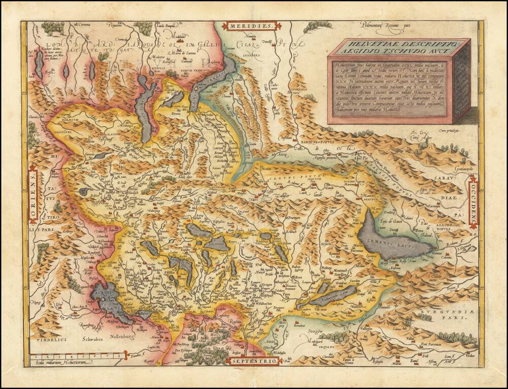
Nice full color example of Ortelius' map of Switzerland, from his Theatrum Orbis Terrarum, the first modern atlas of the world. This is the second state of the map, with the additional place names around Lake Geneva, which first appeared in 1584. The...
![Gallia Narbonensis Ora Marittima Recenter descripta [and] Sabaudiae Et Burgundiae Comitatus descriptio . . .](/map/small/57206.jpg)
The regions include a detailed area map of the Avignon region on the upper Rhodanus River (and coastline from Narbone to Marseille) and the area around Lake Geneva, extending west to Lyon, and showing Grenoble, Geneva, San Moritz, and Torino (Italy)....
![Basiliensis Territorii Descriptio Nova [with] Circulus Sive Liga Suevia Vulgo Schwabische Kraiss](/map/small/65392.jpg)
Two detailed regional maps by Ortelius, from his Theatrum Orbis Terrarum, the first modern atlas. The first map shows the region around Basel, in Switzerland, based upon the work of Sebastian Munster. The second map shows the region bounded by the...
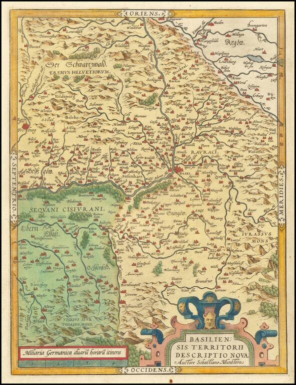
Old color map of the Basel region by Abraham Ortelius, from his Theatrum Orbis Terrarum, the first modern atlas. The first map shows the region around Basel, in Switzerland, based upon the work of Sebastian Munster.