logo

1624. Insular Aliquot Aegaei Maris Antiqua Descrip . . . (Large Cyprus Inset)

  • Insular Aliquot Aegaei Maris Antiqua Descrip . . . (Large Cyprus Inset)

Insular Aliquot Aegaei Maris Antiqua Descrip . . . (Large Cyprus Inset) information:

Year of creation: 
Resolution size (pixels): 
 12599x10063 px
Disk Size: 
 24.9859MiB
Number of pages: 
 1
Place: 
 Antwerp
Author: 

Print information. Print size (Width x height in inches):
Printing at 72 dpi 
  174.99 х 139.76
Printing at 150 dpi 
 83.99 х 67.09
Printing at 300 dpi 
 42 х 33.54

An example of detailing the file of this map of in a printable high-resolution:

Click to open in high resolution (open in new tab).
Attention! this is just the central piece (central area 960x960 px) of the map file!
This is an example, so that you can see and study the level of detail of a given map. The entire Map will be fully available after payment!

Insular Aliquot Aegaei Maris Antiqua Descrip . . . (Large Cyprus Inset)

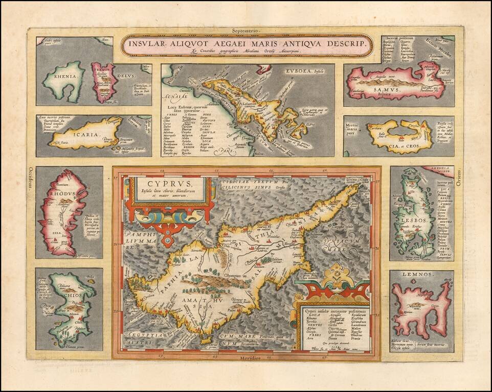
Striking full color example of Ortelius' map of Cyprus, ringed by smaller maps of islands in the Aegean, including Lesbos, Rhodes, Rhenia, Tremon, Icaria, Euboaea, Chios, Lemnos, Cia et Ceos and Samus.

From Abraham Ortelius' Theatrum Orbis Terrarum, the first modern atlas of the world.

Van Den Broecke 216; Stylianou 67

Special conditions for students!

If you are a student, write to us in telegram: @antiquemaps and indicate what material you need and for what work you need a map in high detail. We are ready to provide material on special terms. For students only!

Item information:

Year of creation:
Size:
12599x10063 px
Disk:
24.9859MiB
Number of pages:
1
Place:
Antwerp
Author:
Abraham Ortelius.
$14.99

Related item