Abraham Ortelius is perhaps the best known and most frequently collected of all sixteenth-century mapmakers. Ortelius started his career as a map engraver. In 1547 he entered the Antwerp guild of St Luke as afsetter van Karten. His early career was as a business man, and most of his journeys before 1560 were for commercial purposes. In 1560, while traveling with Gerard Mercator to Trier, Lorraine, and Poitiers, he seems to have been attracted, largely by Mercator’s influence, towards a career as a scientific geographer. From that point forward, he devoted himself to the compilation his Theatrum Orbis Terrarum (Theatre of the World), which would become the first modern atlas.
In 1564 he completed his “mappemonde", an eight-sheet map of the world. The only extant copy of this great map is in the library of the University of Basle. Ortelius also published a map of Egypt in 1565, a plan of Brittenburg Castle on the coast of the Netherlands, and a map of Asia, prior to 1570.
On May 20, 1570, Ortelius’ Theatrum Orbis Terrarum first appeared in an edition of 53 maps. By the time of his death in 1598, a total of 25 editions were published including editions in Latin, Italian, German, French, and Dutch. Later editions would also be issued in Spanish and English by Ortelius’ successors, Vrients and Plantin, the former adding a number of maps to the atlas, the final edition of which was issued in 1612. Most of the maps in Ortelius Theatrum were drawn from the works of a number of other mapmakers from around the world; a list of 87 authors is given by Ortelius himself
In 1573, Ortelius published seventeen supplementary maps under the title of Additamentum Theatri Orbis Terrarum. In 1575 he was appointed geographer to the king of Spain, Philip II, on the recommendation of Arias Montanus, who vouched for his orthodoxy (his family, as early as 1535, had fallen under suspicion of Protestantism). In 1578 he laid the basis of a critical treatment of ancient geography with his Synonymia geographica (issued by the Plantin press at Antwerp and republished as Thesaurus geographicus in 1596). In 1584 he issued his Nomenclator Ptolemaicus, a Parergon (a series of maps illustrating ancient history, sacred and secular.) Late in life, he also aided Welser in his edition of the Peutinger Table in 1598.
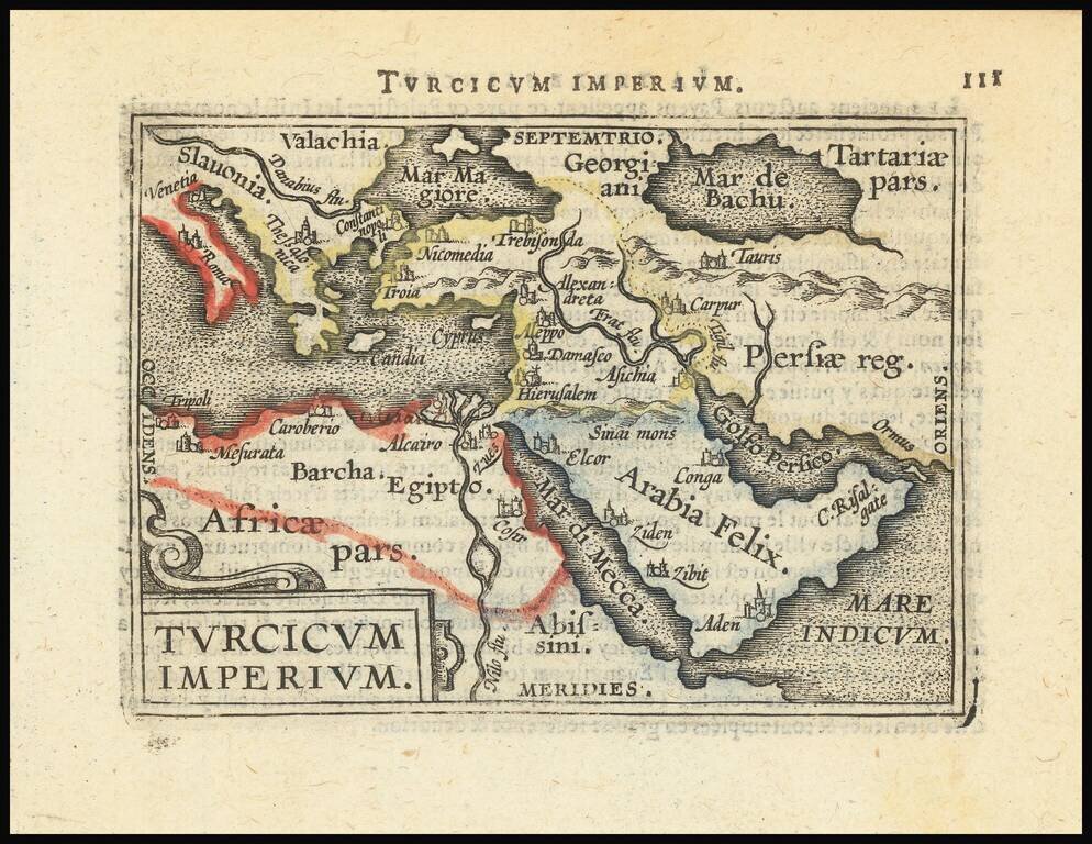
Decorative miniature map of the Turkish Empire. The map appeared in an early edition of Ortelius' Epitome, first published in 1579.
![Chinae, olim Sinarum regionis nova descriptio auctore Ludovico Georgio . . . 1584 [First State]](/map/small/71224.jpg)
First State of Ortelius' Map of China Old color example of the scarce first state of Ortelius' map of China, the first western map of China. Ortelius' map of China is taken directly from reports of the Portuguese mapmaker Luis Jorge de Barbuda...
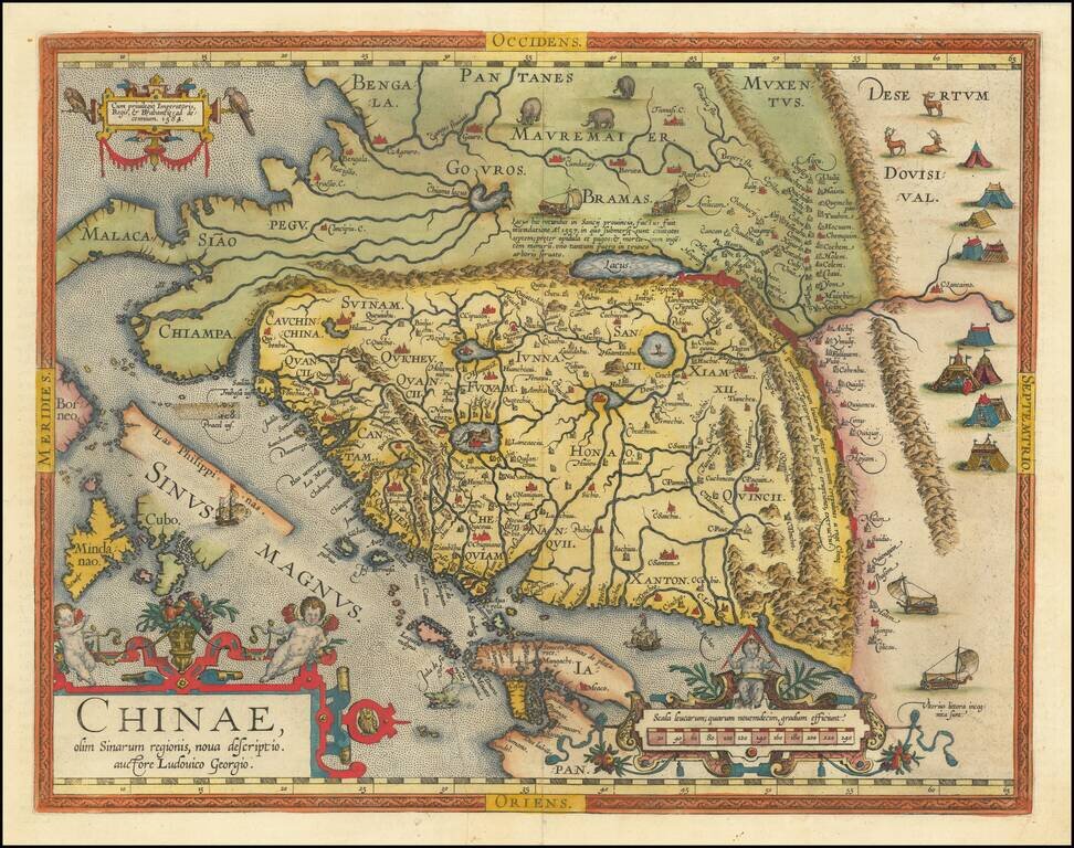
Fine example of the second state of Ortelius' map of China, the first western map of China. Ortelius' map of China is taken directly from reports of the Portuguese mapmaker Luis Jorge de Barbuda (Ludovicus Georgius), who made a manuscript map of China...
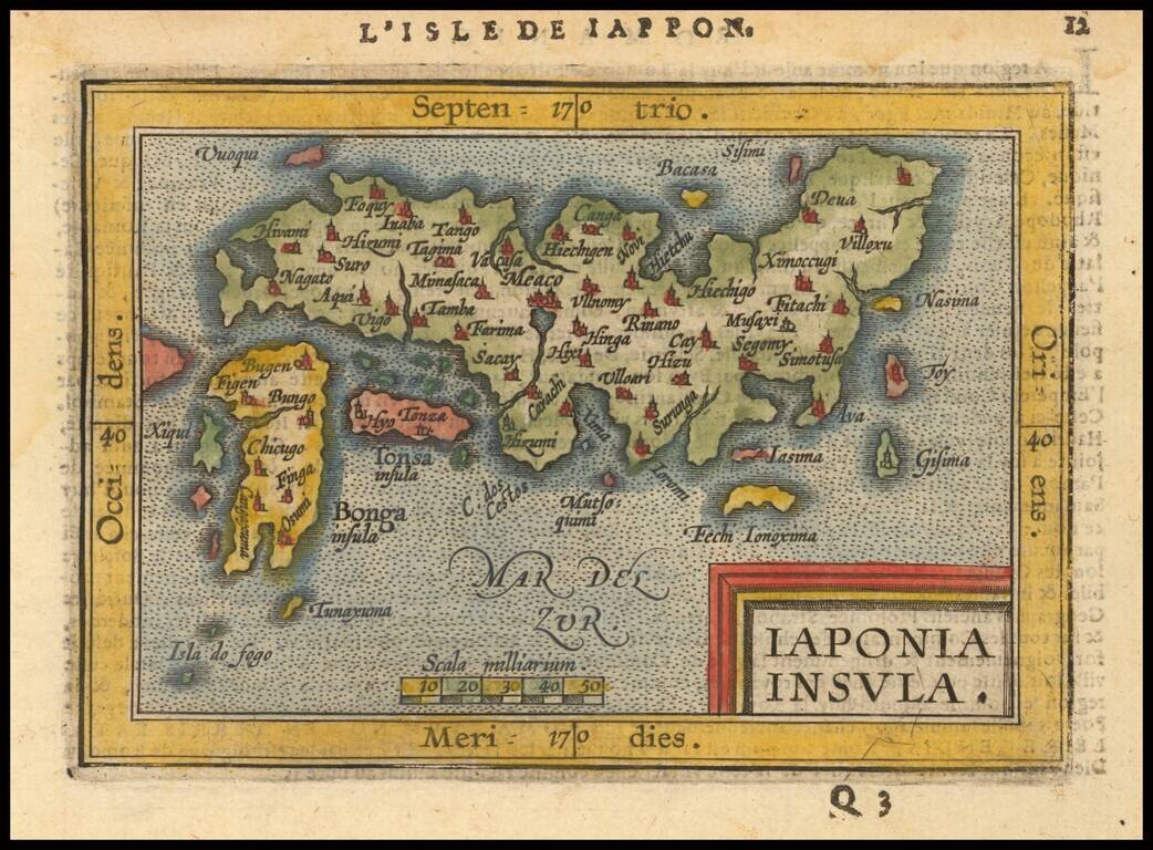
Nice full color example of Ortelius' miniature map of Japan, from the first edition of Ortelius Epitome published by Giovanni Battista Vrients. One of the earliest obtainable separate maps of Japan. J.B. Vrients purchased the rights and plates for...
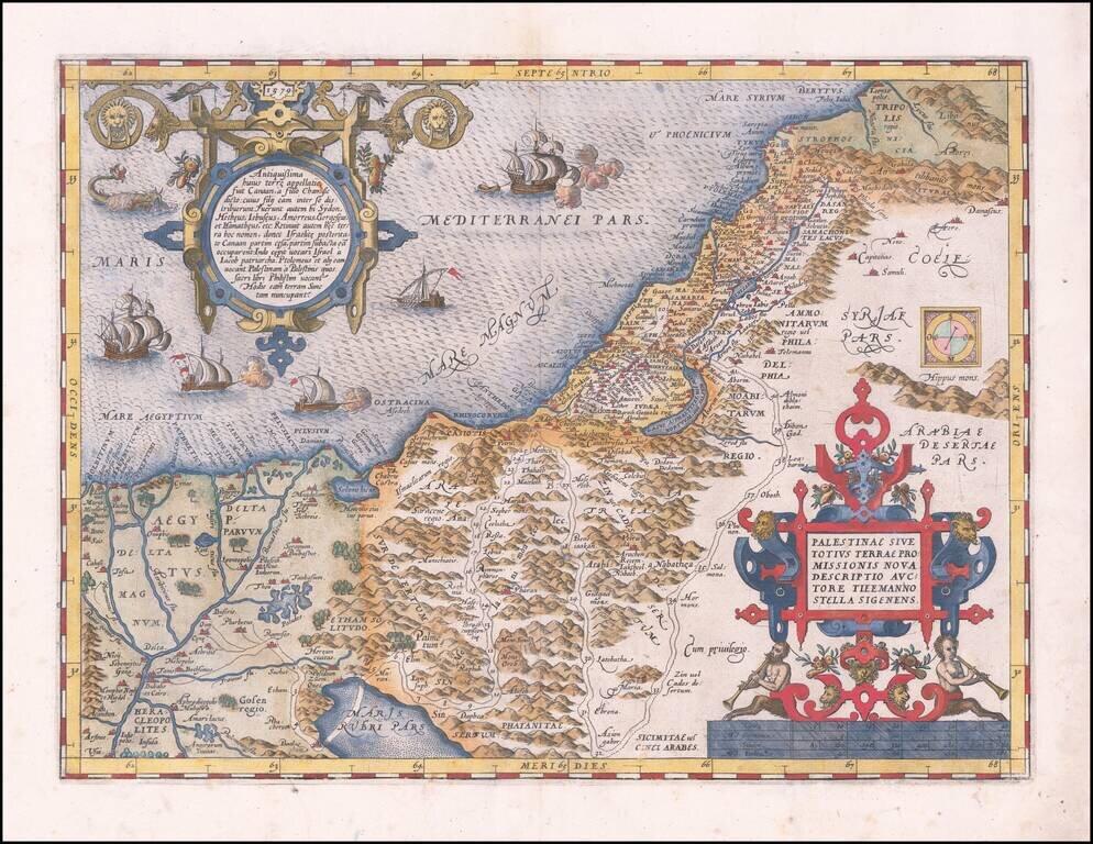
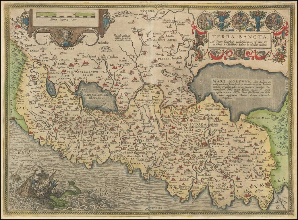
A nice example of Ortelius' map of the Holy Land, from his Theatrum Orbis Terrarum, the first modern atlas. The map shows all of the Holy Lands with Egypt. In the upper left is a text box describing the region. In the bottom right is a fine title...
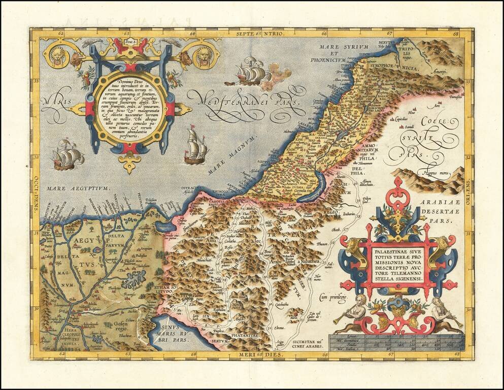
Abraham Ortelius's Modern Map of the Holy Land The most modern of Ortelius' maps of the Holy Land, which first appeared in Ortelius' Theatrum Orbis Terrarum in 1584. The map is based on a 9 sheet map of Palestine by Christian Sgrothen (Christian...
A nice example of Ortelius' map of the Holy Land, from the 1592 Latin edition of his Theatrum Orbis Terrarum, the first modern atlas. The map shows all of the Holy Lands with Egypt. In the upper left is a text box describing the region. In the bottom...
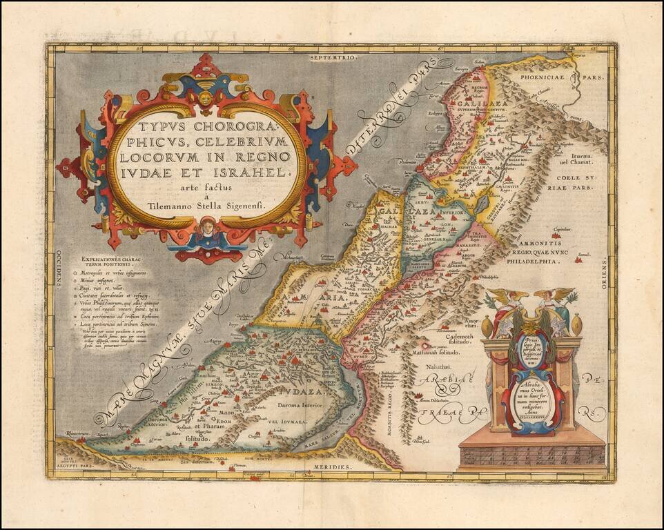
Detailed Ortelius Map of the Holy Land, Based on Tilemann Stella’s Extremely Rare Holy Land Maps Nice example of Ortelius' map of the kingdoms of Judah and Israel from the Parergon, an atlas depicting both secular and religious histories of the...
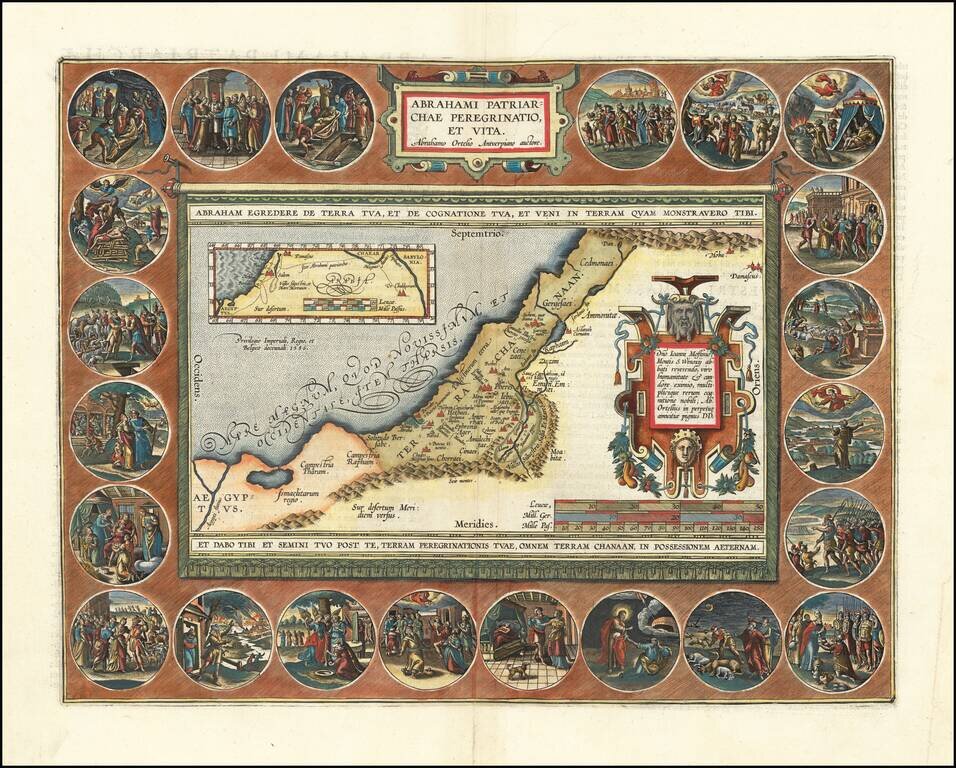
Finely colored example of this decorative map of the Holy Land, illustrating the life of Abraham. The Wanderings of Abraham is among Oretelius' most elaborate productions. It demonstrates his combined talents as mapmaker, artist and historian. This is...
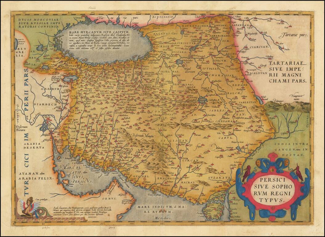
Fine Ortelius Map of Persia from the World’s First Modern Atlas Highly-influential and beautifully-detailed map of Persia from Abraham Ortelius' Theatrum Orbis Terrarum, the first modern atlas of the world. The map shows the Persian Gulf and the...
![Natoliae Quae Olim Asia Minor Nova Descriptio [with] Aegypti Recentior Descriptio [with] Carthageinis Celeberrimi Sinus Typus [shows Cyprus]](/map/small/35175bp.jpg)
Three detailed regional maps by Ortelius, from his Theatrum Orbis Terrarum, the first modern atlas of the world. The first map covers Asia Minor, Cyprus, and the Eastern Mediterranean. The second map shows the region around the Nile, as far as Aswan....
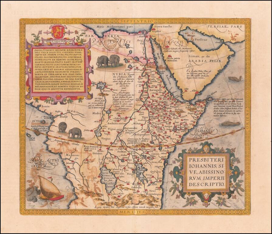
Ortelius’ Map of Central Africa, Chronicling the Christian Kingdom of Prester John Nice old color example of Ortelius' famous map of the Kingdom of Prester John, from his Theatrum Orbis Terrarum, the first modern atlas of the world. The map shows...
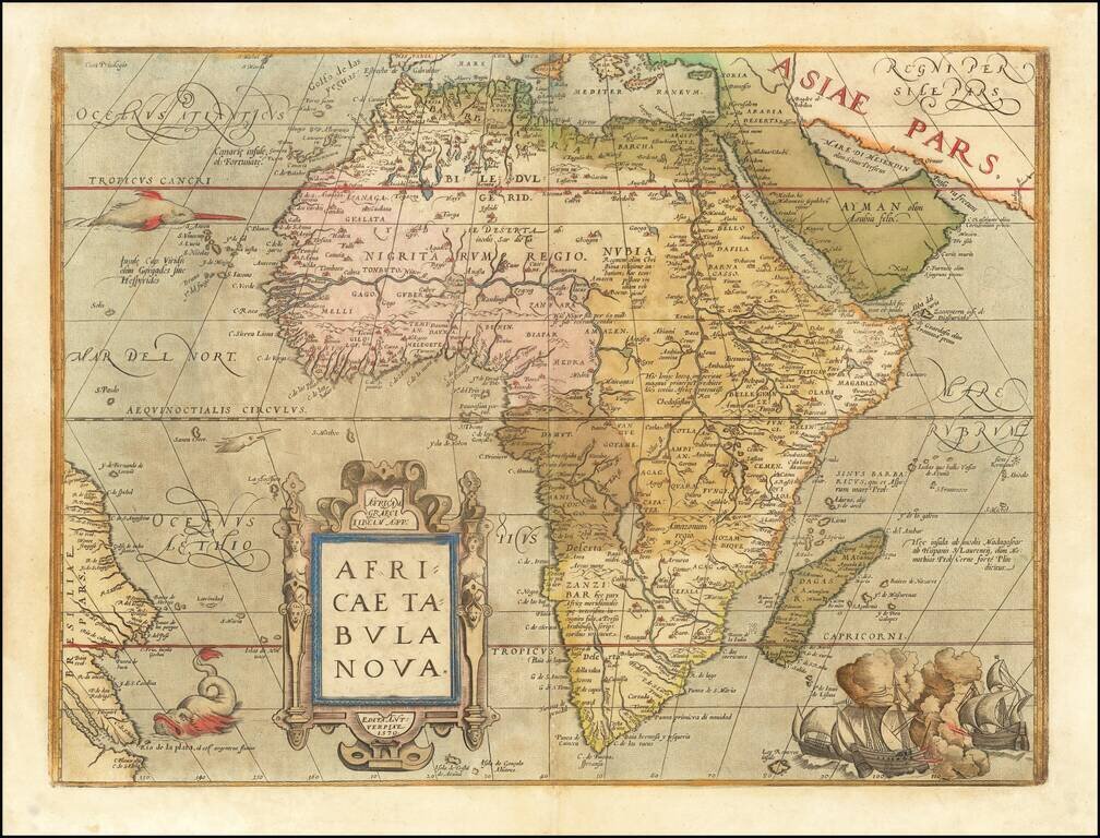
Ortelius’ Africa—One of the Most Influential Maps of the Continent of Africa Finely colored example of Ortelius' map of Africa, from Theatrum Orbis Terrarum, the first modern atlas. The map was one of the first widely-disseminated, modernized...
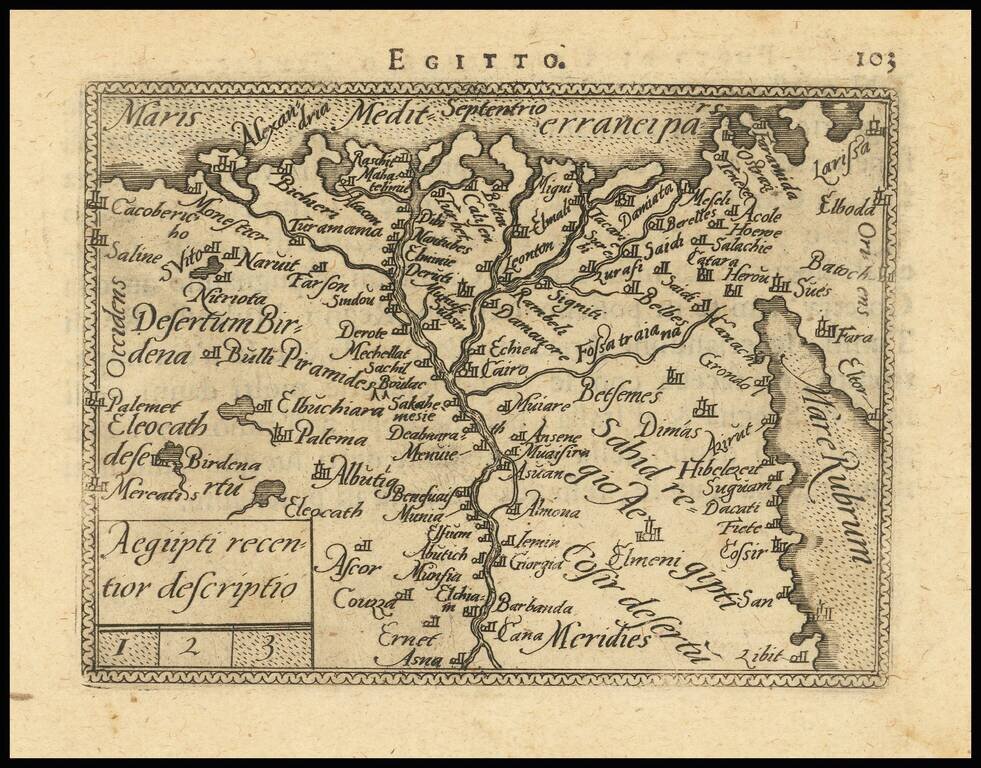
Detailed map of Egypt and a portion of the Red Sea, from and early edition of Ortelius' Epitome. The first miniature version of Ortelius' Theatrum was published by Philippe Galle in 1577 as Spieghel der Werelt. Galle began a new edition with new...
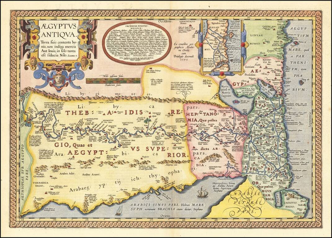
Fascinating Map of Ancient Egypt from Ortelius’ Parergon, The World’s First Historical Atlas Gorgeous example of Ortelius' second map of Egypt, which was issued only in late editions of his Parergon. Ortelius’ interest in ancient civilizations...
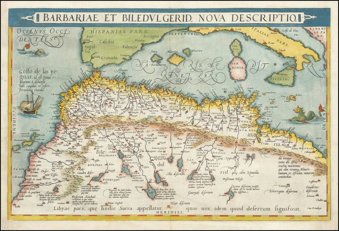
Nice full color example of Ortelius' map of coastal North Africa and the Mediterranean, from Ortelius' Theatrum Orbis Terrarum, the first modern atlas of the world. The map extends from Morocco and the Sahara to Libya and shows most of the...