![[Nevada] Travel-Time in Nevada](/map/small/70216.jpg)
Explore the West with Scenic Guides Scarce folding map of Nevada, published to promote Weldon F. Heald's Scenic Guide to Nevada. The map was issued to promote Healds' travel book, highlighting natural points of interest and other details and...
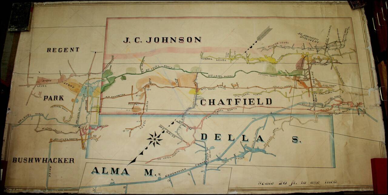
A Remarkable Aspen Mining Map -- Smuggler Mountain Large map illustrating the competing mining claims of several silver mines in Aspen, Colorado, which resulted in litigation between John C. Johnson and the Standard Mining Company of Kansas City,...
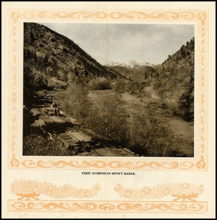
Early photographic view of the Snowy Range in Colorado, from the turn of the Century.
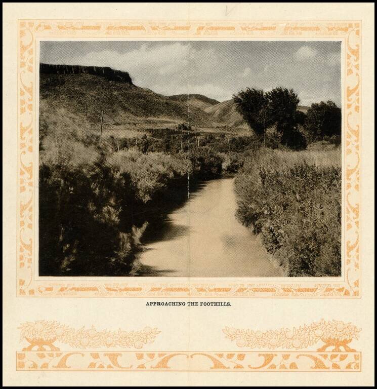
Early photographic view of the foothills on route to Georgetown, Colorado, from the turn of the Century.
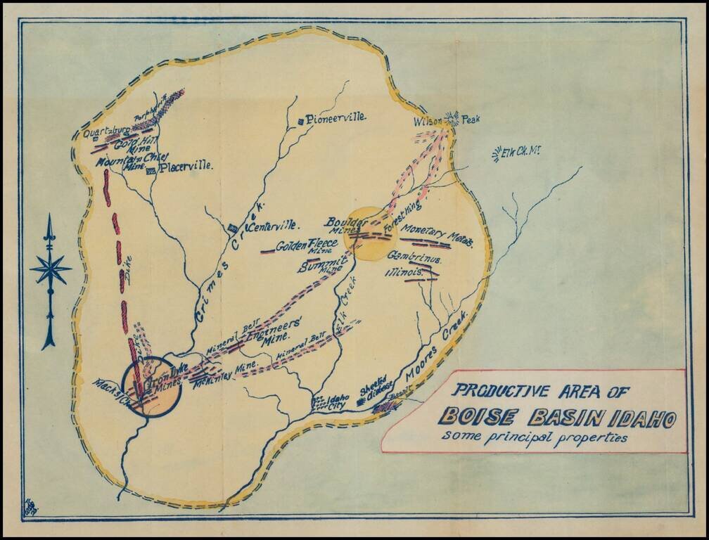
Fascinating mining map, showing the mining regions north of Idaho City, centered on Centerville, Idaho, in the area of the Boise National Forest. The map is centered on Grimes Creek and shows the mining regions between Moore Creek and Placerville....
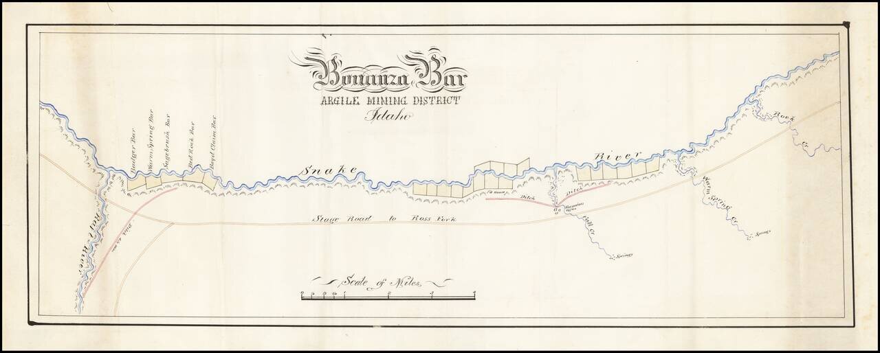
Fine hand drawn map of a section of the Snake River, tracking also the Stage Road to Ross Fork and illustrating Bonanza Bar. Bonanza Bar was centered on the mouth of Fall Creek, with Badger Bar, Warm Springs Bar, Sagebrush Bar, Bed Rock Bar and Boyd...
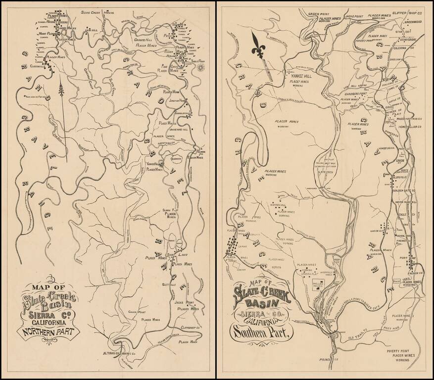
Fine Pair of California Gold Country Maps. Scarce pair of maps showing a portion of Sierra County, in California's Gold Region, with valuable information on individual mines and tunnels.
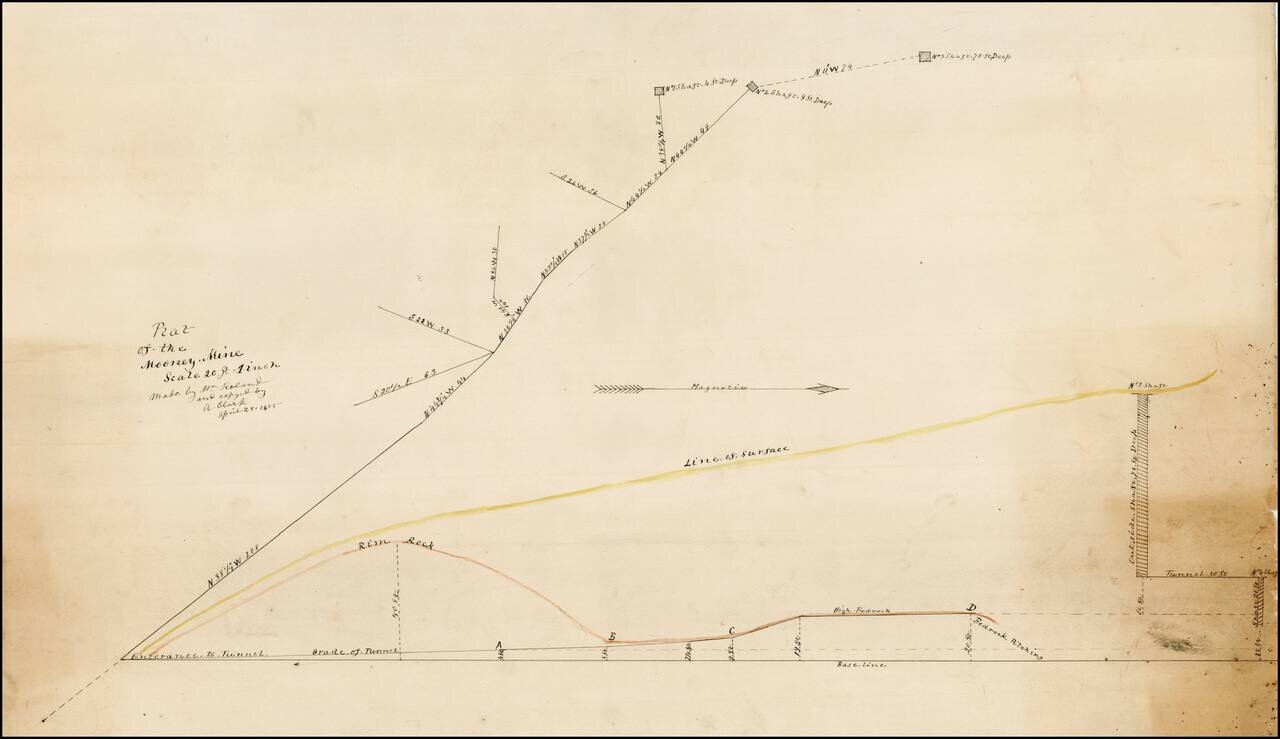
Plat of the Mooney Mine in El Dorado County, California, about 2 miles northeast of the town of Newton. In the Mines of El Dorado County by Doug Noble (2002), it is reported that this mine was only worked from 1894 to 1895. There are several other...
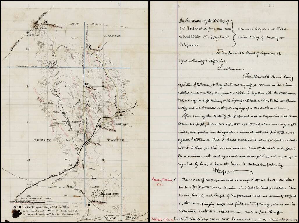
Interesting manuscript map of a part of Yuba County, Northeast of Yuba City and Northwest of Grass Valley, extending from the Yuba River in the south, beyond Sicard Flat and extending north toward Oroville along the Smith Valley. The map and...
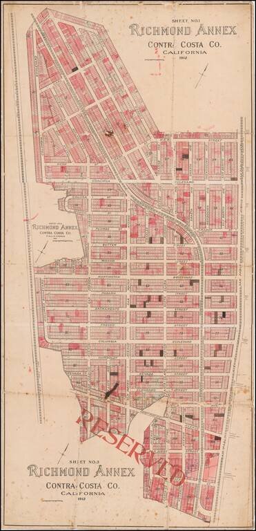
Early Richmond Annex / El Cerrito Real Estate Promotional Map Large separately published map of Richmond Annex, issued in 1912. The map would seem to have been used by a local real estate promoter, with pencil annotations and color shading, neither...
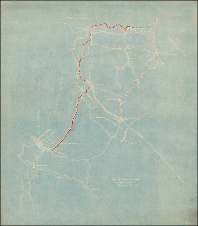
Detailed map of the area between Watsonville and Parjaro in the north and the Carmel River and Laureles in the south. The focus of the map is the New Castroville Road from Monterey to Castroville, Watsonville and Chittendens, with the road tentatively...
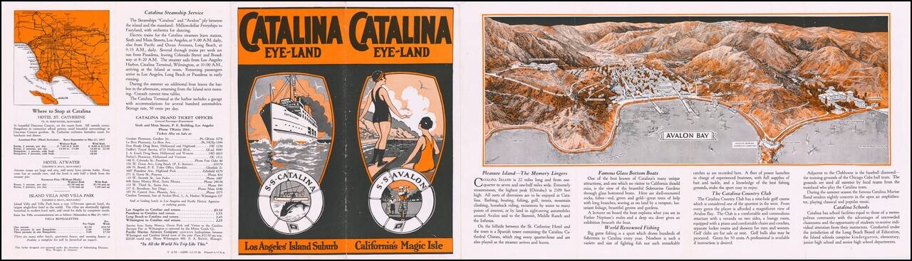
Decorative promotional pamphlet promoting Catalina Island, with a marvelous birdseye view of Avalon Bay, including 2 piers. Interesting early promotional pamphlet with many photographs and early descriptions of the best of Catalina's tourist industry...
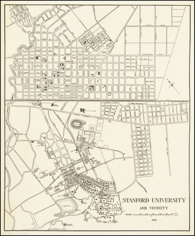
Detailed map of the Stanford University Campus, as it appeared in 1928. The map was likely created for a guide book, although we do not know the source. The map shows a portion of campus in academic use and street map of Palo Alto. The map is very...
![[Sonoma] Hyde Ranch](/map/small/66631.jpg)
Detailed map of the Hyde Ranch Development, in the southeast part of Sonoma. The area shown is immediately east of Sonoma Skypark and south of Vineburg. The map was likely utilized by a real estate agent to track lot sales. Hyde Ranch was established...
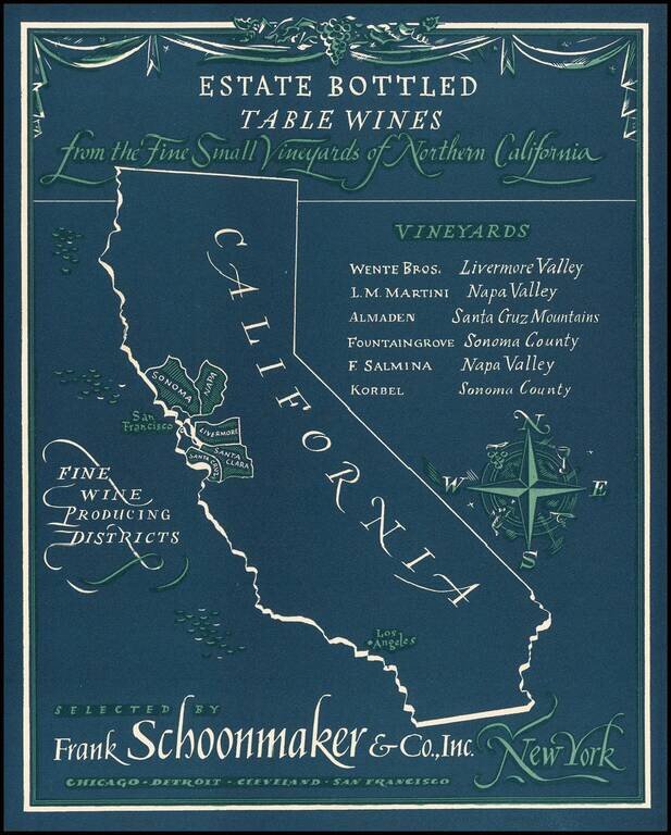
Rare advertising map promoting California wines. Frank Schoonmaker established himself in 1934 with his Complete Wine Book, and later, the classic Frank Schoonmaker's Encyclopedia of Wine. As a wine merchant he started "Frank Schoonmaker Selections"...
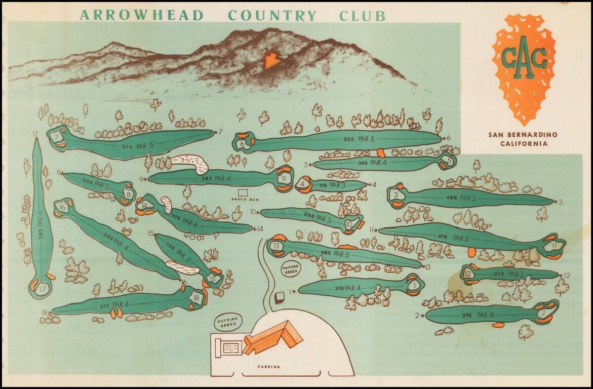
Decorative pictorial style map, showing the golf course and the San Bernardino mountains in the background, including the famous Arrowhead on the mountain. Having grown up in Rialto, I can say with confidence that the Arrowhead, while very clear on...