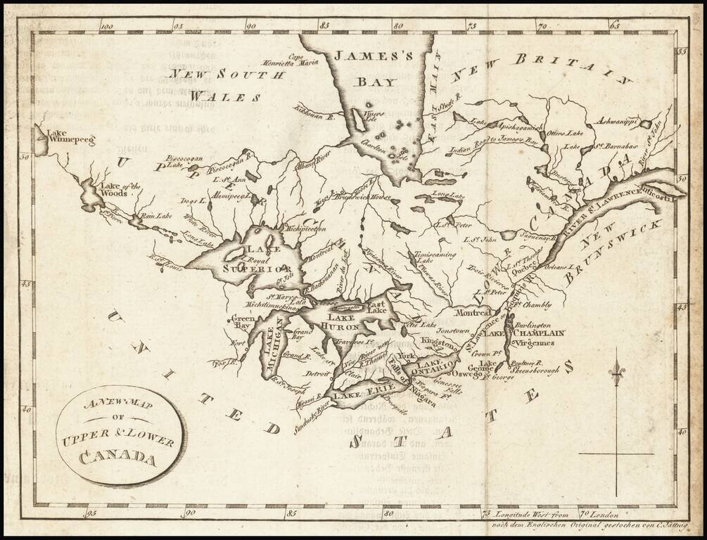
Interesting map of the Great Lakes and Canada, from a German edition of Isaac Weld's Travels Through the States of North America During the Years 1795-97, first published in London in 1798. The map extends from the St. Lawrence to Lake Winnipeg,...
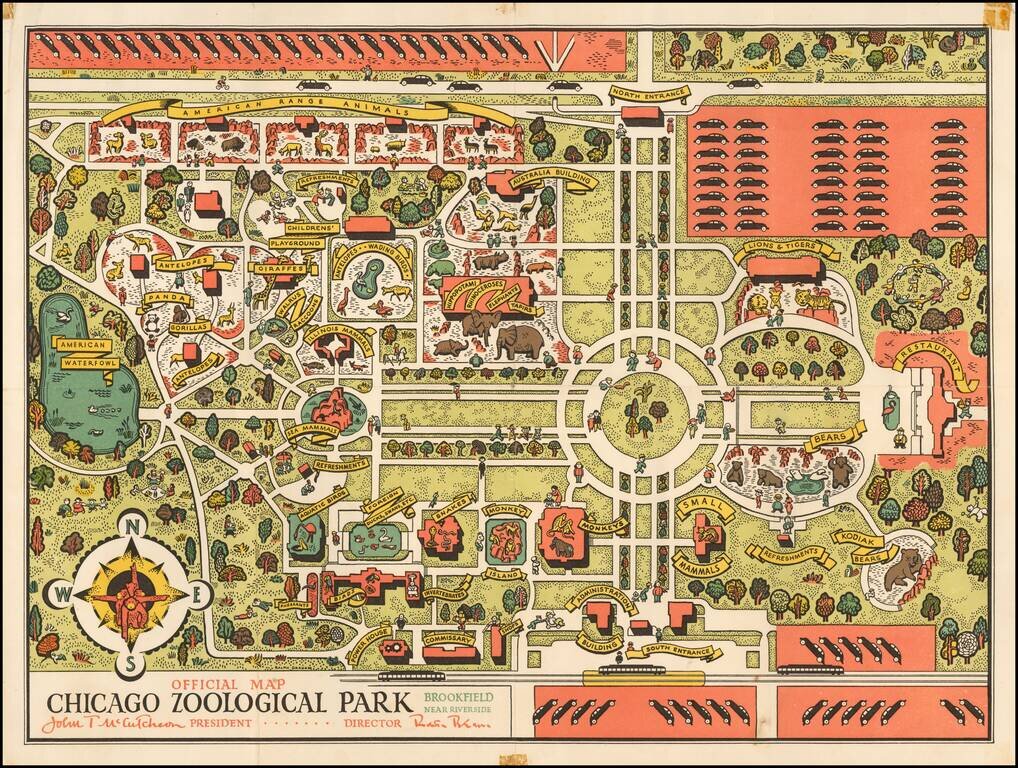
The Brookfield Zoo Map Shortly After Its Opening. A decorative early map of the Brookfield Zoo. The zoo extends to much the same size that it does today, though it is much less densely built up. The map is designed in an attractive pictorial style,...
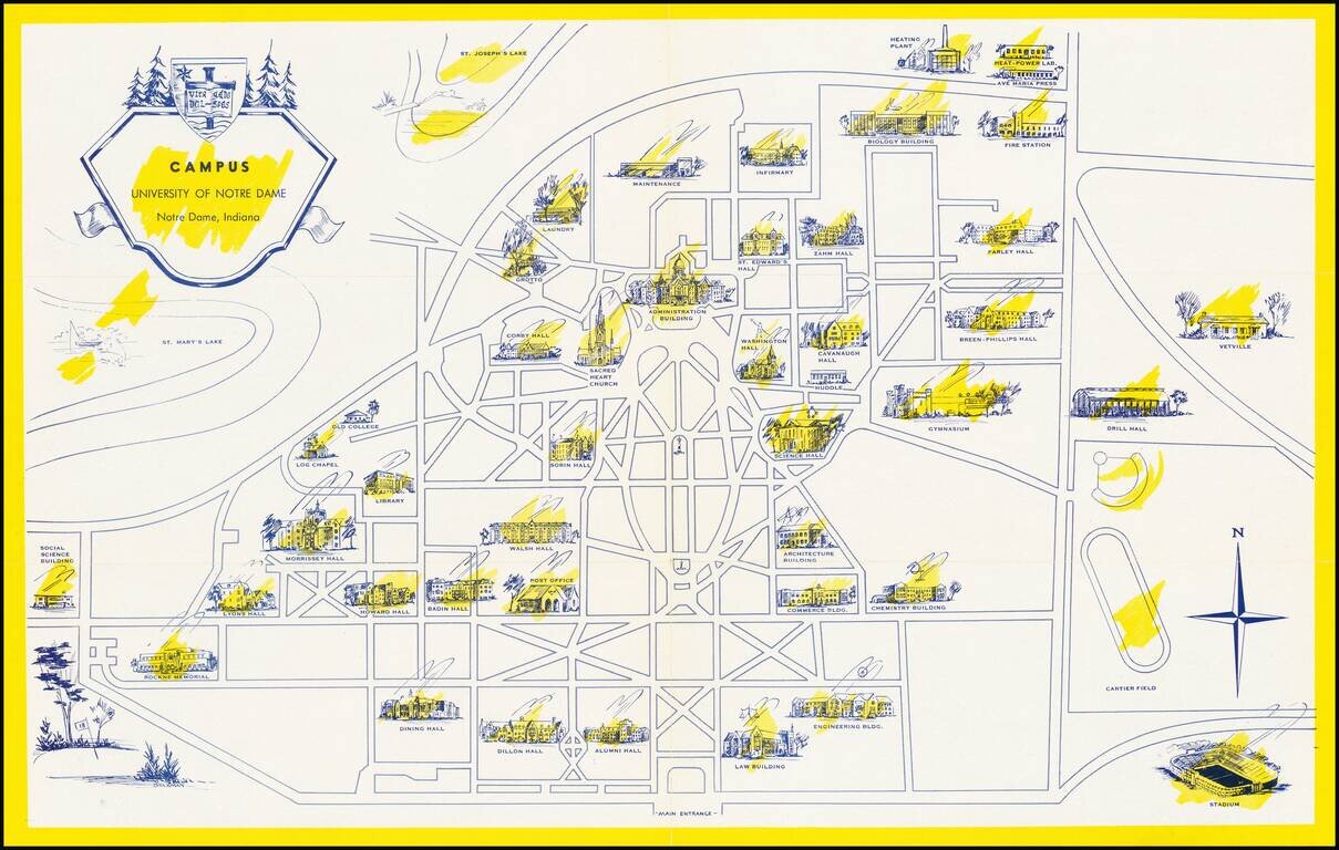
Scarce pictorial map the University of Notre Dame campus in South Bend, Indiana. The recto shows the campus with important buildings, including Notre Dame Stadium (opened in 1930), scattered around the grid of pathways and roads. On the verso, the...
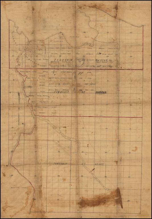
Finely drafted map of part of Cheboygan County in northern Michigan, likely drafted by a local surveyor. Place names include: Village of Cheboygan Township of Benton Township of Duncan Township of Grant Township of Inverness Information on...
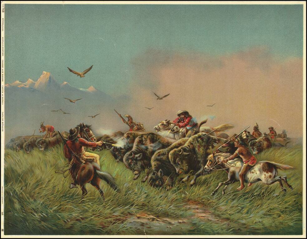
This is a great color-lithograph of a buffalo-hunting scene. The image is heavily romanticized, painting a rosy picture of the American West. Hardened cowboys on bucking horses use guns while Indians spear or stab the buffalo. Raptors fly above the...
![[North Dakota - Fargo]](/map/small/46531fb.jpg)
Rare letter sheet with map on verso, printed for The Oriska Elevator. The map is centered on Fargo, North Dakota and extends north to Grand Forks and South to Big Stone Lake, focusing on the railroad lines, towns and other features. The map...
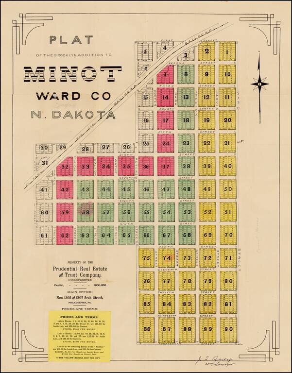
Fine early plat for a portion of downtown Minot, North Dakota, printed shortly after the creation of North Dakota in 1889, one of the earliest surviving maps of the town of Minot, North Dakota. The Brooklyn Addition is a part of Minot's central...
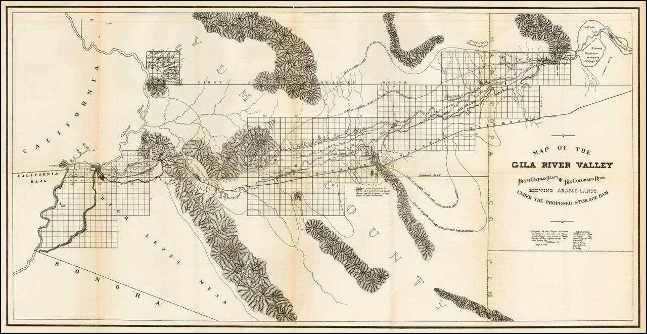
Scarce regional map of the region extending from Yuma and the Colorado River to Oatman Flat, which at the time was the site of a proposed reservoir. The map was prepared by the Citizens Executive Committee on a proposed reservoir and irrigation of Yuma...
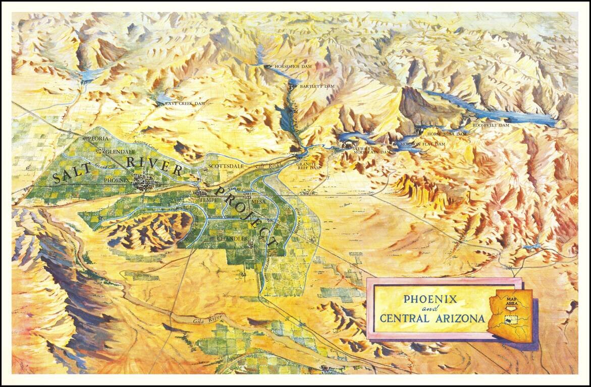
Scarce birdseye view style map of the area around Phoenix, highlighting the Salt River Project and the lands irrigated by the various canals in the area. The map shows a number of important early dams, including: Granite Reef Dam (built 1906-1908)...
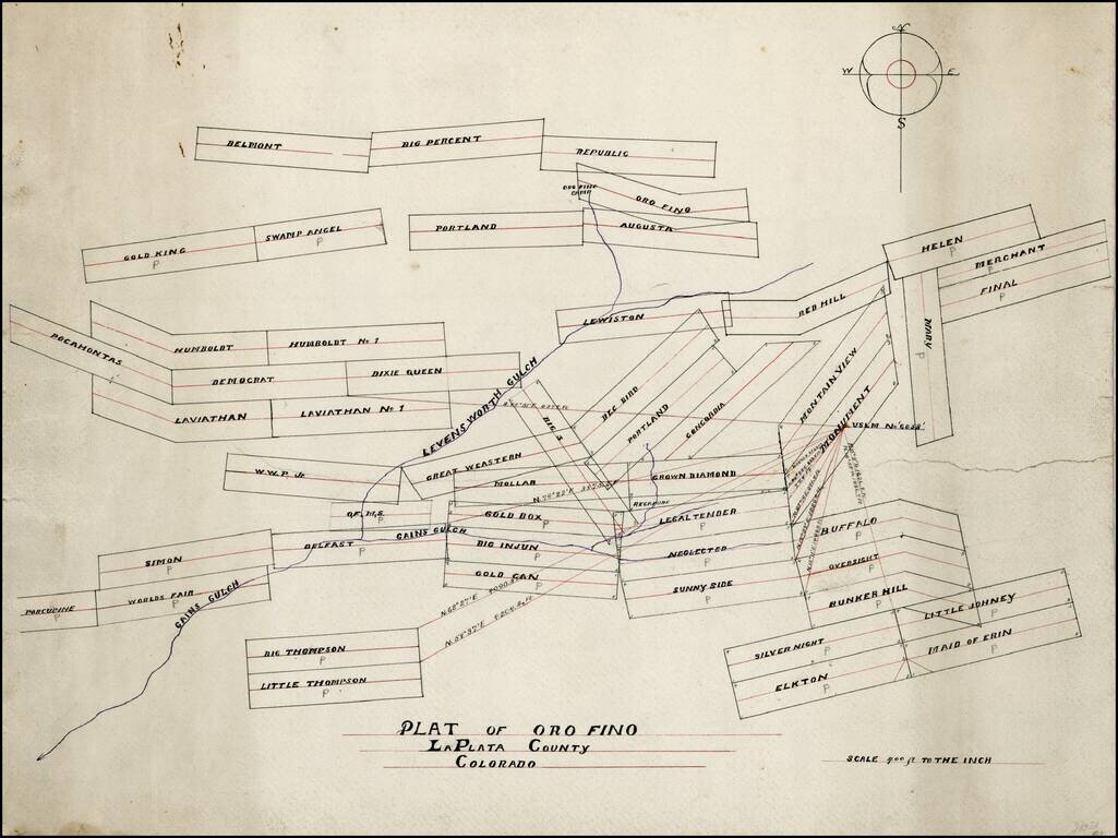
Hand drawn map of mining claims in the Oro Fino Mining District, in La Plata County, Colorado. The map is focused on the area around Gains Gulch and Leavenworth Gulch, extending north to Oro Fino Camp. Based upon the names of the claims, we date the...
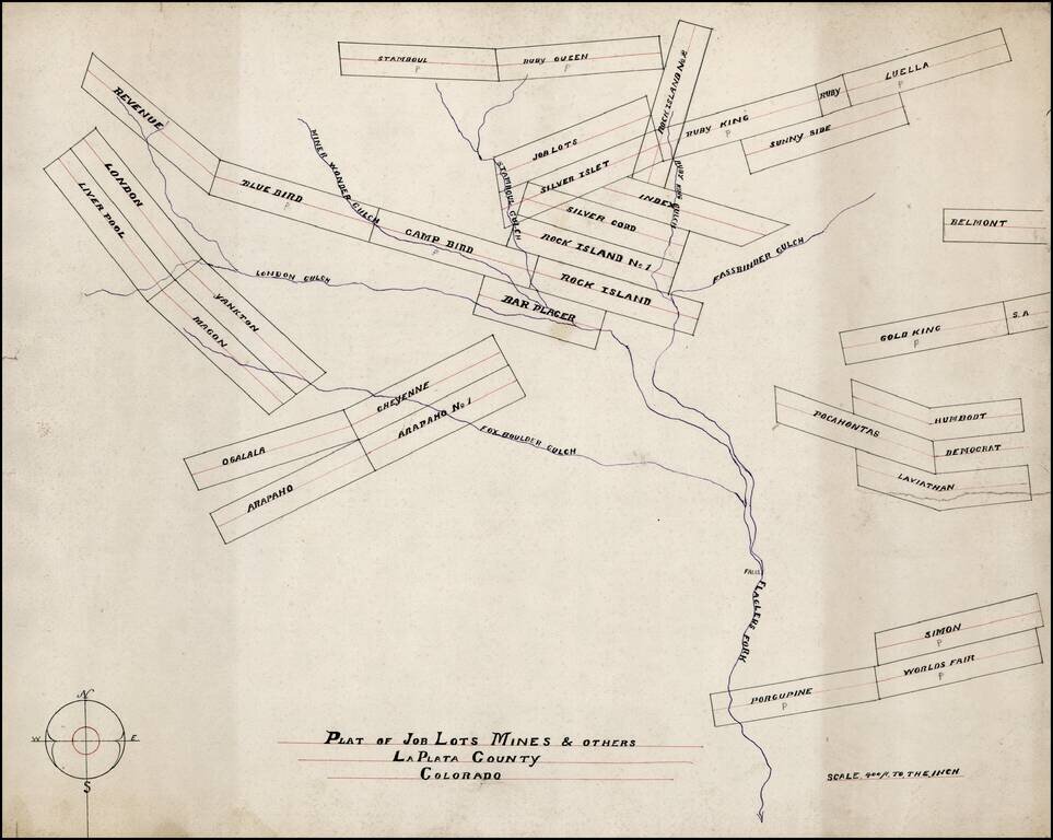
Hand drawn map of mining claims on or near Flagler's Fork and tributaries, in La Plata County, Colorado. The map is focused on the area Flagler's Fort and tributaries, including Fox Boulder Gulch, London Gulch, Miner Wonder Gulch, Stamboul Gulch and...
Hand drawn map of mining claims on or near Flagler's Fork and tributaries, in La Plata County, Colorado. The map is focused on the area Flagler's Fort and tributaries, including Fox Boulder Gulch, London Gulch, Miner Wonder Gulch, Stamboul Gulch and...
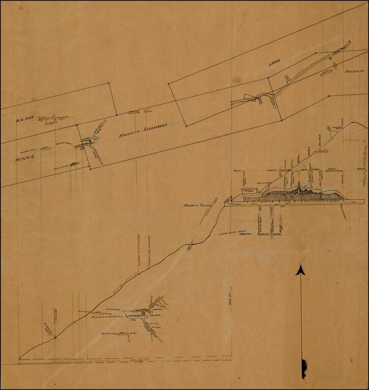
Elaborate set of drawings relating to a proposed tunnel on "Favorite Vein," one of a group of maps and plats from a mining collection relating to La Plata County, Colorado. Snow Slide Gulch, near Root Creek, appears on modern topographical maps in La...
![[Tracing Route Map of Colorado] Colorado -- Explore the West with Scenic Guides](/map/small/69878.jpg)
Scarce folding map of Colorado, published to promote Weldon F. Heald's Scenic Guide to Colorado. The map was issued to promote Healds' travel book, highlighting natural points of interest and other details and emphasizing the major routes through...
![[Salt Lake City] La Nouvelle Jerusalem, ou La Grande Ville du Lac Sale (Amerique) . . .](/map/small/63205.jpg)
Large panoramic view of Salt Lake City, which appeared in a French Newspaper in 1863.
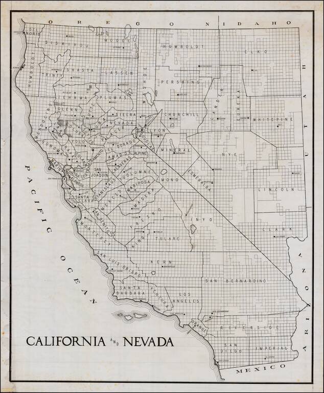
Early manuscript draft of a large format map of California and Nevada. The county configurations would appear to be circa 1908-1909, based upon shape of Glenn County. The guidelines in the title and other places are visible.