![[Para] Estados Unidos do Brasil -- Mappa do Estado Do Para Mandado organisar pelo Exmo. Snr. Dor. Augusto Montenegro Governador do Estado 1908](/map/small/62471.jpg)
Rare Map of the Brazilian State of Pará, Including the Mouth of the Amazon River Rare, separately-published map of what are today the Brazilian states of Pará and Amapá in northern Brazil. The map, which is the only example we could locate, offers...
![[Manuscript map of the Mantaro River Valley, Peru]](/map/small/30411.jpg)
Interesting manuscript map of part of the central highlands of Peru, from Jauja in the north to Huancayo and Chupaca in the south. The map covers a little more than 50 miles north-to-south and east-to-west. Many smaller villages and hamlets are...
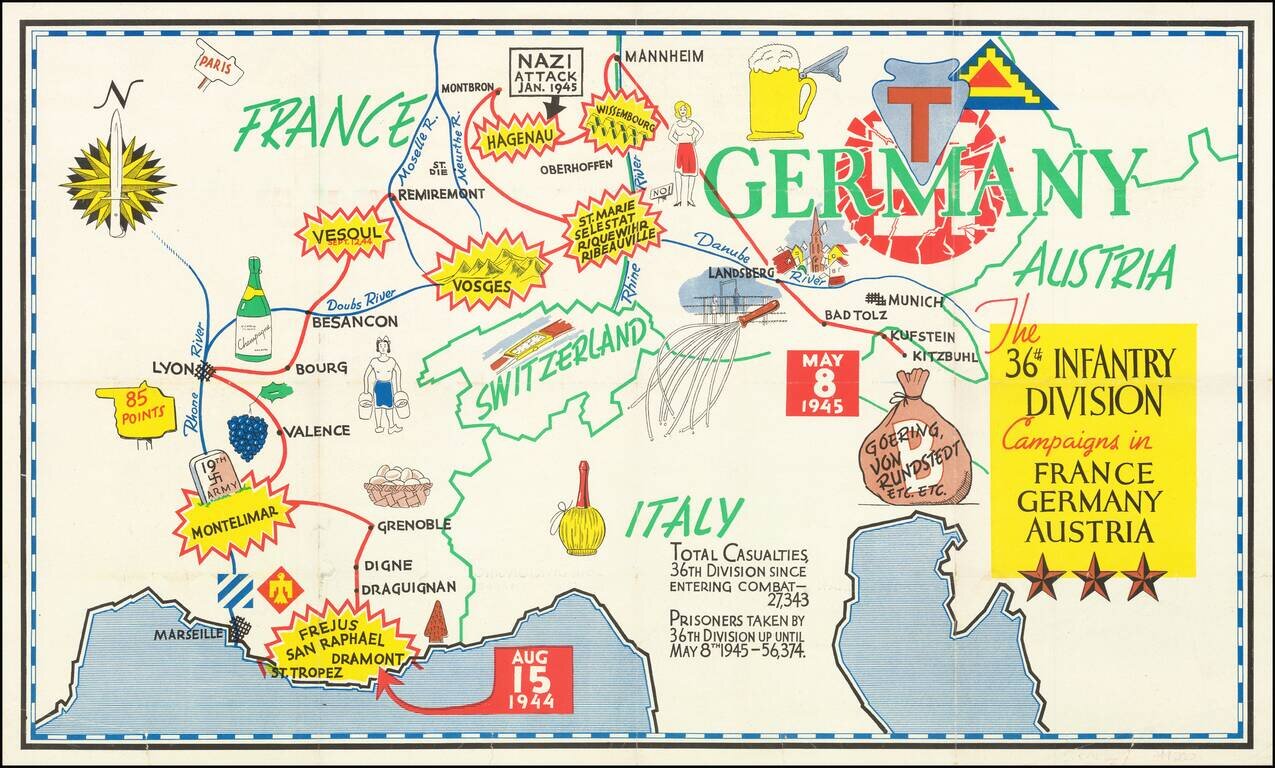
Triumphal Pictorial Map of the 36th Infantry Division's Campaign in Europe. The map shows the T-patchers landing in Saint-Raphaël-Fréjus in southern France on Aug. 15, 1944, during Operation Dragoon. The Division proceeds to Montelimar where it...
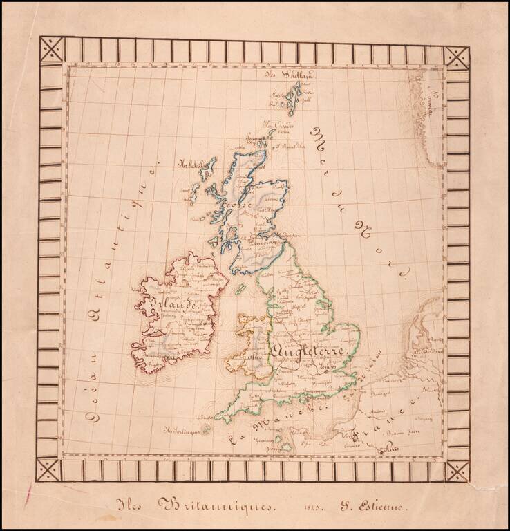
Finely executed hand drawn map of the British Isles by S(?) Estienne. The map was likely drawn by a school-aged child and is well executed for the period. The decorative border is unsual for a school project map.
![(Karamanli Turkish-Language Map) Ṫζεζαϊρι Πριταnια [Great Britain / British Isles?]](/map/small/66716.jpg)
Fascinating and highly unusual map of the British Isles, written in Karamanli Turkish, and published in Istanbul in the 1860s or 1870s. Karamanli Turkish (called Kαραμανλήδικα in Greece) is a dialect of written and spoken Turkish that uses...
![[Manuscript Map of Gibraltar]](/map/small/66061.jpg)
Original Early-18th Century Manuscript Map of Gibraltar. Pen, ink, and wash hand-drawn map of Gibraltar, probably done by a French or Spanish mapmaker around the time of the 1727 Spanish siege. The map is unusual in its configuration and does not...
![[Monastery Ter Apel] Petite carte des environs de Klooster ter apel et de Rooswinkel . . . 1796](/map/small/60565.jpg)
Finely executed manuscript map of the area around the Monastery Ter Apel in the Groningen area. Ter Apel Monastery Ter Apel Monastery was a monastery in the village of Ter Apel in the northeastern Dutch province of Groningen. It is the only monastery...
![[Monastery Ter Apel] Plan des digues de retenues nommees Leijdijken, derriere le Village de Klooster ter Apel, avec le project d' une Redoute sur l'alignement de la digue de traverse nommee, Korten ??? ??? dam, pour la defence de cet acces: paasage unique](/map/small/60585.jpg)
Finely executed manuscript map of the area around the Monastery Ter Apel in the Groningen area. The full title and translation are: [Monastery Ter Apel] Plan des digues de retenues nommees Leijdijken, derriere le Village de Klooster ter Apel, avec...
![[Napoleon's Battles in France, Belgium Netherlands, Luxembourg, Germany] No. 1 Frontiere du Nord. Mesny 5.](/map/small/60727.jpg)
Finely executed manuscript map of the Theater of War in Northwestern Europe, illustrating various battles, some with dates. The maps are printed on hand made paper with a large elaborate watermark D & C Blauw, the paper of the iconic Blaeu firm,...
Manuscript Plan of Antwerp and Environs. Detailed hand drawn plan of Antwerp, focusing on its fortifications in the Vauban style. The plan is unfinished, with no place names given or information in the title cartouche. The town name is written in...
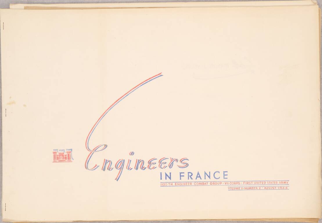
A Series of Albums Commemorating American Engineer's Roles in the Liberation of Europe, Made for a Decorated Colonel This is a truly outstanding work consisting of three booklets, each showcasing the role of the 1120th Engineer Combat Group, attached...
![[Untitled Map of Part of Switzerland in the area of Canton Berne and Terre de Saint Claude]](/map/small/29668.jpg)
One sheet of a larger map of part of Switzerland, probably covering the region south of the Canton of Berne. The map is centered on Terre De Saint Claude and shows the Bailliages' of Pontarlier, Salins, Quingey, Poligny, Arbois, Gex, Bugy, Saunier and...
![[Plan of the Siege of Guînes, France] Ritratto Della Fortezza di Ghines, presa perforza dallo essecito del Re Christianissimo . . .](/map/small/41817sb.jpg)
State 3 of rare plan of the Siege of Guînes, France, by Pietro de Nobili. Rare third state of this finely engraved battle plan depicts the Siege of Guînes (near Calais, France), in January 1558, following which a French army seized the fortress...
![[Calais] Chales](/map/small/61280sb.jpg)
Extremely Rare Plan of The Siege of Calais in 1558 Rare early map / view of Calais, showing its capture by the French in 1558. The map is very similar to the map of Bertelli, but no engraver or publisher is given. Siege of Calais The Siege of...
![[Viscounty of Limoges] (Manuscript map of Southern Limousin]](/map/small/61140.jpg)
An early manuscript map showing the Viscounty of Limoges 16th Century Map of the southern part of Limousin, drawn in an early hand. The map is oriented with south at the top and extends from Limoges on the Vienne River to the towns of Tulle and...
![[Venaissin]](/map/small/60728.jpg)
Manuscript Map of the Comte de Venaissin Fine early manuscript map of the Comte / County of Venaissin, oriented with west at the top, in an early French hand. The region shown is just above Avignon and tracks the Rhone River from Caderousse and...