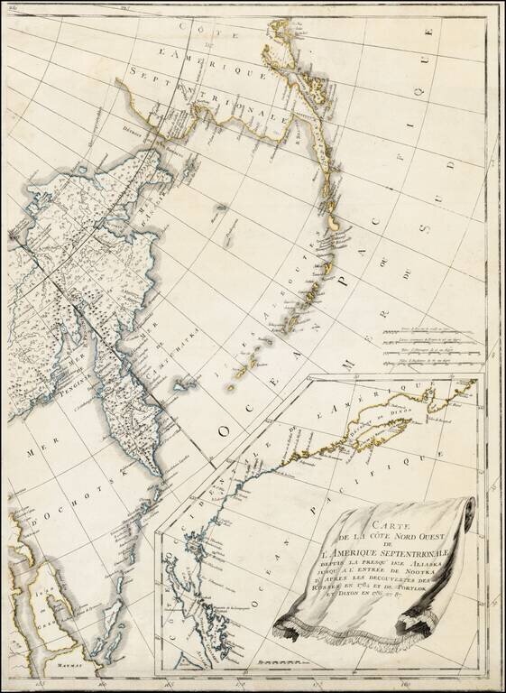
Eastern sheet Wilbrecht's a rare 3-sheet map of the Russian Empire, depicting Alaska, the Northwest Coast of America and the West Coast of Canada, prior to the discovery of Vancouver Island, along with Kamchatka, Northeast Russia and Iezo. The map is...
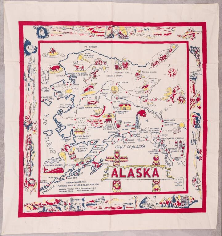
Large vintage pictorial map of Alaska printed on linen. The map is surrounded by a large decorative border featuring native Alaskans, landscapes, and wildlife. The map is not without humor; it describes whales as "portable geysers of Alaska". The...
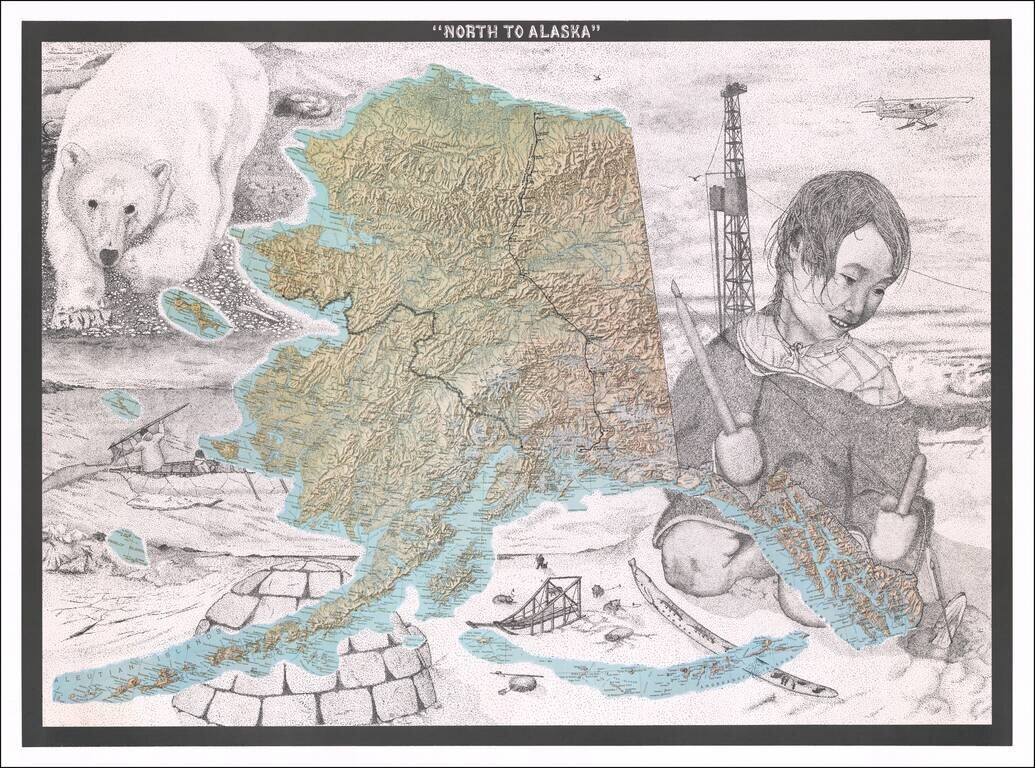
Fine Topographic Poster Map of Alaska with Images of Alaskan Life Detailed map poster depicting the topography of Alaska set amongst stippled drawings showing pictures of Alaska’s snowy landscape and life. This is the first time we have seen the...
![[Hand Drawn Map of the Hawaiian Islands]](/map/small/62429.jpg)
Early Manuscript Chart of Hawai’i/Sandwich Islands with Ships’ Track Finely executed chart of the Hawai’ian Islands, drawn from contemporary sources, including the first Admiralty chart of the archipelago. Although intended as a nautical...
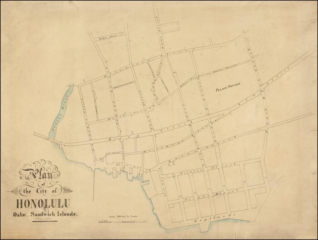
A Remarkable and Previously Unknown Early Manuscript Survey of Honolulu Highly important early manuscript map of Honolulu, Hawaii, likely dating from the late 1850s, and most likely the work of Hawaii's most important early surveyor William C....
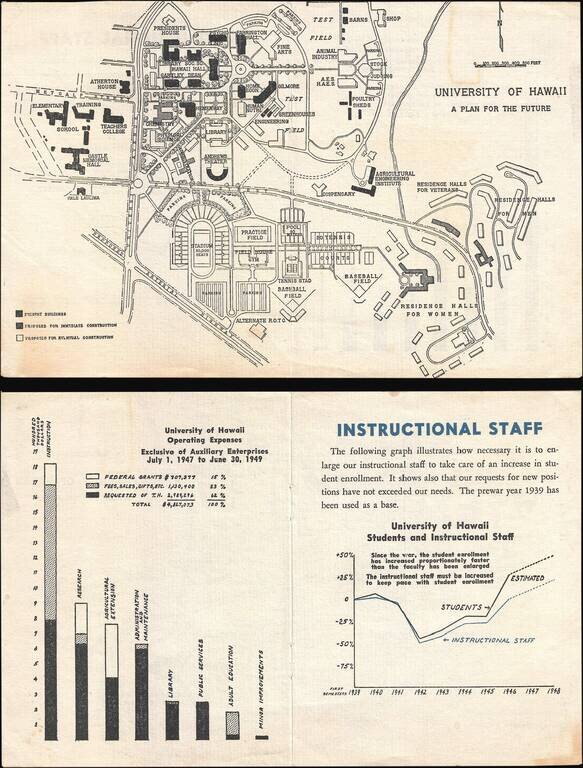
This is a 1946 University of Hawaii map of the Mānoa campus highlighting proposed building projects. Because of the G.I. Bill, which was passed in 1944, American servicemen returning from World War II could pursue higher education at American...
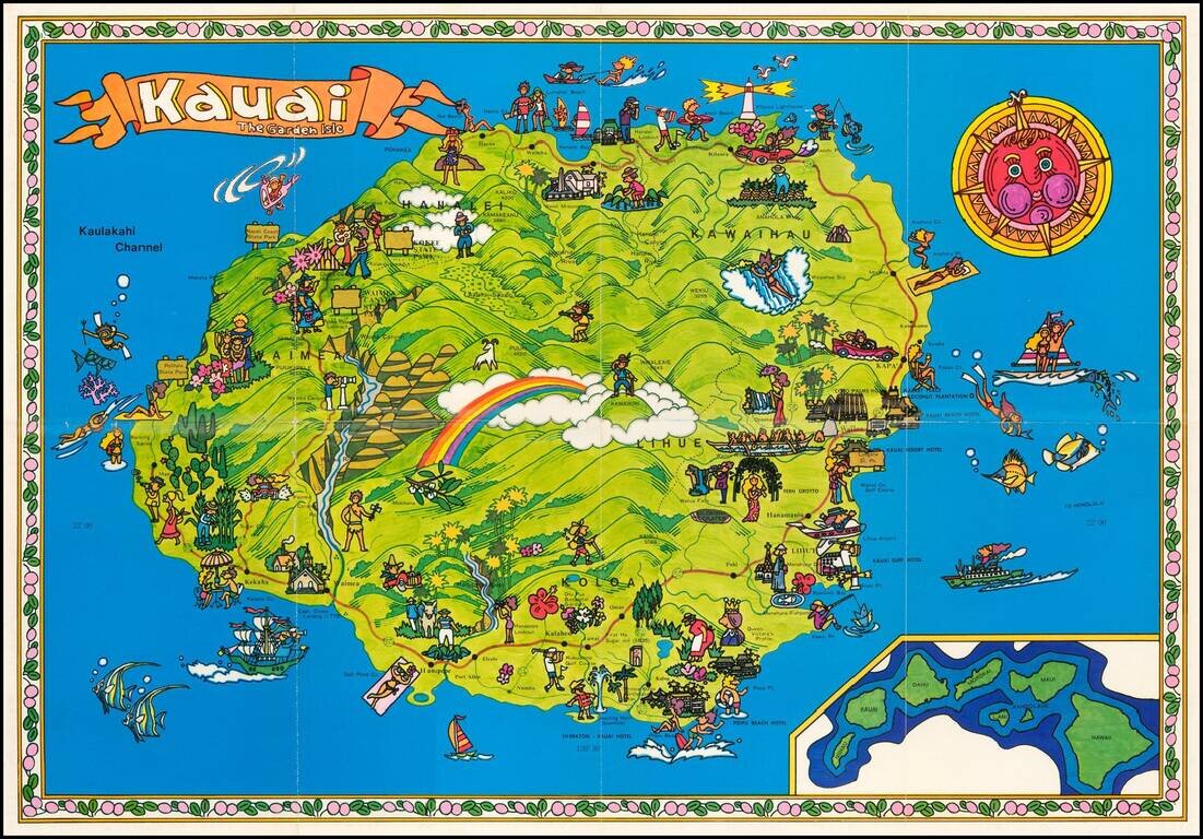
Whimsical promotional map of the Garden Island of Kauai in vivid colors. On the back of the map is a more conventional map of Kauai with insets of key cities. We have not previously seen or offered this map.
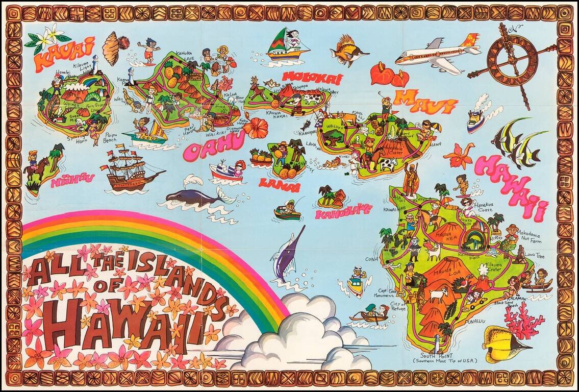
Whimsical promotional map of Hawaii in vivid colors. We have not previously seen or offered this map.
![Wailuku [Maui]](/map/small/61147.jpg)
Interesting pictorial advertising map of Wailuku, Hawaii, which seems to have been published by Uncle Harold's Lunch Wagon. The map is a fun mix of cultural and promotional material, with an image of pre-WWII Wailuku at the top (with Ox Cart),...
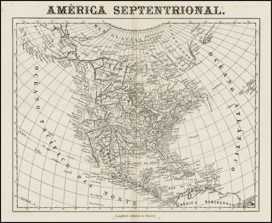
Very unusual Spanish map of North America, apparently issued some time in the middle of the 19th Century. While the paper suggests that it was published in the 2nd half of the 19th Century, the map's cartography is circa 1830, showing Russian America,...
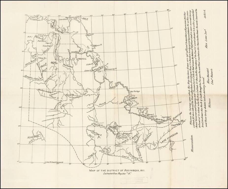
Early copy of one of the original maps delineating the Red River Colony, undertaken by Alex Lean, surveyor, in Selkirk. The name District of Assiniboia was used to describe the Red River Colony, (for official purposes), between 1812 and 1869. An...
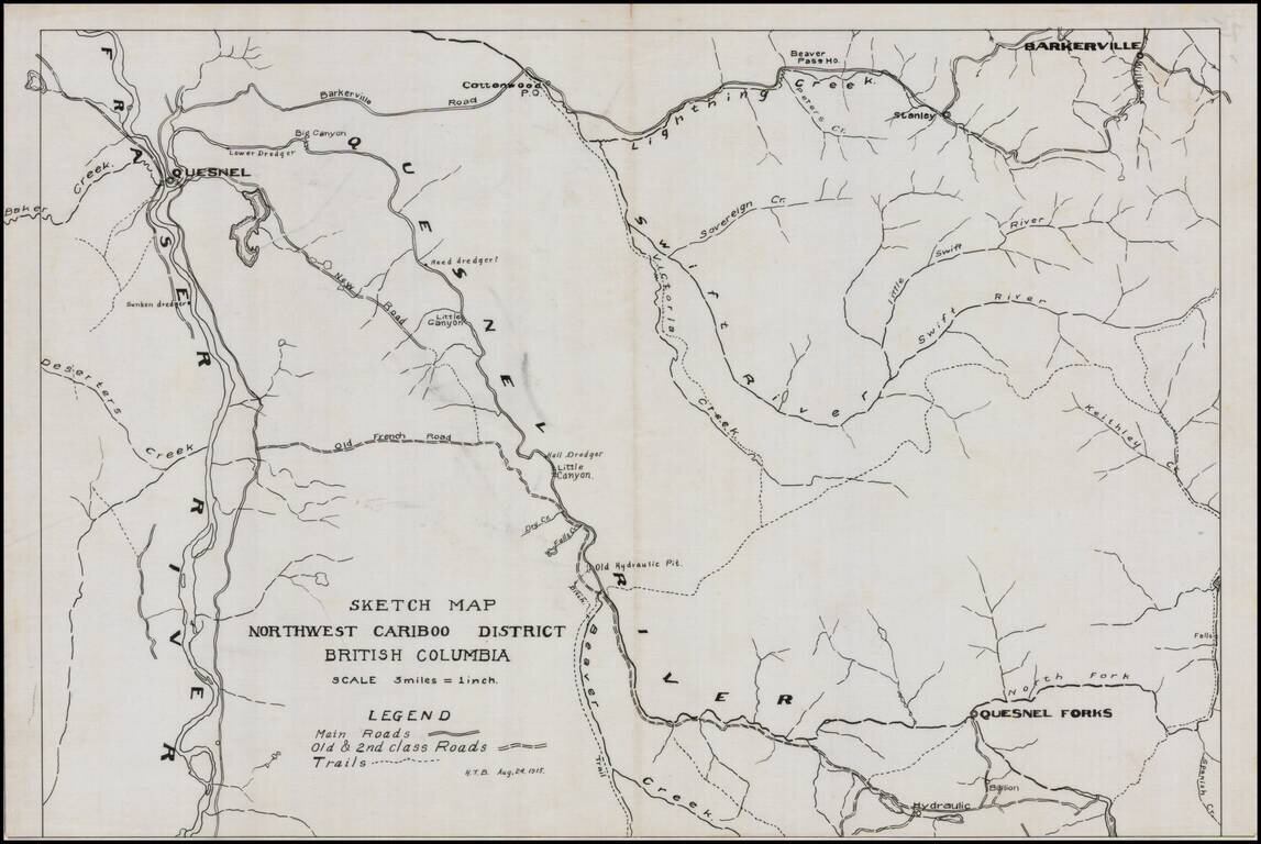
Detailed map of the Northwest Cariboo District, in British Columbia, drawn on a scale of 3 Miles = 1 inch. The legend shows main roads, old and second class roads and trails. The map focuses on the region between the Fraser River to the west and...
![[Sketch of Río Chacalapa and surrounding hills]](/map/small/49303ba.jpg)
Cartographic Sketch of Mountainous Region and the Chacalapa River This is a partial sketch showing a stretch of land surrounded by hills on two sides. The Río Chacalapa runs through the sketch diagonally, seemingly connecting to another stream...
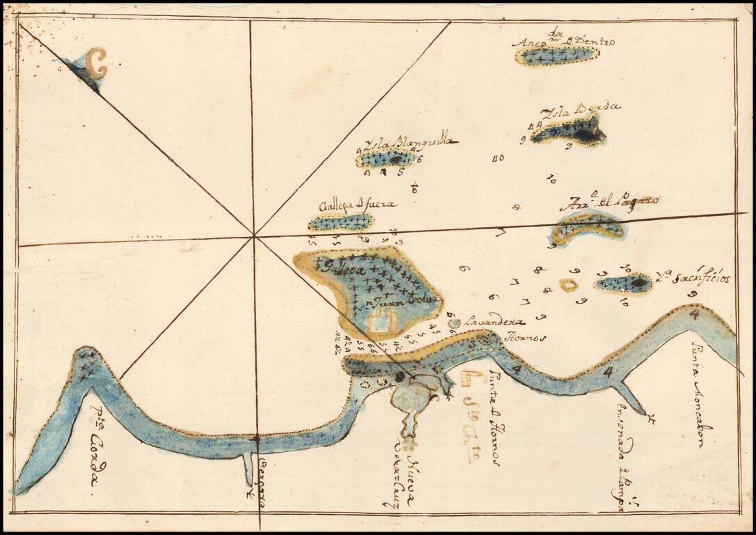
Fine Manuscript Chart of the Waters Around Veracruz, Mexico, including the Fortress of San Juan de Ulúa Nice manuscript chart of the waters surrounding the important port of Veracruz, Mexico. This chart was found laid in loosely in a Spanish edition...
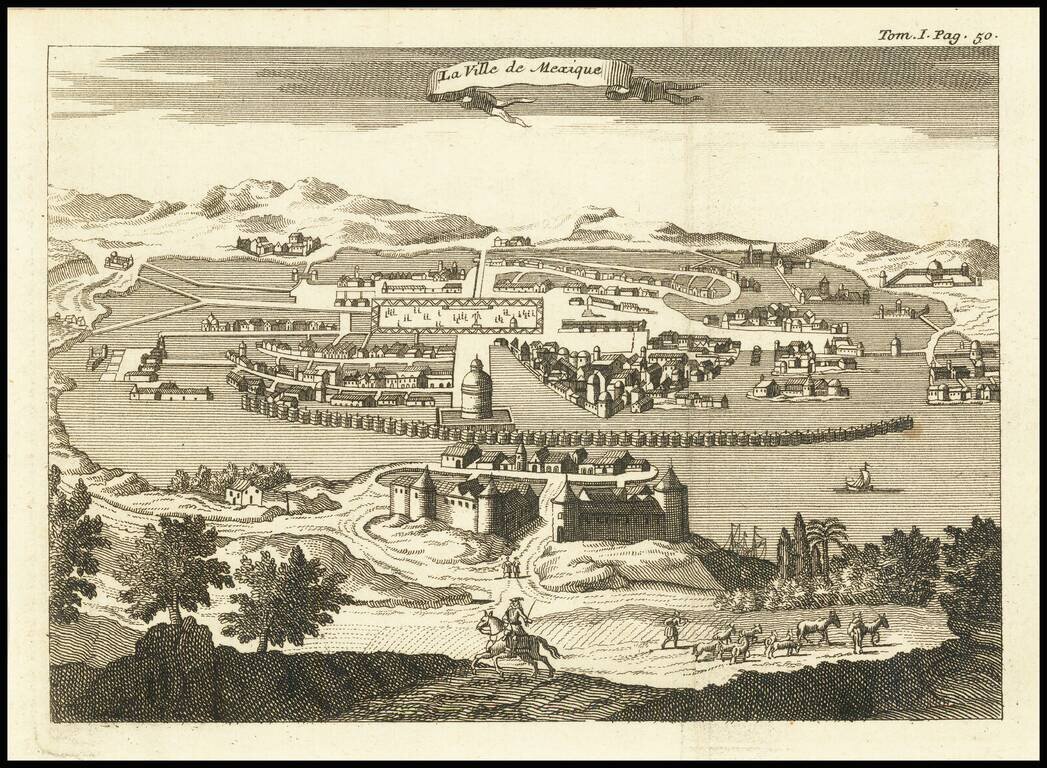
Engraved view of Mexico City, from an unidentified edition of Thomas Gage's voyages in New Spain, probably published circa 1720. This edition of the view has the binding note "Tom. I Pag. 50" in the upper-right corner. The city appears much as it did...
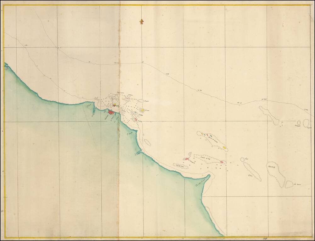
Fine Manuscript Chart of the Waters around Veracruz, Mexico Nice manuscript chart of the waters surrounding the important port of Veracruz, on Mexico's eastern coast. The simple yet aesthetically pleasing chart was meant to aid in navigation to and...