
Antique Map of the Western Hemisphere and Eastern Hemisphere Scarce pair of hemispheric maps, issued in about 1800. Tasmania is separated from Australia and Washington D.C. is named, both of which suggest a date of about 1800.
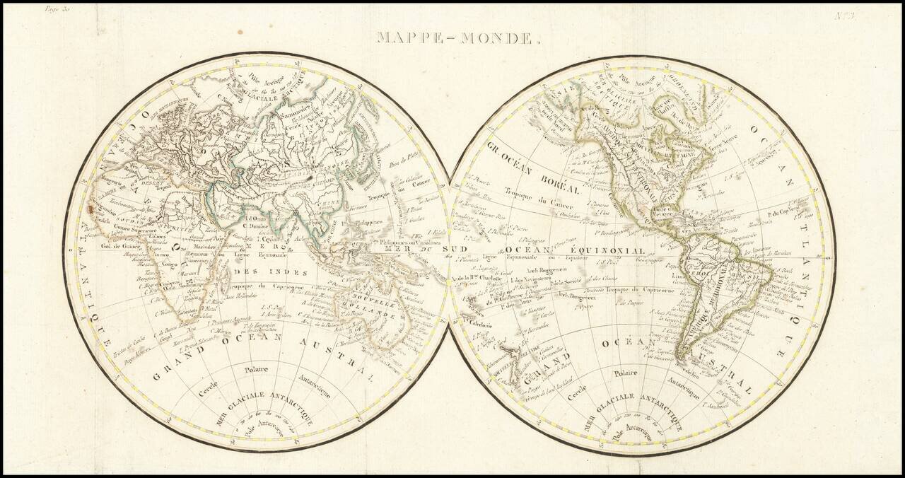
Double hemisphere map of the world, issued early in the 19th Century. We date the map based upon the configuration of the Rocky Mountains, which is in the style of Alexander von Humboldt and the presence of the Bass Strait, between Tasmania and the...
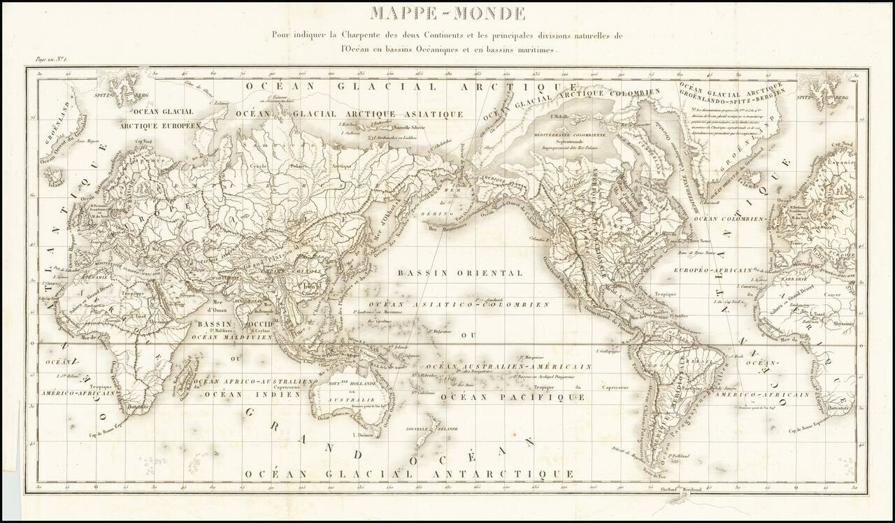
Fine General Hydrographical World Map Striking world map showing the world’s maritime basins. It was part of a geographic system meant to teach an overview of the world’s hydrography. The map was featured in Mémorial topographique et militaire...
![[Early Photographic Facsimile] Kunstmann II (Four-Finger Map)](/map/small/66513.jpg)
Early Facsimile of the Kuntsmann II Portolan from the Collection of Edward Luther Stevenson. Fascinating early facsimile of the Kunstmann II map, one of the earliest maps of any kind to show the new world. The map is sometimes attributed to Amerigo...
![[Early Photographic Facsimile of Kunstmann III]](/map/small/66577.jpg)
Photographic Facsimile of a Now-Lost Map of the New World, From the Collection of Edward Luther Stevenson. An early photographic facsimile of the famed, and now-lost, Kunstmann III map of the New World. Kunstmann III (Cod. 31-2) was one of at least...
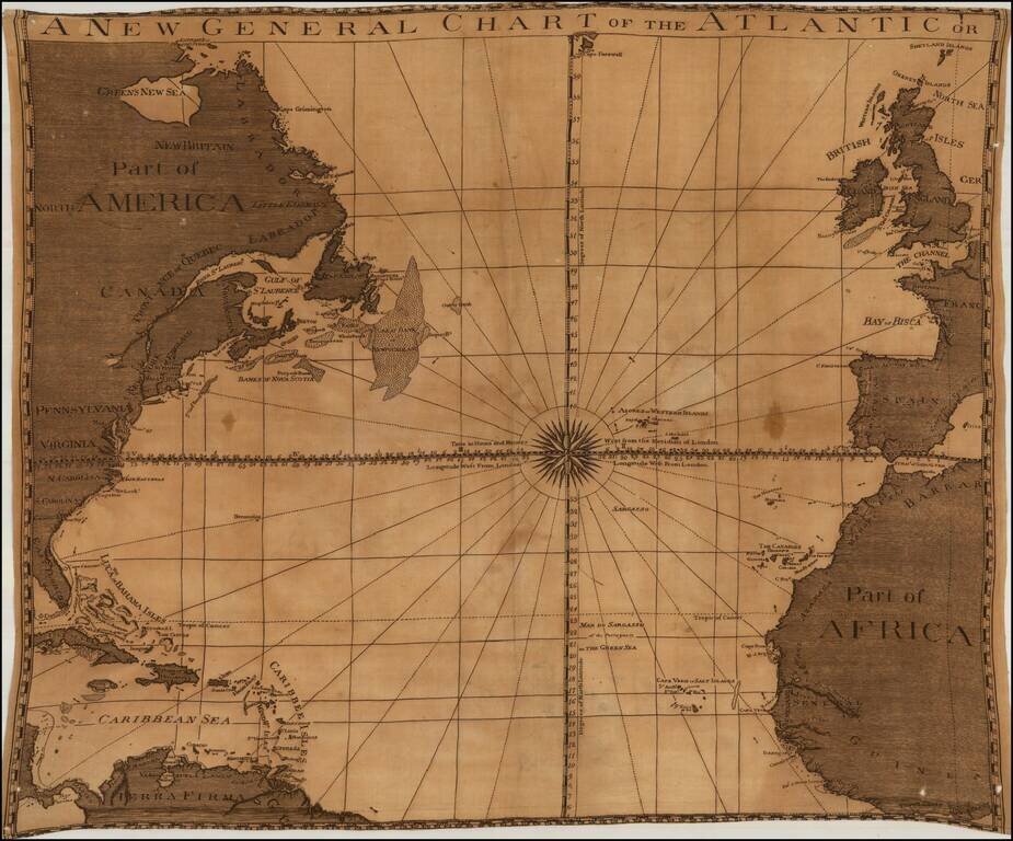
Unrecorded map of the Atlantic Ocean, printed on linen, likely published in London about 1780. The title of the map and its style and nomenclature are very similar to the 1777 edition of Sayer & Bennett's A New General Chart of the Atlantic or...
![[ Atlantic Ocean / Triangular Trade / Negroland ]](/map/small/65187.jpg)
Interesting hand drawn sea chart of the North Atlantic, illustrating the region covered by the Triangular Trade. The chart focuses on the major trading ports in America (Charleston, Boston, New York, Baltimore and Philadelphia), with a very curious...
![[Australia, Phiippines, New Zealand, Hawaii] Oceanica 1828](/map/small/61780.jpg)
Rare Italian Map of the South Pacific, extending from Australia and the Philippines in the east to Hawaii and the Marquesas in the west, The map illustrates the recent discoveries in Australia and provides good detail in Australia and a good sense of...
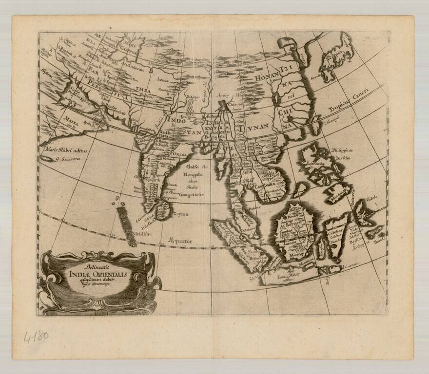
Scarce map of East Asia and the Indian Ocean, extending from Japan and Korea to the Caspian Sea and the Persian Gulf. The map is centered on the Indian Ocean.
![[Port Louis, Mauritius] Legende du Plan du Port-Louis](/map/small/51740.jpg)
Handsome and highly detailed manuscript map of Port Louis, the capital of Île-de-France (present-day Mauritius), done in pen and watercolor, showing the town, surrounding countryside, and the harbor, with many points keyed and identified in the...
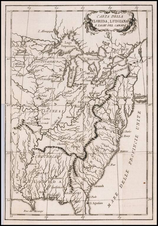
Albany called Albania! Rare Italian map of the United States, Florida, Louisiana and Canada, which appears to have been issued during the American Revolutionary War. The US is called Province Unite, with Albany, New York called Albania. The city (or...
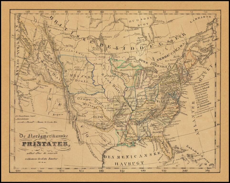
Illustrating Norwegian Settlements In Illinois Rare Norwegian map of the United States from Coast to Coast, published in the first part of the 19th Century. The map almost certainly relates to the promotion of Norwegian settlement near Kaskassias...
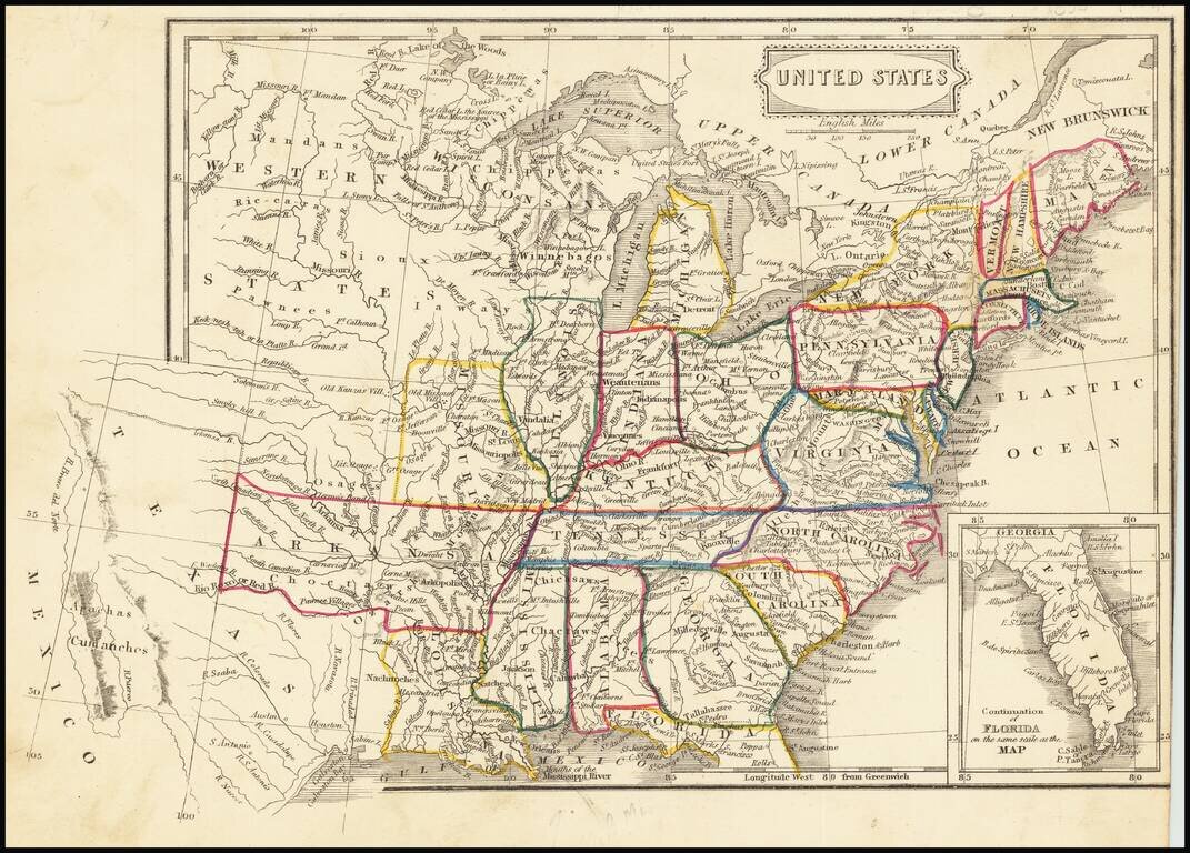
Fascinating map of the United States and Texas, published about the time Texas became a Republic. The map names "Wisconsan", suggesting the map was published about the time Wisconsin was becoming a Territory. In Texas, the Houston and Austin are...
![Vereinigte Staaten von Nord-Amerika [Views of New York City and Back Country Scenes]](/map/small/25442.jpg)
Decorative set of illustrations, including a view of the State House in New York, and views of Niagara Falls, Saratoga, the Mississippi Valley, a wagon train headed west, a buffalo hunt and a series of indigenous Indian scenes.
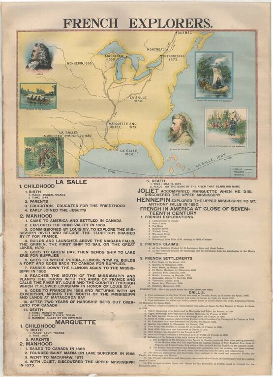
Rare Large Educational Map, With Pictorial Map Illustrating French Exploration of America and Illustrated Historical Chart of the United States. Decorative large format image, printed in color on both sides, almost certainly for educational purposes....
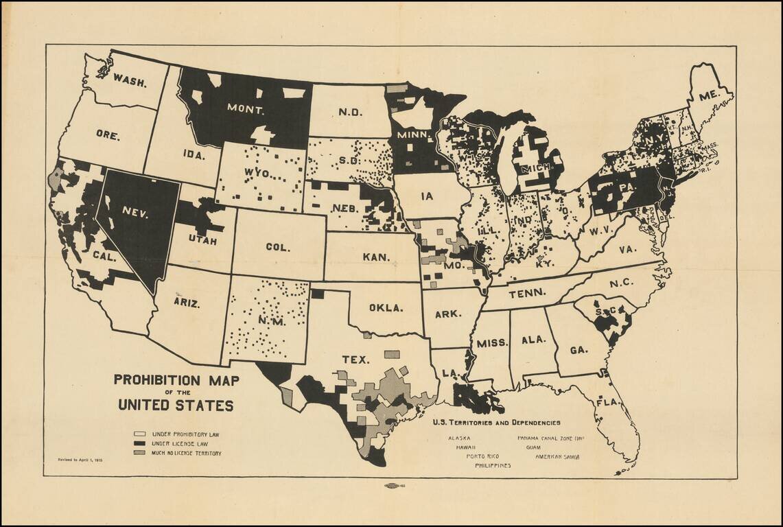
Pre-prohibition map of the United States, illustrating the various local laws that controlled the consumption and sale of liquor in the US. The map illustrates interesting geographical (and underlying cultural) variables in the implementation of...