![A View and Plan of Mud Island on the Delaware [One of the First Depictions of an American Flag]](/map/small/65207.jpg)
Revolutionary War Manuscript Map of Fort Mifflin, with a very early Drawing of an American Flag Finely-executed Revolutionary War manuscript plan and view of Fort Mifflin on Mud Island on the Delaware River, just below Philadelphia, including a fine...
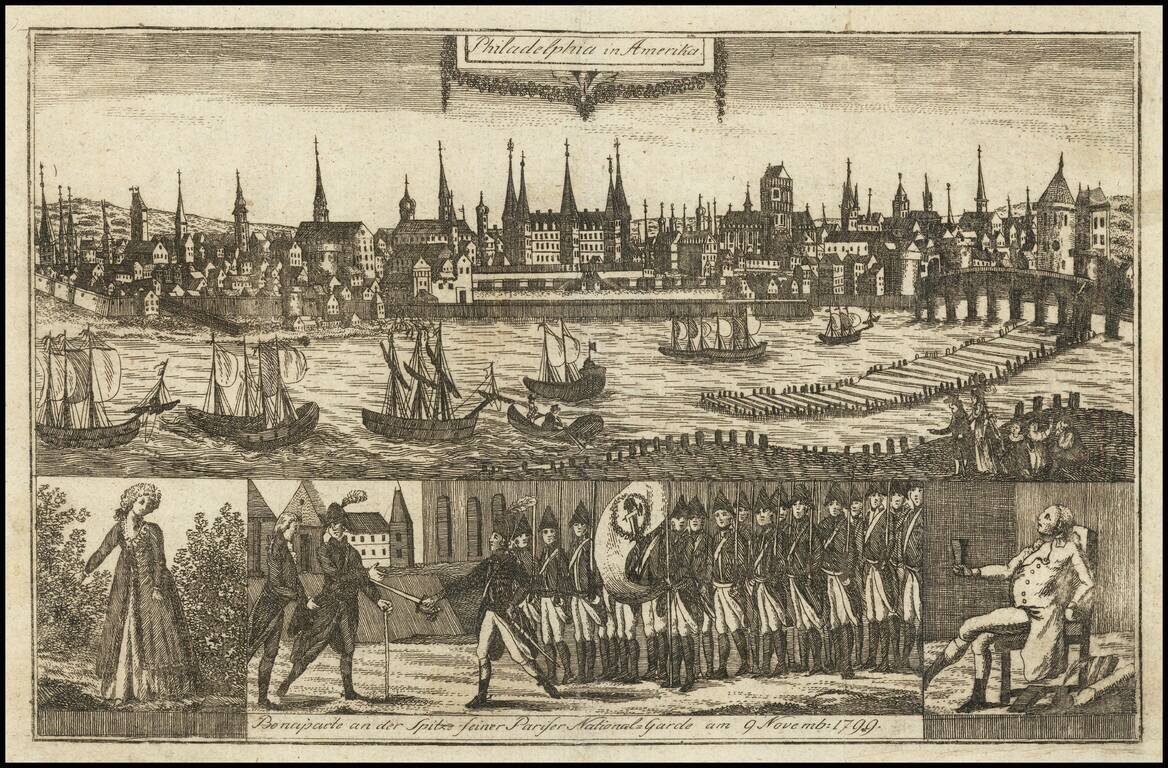
Capital of the United States Rare early view of Philadelphia, then capital of the United States, from a rare German publication The view was published in "Allgemeine Welt-Chronik oder neue und wichtige Zeit-Geschichte aller Länder und Völker." The...
![[ Wilmington, Delaware -- Colonial Manuscript Map and Indenture ]](/map/small/36737.jpg)
Manuscript indenture with seal, signed by Peter Peterson and Rebecah R. Peterson, conveying land in the central part of Wilmington, Delaware, just southwest of Brandywine Creek and dated May, 1761. The land in question, bounded by Brandywine Creek,...
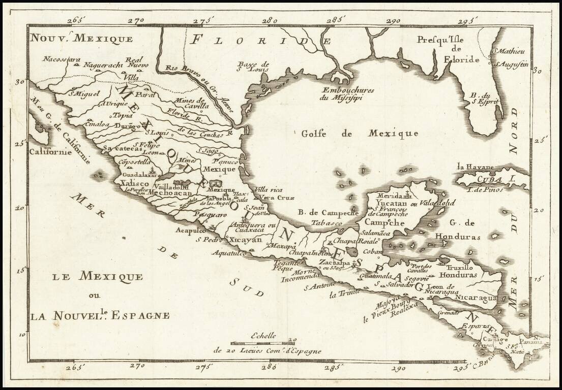
Rare map of Florida, the Gulf Coast, Texas, Central America and the Caribbean. Florida extends to the Rio Grande River. Only a few settlements shown in Florida and none on the Gulf Coast, apparently pre-dating New Orleans. Reminiscent of De Fer's map...

The Neutral Lands and the Race To Construct Railroad Lines from Northern Kansas to Indian Territory Unrecorded railroad map of Texas, the Southern and Mdiwestern States, published by the Missouri River, Fort Scott & Gulf Railroad and the...
![[Siege of Vicksburg -- Manuscript Battle Map / Field Sketch]](/map/small/62795.jpg)
Hand Drawn During The Siege of Vicksburg Detailed hand drawn map / field sketch showing troop positions during the siege of Vicksburg, during the American Civil War. The map locates troop positions, Rebel Works, topographical features, bridges and...

Lively pictorial map of Williamsburg, illustrating the town following its restoration "through the generosity of . . . John D. Rockefeller, Jr. and members of his family." The main map provides a fine overview of the town, with buildings named.
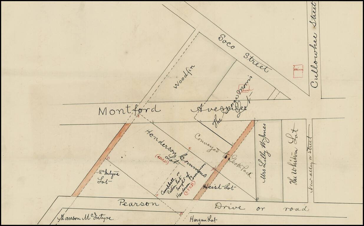
Early cadastral map of part Asheville, North Carolina, just south of the University of North Carolina, Asheville, identifying the land owners in a section of town including Pearson Drive, Montford Avenue, Soco Street and Cullowhee Street, just...
![Nuovo Messico appartiene alla Spagna [with] A. Luisiana Inglese B. Luisiana Francese](/map/small/7075.jpg)
Extremely rare pair of miniature maps on one sheet, from a miniature Italian Atlas. The first example we have ever seen. The upper map extends from Baja California and the Pacific to Texas, centered on the Rio Grande. Full of very curious place names....
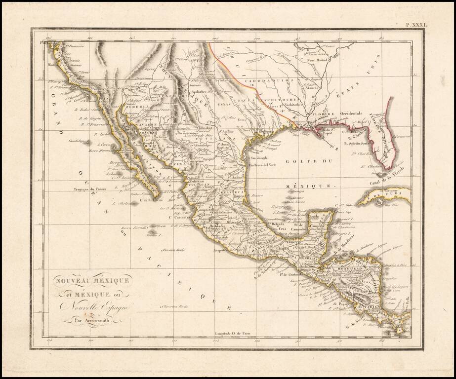
The West at the Time of the Louisiana Purchase Detailed map of Mexico and the American West, published in Paris. The map shows the limits of the United States at the Mississippi River, with Louisiana shown to the west, albeit somewhat vaguely. The...
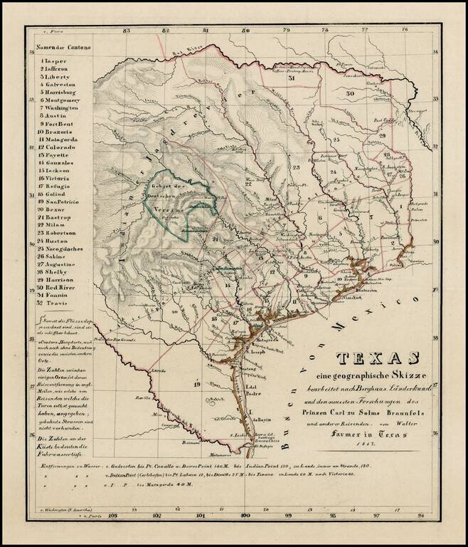
Rare and important early German immigration map of Texas prepared in connection with the Solms-Braunfels promotion of German colonies in Texas, based upon the larger Hunt & Randel map of 1839. The map provides a detailed look at Texas during its...
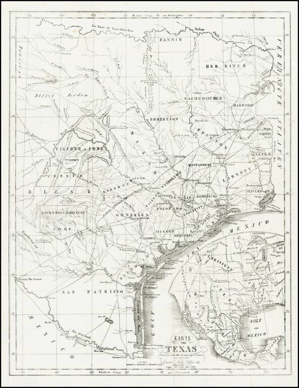
Extremely rare map of Texas, not listed in Day, Phillips, Streeter, Taliaferro, or any other Texas reference. While the map is unrecorded and its source is unknown, we are of the opinion that the map was printed, but ultimately never included in a...
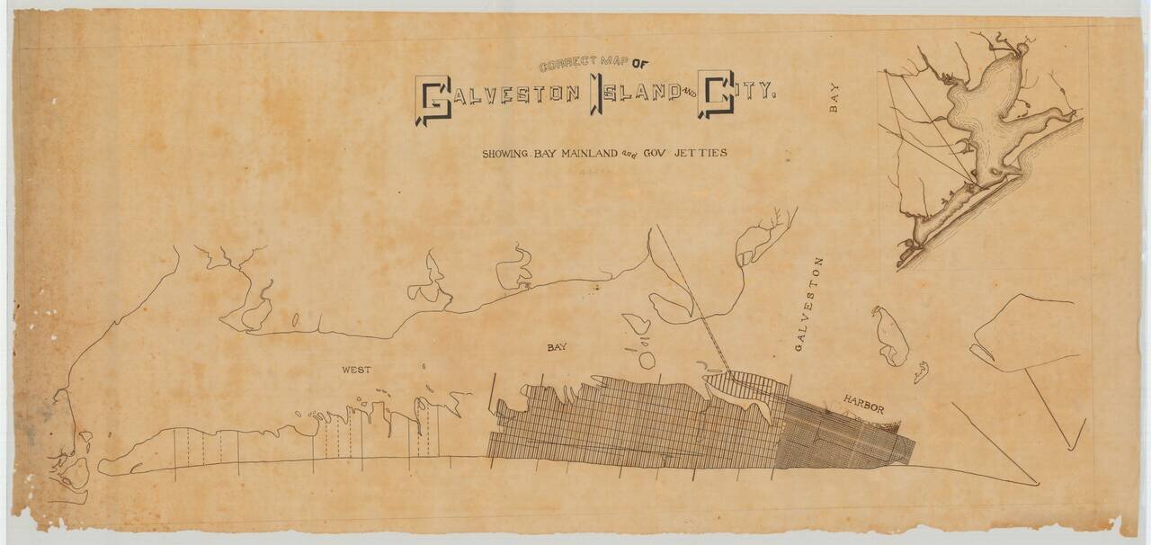
A Pre-Hurricane Manuscript Map of Galveston. Detailed manuscript map of Galveston Island and the city of Galveston, Texas. The map was prepared before the Galveston Hurricane of 1900, when the city was booming and plans for its expansion across the...
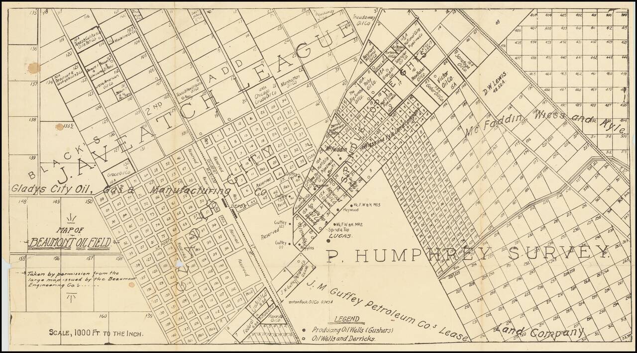
One of the first printed maps of the first major Texas oilfield centered on the Spindletop "Lucas" Gusher. The map is reflective of the frenzy of commercial and oil-drilling activity that took place around the Lucas Gusher in 1901, especially in the...
![[Manuscript Map of Oil Development at High Island, Texas]](/map/small/66465.jpg)
An interesting manuscript map of High Island, Texas, one of the first big oil strikes after Spindletop. Showing drilling blocks in the process of being developed. The map includes notes about a spring and "foot ridge" (?) The map offers an...
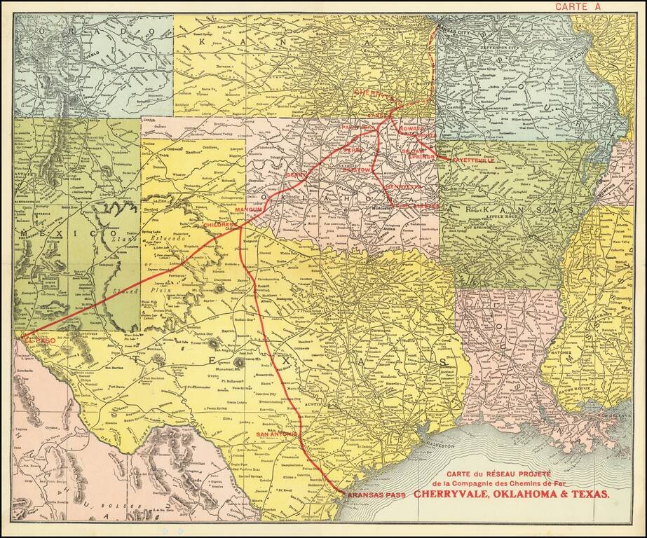
Promoting Railroads To French Investors Fine example of this rare promotional map centered on Texas, Oklahoma and Kansas, published to attract French investors in the issuance of bonds to construct the Cherryvale, Oklahoma & Texas Railway. This...