![[Untitled Map of Pittburg, California & Vicinity] Pittsburg Chamber of Commerce Trade Card](/map/small/19402.jpg)
An interesting trade card map, with promotional info for the Pittsburg Chamber of Commerce on the verso. See verso here: /gallery/enlarge/19402a
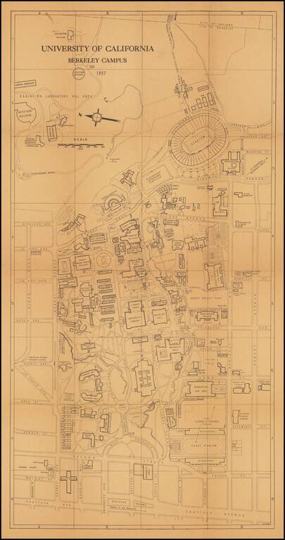
This is a great 1950s map of Berkeley, showing the campus in detail as it stood at the time. Many dozens of buildings on campus are named, as well as some features from the surrounding neighborhood. The verso includes an extensive index of places on...
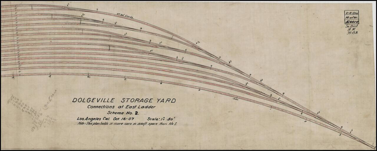
Manuscript plan for a proposed rail yard in Los Angeles, California, composed in 1907. The rail yard was probably located in the Dolgeville Subdivision of Alhambra, California. Dolgeville was named after the Alfred Dolge Manufacturing Company. This...
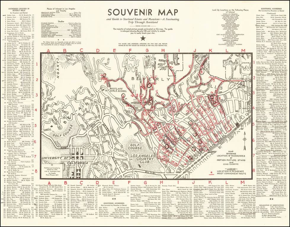
1938 Hollywood Stars Souvenir Map Scarce early map of Beverly Hills and Westwood, showing the locations of prominent movie star homes, published in the August 1938. Stars named include Fred Astaire, James Cagney, Charles Chaplin, Marlene Dietrich,...
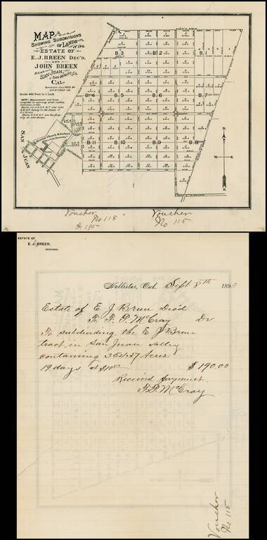
Map of the lands owned by the Breen family in San Juan Valley, San Benito, California. The lands shown were owned by Edward Breen and John Breen, two of the sons of Patrick Breen and Margaret Breen, survivors of the Donner Party. It was Patrick Breen...
![[Corona Del Mar]](/map/small/66927.jpg)
Rare promotional map of Corona Del Mar, promoting Hal Will Smith, Realtor / Fire Insurance. The map shows the City Boundary as of February 1924, with land ownership information dated as late as 1937, with one large oceanfront tract owned by Citizens...
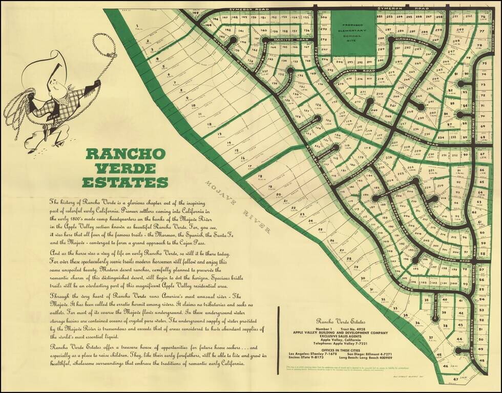
Detailed plan of Rancho Palos Verdes Estates, a planned community in Apple Valley, California. The area is now called Desert Knolls, on the north end of Mojave Narrows Regional Park. Apple Valley is in the High Desert region of San Bernardino County....
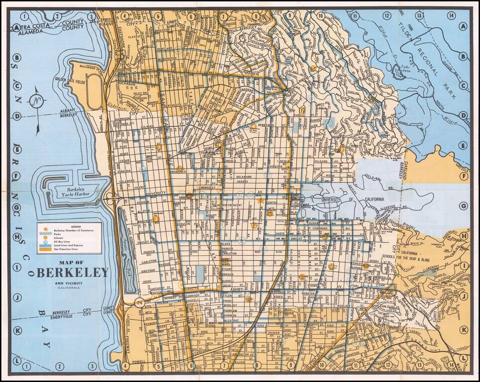
Detailed map of Berkeley, with emphasis on public transit and public works. The map locates the Chamber of Commerce, Parks, Schools, AC Bus Lines, Local and Express Bus Lines and San Francisco Bus Lines.
![[Placerville, California]](/map/small/63008.jpg)
Lively pictorial advertising map for Placerville, California, issued in the mid-1970s. We dated the map based upon the Master Charge logo (1969-1979). The map provides a whimsical look at Placerville, in the foothills of the Sierra Mountains, with...
![L'Amerique Septentrionale [Unrecorded map showing California as an Island]](/map/small/70283.jpg)
Unrecorded map of North America, showing California as an island, with a very curious shape. A close study of the lower part of California suggests a knowledge of De L'Isle's 1700 map of North America, which was one of the first maps to show...
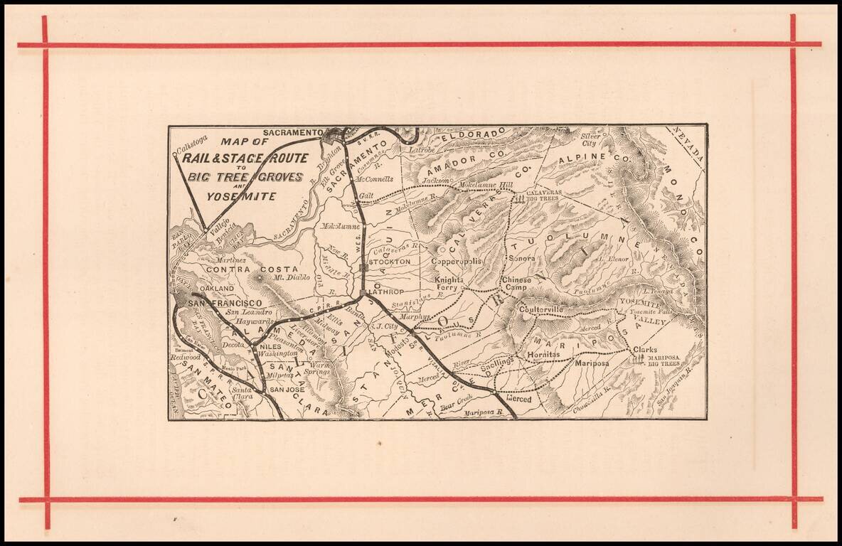
Rare early map of the routes to Yosemite and the Redwood Groves to the south, which would become Sequoia National Park. Versions of this map are known to have been published as early as 1872, in The Wonders of the Yosemite Valley, and of California...
![СѢВЕРНАЯ АМЕРИКА въ Санктпетербургъ. 1788. [North America (published) in St. Petersburg. 1788.]](/map/small/56512.jpg)
One of the First Russian Maps of the United States. Stating the Pacific Northwest was "acquired by Bering [and] Chirikov [in] 1741". Superb, separately issued engraved map of North America, published in Saint Petersburg in 1788. The map represents...
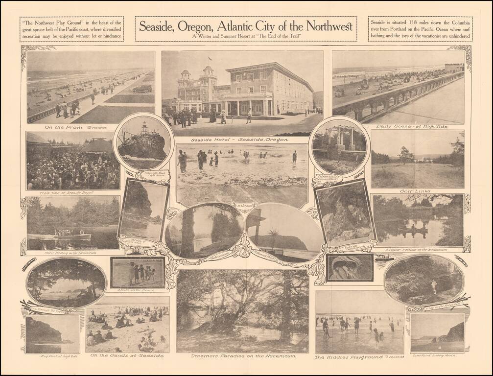
A Winter and Summer Resort at "The End of the Trail" Rare promotional pamphlet for Seaside, Oregon, including approximately 20 black and white photos of the town, beach and tourist features. Promotional text on the verso. Rarity OCLC locates 2...
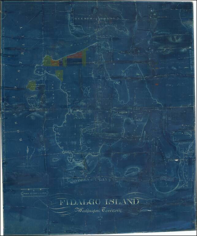
One of the Earliest Surviving Maps of Fidalgo Island Rare map of Fidalgo Island, named after the Spanish explorer and cartographer Salvador Fidalgo who explored the area in 1790. The map is color coded to show the lands owned by several different...
![[Map of Clarke County Washington]](/map/small/58454.jpg)
You'll Prosper in Vancouver, Washington Early promotional map of Clarke County, promoting businesses in and around the Vancouver, Washington area. The map is ringed by illusrations of local businesses. On the verso, an illustrated guide shows the...
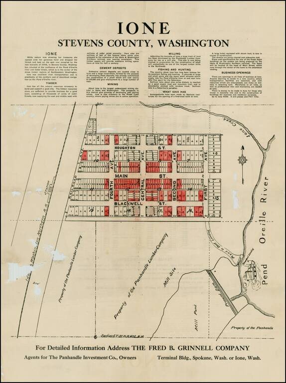
Detailed plan of Ione, Washington, promoting the town's natural resources, including Timber, Cement Deposits, Mining, Milling, Fishing & Hunting, etc. The map shows the steamboat landing, proposed dam, town plan and other details. The present map...