![[Manuscript Map, Michoacan, Mexico]](/map/small/65663ba.jpg)
18th Century Mexican Manuscript Map Describing A Dispute Over Water and Land Ownership Rights This manuscript describes the location of a disputed dam or weir near the stream of Chichipican de San Juan, which may be near Tzintzuntzan in Michoacán...
![[Manuscript Map of Part of Morelos]](/map/small/49429ba.jpg)
Manuscript pictographic map of Morelos showing area now partially underwater This is a road and boundary map with pictographic symbols showing area in the modern state of Morelos. At least some of the area is now underwater, inundated by the man-made...
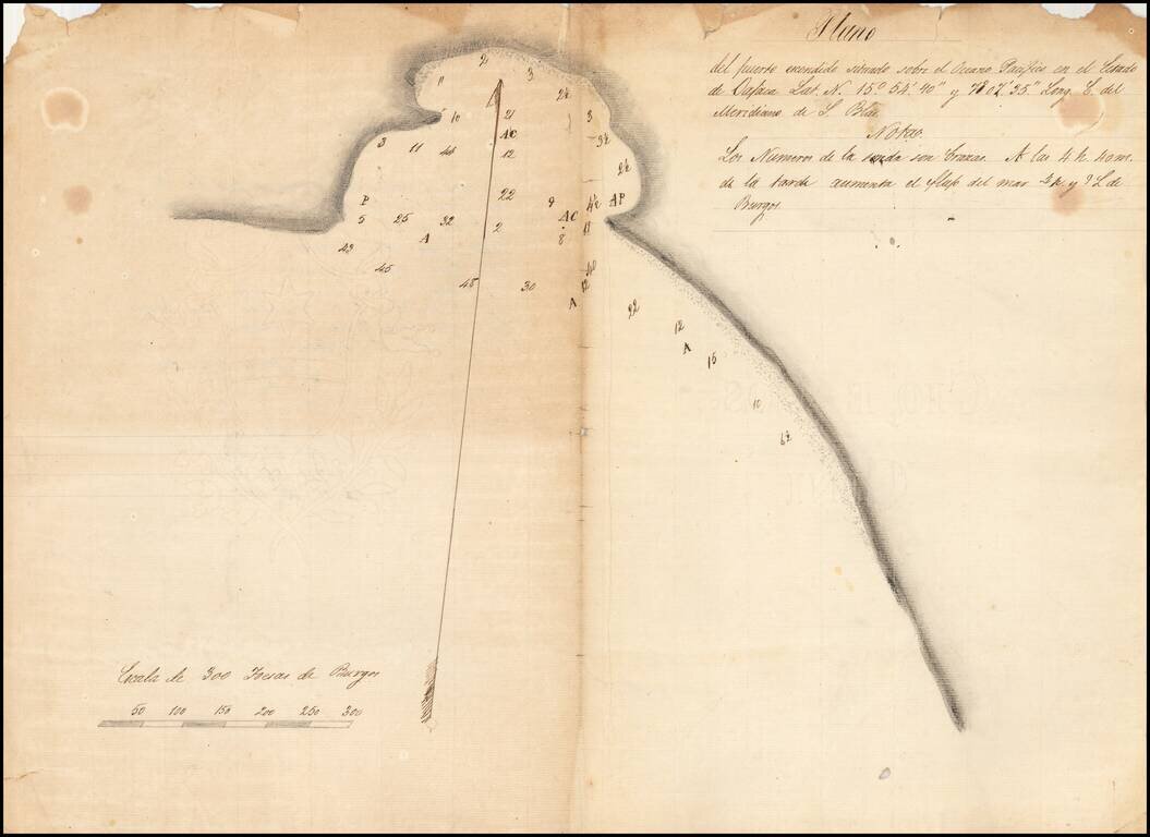
Finely-Executed, Early Manuscript Plan of Puerto Escondido, in the State of Oaxaca Good example of a survey of Puerto Escondido, most likely sketched in the early-nineteenth century. The plan shows the bay with detailed soundings and is one of the...
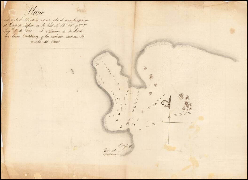
Detailed, Early Manuscript Plan of Huatulco, Oaxaca Finely-executed sketch of the port of Huatulco in the state of Oaxaca, Mexico. The north-oriented plan shows sounding depths and sea-floor quality indications, one of the earliest surveys to show...
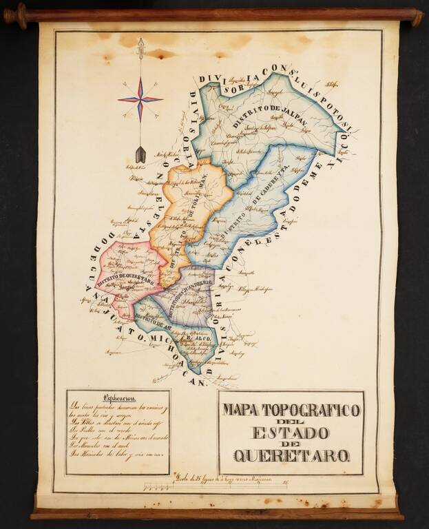
Striking Manuscript Map of the Mexican State of Querétaro Colorful and detailed manuscript map of the state of Querétaro, in central Mexico. The map is drawn is a skilled hand and was likely prepared by an official for government use and possible...
![El numero 1 q[ue] se haya en la orilla de la ???ya que corre a San Ysidro es el gran ?? de partida siguencio? la numeracion immediata a los puntos amarillos ?on los ?inderos, hasta? el numero 19 con que vierra en el terreno marcados con la letra C.](/map/small/65664ba.jpg)
Resolving a Land Dispute In Temascalcingo, Mexico in 1845 Finely construted map of a large portion of the city of Temascalcingo in the State of Mexico, which officially set the boundary markers (mojoneras, spelled here with an h), for different...
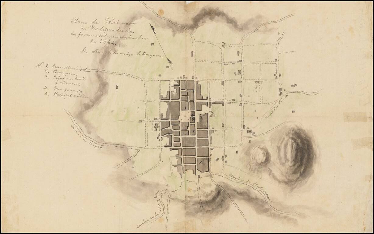
Town Plan of Zitácuaro de Independencia with Manuscript Notes This is a sketch of a plan of Zitácuaro, another copy of which is available at /gallery/detail/49465ba . It is not an exact copy, however, as it has some manuscript notes, including one...
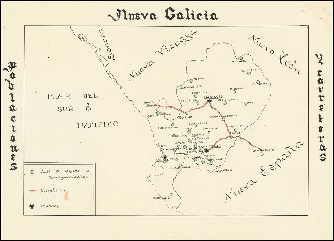
Hand drawn thematic map of the Nueva Galicia, centered on Zacatecas, showing primary roads and population centers. The date is estimated.
![{Central Mexico] Mapa de producciones](/map/small/62148.jpg)
Hand drawn thematic map of the region of Mexico centered on Zacatecas, displaying the agricultural, livestock and mineral producing regions. The date is estimated.
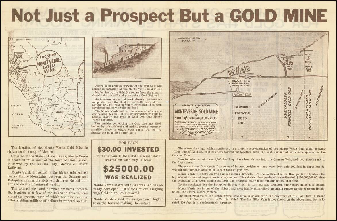
Interesting and very rare promotional map for what was in all likelihood a gold mine scam perpetrated in the early 1930s. In breathless language, the sheet solicits investment in the "Monteverde Gold Mine", supposedly located in southwest Chihuahua,...
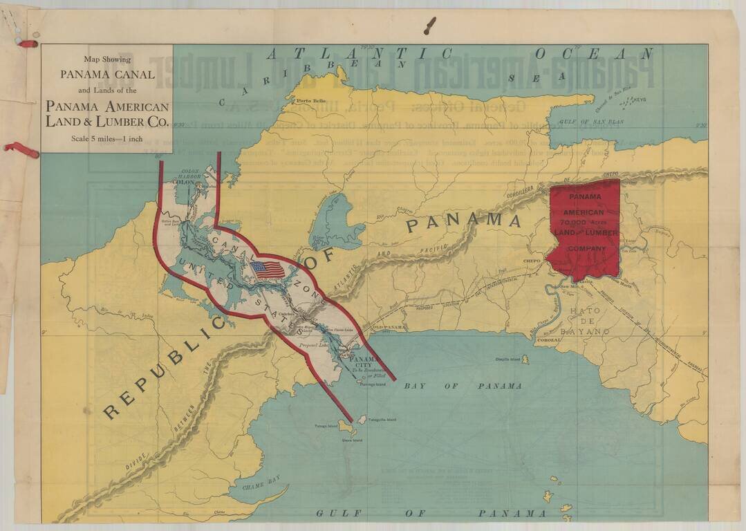
Fine promotional map of Panama, created to illustrate the lands of the Panama American Land and Lumber Company, with a map of the world on the verso. Affixed to the map is type written document. The Panama American Land and Lumber Company was formed to...
![[Cuba] [Plan of Lands at Bahia Honda]](/map/small/67161.jpg)
Intriguing Manuscript Map of Plantation Lands in Cuba Including Coffee Plantations Schematic manuscript sketch map of Bahía Honda, along the north coast of Cuba. The paleography indicates the map was made in the mid- to late-eighteenth century....
![[Hispaniola, Cuba, Martinique and Guadalupe] Carte de S.Domingue . . . / Carte de Cuba . . . / Carte de Martinique . . . / Carte de Guadalupe et des Isles de Saintes . .](/map/small/70543.jpg)
Fine, Detailed French Map of Prominent Caribbean Islands Rare, separately-published map illustrating Hispaniola, Cuba, Martinique and Guadaluope. Each inset map is nicely detailed and includes a description in the title block. This text offers a...
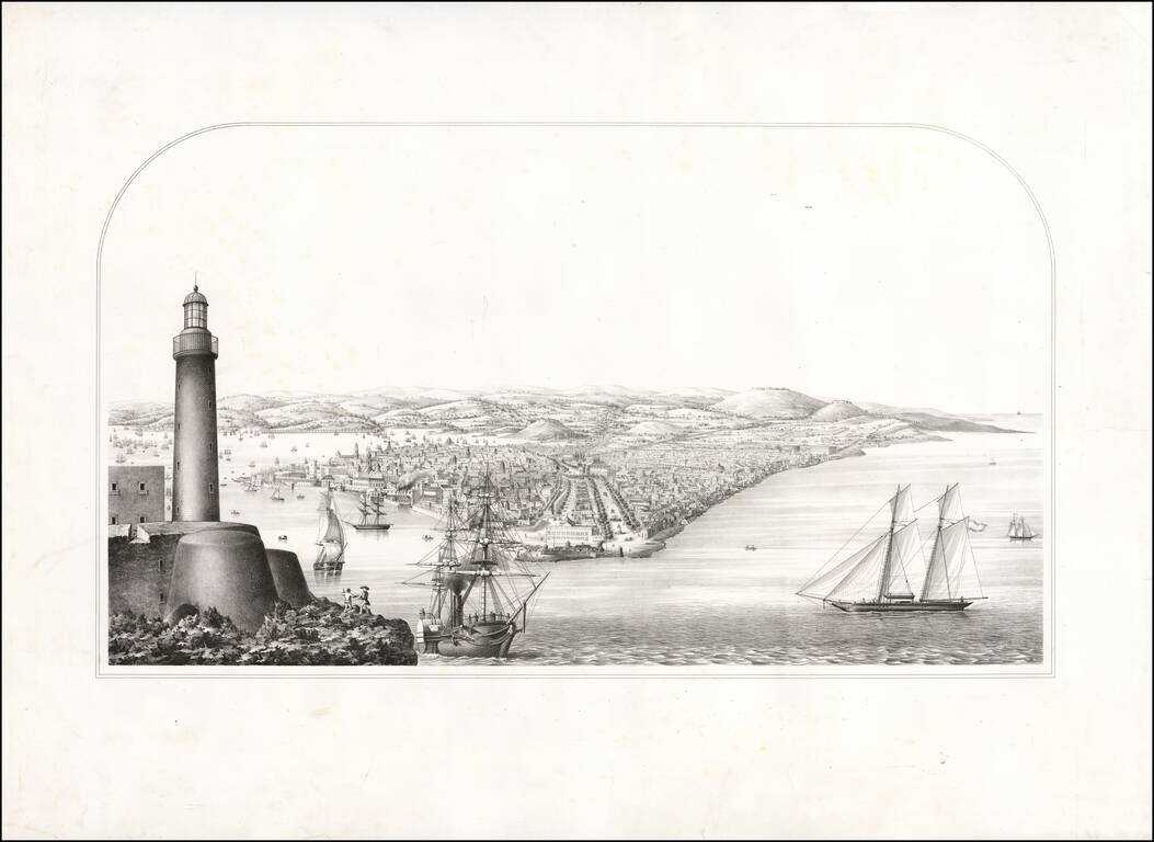
Proof state of a rare view of Havana. The view was acquired in group of other items, most of which related to Rafael Rodriguez, whose most famous work is a Cuban Atlas described by Emilio Cueto as follows: 528. Rodriguez Rodriguez, Rafael Ρίο...
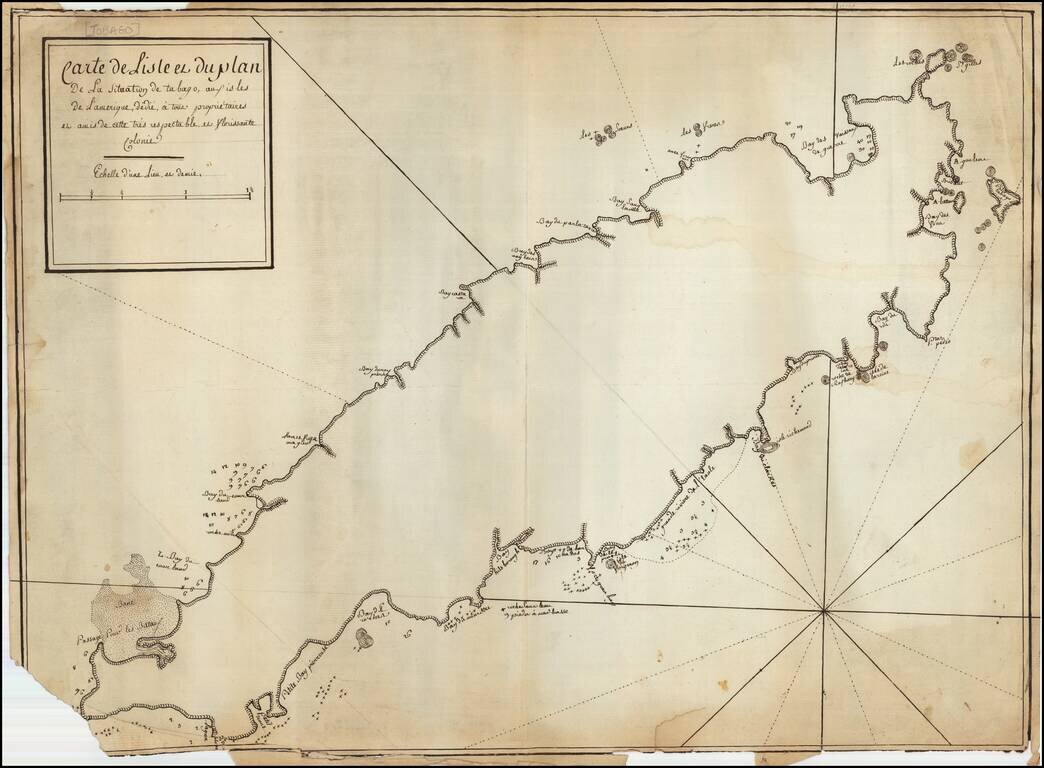
French Manuscript Map of Tobago Revealing its Complex Colonial History Manuscript map showing the island of Tobago and revealing its complicated history of European settlement. The map shows continued interest in Tobago across Europe and could have...
![[Windward & Leeward Islands -- Puerto Rico to Trinidad]](/map/small/36239mb.jpg)
Interesting untitled sea chart of the Windward and Leeward Islands, extending from Puerto Rico to Trinidad. The chart shows signs of use around the Virgin Islands, with navigational lines apparently shown for transit thorough the islands from St....