Map size in jpg-format: 18.1495MiB
Click to open in high resolution (open in new tab).
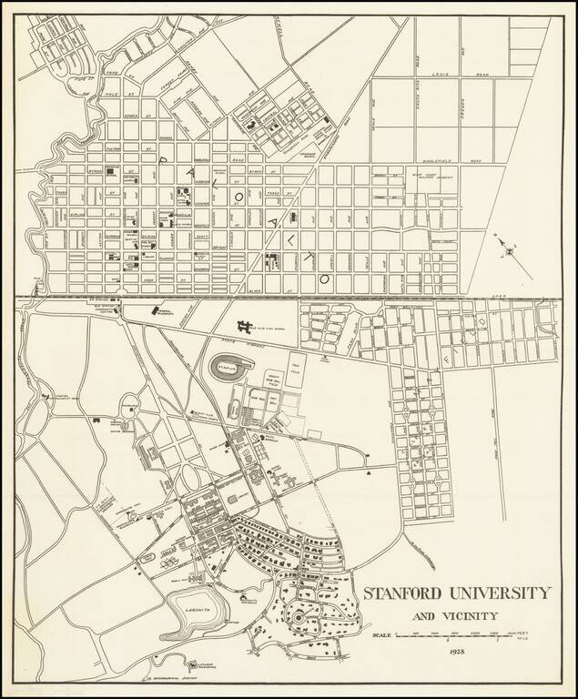
Detailed map of the Stanford University Campus, as it appeared in 1928.
The map was likely created for a guide book, although we do not know the source.
The map shows a portion of campus in academic use and street map of Palo Alto.
The map is very early, pre-dating the arrival of the Peninsular Railway, Carnegie Institute Library, the U.C. Experimental Station, Palo Alto Hospital, Golf Course.
If you are a student, write to us in telegram: @antiquemaps and indicate what material you need and for what work you need a map in high detail. We are ready to provide material on special terms. For students only!


