![[Come To Dallas] Easy To Reach -- Hard To Leave](/map/small/63387.jpg)
Pictorial map of the United States, focusing on Dallas as the center of the country. The map shows distances from Dallas to many other major cities in the United States. The map was published as part of the centennial of the Republic of Texas...
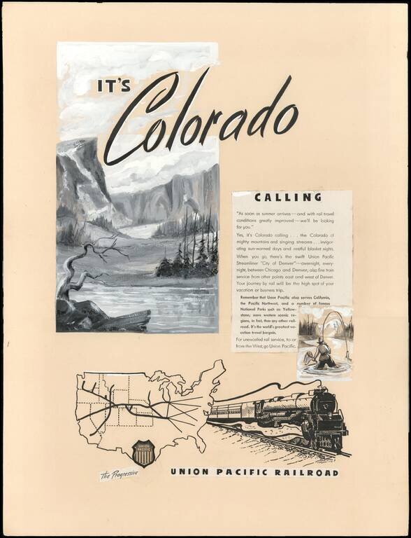
An Interesting Part of U.P.R.R. Advertising and Mapmaking History. This is a circa 1946 manuscript proof for a print advertisement promoting Union Pacific rail service from Chicago, Illinois to Denver, Colorado on the Union Pacific Streamliner 'City...
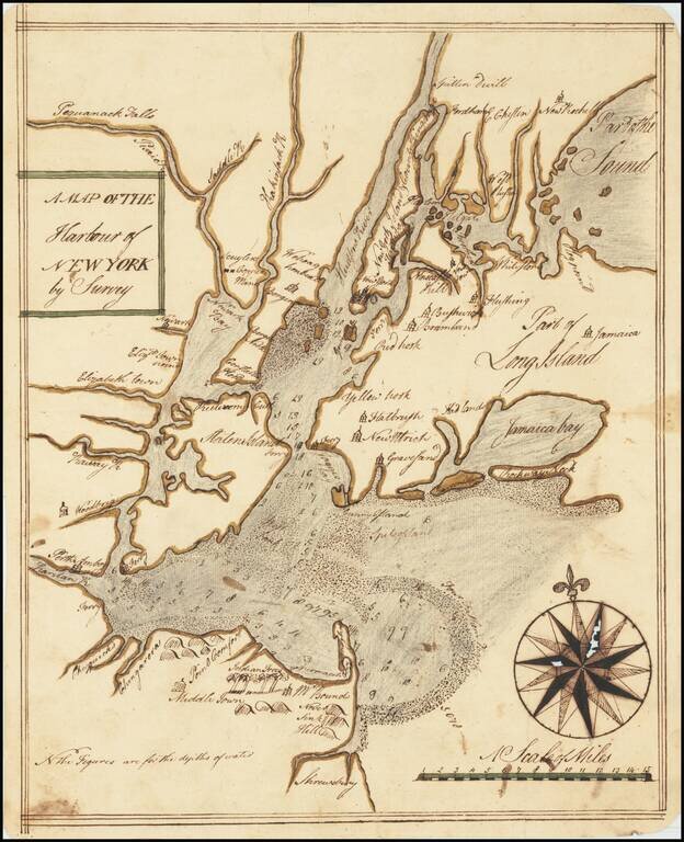
An Early Manuscript Map of Present-Day New York City. With Provenance to One of The U.S. Navy's First Frigate Captains. An early manuscript map of what is now New York City, based closely on William Bradford's New Map of the Harbour of New York, one...
![(American Revolution) [Manuscript Map of New York City and Northern New Jersey]](/map/small/69609.jpg)
An American Revolutionary War Manuscript Map -- From the Collection of One of the First U.S. Frigate Captains Manuscript map in pen and ink on laid paper of New York City and northern New Jersey, "the cockpit of the American Revolution". The map was...
![[Vermont / New Hampshire Grants]](/map/small/69612.jpg)
Manuscript Map Showing the New Hampshire Grants Which Would Become The State of Vermont Finely executed manuscript map delineating the New Hampshire Grants, the first meaningful delineation of the future state of Vermont. The map extends north to...
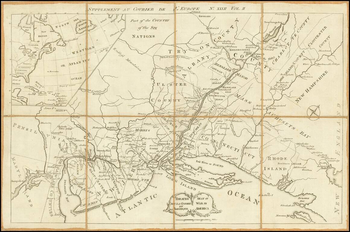
A very rare Revolutionary War map centered on the Mid-Atlantic colonies, which appeared as a supplement to an issue of the British published periodical Courier de L¹Europe. The present map employs a curious angular projection, and is centered on New...
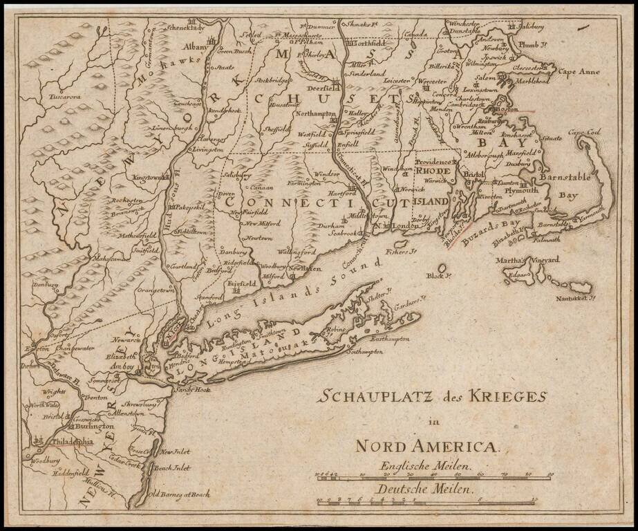
Unrecorded German map of the Theater of War in the northeast during the American Revolution. The towns of Boston, Providence, Newport, New York and Philadelphia are underlined in red. This is the first time we have ever seen the map and we can find...
![[Manuscript Sea Chart of Cape Cod area / Nantucket / Martha's Vineyard / Boston Bay]](/map/small/69611.jpg)
Revolutionary War Era Sea Chart Interesting unsigned hand drawn sea chart, centered on Cape Cod and Martha's Vineyard. The chart tracks the coast of Massachusetts and Rhode Island, with Block Island and Nantucket in the south and Boston Harbor and...
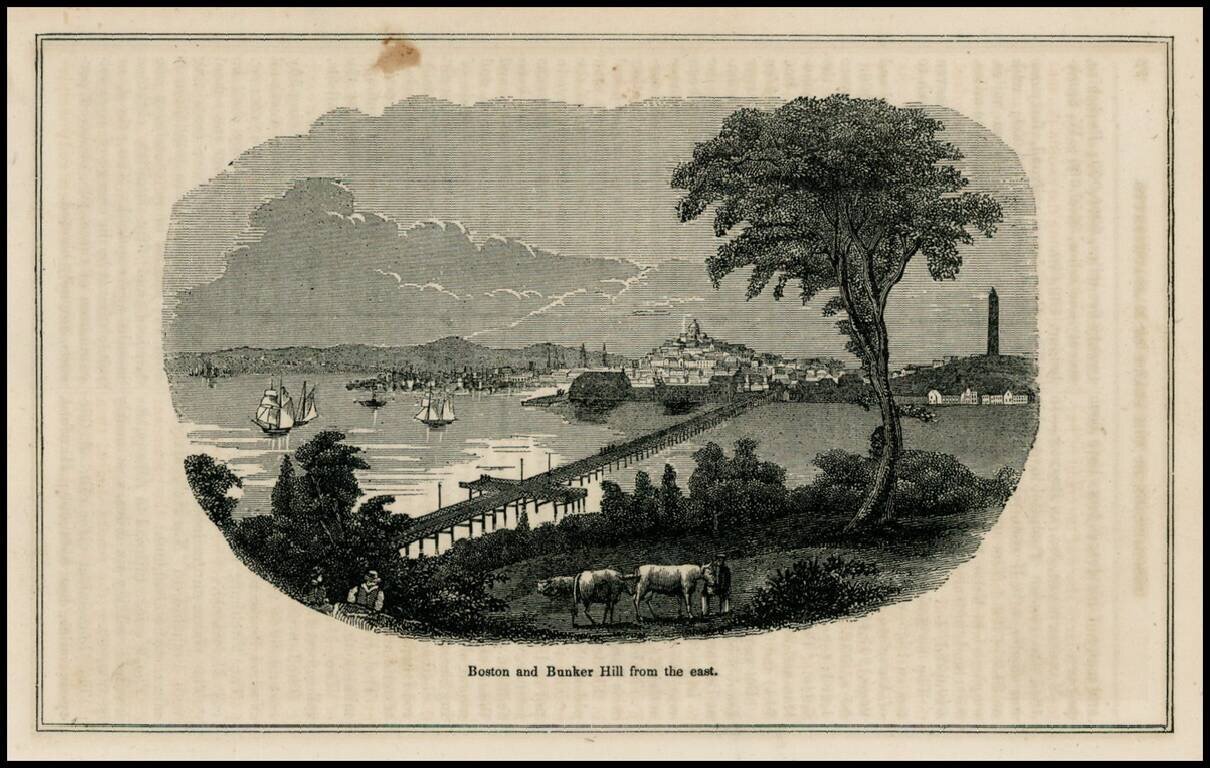
Woodcut view of Boston and Bunker Hill, from a mid 19th Century work.
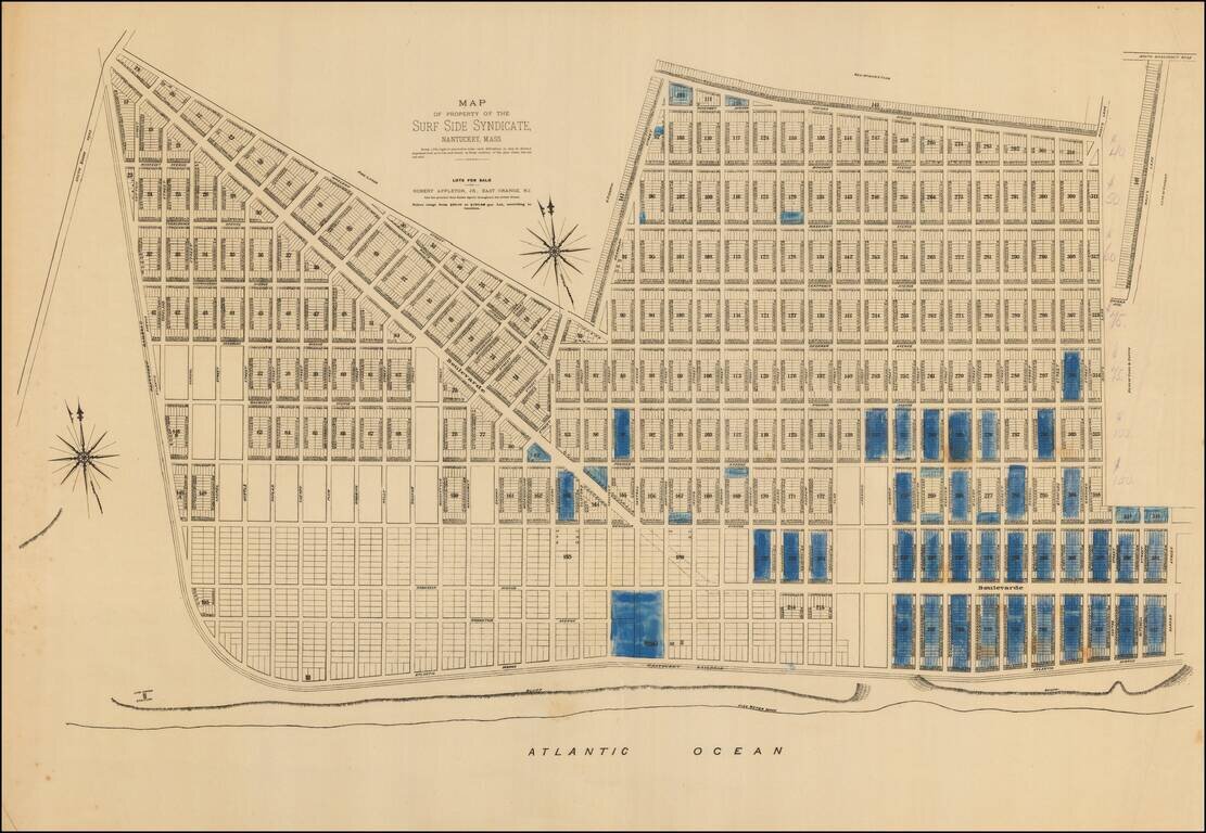
An extremely rare 1880s plat of lots for sale in Surfside on Nantucket’s South Shore. Note: This plat was acquired in partnership with Boston Rare Maps as part of an archive of some 150 Nantucket real estate maps and plats. The group includes...

State of New Hampshire Diploma, presented to reporter Charles P. Bosson in 1858. Includes a fantastic decorative vignetter showing the rich diverse livestock of New Hampshire.
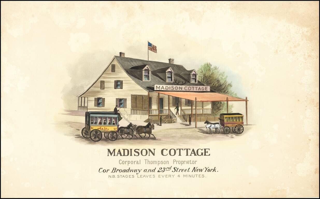
A Famous Resort of the Riders and Drivers from the City -- The Future Home Fine early image of the Madison Cottage, shortly after it was acquired by William Thompson in 1841. The Madison Cottage is the iconic New York landmark which gave rise to the...
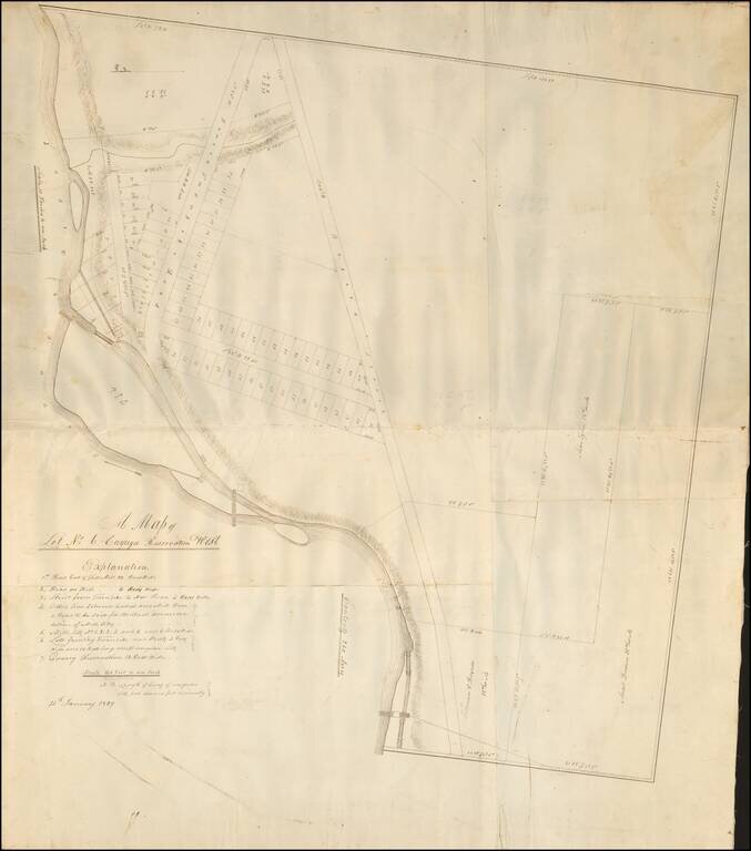
The Lands of the Bayard Land Company -- The Future Seneca Falls, New York. Finely executed manuscript map of a portion of the Cayuga Reservation on the Seneca River, dated January 15, 1829, four years after the lands were sold by the Bayard Land...
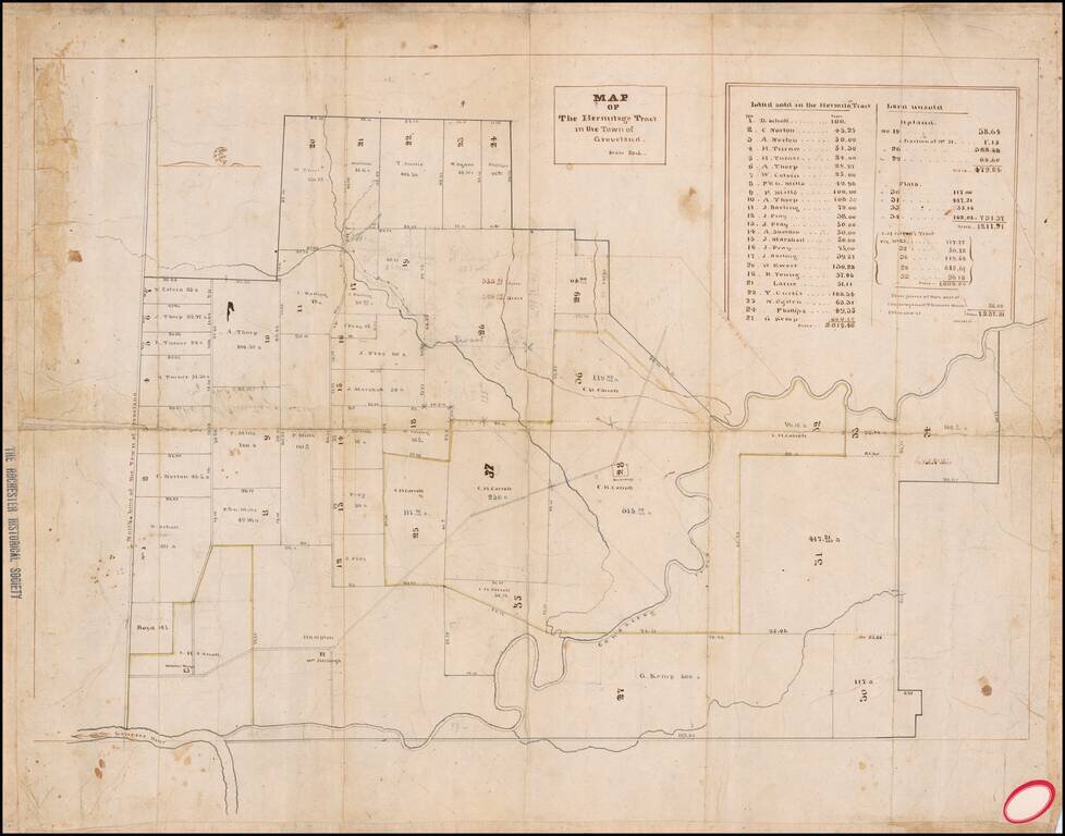
Detailed map of the "Hermitage Tract", between Geneseo and Groveland, New York. The map is oriented with east at the top. The map shows a stretch of Canaseraga Creek, just south its confluence with the Genesse River. The map locates 27 tracts of...
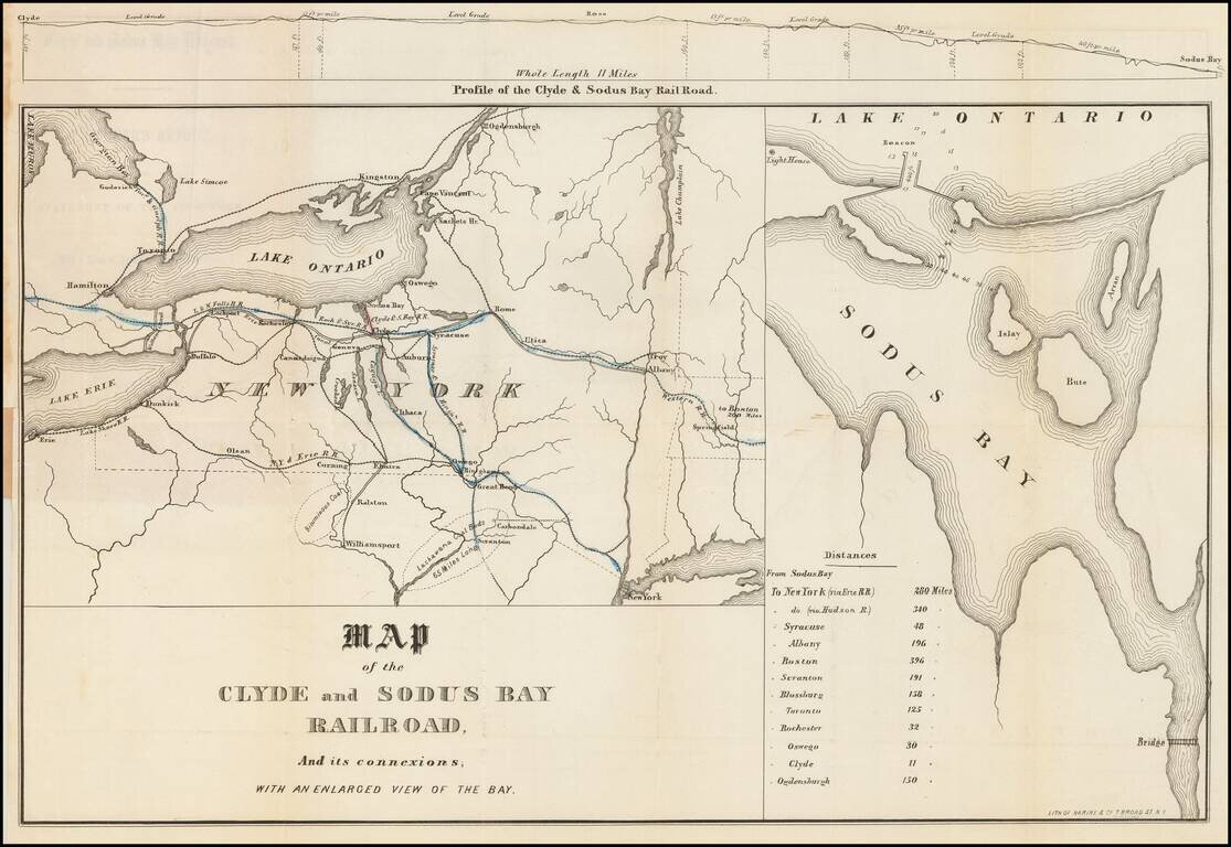
A New York Railroad Which Was Never Built Rare map of the Clyde and Sodus Bay Railroad, showing its route from Clyde New York to Sodus Bay on Lake Ontario. The Clyde and Sodus Bay Railroad was organized at a meeting of the citizens of Galen, Rose...
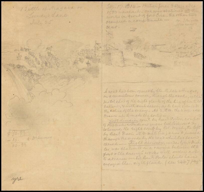
Late-19th or early 20th-century drawing of the Battle of Lundy's Lane during the War of 1812. There is a pencil drawing of the action on the left side of the sheet and a description on the right.