Map size in jpg-format: 65.0559MiB
Click to open in high resolution (open in new tab).
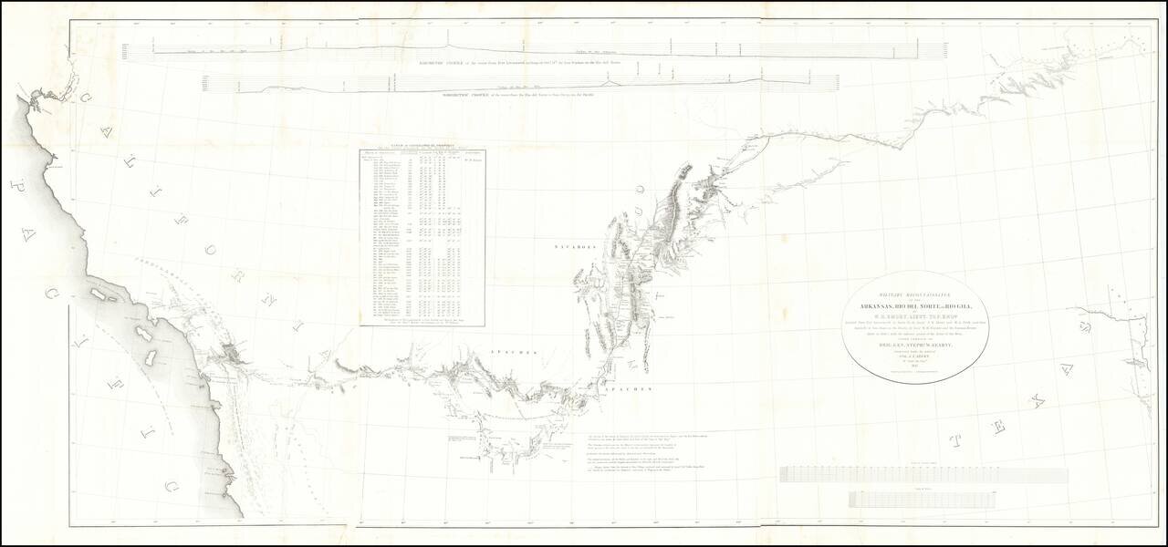
Fine example of the William Emory's milestone mapping of the Southwestern United State, from Ft. Leavenworth to the West Coast, from Emory's Notes of a Military Reconnaissance, from Fort Leavenworth, in Missouri, to San Diego, in California . . ., one of the most important maps of the Southwest from the first half of the 19th Century.
The map accompanied Emory's superb study of the lands newly acquired from the Mexican government. As Wagner-Camp notes,
[Emory's] report was a major contribution to the geographical knowledge of North America. His map, in which he limited himself to recording only the data which he and his assistants had actually observed, was the first accurate depiction of that vast area, and is still regarded as one of the landmarks of American cartography. The report includes sections on the plants and animals, as well as on the geology and the prehistoric town sites and other archeological remains. Emory's descriptions of the various Indian tribes that he encountered were steps toward the newly-forming discipline -Anthropology- concerned with primitive man.
Carl Wheat states, "In many respects, Emory's map was the most important milestone in the cartographic development and accurate delineation of the Southwest. In its period only the similarly scientifically based reconnaissance maps of Fremont were its equals."
Norman Thrower notes in Forty-Nine Maps of California from the Sixteenth Century to the Present (Map 26), "Emory's map accurately tied the southwest from Santa Fe, New Mexico, to Southern California together for the first time."
This is the later of the two states of the map, with The full title of the map is Military Reconnaissance Of The Arkansas Rio Del Norte And Rio Gila By W.H. Emory, Lieut. Top. Engrs. Assisted ... by J.W. Abert and W.G. Peck, and ... by W.H. Warner and Mr. Norman Bestor, Made in 1846-7, with the advance guard of the "Army of the West". Under Command Of Brig. Gen. Stephn. W. Kearny. Constructed under the orders of Col. J.J. Abert ... 1847. Drawn by Joseph Welch.
If you are a student, write to us in telegram: @antiquemaps and indicate what material you need and for what work you need a map in high detail. We are ready to provide material on special terms. For students only!


