
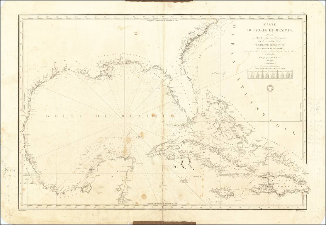
A Well Used Sea Chart of Florida, Gulf Coast and the Caribbean French Sea Chart of Florida, the Gulf Coast, Mexico, Yucatan, the Bahamas, Cuba and the western Caribbean, published in Paris in 1843. The chart was used as sea, with what appears to be a...
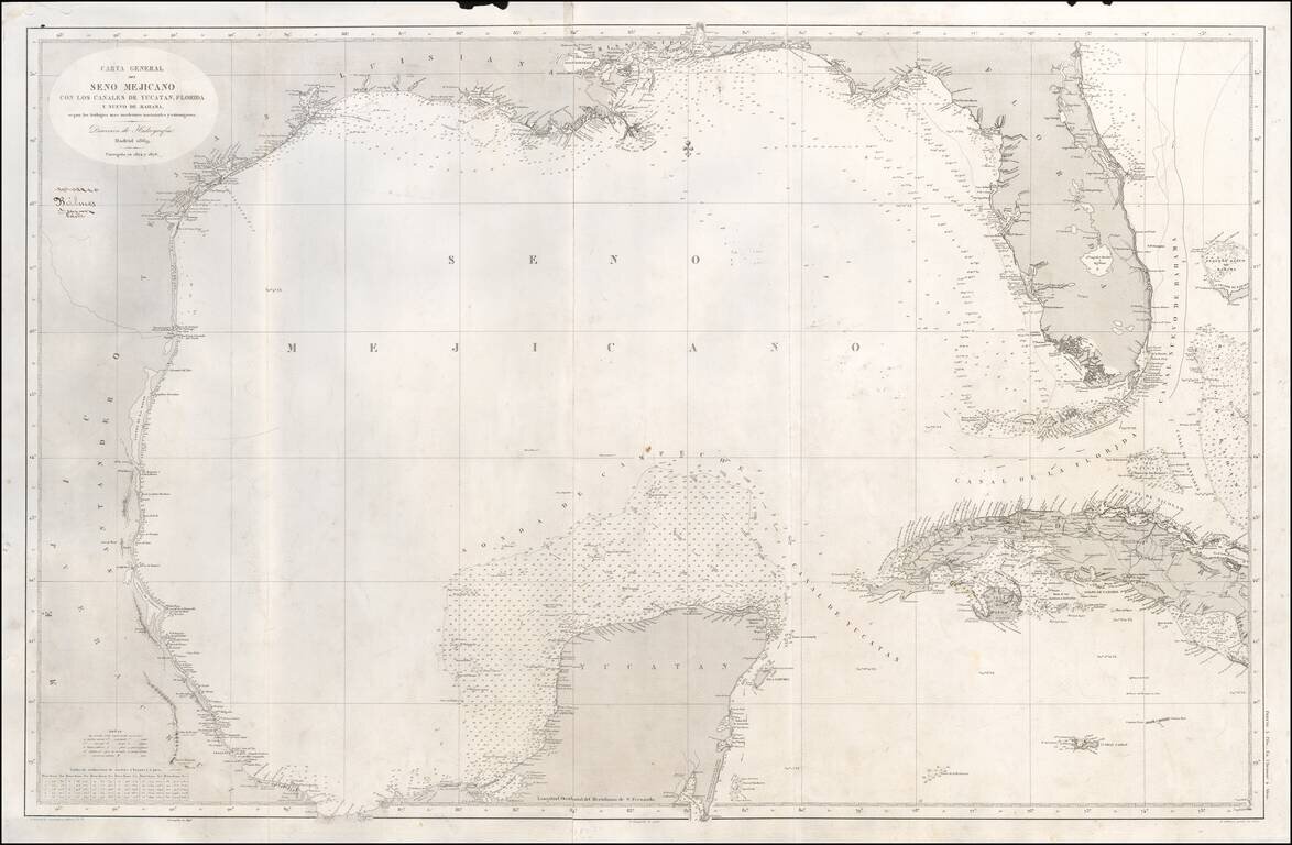
Scarce Spanish Sea Chart of the Gulf of Mexico, from Texas and the Yucatan to Florida and Cuba. Includes notes on the direction of the currents. A note opposite the Florida keys states that "Within these limit the current is directed strongly over...
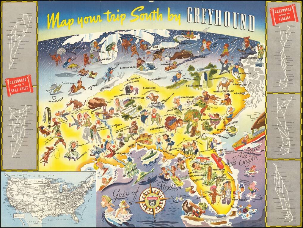
Whimsical map of the American South, promoting Greyhound's routes to Florida and the Gulf Coast in 1938. The image is dominated images of Florida tourist attractions, as well as other southern sites. Further north, the residents of the Midwest,...
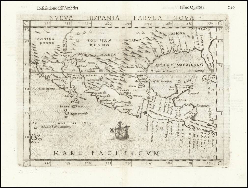
Second Earliest Obtainable Map of Florida, Texas, the Gulf Coast and the American Southwest—Rare Third State! Rare and influential regional map of the American South and Mexico, featured in Ruscelli’s edition of Ptolemy’s Geographia. This is an...
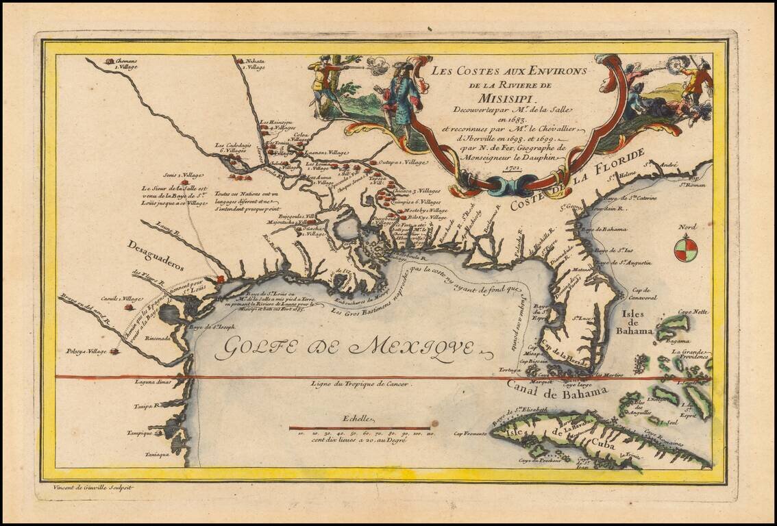
Rare 1701 First Edition Nice example of this historically important and fascinating map of the Gulf Coast and Mississippi River region, from Nicolas De Fer's Atlas Curieux. In preparing this fine map, the leading French cartographer Nicolas De Fer...
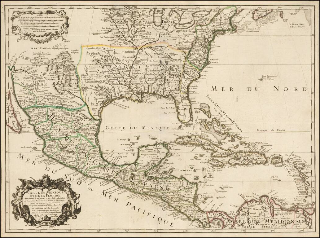
Rare Second State. Fine example of the second state of Guillaume De L'Isle's landmark map, the first printed map to accurately depict the course and mouth of the Mississippi River. De L'Isle's Carte du Mexique . . . is drawn from the reports brought...
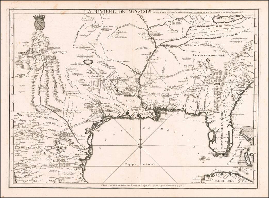
Nicolas De Fer's Landmark 1715 Map of the Mississippi River Valley and the French Regions in the Interior of North America. Fine example of De Fer's rare map of the southern part of the French regions in North America, one of the most important maps...
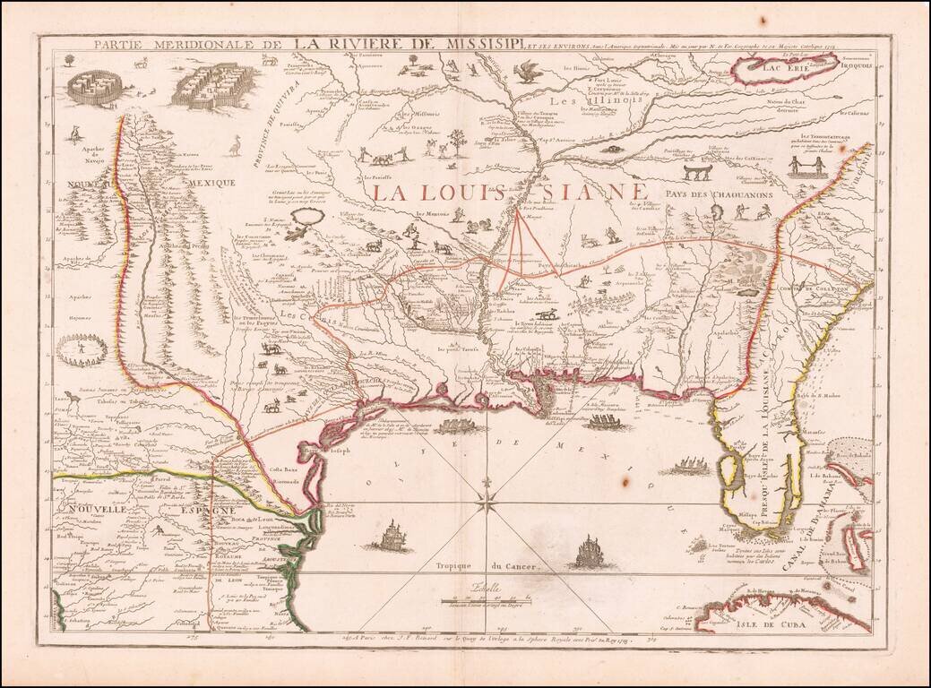
De Fer's Landmark Map of the Mississippi River Valley and the French Regions in interior of North America. Fine example of De Fer's rare map of the southern part of the French regions in North America, prepared by De Fer for the French Company of...
![Carte De La Louisiane Et Du Cours Du Mississipi . . . Juin 1718 [1st State!]](/map/small/62086.jpg)
"The Mother and Main Source of All the Later Maps" of the Mississippi River and Interior Parts of the United States and The First Map to Name Texas First state of De L'Isle's seminal map, one of the most important and influential maps of the 18th...
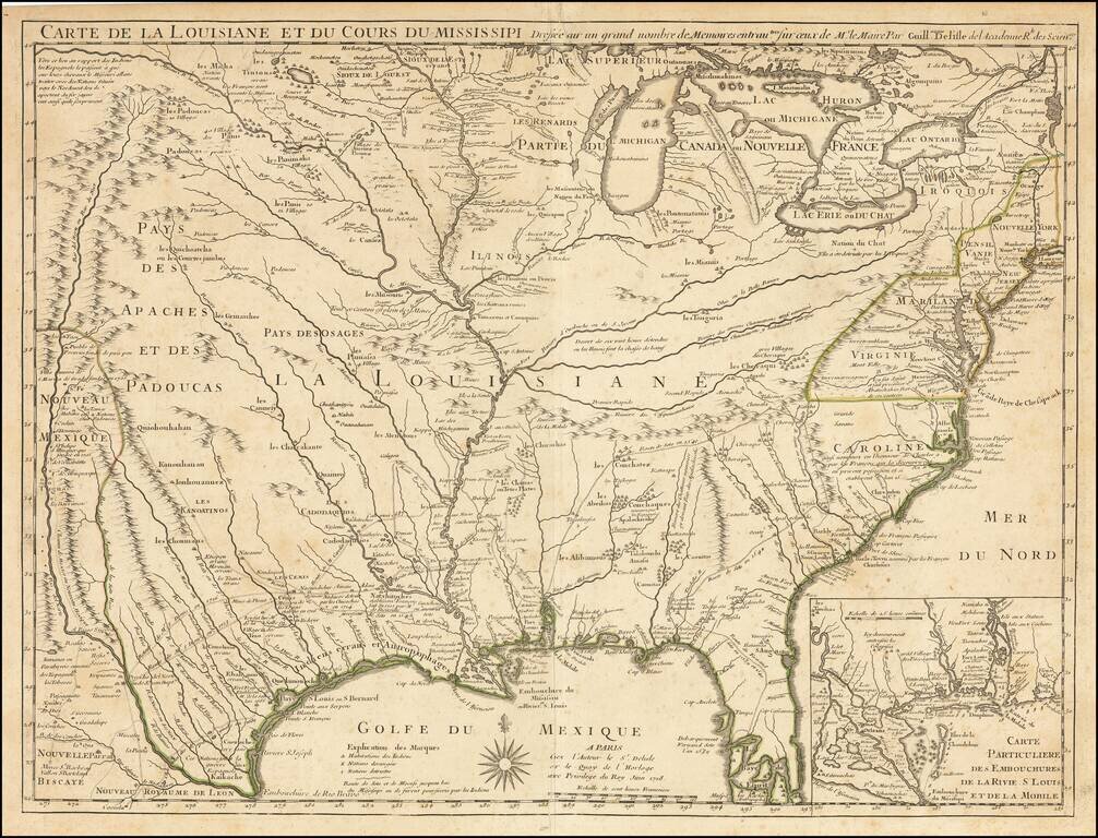
First Map To Name New Orleans -- "The Mother and Main Source of All the Later Maps" of the Mississippi River and Interior Parts of the United States and The First Map to Name Texas Second state of De L'Isle's seminal map, one of the most important and...
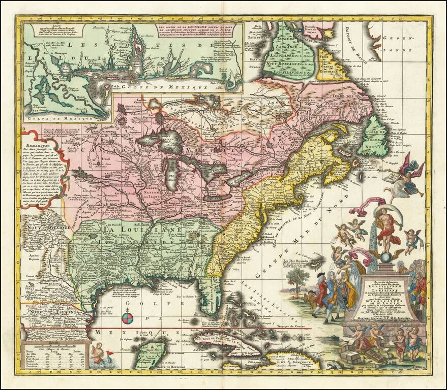
18th-century Map of Eastern North America with a Satirical Cartouche A finely colored example of Seutter's so-called Mississippi Bubble map, depicting the short-lived French financial-colonial scheme masterminded by Scottish financier John Law. The...
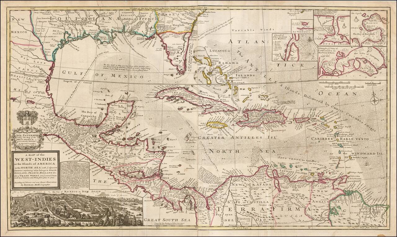
Highly detailed and decorative large format engraved map of the Caribbean by Herman Moll. Moll's map was the most popular large English map of the Caribbean, Florida, the Gulf Coast, Texas, and Central America in its day. It was a central image in the...
![A New & Accurate Map of Mexico or New Spain together with California New Mexico &c. [Inset map of the Galapagos Islands]](/map/small/70276.jpg)
Striking map of the Southwestern and Southeastern United States, Baja California, Mexico, Central America and the Gulf Coast region, centered on Texas. Includes nice annotations throughout the map, including annotations describing Kino's expedition to...
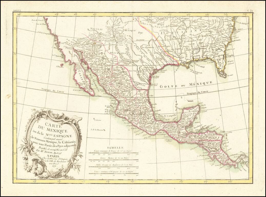
18th Century French Map of Texas, Mexico and the Southwest, etc. Decorative map of the Southwest, Texas, the southern United States, Mexico and Central America. Includes excellent detail in Texas and along the Rio Grande River, Rio Colorado and Gila....
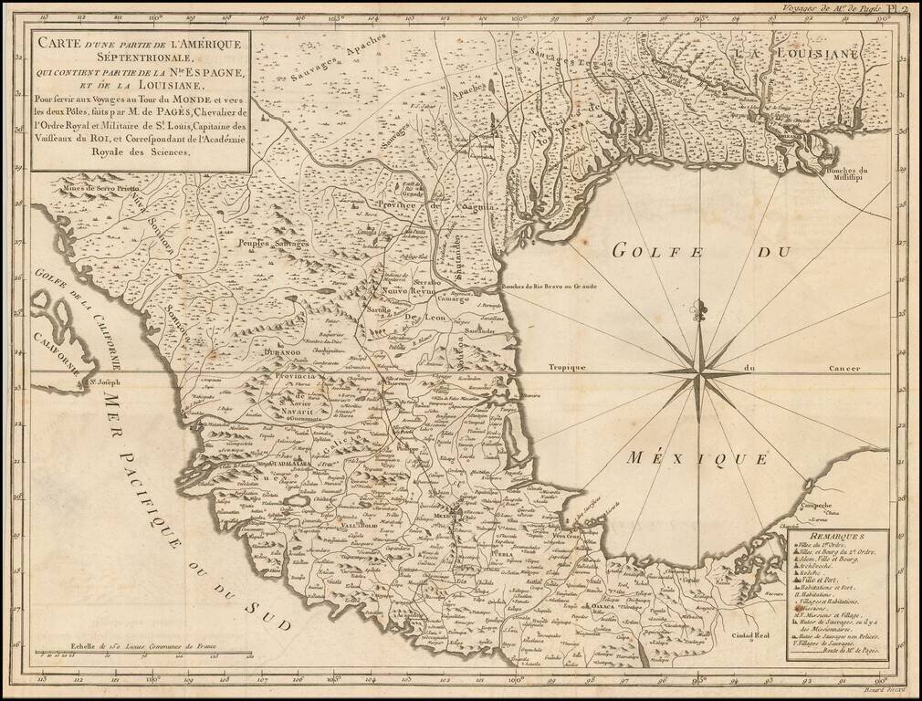
Description of an Overland Expedition Through Texas in 1767. Interesting early map of the Texas, the Gulf Coast and Mexico, from De Pages Voyages Au Tour Du Monde, published in 1782. Pages accompanied the Spanish Governor of Texas on a Journey from...
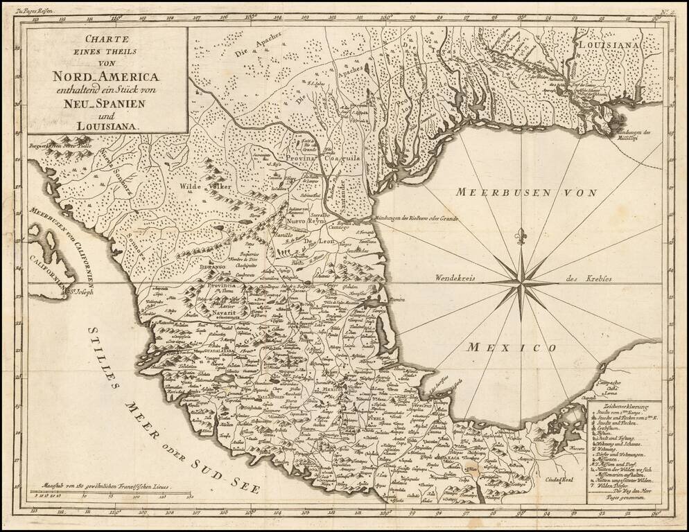
An Description of his Overland Expedition Through Texas in 1767. Interesting early map of the Texas, the Gulf Coast and Mexico, from a German edition of Pierre du De Pages Voyages Au Tour Du Monde, published in 1782. Pages accompanied the Spanish...