Map size in jpg-format: 1.54724MiB
Click to open in high resolution (open in new tab).
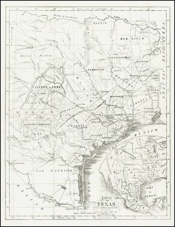
Rare and important early German immigration map of Texas prepared in connection with the Solms-Braunfels promotion of German colonies in Texas, based upon the larger Hunt & Randel map of 1839.
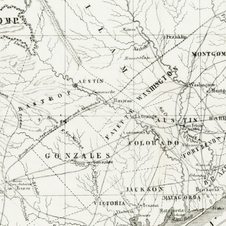
The map provides a detailed look at Texas during its early republic period. Of particular interest are the indications of the land grants with which the Adelsverein was involved. West of San Antonio is the (expired) grant of "Bourgnois D'Orvanne et Comp" and to the north is the grant of "Fischer et Comp übernommen vom Verein" (Fisher's grant acquired by the company). The map is also The title translates as: ' Map of Texas Compiled from Surveys on Record in the General Land Office of the Republic, to the Year 1839'.
While similar in title to the Stempfle map of 1841 and Ehrenkreutz map of 1846, this map locates and names both of the grants referenced above. While we have not been able to confirm the source, the title is identical to the map in Gesammelte Acten-Stucke des Vereins zum Schutze deutscher Auswanderer in Texas (Mainz 1847), which is noted as item 1064 in the Sociedad Mexicana de Geografia y Estadistica's Materials para una cartografie mexicana por el ingeniero Lic. Manuel Orozco (Orozco y Berra: Mexico City, 1871) and also to the German edition of William Kennedy's book ( Geographie, Naturgeschichte und Topographie von Texas. Aus dem Englischen von Otto von Czarnowsky. Mit einer Karte von Texas, Frankfurt am Main, 1845).
As head of the Society for German Emigration to Texas, Solms-Braunfels had detailed and accurate information about the state of Texas, its geography, towns, etc. This map provides a highly detailed depiction of the Republic, using first-hand surveying and material from the General Land Office. In edition to the Fischer et Comp, Bourgeois D'Ovant Colonies, the map shows Robertson's Colony, Austin's Colony, etc. The map is very strong on locating Texas tribes. Unlike contemporary maps promoting German Colonization, this map removes several of the defunct Texas Colonies, including Burnet's Colony, McMullen & McGloin's Colony, De Leon's Colony and Power's Colony.
A marvelous example of this Texas rarity.
If you are a student, write to us in telegram: @antiquemaps and indicate what material you need and for what work you need a map in high detail. We are ready to provide material on special terms. For students only!


