Map size in jpg-format: 1.12608MiB
Click to open in high resolution (open in new tab).
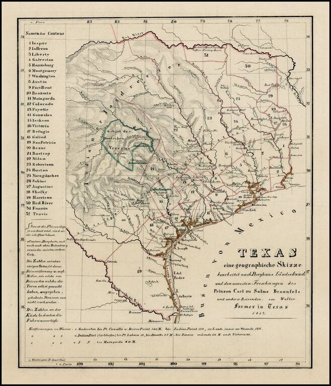
Extremely rare map of Texas, not listed in Day, Phillips, Streeter, Taliaferro, or any other Texas reference.
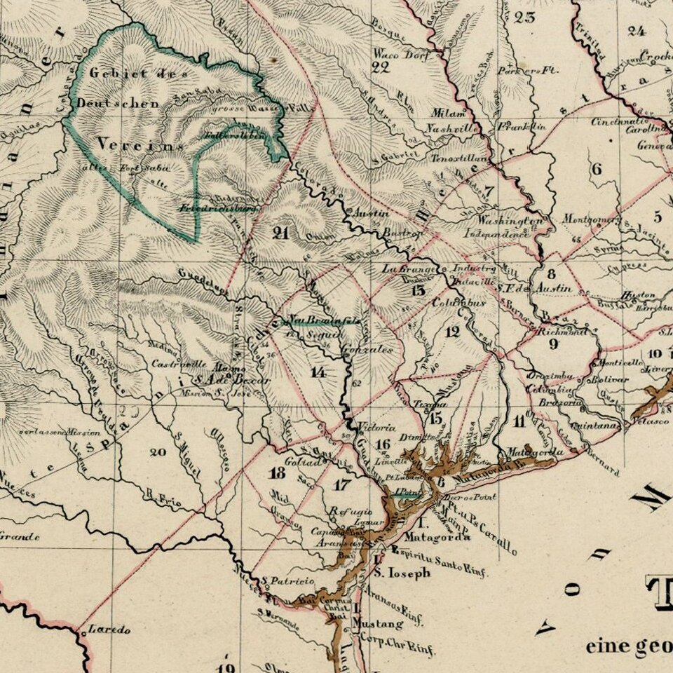
While the map is unrecorded and its source is unknown, we are of the opinion that the map was printed, but ultimately never included in a printed book or pamphlet. Originally intended for use by German emigrants to the Adelsverein lands in Texas, the map locates several Texas colonies in outline color. The map also includes distances from Galveston and Indian Point to various locales. The road from Port Lavaca through Victoria, Seguin, New Braunfels, Fredericksburg, and on to Fort San Saba is shown, as is the old King's Highway between Presidio Rio Grande and Nacogdoches, with intermediate distances. In North Texas, Coffee's Trading House is located on the Red River.
The title translates as "Texas a geographical sketch edited by Berghaus Area Studies, including the latest information from Prince Carl of Solms Braunfels and other travelers, by Walter Farmer in Texas 1847."
The ambitious plans for German emigration to Texas generally were unsuccessful and by the time this map was printed, the idea Adelsverein and Solms-Braunfels colonization efforts had failed. The appearance of the map with wide uncut margins strongly suggest that it as engraved, but never bound into any pamphlet. The only record for the present map is a listing in Katlog der Commerz-Bibliothek in Hamburg (Hamburg, 1864, column 1261), where it is attributed to Walter. While one commentator suggests the map is F. E. Walther's Texas in sein wahres Licht gestellt.... (Dresden & Leipzig: Arnoldische Buchhandlung, 1848), the map in Walther is not the same (or similar) map.
If you are a student, write to us in telegram: @antiquemaps and indicate what material you need and for what work you need a map in high detail. We are ready to provide material on special terms. For students only!


