Map size in jpg-format: 9.07407MiB
Click to open in high resolution (open in new tab).
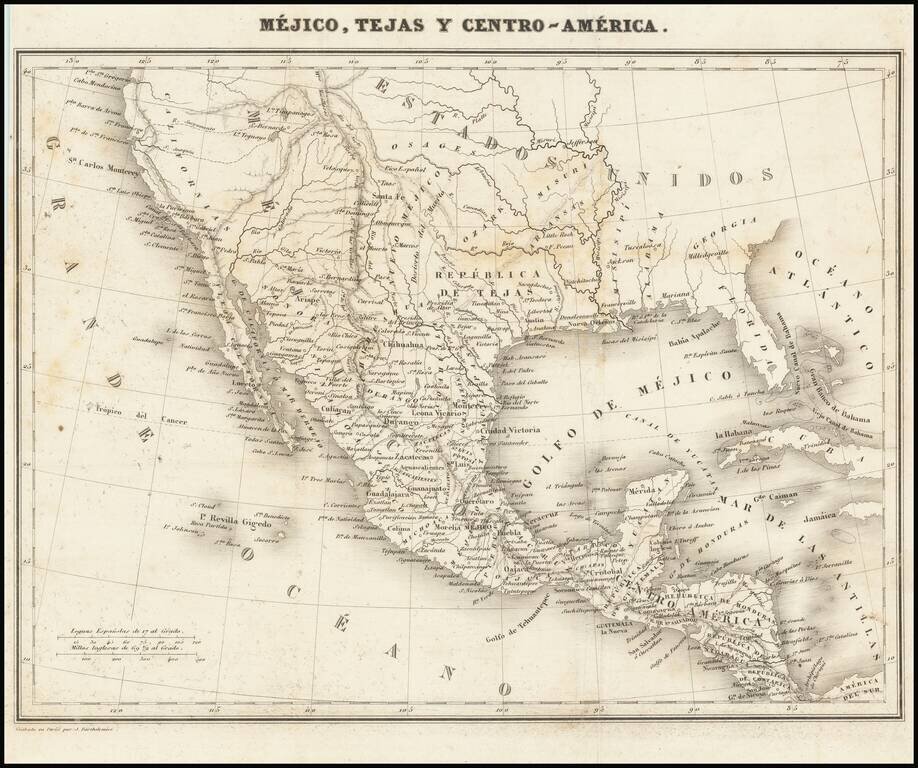
Rare map showing the Republic of Texas (República de Tejas), one of only a few maps to specifically refer to Texas as "Republic of Texas," during the period between 1836 and 1845.
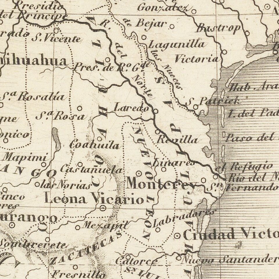
The map was originally published in Sanchez de Bustamante's Nuevo curso completo de geografia universal... para uso de los nuevos estados americanos, con un resumen preliminar de geografia antigua y sagrada. The map's geography is quite accurate, although Austin is placed to the east of the Brazos de Dios River, a bit north of present-day Houston.
This map is special for giving the full name to the Republic of Texas; most maps from the period simply call it "Texas" or some variation thereon.
If you are a student, write to us in telegram: @antiquemaps and indicate what material you need and for what work you need a map in high detail. We are ready to provide material on special terms. For students only!


