Map size in jpg-format: 14.4733MiB
Click to open in high resolution (open in new tab).
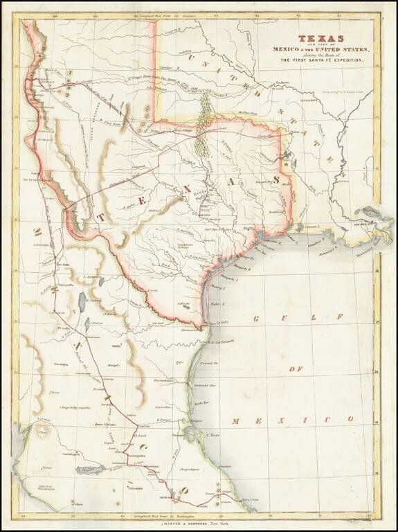
Map of the Republic of Texas, which appeared in Kendall's Narrative Of The Texan Santa Fe Expedition ....
This map shows efforts of the Republic of Texas, under President Mirabeau Lamar, seeking to take control over Santa Fe and develop trade links between Texas and New Mexico.
The expedition was undertaken because the Texas leadership believed New Mexico would be interested in forging and alliance with the Republic. However, the expeditionary force was met in Santa Fe by 1,500 Mexican troops and forced to march the 2,000 mile route to Mexico City before diplomatic measures guaranteed their release a year later.
The map also locates Josiah Gregg’s route from Van Buren, Pike’s route from Ft. Smith, and the Chihuahua Trail. Published in George Kendall's Narrative of the Texan Santa Fe Expedition.
If you are a student, write to us in telegram: @antiquemaps and indicate what material you need and for what work you need a map in high detail. We are ready to provide material on special terms. For students only!


