
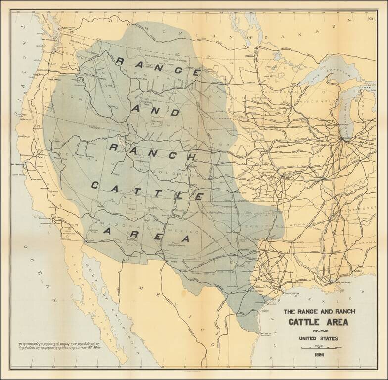
Rare map of the US, focusing on the Ranch and Cattle Industry. From Nimmo's Report on the Internal Commerce of the United States. Nimmo's book is held to be perhaps the most important of the cattle books. Nimmo's essay on the range and ranch cattle...
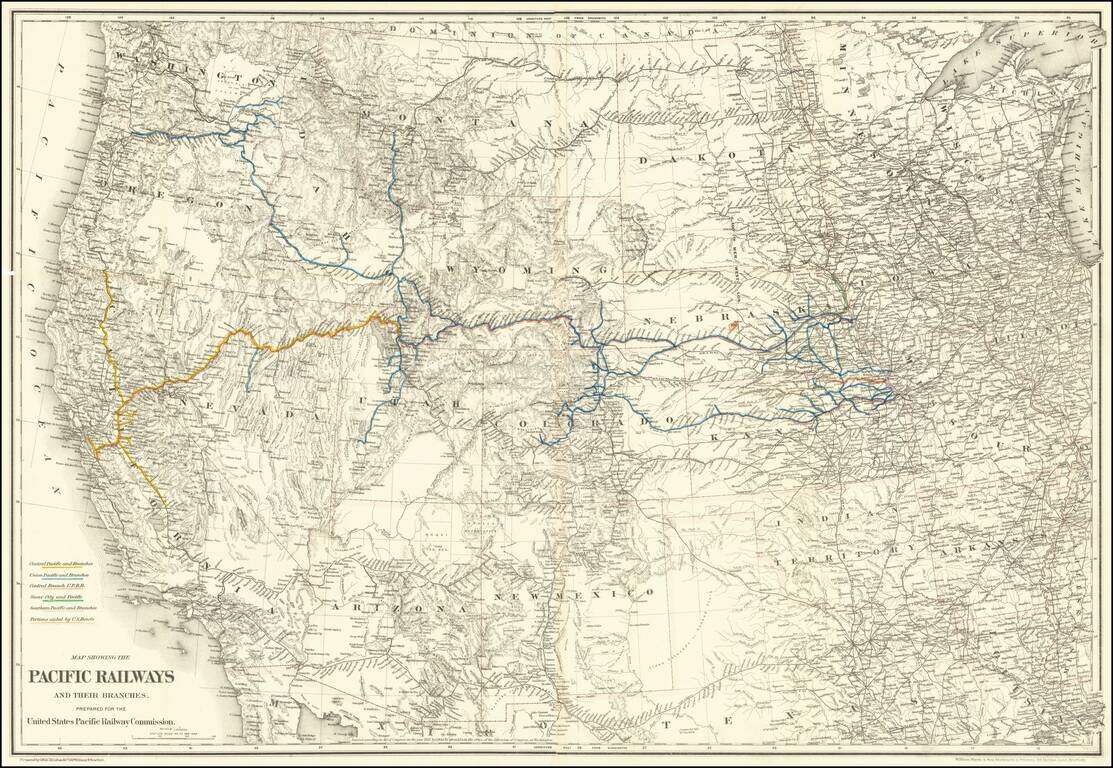
Mapping the Railroads of the Transmississippi West. Highly detailed map of the Western United States, illustrating the railroads in operation and under construction west of the Mississippi River. The key at the lower left identifies the Central...
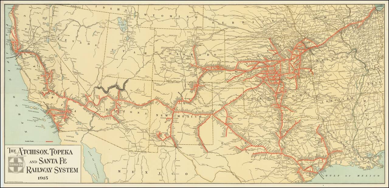
Fine example of The Atchison, Topeka and Santa Fe Railroad's general promotional map for 1915. Includes all the routes and train stations along the route in fine detail.
![[Come To Dallas] Easy To Reach -- Hard To Leave](/map/small/63387.jpg)
Pictorial map of the United States, focusing on Dallas as the center of the country. The map shows distances from Dallas to many other major cities in the United States. The map was published as part of the centennial of the Republic of Texas...

A highly decorative and important sea chart showing Florida, the Gulf Coast, Caribbean, Central America and the region from south of the mouth of the Delaware River. This fine separately published map was first engraved around 1650, but is based...
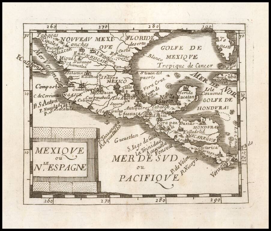
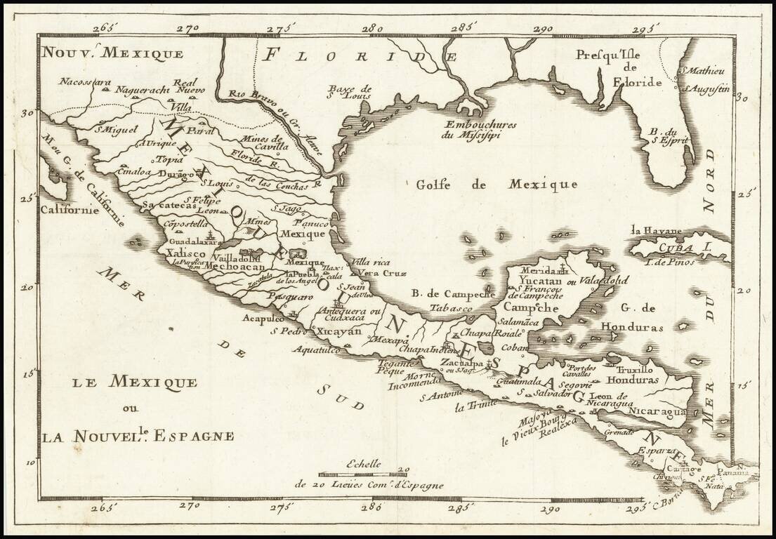
Nice example of Du Val's map of New Spain, extending from the American Southwest and Florida to Costa Rica and Panama.
![[Gulf Coast & West Coast of Florida] De Cust van Westindien Van La Desconoscida, tot C. Escondido. . .](/map/small/65741.jpg)
The First Dutch Chart of the Gulf Coast - Texas - West Coast of Florida Roggeveen's chart of the Gulf Coast, etc. is the first sea chart to focus on the region and one of great importance, showing for the first time on a printed Sea Chart the entire...

Mexico and Southwestern Rarity Rare English map of New Spain, published by Sir Jonas Moore. Extends to Baja California, Southern Florida, Texas and the Southwest. The map appeared in Moore's A New Geography. Many of the plates in the work were...
![[Florida Panhandle to Yucatan] Pas-Kaart Van de Golff van Mexico . . .](/map/small/23053.jpg)
The Earliest Obtainable Sea Chart of the US Gulf Coast Unrecorded variant edition of Van Keulen's chart of the Gulf Coast, from the Yucatan to Florida and centered on Texas, the earliest obtainable sea chart to focus this closely on Texas and the...
Rare map of Florida, the Gulf Coast, Texas, Central America and the Caribbean. Florida extends to the Rio Grande River. Only a few settlements shown in Florida and none on the Gulf Coast, apparently pre-dating New Orleans. Reminiscent of De Fer's map...
![[Gulf Coast - Texas - Florida - Yucatan ] Pas-Kaart Van de Golff van Mexico . . . [Rare 4th state!]](/map/small/62736.jpg)
Charting the Gulf Coast in the Early 18th Century Rare fourth state of Van Keulen's map of the Gulf Coast, from Florida and Texas to the Yucatan. The map is oriented with West at the top, Gerard Van Keulen's map of the Gulf Coast is a landmark...
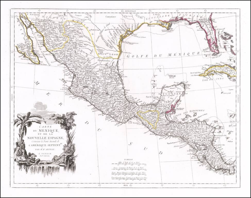
Striking map of Mexico, Texas and the Gulf Coast, including Florida, published in Venice. The map notes that it is based upon the work of J.B.B. D'Anville. Texas is named, with references to La Salle's visit to the region in 1685. Florida is shown...
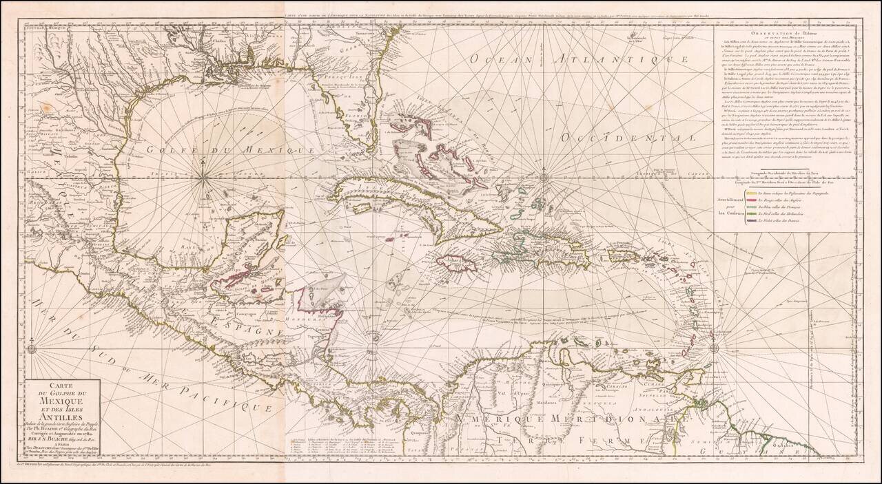
Striking, Intricate Map of the Caribbean Region Scarce and highly-detailed map of the Gulf Coast, Florida, Central America and the Caribbean from J.A. Dezauche, successor to Philippe Buache and Guillaume De L'Isle. The map is incredibly detailed, not...
The foundational Spanish sea chart of the Gulf Coast, Florida, Texas, etc. -- One of the six most important maps of Texas (Streeter). This is the first large-scale printed chart of the Texas coast based upon actual soundings and explorations. The map...
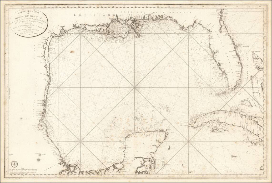
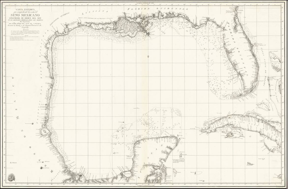
The First Modern French Sea Chart of the Gulf of Mexico Important early chart of the Gulf Coast and Florida, issued in the 9th Year of the French Revolution (An. IX.) The map was issued one year after the Spanish Carta Esferica and draws extensively...
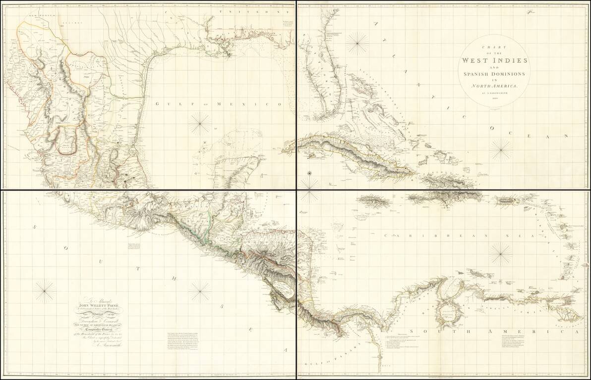
A Seminal Map of Florida, The Caribbean and Texas! First edition of Arrowsmith's map of Mexico & the West Indies, and the only edition to extend to the Pacific, thereby showing modern Texas and parts of New Mexico and Arizona. The map is...